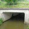
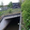
Tom Benson Way Bridge No 3
is a minor waterways place
on the River Ribble (Ribble Link) between
Ribble Link Lock No 9 (Sea lock with rotating gates) (2 miles and 2 furlongs
and 5 locks
to the west) and
Ribble Link - Lancaster Canal Junction (1¼ furlongs
and 3 locks
to the north).
The nearest place in the direction of Ribble Link Lock No 9 is Ribble Link Railway Bridge No 4 (Preston to Blackpool Line);
a few yards
away.
The nearest place in the direction of Ribble Link - Lancaster Canal Junction is Tom Benson Way Footbridge No 2;
a few yards
away.
There is no access to the towpath here.
Mooring here is impossible (it may be physically impossible, forbidden, or allowed only for specific short-term purposes).
There is a bridge here which takes a track over the canal.
| Ribble Link Lock No 5 | 4½ furlongs | |
| Ribble Link Lock No 5 Winding Hole | 4 furlongs | |
| Savick Way Bridge No 5 | 2½ furlongs | |
| Ribble Link Lock No 4 | 1 furlong | |
| Ribble Link Railway Bridge No 4 | a few yards | |
| Tom Benson Way Bridge No 3 | ||
| Tom Benson Way Footbridge No 2 | a few yards | |
| Ribble Link Staircase Winding Hole | ¼ furlongs | |
| Ribble Link Staircase Locks Nos 1 to 3 | ½ furlongs | |
| Ribble Link Staircase Public Art | ¾ furlongs | |
| Ribble Link Junction Basin | ¾ furlongs | |
Amenities nearby at Ribble Link Railway Bridge No 4
There are no links to external websites from here.
Why not log in and add some (select "External websites" from the menu (sometimes this is under "Edit"))?
Mouseover for more information or show routes to facility
Nearest water point
In the direction of Ribble - Savick Brook Junction
Spark Bridge Sanitary Station — 13 miles, 4¼ furlongs and 7 locks away
Travel to Ribble - Savick Brook Junction, then on the River Ribble (Main River) to Astland Lamp, then on the River Douglas to Tarleton Junction, then on the Leeds and Liverpool Canal (Rufford Branch) to Spark Bridge Sanitary Station
St Mary's Marina — 14 miles, 4 furlongs and 7 locks away
Travel to Ribble - Savick Brook Junction, then on the River Ribble (Main River) to Astland Lamp, then on the River Douglas to Tarleton Junction, then on the Leeds and Liverpool Canal (Rufford Branch) to St Mary's Marina
Burscough Bridge Wharf — 18 miles, 1¾ furlongs and 14 locks away
Travel to Ribble - Savick Brook Junction, then on the River Ribble (Main River) to Astland Lamp, then on the River Douglas to Tarleton Junction, then on the Leeds and Liverpool Canal (Rufford Branch) to Lathom Junction, then on the Leeds and Liverpool Canal (Main Line - Liverpool to Wigan) to Burscough Bridge Wharf
In the direction of Ribble Link - Lancaster Canal Junction
Woodplumpton Road Bridge No 12 — 1 mile, ¼ furlongs and 3 locks away
Travel to Ribble Link - Lancaster Canal Junction, then on the Lancaster Canal (Main Line) to Woodplumpton Road Bridge No 12
Blackleach Lane Marina — 5 miles, 4 furlongs and 3 locks away
Travel to Ribble Link - Lancaster Canal Junction, then on the Lancaster Canal (Main Line) to Blackleach Lane Marina
Swill Brook Basin — 5 miles, 7¼ furlongs and 3 locks away
Travel to Ribble Link - Lancaster Canal Junction, then on the Lancaster Canal (Main Line) to Swill Brook Basin
Bilsborrow Winding Hole — 10 miles, 3½ furlongs and 3 locks away
Travel to Ribble Link - Lancaster Canal Junction, then on the Lancaster Canal (Main Line) to Bilsborrow Winding Hole
Moss Lane Bridge No 63 — 15 miles, 4¼ furlongs and 3 locks away
Travel to Ribble Link - Lancaster Canal Junction, then on the Lancaster Canal (Main Line) to Moss Lane Bridge No 63
Ratcliffe Bridge No 75 — 19 miles, 5¼ furlongs and 3 locks away
Travel to Ribble Link - Lancaster Canal Junction, then on the Lancaster Canal (Main Line) to Ratcliffe Bridge No 75Nearest rubbish disposal
In the direction of Ribble - Savick Brook Junction
Spark Bridge Sanitary Station — 13 miles, 4¼ furlongs and 7 locks away
Travel to Ribble - Savick Brook Junction, then on the River Ribble (Main River) to Astland Lamp, then on the River Douglas to Tarleton Junction, then on the Leeds and Liverpool Canal (Rufford Branch) to Spark Bridge Sanitary Station
Moss Bridge No 35 — 18 miles, 3¼ furlongs and 14 locks away
Travel to Ribble - Savick Brook Junction, then on the River Ribble (Main River) to Astland Lamp, then on the River Douglas to Tarleton Junction, then on the Leeds and Liverpool Canal (Rufford Branch) to Lathom Junction, then on the Leeds and Liverpool Canal (Main Line - Liverpool to Wigan) to Moss Bridge No 35
In the direction of Ribble Link - Lancaster Canal Junction
Woodplumpton Road Bridge No 12 — 1 mile, ¼ furlongs and 3 locks away
Travel to Ribble Link - Lancaster Canal Junction, then on the Lancaster Canal (Main Line) to Woodplumpton Road Bridge No 12
Bilsborrow Winding Hole — 10 miles, 3½ furlongs and 3 locks away
Travel to Ribble Link - Lancaster Canal Junction, then on the Lancaster Canal (Main Line) to Bilsborrow Winding HoleNearest chemical toilet disposal
In the direction of Ribble - Savick Brook Junction
Spark Bridge Sanitary Station — 13 miles, 4¼ furlongs and 7 locks away
Travel to Ribble - Savick Brook Junction, then on the River Ribble (Main River) to Astland Lamp, then on the River Douglas to Tarleton Junction, then on the Leeds and Liverpool Canal (Rufford Branch) to Spark Bridge Sanitary Station
St Mary's Marina — 14 miles, 4 furlongs and 7 locks away
Travel to Ribble - Savick Brook Junction, then on the River Ribble (Main River) to Astland Lamp, then on the River Douglas to Tarleton Junction, then on the Leeds and Liverpool Canal (Rufford Branch) to St Mary's Marina
Burscough Bridge Wharf — 18 miles, 1¾ furlongs and 14 locks away
Travel to Ribble - Savick Brook Junction, then on the River Ribble (Main River) to Astland Lamp, then on the River Douglas to Tarleton Junction, then on the Leeds and Liverpool Canal (Rufford Branch) to Lathom Junction, then on the Leeds and Liverpool Canal (Main Line - Liverpool to Wigan) to Burscough Bridge Wharf
In the direction of Ribble Link - Lancaster Canal Junction
Woodplumpton Road Bridge No 12 — 1 mile, ¼ furlongs and 3 locks away
Travel to Ribble Link - Lancaster Canal Junction, then on the Lancaster Canal (Main Line) to Woodplumpton Road Bridge No 12
Bilsborrow Winding Hole — 10 miles, 3½ furlongs and 3 locks away
Travel to Ribble Link - Lancaster Canal Junction, then on the Lancaster Canal (Main Line) to Bilsborrow Winding HoleNearest place to turn
In the direction of Ribble - Savick Brook Junction
Ribble Link Lock No 5 Winding Hole — 4 furlongs and 1 lock away
On this waterway in the direction of Ribble - Savick Brook Junction
Winding Hole above Lock No 8 — 1 mile, 5½ furlongs and 4 locks away
On this waterway in the direction of Ribble - Savick Brook Junction
Tarleton Boat Yard — 10 miles, 2¼ furlongs and 7 locks away
Travel to Ribble - Savick Brook Junction, then on the River Ribble (Main River) to Astland Lamp, then on the River Douglas to Tarleton Junction, then on the Leeds and Liverpool Canal (Rufford Branch) to Tarleton Boat Yard
In the direction of Ribble Link - Lancaster Canal Junction
Ribble Link Staircase Winding Hole — ¼ furlongs away
On this waterway in the direction of Ribble Link - Lancaster Canal Junction
Ribble Link - Lancaster Canal Junction — 1¼ furlongs and 3 locks away
On this waterway in the direction of Ribble Link - Lancaster Canal Junction
Tom Benson Way Bridge Winding Hole — 2¾ furlongs and 3 locks away
Travel to Ribble Link - Lancaster Canal Junction, then on the Lancaster Canal (Main Line) to Tom Benson Way Bridge Winding Hole
Bexhill Road Winding Hole — 4½ furlongs and 3 locks away
Travel to Ribble Link - Lancaster Canal Junction, then on the Lancaster Canal (Main Line) to Bexhill Road Winding Hole
Ashton Basin — 1 mile, 4¼ furlongs and 3 locks away
Travel to Ribble Link - Lancaster Canal Junction, then on the Lancaster Canal (Main Line) to Ashton Basin
Ward's House Winding Hole No 1 — 2 miles, 3¼ furlongs and 3 locks away
Travel to Ribble Link - Lancaster Canal Junction, then on the Lancaster Canal (Main Line) to Ward's House Winding Hole No 1
Ward's House Winding Hole No 2 — 2 miles, 5½ furlongs and 3 locks away
Travel to Ribble Link - Lancaster Canal Junction, then on the Lancaster Canal (Main Line) to Ward's House Winding Hole No 2
Salwick Hall Winding Hole — 2 miles, 7½ furlongs and 3 locks away
Travel to Ribble Link - Lancaster Canal Junction, then on the Lancaster Canal (Main Line) to Salwick Hall Winding Hole
Swill Brook Basin — 5 miles, 7¼ furlongs and 3 locks away
Travel to Ribble Link - Lancaster Canal Junction, then on the Lancaster Canal (Main Line) to Swill Brook Basin
Moons Bridge Marina — 7 miles, 3¼ furlongs and 3 locks away
Travel to Ribble Link - Lancaster Canal Junction, then on the Lancaster Canal (Main Line) to Moons Bridge Marina
Hollowforth Winding Hole — 7 miles, 4¼ furlongs and 3 locks away
Travel to Ribble Link - Lancaster Canal Junction, then on the Lancaster Canal (Main Line) to Hollowforth Winding Hole
Park Head Winding Hole — 8 miles, 2¼ furlongs and 3 locks away
Travel to Ribble Link - Lancaster Canal Junction, then on the Lancaster Canal (Main Line) to Park Head Winding Hole
White Horse Winding Hole — 9 miles, 2¾ furlongs and 3 locks away
Travel to Ribble Link - Lancaster Canal Junction, then on the Lancaster Canal (Main Line) to White Horse Winding Hole
Bilsborrow Winding Hole — 10 miles, 3½ furlongs and 3 locks away
Travel to Ribble Link - Lancaster Canal Junction, then on the Lancaster Canal (Main Line) to Bilsborrow Winding Hole
Catterall Bridge Winding Hole — 13 miles, 1¾ furlongs and 3 locks away
Travel to Ribble Link - Lancaster Canal Junction, then on the Lancaster Canal (Main Line) to Catterall Bridge Winding Hole
Greenhalgh Castle Bridge Winding Hole — 14 miles, 2½ furlongs and 3 locks away
Travel to Ribble Link - Lancaster Canal Junction, then on the Lancaster Canal (Main Line) to Greenhalgh Castle Bridge Winding Hole
Dimples Bridge Winding Hole — 14 miles, 4½ furlongs and 3 locks away
Travel to Ribble Link - Lancaster Canal Junction, then on the Lancaster Canal (Main Line) to Dimples Bridge Winding HoleNearest self-operated pump-out
In the direction of Ribble - Savick Brook Junction
Spark Bridge Sanitary Station — 13 miles, 4¼ furlongs and 7 locks away
Travel to Ribble - Savick Brook Junction, then on the River Ribble (Main River) to Astland Lamp, then on the River Douglas to Tarleton Junction, then on the Leeds and Liverpool Canal (Rufford Branch) to Spark Bridge Sanitary StationNearest boatyard pump-out
In the direction of Ribble - Savick Brook Junction
Fettlers Wharf Marina — 14 miles, 4 furlongs and 7 locks away
Travel to Ribble - Savick Brook Junction, then on the River Ribble (Main River) to Astland Lamp, then on the River Douglas to Tarleton Junction, then on the Leeds and Liverpool Canal (Rufford Branch) to Fettlers Wharf Marina
St Mary's Marina — 14 miles, 4 furlongs and 7 locks away
Travel to Ribble - Savick Brook Junction, then on the River Ribble (Main River) to Astland Lamp, then on the River Douglas to Tarleton Junction, then on the Leeds and Liverpool Canal (Rufford Branch) to St Mary's MarinaDirection of TV transmitter (From Wolfbane Cybernetic)
There is no page on Wikipedia called “Tom Benson Way Bridge”
Wikipedia pages that might relate to Tom Benson Way Bridge
[Thomas Lennon]
John Oliver's New York Stand-Up Show, The Jeselnik Offensive, and The Benson Interruption. He was the guest on the first episode of Chris Hardwick's
[Ode to Billy Joe (film)]
accepts. The film ends with the two of them walking across the bridge together. Robby Benson as Billy Joe McAllister Glynnis O'Connor as Bobbie Lee Hartley
[List of Benson episodes]
This is a list of episodes in the ABC television series Benson. 1981-82 Ratings History 1982-83 Ratings History 1983-84 Ratings History 1983-84 Ratings
[Alan Rubin]
Starr Ringo's Rotogravure (Polydor, 1976) With George Benson White Rabbit (CTI, 1972) Bad Benson (CTI, 1974) With Phoebe Snow Never Letting Go (Columbia
[Simon & Garfunkel]
Sound of Silence" (1965), "Mrs. Robinson" (1968), "The Boxer" (1969), and "Bridge over Troubled Water" (1970)—reached number one on singles charts worldwide
[Grammy Award for Album of the Year]
engineer or mixer. The category expanded to include eight nominees in 2019. Tom Coyne (as mastering engineer), Serban Ghenea, and John Hanes (as engineers/mixers)
[Fin Tutuola]
relationship with his colleagues in SVU, especially with Munch and Olivia Benson (Mariska Hargitay). Unlike them, he views justice in a "black and white"
[Helena (My Chemical Romance song)]
funeral of a girl, who, according to Gerard Way, died tragically (possibly in a car crash, with the line in the bridge of the song, "When both our cars collide
[Nelson Mandela]
Benson 1986, p. 21; Mandela 1994, pp. 78–86; Lodge 2006, pp. 11–12; Smith 2010, pp. 34–35; Meredith 2010, pp. 19–20; Sampson 2011, pp. 26–27. Benson 1986
[U.S. Route 80 in Arizona]
Stone Avenue Underpass, Tucson Ciénega Bridge, Historic concrete arch bridge in Pima County Horseshoe Cafe, Benson, 1940s cafe O.K. Corral and C.S. Fly's
Results of Google Search
Tom Benson Way, Preston, Lancashire, PR2 1SG ... The centre is accessed from the B6241 Tom Benson Way and is located on the first roundabout north of ...
Location, From Its Junction With Tom Benson Way To A Point 180M East Of Its Junction With Tom .... Roadname, Rear Of Bridge Road Nos 5 To 55, Preston.
The Lancaster Canal is a canal in North West England, originally planned to run from ... B6241 Tom Benson Way .... the canal was culverted in three places, despite a local campaign for bridges to be built, so that restoration would be possible ...
Jul 14, 2007 ... Used to climb up the side of this bridge on my way home from school. A London Euston to Blackpool Central express passed at about 4.10, ...
Benson Way crossing of Ruckel Creek (bobcat). Small tarn ... Turn right and follow the "Bridge" Trail downhill less than half of a mile to the Herman Creek Bridge.
Part Deux (1993) Lloyd Bridges and Jerry Haleva in Hot Shots! ... President Thomas 'Tug' Benson : Topper Harley, of course, the son I never had. ... ready to battle Saddam Hussein] We'll settle this the old navy way; The first guy to die, LOSES!
Mar 15, 2018 ... United Way SELA – Bridge House Grace House ... Saints Owner Tom Benson, 90 , passed away peacefully today at Ochsner Medical Center ...
Admiral Benson : Good thinking. We'll pick it up on the way back. We gotta mark the spot, though. Put Robinowitz in a life raft. Have him row in circles until we ...
Gayle Benson provides leadership for the New Orleans Saints and New Orleans Pelicans as Owner, succeeding her husband, Tom Benson, who passed .... Senior Corporate Sales Account Executive; Gerald Bridges Corporate Partnership ...


![Savick Brook. The brook flows into this basin in the foreground on the right, and flows out to the left in the background, passing under a footbridge, road bridge and railway bridge in quick succession.The staircase of 3 locks up to the Lancaster Canal is just right of centre.Boats navigating the Ribble Link have to turn through about 120° here, but due to limited space, this effectively requires a reversal of direction. I suspect that longer boats pass through the staircase backwards. See [[3113419]] for a view in the opposite direction. by Ian Taylor – 26 August 2012](https://s3.geograph.org.uk/geophotos/03/11/34/3113423_f4329f8d_120x120.jpg)


![Lock 1, Ribble Link. The top lock, which is one of a staircase of 3.On the left is the plinth where a wooden statue used to stand. See [[3100509]]. by Ian Taylor – 26 August 2012](https://s1.geograph.org.uk/geophotos/03/10/36/3103669_0d581b4c_120x120.jpg)
![Canal Builders. This artwork by Derbyshire artist Denis O'Connor looks down on no 1 lock on the Ribble Link. According to its creator, the sculpture, depicting a narrowboat filled with a selection of handtools, represents the people who built the canals. Alternatively, the 'wave' on which it sits represents the tidal River Ribble. The work was unveiled in 2014 replacing the first sculpture on the site which was officially known as 'Gauging the Ripple' (sic) but was christened by local people the 'Ribble Piddler'. The piddler was a giant figure carved from oak and the reason for its nickname is obvious in this view: [[3100509]]. It is tempting to think that the artist was having a joke, but in any case it had to be removed in 2008 apparently suffering from rot. by Stephen McKay – 25 April 2023](https://s0.geograph.org.uk/geophotos/07/46/85/7468504_5cd1f273_120x120.jpg)
![Savick Brook. The brook flows into this basin at the far end, and flows out to the right in the foreground.Boats navigating the Ribble Link have to turn through about 120° here, but due to limited space, this effectively requires a reversal of direction. See [[3113423]] for a view in the opposite direction. by Ian Taylor – 26 August 2012](https://s3.geograph.org.uk/geophotos/03/11/34/3113419_052f7c7f_120x120.jpg)

![Narrow boat sculpture. Stainless steel narrow boat on top of a 3m high weathering steel plinth, by Denis O'Connor.See [[5913795]] & [[6081829]] for general views. by Ian Taylor – 06 March 2019](https://s0.geograph.org.uk/geophotos/06/08/18/6081832_c6b32b4f_120x120.jpg)

![Gauging the Ripple. Oak statue by the top lock of the Ribble Link, by Thompson Dagnall. About 5m tall.According to the Lancashire Evening Post, it was known locally as the Ribble Piddler.Whether this contributed to the leg rot that caused its removal in January 2008 is not known.Also see [[15473]] and [[22050]] . by Ian Taylor – May 2003](https://s1.geograph.org.uk/geophotos/03/10/05/3100509_b0a97e7e_120x120.jpg)
![Narrow boat sculpture. Stainless steel narrow boat on top of a 3m high weathering steel plinth, by Denis O'Connor.This was erected in 2014 by the top lock of the Ribble Link, to replace the Gauging the Ripple statue [[3100509]].See [[6081832]] for a close view. by Ian Taylor – 06 March 2019](https://s1.geograph.org.uk/geophotos/06/08/18/6081829_4ea5a4ca_120x120.jpg)


![Basin at the top end of the Ribble Link. Bridge 1 is in the centre (see [[3115269]]), with the Lancaster Canal junction just beyond.Lock 1 is out of picture to the right (see [[3115283]]). by Ian Taylor – 26 August 2012](https://s1.geograph.org.uk/geophotos/03/11/52/3115277_0fe34eb9_120x120.jpg)