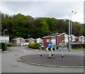
Haverfordwest - London Railway Bridge
A465, Neath SA10 8AZ, United Kingdom
(A465)

Haverfordwest - London Railway Bridge
is a minor waterways place
on the Neath and Tennant Canal - (Tennant Canal) between
Aberdulais Junction (1 mile and 4¾ furlongs
and 1 lock
to the east) and
Port Tennant (6 miles and 3¼ furlongs
to the southwest).
The nearest place in the direction of Aberdulais Junction is Tennant Footbridge;
2 furlongs
away.
The nearest place in the direction of Port Tennant is Neath (A465T) Road Bridge No 3;
½ furlongs
away.
Mooring here is unrated.
There is a bridge here which takes a railway over the canal.
Neath (A465T) Slip Road Bridge | 1 mile, 1¼ furlongs | |
Neath (A465T) Road Tunnel (eastern entrance) | 1 mile, ¾ furlongs | |
Neath (A465T) Road Tunnel (western end) | 1 mile, ¼ furlongs | |
Neath Bridge | 7¾ furlongs | |
Tennant Footbridge | 2 furlongs | |
Haverfordwest - London Railway Bridge | ||
Neath (A465T) Road Bridge No 3 | ½ furlongs | |
B4434 Road Bridge | 2 furlongs | |
Port Talbot - Swansea Railway Bridge | 2¼ furlongs | |
Neath (A465T) Footbridge | 3 furlongs | |
Neath (A465T) Road Bridge No 4 | 5¾ furlongs |
Amenities nearby at Neath (A465T) Road Bridge No 3
There are no links to external websites from here.
Why not log in and add some (select "External websites" from the menu (sometimes this is under "Edit"))?
Mouseover for more information or show routes to facility
No information
CanalPlan has no information on any of the following facilities within range:water point
rubbish disposal
chemical toilet disposal
place to turn
self-operated pump-out
boatyard pump-out
Direction of TV transmitter (From Wolfbane Cybernetic)
There is no page on Wikipedia called “Haverfordwest - London Railway Bridge”
Wikipedia pages that might relate to Haverfordwest - London Railway Bridge
[Milford Haven railway station]
train from London Paddington through to Milford Haven via Reading, Bristol Parkway, Cardiff Central, Swansea, Whitland and Haverfordwest, usually operated
[National Cycle Route 4]
Between Pembroke and Haverfordwest, NCR follows the route of a disused railway called the Brunel Trail and crosses over the Cleddau Bridge. National Cycle
[Johnston railway station]
in 1856 as part of the final section of the South Wales Railway main line from Haverfordwest to Neyland. It has gone by various names and is now operated
[Hakin Docks railway station]
modified to a location on the Milford Haven waterway. 1854 saw track reach Haverfordwest, at which point a decision had to be made as to the terminus. New Milford
[A487 road]
from Haverfordwest, Pembrokeshire, in the south, to Bangor, Gwynedd, in the north. The road starts at a junction with the A40 in Haverfordwest and travels
[List of railway stations in Wales]
serving the Cardiff suburb Dolau - Visited by Queen Elizabeth in 2002 Haverfordwest - Gateway to St. David's Minffordd - Serving Portmeirion Newport - Third
[South Wales Railway]
Clarbeston Road station to Haverfordwest. Soon after the passing of the Act the Company agreed with the Gloucester and Dean Forest Railway that the SWR would
[Neyland railway station]
allow large ships to dock. The SWR was opened in stages, and reached Haverfordwest on 2 January 1854; the last section from there to the new port was opened
[Pembrey and Burry Port railway station]
Ferryside, with a two-hourly extension to Milford Haven via Whitland and Haverfordwest. There are also several daily services between Pembroke Dock and Swansea
[A40 road]
Clears to Haverfordwest dualling There were plans in 2002 for a major improvement of the 23-mile stretch between St Clears and Haverfordwest which included