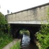
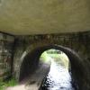
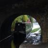
Morley Lane Bridge No 33
is a minor waterways place
on the Huddersfield Narrow Canal between
Golcar (2¾ furlongs
and 1 lock
to the west) and
Aspley Basin (Huddersfield) (Moorings for Huddersfield and Junction of Huddersfield Broad and Narrow Canals) (2 miles and 3¼ furlongs
and 11 locks
to the east).
The nearest place in the direction of Golcar is Rough Holme Lock No 12E;
2 furlongs
away.
The nearest place in the direction of Aspley Basin (Huddersfield) is Library Lock No 11E;
¾ furlongs
away.
There may be access to the towpath here.
Mooring here is unrated.
There is a bridge here which takes a minor road over the canal.
Holme Mills | 5¼ furlongs | |
Scarr Bottom Roadbridge No 36 | 4½ furlongs | |
Golcar Aqueduct | 3½ furlongs | |
Golcar | 2¾ furlongs | |
Rough Holme Lock No 12E | 2 furlongs | |
Morley Lane Bridge No 33 | ||
Library Lock No 11E | ¾ furlongs | |
Spring Garden Lock No 10E | 1¼ furlongs | |
Whiteley Bottom Bridge No 32 | 1¼ furlongs | |
Isis Lock No 9E | 1½ furlongs | |
Isis Lock Winding Hole | 1¾ furlongs |
There are no links to external websites from here.
Why not log in and add some (select "External websites" from the menu (sometimes this is under "Edit"))?
Mouseover for more information or show routes to facility
Nearest water point
In the direction of Ashton-under-Lyne Junction
Waterside Lock No 21E — 2 miles, 2½ furlongs and 9 locks away
On this waterway in the direction of Ashton-under-Lyne Junction
Slaithwaite Winding Hole — 2 miles, 3 furlongs and 10 locks away
On this waterway in the direction of Ashton-under-Lyne Junction
Standedge Tunnel (eastern entrance) — 5 miles, 6 furlongs and 31 locks away
On this waterway in the direction of Ashton-under-Lyne Junction
Standedge Tunnel (western entrance) — 9 miles and 31 locks away
On this waterway in the direction of Ashton-under-Lyne Junction
Wool Road Bridge No 70 — 10 miles, 7¾ furlongs and 40 locks away
On this waterway in the direction of Ashton-under-Lyne Junction
Grove Road Bridge No 96 — 17 miles and 55 locks away
On this waterway in the direction of Ashton-under-Lyne Junction
In the direction of Aspley Basin (Huddersfield)
Aspley Basin (Huddersfield) — 2 miles, 3¼ furlongs and 11 locks away
On this waterway in the direction of Aspley Basin (Huddersfield)
Shepley Bridge Sanitary Station — 8 miles, 7¾ furlongs and 22 locks away
Travel to Aspley Basin (Huddersfield), then on the Huddersfield Broad Canal to Cooper Bridge Junction, then on the Calder and Hebble Navigation (Main Line) to Shepley Bridge Sanitary Station
Brighouse Basin — 8 miles, 1½ furlongs and 24 locks away
Travel to Aspley Basin (Huddersfield), then on the Huddersfield Broad Canal to Cooper Bridge Junction, then on the Calder and Hebble Navigation (Main Line) to Brighouse Basin
Salterhebble Sanitary Station — 12 miles, 3½ furlongs and 33 locks away
Travel to Aspley Basin (Huddersfield), then on the Huddersfield Broad Canal to Cooper Bridge Junction, then on the Calder and Hebble Navigation (Main Line) to Salterhebble Sanitary Station
Broad Cut Low Lock No 3 — 15 miles, 4¾ furlongs and 30 locks away
Travel to Aspley Basin (Huddersfield), then on the Huddersfield Broad Canal to Cooper Bridge Junction, then on the Calder and Hebble Navigation (Main Line) to Broad Cut Low Lock No 3
Salterhebble Junction — 12 miles, 4 furlongs and 34 locks away
Travel to Aspley Basin (Huddersfield), then on the Huddersfield Broad Canal to Cooper Bridge Junction, then on the Calder and Hebble Navigation (Main Line) to Salterhebble Junction
Sowerby Bridge Basin — 14 miles, 5¾ furlongs and 34 locks away
Travel to Aspley Basin (Huddersfield), then on the Huddersfield Broad Canal to Cooper Bridge Junction, then on the Calder and Hebble Navigation (Main Line) to Salterhebble Junction, then on the Calder and Hebble Navigation (Main Line) to Sowerby Bridge BasinNearest rubbish disposal
In the direction of Ashton-under-Lyne Junction
Pickle Lock No 22E — 2 miles, 3¾ furlongs and 10 locks away
On this waterway in the direction of Ashton-under-Lyne Junction
Wool Road Visitor Mooring — 11 miles and 40 locks away
On this waterway in the direction of Ashton-under-Lyne Junction
In the direction of Aspley Basin (Huddersfield)
Aspley Basin (Huddersfield) — 2 miles, 3¼ furlongs and 11 locks away
On this waterway in the direction of Aspley Basin (Huddersfield)
Shepley Bridge Sanitary Station — 8 miles, 7¾ furlongs and 22 locks away
Travel to Aspley Basin (Huddersfield), then on the Huddersfield Broad Canal to Cooper Bridge Junction, then on the Calder and Hebble Navigation (Main Line) to Shepley Bridge Sanitary Station
Brighouse Lower Basin Visitor Moorings — 8 miles, 1¼ furlongs and 23 locks away
Travel to Aspley Basin (Huddersfield), then on the Huddersfield Broad Canal to Cooper Bridge Junction, then on the Calder and Hebble Navigation (Main Line) to Brighouse Lower Basin Visitor Moorings
Horbury Basin Residential Moorings & Sanitary Station — 13 miles, 4¼ furlongs and 29 locks away
Travel to Aspley Basin (Huddersfield), then on the Huddersfield Broad Canal to Cooper Bridge Junction, then on the Calder and Hebble Navigation (Main Line) to Horbury Basin Residential Moorings & Sanitary Station
Salterhebble Sanitary Station — 12 miles, 3½ furlongs and 33 locks away
Travel to Aspley Basin (Huddersfield), then on the Huddersfield Broad Canal to Cooper Bridge Junction, then on the Calder and Hebble Navigation (Main Line) to Salterhebble Sanitary Station
Sowerby Bridge Basin — 14 miles, 5¾ furlongs and 34 locks away
Travel to Aspley Basin (Huddersfield), then on the Huddersfield Broad Canal to Cooper Bridge Junction, then on the Calder and Hebble Navigation (Main Line) to Salterhebble Junction, then on the Calder and Hebble Navigation (Main Line) to Sowerby Bridge BasinNearest chemical toilet disposal
In the direction of Ashton-under-Lyne Junction
Waterside Lock No 21E — 2 miles, 2½ furlongs and 9 locks away
On this waterway in the direction of Ashton-under-Lyne Junction
Pickle Lock No 22E — 2 miles, 3¾ furlongs and 10 locks away
On this waterway in the direction of Ashton-under-Lyne Junction
Wool Road Bridge No 70 — 10 miles, 7¾ furlongs and 40 locks away
On this waterway in the direction of Ashton-under-Lyne Junction
Grove Road Bridge No 96 — 17 miles and 55 locks away
On this waterway in the direction of Ashton-under-Lyne Junction
In the direction of Aspley Basin (Huddersfield)
Aspley Basin (Huddersfield) — 2 miles, 3¼ furlongs and 11 locks away
On this waterway in the direction of Aspley Basin (Huddersfield)
Shepley Bridge Sanitary Station — 8 miles, 7¾ furlongs and 22 locks away
Travel to Aspley Basin (Huddersfield), then on the Huddersfield Broad Canal to Cooper Bridge Junction, then on the Calder and Hebble Navigation (Main Line) to Shepley Bridge Sanitary Station
Brighouse Basin — 8 miles, 1½ furlongs and 24 locks away
Travel to Aspley Basin (Huddersfield), then on the Huddersfield Broad Canal to Cooper Bridge Junction, then on the Calder and Hebble Navigation (Main Line) to Brighouse Basin
Savile Town Wharf and Basin (Dewsbury) — 12 miles, 3¼ furlongs and 26 locks away
Travel to Aspley Basin (Huddersfield), then on the Huddersfield Broad Canal to Cooper Bridge Junction, then on the Calder and Hebble Navigation (Main Line) to Dewsbury Arm Junction, then on the Calder and Hebble Navigation (Dewsbury Old Cut) to Savile Town Wharf and Basin (Dewsbury)
Horbury Basin Residential Moorings & Sanitary Station — 13 miles, 4¼ furlongs and 29 locks away
Travel to Aspley Basin (Huddersfield), then on the Huddersfield Broad Canal to Cooper Bridge Junction, then on the Calder and Hebble Navigation (Main Line) to Horbury Basin Residential Moorings & Sanitary Station
Salterhebble Sanitary Station — 12 miles, 3½ furlongs and 33 locks away
Travel to Aspley Basin (Huddersfield), then on the Huddersfield Broad Canal to Cooper Bridge Junction, then on the Calder and Hebble Navigation (Main Line) to Salterhebble Sanitary Station
Sowerby Bridge Basin — 14 miles, 5¾ furlongs and 34 locks away
Travel to Aspley Basin (Huddersfield), then on the Huddersfield Broad Canal to Cooper Bridge Junction, then on the Calder and Hebble Navigation (Main Line) to Salterhebble Junction, then on the Calder and Hebble Navigation (Main Line) to Sowerby Bridge BasinNearest place to turn
In the direction of Ashton-under-Lyne Junction
Linthwaite Winding Hole — 1 mile, 2½ furlongs and 5 locks away
On this waterway in the direction of Ashton-under-Lyne Junction
Slaithwaite Winding Hole — 2 miles, 3 furlongs and 10 locks away
On this waterway in the direction of Ashton-under-Lyne Junction
Booth Lock Winding Hole — 4 miles and 20 locks away
On this waterway in the direction of Ashton-under-Lyne Junction
Standedge Tunnel End Winding Hole — 5 miles, 5¼ furlongs and 31 locks away
On this waterway in the direction of Ashton-under-Lyne Junction
Diggle Winding Hole — 9 miles, 2½ furlongs and 31 locks away
On this waterway in the direction of Ashton-under-Lyne Junction
In the direction of Aspley Basin (Huddersfield)
Isis Lock Winding Hole — 1¾ furlongs and 3 locks away
On this waterway in the direction of Aspley Basin (Huddersfield)
University Arm — 2 miles, 2½ furlongs and 11 locks away
On this waterway in the direction of Aspley Basin (Huddersfield)
Aspley Basin (Huddersfield) — 2 miles, 3¼ furlongs and 11 locks away
On this waterway in the direction of Aspley Basin (Huddersfield)
Anchor Street Winding Hole — 3 miles and 11 locks away
Travel to Aspley Basin (Huddersfield), then on the Huddersfield Broad Canal to Anchor Street Winding Hole
New Road Winding Hole — 3 miles, 3½ furlongs and 11 locks away
Travel to Aspley Basin (Huddersfield), then on the Huddersfield Broad Canal to New Road Winding Hole
Deighton Road Bridge Winding Hole — 4 miles, 5¼ furlongs and 16 locks away
Travel to Aspley Basin (Huddersfield), then on the Huddersfield Broad Canal to Deighton Road Bridge Winding Hole
Cooper Bridge Junction — 5 miles, 7¼ furlongs and 20 locks away
Travel to Aspley Basin (Huddersfield), then on the Huddersfield Broad Canal to Cooper Bridge Junction
Battye Weir Entrance — 6 miles, 4¼ furlongs and 21 locks away
Travel to Aspley Basin (Huddersfield), then on the Huddersfield Broad Canal to Cooper Bridge Junction, then on the Calder and Hebble Navigation (Main Line) to Battye Weir Entrance
Shepley Bridge Marina — 9 miles and 22 locks away
Travel to Aspley Basin (Huddersfield), then on the Huddersfield Broad Canal to Cooper Bridge Junction, then on the Calder and Hebble Navigation (Main Line) to Shepley Bridge Marina
Brighouse Basin — 8 miles, 1½ furlongs and 24 locks away
Travel to Aspley Basin (Huddersfield), then on the Huddersfield Broad Canal to Cooper Bridge Junction, then on the Calder and Hebble Navigation (Main Line) to Brighouse Basin
Ganny Winding Hole — 8 miles, 7 furlongs and 25 locks away
Travel to Aspley Basin (Huddersfield), then on the Huddersfield Broad Canal to Cooper Bridge Junction, then on the Calder and Hebble Navigation (Main Line) to Ganny Winding Hole
Dewsbury Arm Junction — 11 miles, 3¼ furlongs and 26 locks away
Travel to Aspley Basin (Huddersfield), then on the Huddersfield Broad Canal to Cooper Bridge Junction, then on the Calder and Hebble Navigation (Main Line) to Dewsbury Arm Junction
Savile Town Wharf and Basin (Dewsbury) — 12 miles, 3¼ furlongs and 26 locks away
Travel to Aspley Basin (Huddersfield), then on the Huddersfield Broad Canal to Cooper Bridge Junction, then on the Calder and Hebble Navigation (Main Line) to Dewsbury Arm Junction, then on the Calder and Hebble Navigation (Dewsbury Old Cut) to Savile Town Wharf and Basin (Dewsbury)
Horbury Basin Residential Moorings & Sanitary Station — 13 miles, 4¼ furlongs and 29 locks away
Travel to Aspley Basin (Huddersfield), then on the Huddersfield Broad Canal to Cooper Bridge Junction, then on the Calder and Hebble Navigation (Main Line) to Horbury Basin Residential Moorings & Sanitary Station
Salterhebble Wharf — 12 miles, 3 furlongs and 32 locks away
Travel to Aspley Basin (Huddersfield), then on the Huddersfield Broad Canal to Cooper Bridge Junction, then on the Calder and Hebble Navigation (Main Line) to Salterhebble WharfNearest self-operated pump-out
In the direction of Ashton-under-Lyne Junction
Slaithwaite Winding Hole — 2 miles, 3 furlongs and 10 locks away
On this waterway in the direction of Ashton-under-Lyne Junction
Wool Road Bridge No 70 — 10 miles, 7¾ furlongs and 40 locks away
On this waterway in the direction of Ashton-under-Lyne JunctionNearest boatyard pump-out
In the direction of Aspley Basin (Huddersfield)
Aspley Basin (Huddersfield) — 2 miles, 3¼ furlongs and 11 locks away
On this waterway in the direction of Aspley Basin (Huddersfield)
Shepley Bridge Marina — 9 miles and 22 locks away
Travel to Aspley Basin (Huddersfield), then on the Huddersfield Broad Canal to Cooper Bridge Junction, then on the Calder and Hebble Navigation (Main Line) to Shepley Bridge Marina
Sowerby Bridge Basin — 14 miles, 5¾ furlongs and 34 locks away
Travel to Aspley Basin (Huddersfield), then on the Huddersfield Broad Canal to Cooper Bridge Junction, then on the Calder and Hebble Navigation (Main Line) to Salterhebble Junction, then on the Calder and Hebble Navigation (Main Line) to Sowerby Bridge BasinDirection of TV transmitter (From Wolfbane Cybernetic)
There is no page on Wikipedia called “Morley Lane Bridge”
Wikipedia pages that might relate to Morley Lane Bridge
[Walnut Lane Bridge]
Life[dead link] Morley, from "Up the Wissahickon," in Christopher Morley's Philadelphia (New York: Fordham Press, 1990) 217-218. "Walnut Lane Bridge". Structurae
[Robert Morley]
Robert Adolph Wilton Morley, CBE (26 May 1908 – 3 June 1992) was an English actor who enjoyed a lengthy career in both Britain and the United States. He
[Severn Bridge]
The bridge has been featured in several promotions. In January 1977, it was announced that bridge traffic would be restricted to a single lane in each
[Hebden Bridge]
Press Secretary to Margaret Thatcher, was educated at Hebden Bridge Grammar School. Paula Lane, actor with roles including Kylie Platt of Coronation Street
[List of places in Derbyshire]
Moravian Settlement Morley Morley Park Morley Smithy Morleymoor Mornington Rise Morton Muggington Muggington Lane End Mytham Bridge Nether Biggin Nether
[William James Morley]
George Morley CBE KPM (1873–1942) Richard Morley (1876–1940) William Harold Morley (b. 1877) Agnes Brook Morley (189–1968) Mary Isabel Morley (1880–1961)
[Theatre Royal, Drury Lane]
The building faces Catherine Street (earlier named Bridges or Brydges Street) and backs onto Drury Lane. The building is the most recent in a line of four
[Tingley]
Council, whilst west Tingley forms part of Morley South ward. Both wards make up the western half of the Morley and Outwood parliamentary constituency. Historically
[New Zealand, Derby]
to Brackensdale Bridge/Lyttleton Street then Lyttleton Street to Cheviot Street then Cheviot Street to Slack Lane and finally Slack Lane to Uttoxeter Old
[Leeds railway station]
around City Square outside the railway station. Infirmary Street and Boar Lane bus points are a short walk for more bus connections. Leeds Interchange hosts
Results of Google Search
Bus travel alerts | MetroServices affected: 358. Wood Lane closed for surface dressing from Wednesday 18 to Wednesday 25 July ... 310 Not serving Dunford Road, Holmfirth in both directions. ... Leeds Bridge closed towards the City Centre for refurbishment. Closure ... Services affected: 4, 4G, 11, 11E, 15, 16, 33, 33A, 42, 60, 508, 670 and 757.
The Huddersfield Narrow Canal is an inland waterway in northern England. It runs just under ... Morley Lane ... Lock 33E (Sparth Reservoir) .... A new bridge was built in 1985 but the width was only sufficient for narrowboats ... Due to a legal quirk, the stretch of the canal from Lock 1E to Queen Street South Bridge was not ...
Jan 27, 2017 ... allocations not developed), planning permissions expired since 31.3.12 and planning ... 33. HG1-351. 1285. Owlers Farm PAS , W ide Lane, Morley. 114. 0. 114 ... HG1-367 HLA2303950 Hollow Top Mill Bridge Street Morley.
Morley North. Easterly Road. Harehills ... Henconner Lane. Gamble Hill Drive To Railway Bridge .... Alwoodley. The Grove. Common Lane To O/S No's 33-36.
52 service diverting via Parkside Rd and Tongue Lane due to RTC ... 616 service unable to serve Eldwick due to an RTC, service will turn at Warren Lane Top.
Over 1000 independently owned stores nationwide. Enter your town or post code and find your local store online.
Many of the lanes no longer exist and is such cases the placemarks indicate the location of where the lane/alley would have been. In circumstances ... Bridge's Lane, Holy Trinity, Between 73-74 South Main Street .... Kift's Lane, Holy Trinity, Between 33-34 South Main Street ... Morley's Lane, St Peter, off North Main Street .
Leeds, LS27 0AD (No Longer In Use) Baker Street ... America Moor Lane, Morley , Leeds, LS27 0AX · Leeds, LS27 ... Bridge Street, Morley, Leeds, LS27 0EN
1, Castle Mountain Junction to Banff Town Site, bridge. bridge repair. lane closure, width ... construction. paving. lane closure, use alternate route, no passing, speed reduction, no wide loads, heig. ... 1A, Morley to Jct Hwy 22, Bare dry, 2018-06-17 15:08 ...... 16, Jasper Park West Gates to Jasper, Bare dry, 2018- 05-01 07:33.
Morley Road Nursery Ltd, Nursery, Formerly of Morley Road, Farnham, Surrey, ... Flat 4, 33 St Aubyns, Hove, East Sussex, BN3 2TH and formerly of 2nd Floor, .... Prism Perceptions Ltd, Printing, Formerly Of 6 Fivewood Barn, Money Lane, ... Restaurant and Takeaway, Formerly of Cromwell House, Wolseley Bridge, Stafford,