CanalPlanAC

Ash Vale Railway Station Bridge

 
Twin Bridges
Basingstoke Canal Towpath, Ash Vale GU12 5LR, United Kingdom
 
Information about the place
Ash Vale Railway Station Bridge is a place on the waterways on the Basingstoke Canal between Woodham Junction (Junction of Basingstoke Canal with River Wey) (14 miles and 1 furlong and 28 locks to the east) and Odiham Castle Stop (End of Navigation) (16 miles and 4 furlongs and 1 lock to the west).
 
 
The nearest place in the direction of Woodham Junction is Winter's Close Winding Hole; 1¾ furlongs away.
 
The nearest place in the direction of Odiham Castle Stop is Great Bottom Flash; 1½ furlongs away.

Mooring here is unrated.

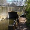
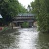
There is a bridge here which takes a railway over the canal.


Amenities

Amenities here

 Cooksley & Cobb M-F 5.30pm Sa 1pm
 Ash Vale Station
 
Maps
If you are a user and are logged on, or if you are actively planning a route, a map will be displayed here.
Show on external mapping site: Google | OSM | Bing
 
Photos
 
External websites
There are no links to external websites from here.
Why not log in and add some (select "External websites" from the menu (sometimes this is under "Edit"))?
 
Nearest facilities

Mouseover for more information or show routes to facility

Nearest water point

In the direction of Odiham Castle Stop

Ash Lock Canal Depot2 miles, 2¼ furlongs and 1 lock away
On this waterway in the direction of Odiham Castle Stop
The Fox and Hounds (Crookham)8 miles, ½ furlongs and 1 lock away
On this waterway in the direction of Odiham Castle Stop
Barley Mow Bridge12 miles, 1½ furlongs and 1 lock away
On this waterway in the direction of Odiham Castle Stop

In the direction of Woodham Junction

Mytchett Bridge1 mile, ¼ furlongs away
On this waterway in the direction of Woodham Junction
Canal Centre Swing Bridge1 mile, 1¼ furlongs away
On this waterway in the direction of Woodham Junction
Arthur's Bridge9 miles, 3½ furlongs and 22 locks away
On this waterway in the direction of Woodham Junction
Pyrford Lock No 1216 miles, ¼ furlongs and 28 locks away
Travel to Woodham Junction, then on the River Wey Wey Navigation to Pyrford Lock No 12
Thames Lock No 1616 miles, 6½ furlongs and 31 locks away
Travel to Woodham Junction, then on the River Wey Wey Navigation to Thames Lock No 16
Cartbridge Wharf19 miles, 6¼ furlongs and 32 locks away
Travel to Woodham Junction, then on the River Wey Wey Navigation to Cartbridge Wharf
Chertsey Lock19 miles, 1½ furlongs and 33 locks away
Travel to Woodham Junction, then on the River Wey Wey Navigation to Thames - Wey Junction, then on the River Thames (below Oxford) to Chertsey Lock

Nearest rubbish disposal

In the direction of Odiham Castle Stop

Ash Lock Canal Depot2 miles, 2¼ furlongs and 1 lock away
On this waterway in the direction of Odiham Castle Stop

In the direction of Woodham Junction

Mytchett Bridge1 mile, ¼ furlongs away
On this waterway in the direction of Woodham Junction
Canal Centre Swing Bridge1 mile, 1¼ furlongs away
On this waterway in the direction of Woodham Junction
Arthur's Bridge9 miles, 3½ furlongs and 22 locks away
On this waterway in the direction of Woodham Junction
Pyrford Lock No 1216 miles, ¼ furlongs and 28 locks away
Travel to Woodham Junction, then on the River Wey Wey Navigation to Pyrford Lock No 12
Shepperton Lock17 miles, 1¾ furlongs and 32 locks away
Travel to Woodham Junction, then on the River Wey Wey Navigation to Thames - Wey Junction, then on the River Thames (below Oxford) to Shepperton Lock

Nearest chemical toilet disposal

In the direction of Woodham Junction

Canal Centre Swing Bridge1 mile, 1¼ furlongs away
On this waterway in the direction of Woodham Junction
Arthur's Bridge9 miles, 3½ furlongs and 22 locks away
On this waterway in the direction of Woodham Junction
Pyrford Lock No 1216 miles, ¼ furlongs and 28 locks away
Travel to Woodham Junction, then on the River Wey Wey Navigation to Pyrford Lock No 12
Shepperton Lock17 miles, 1¾ furlongs and 32 locks away
Travel to Woodham Junction, then on the River Wey Wey Navigation to Thames - Wey Junction, then on the River Thames (below Oxford) to Shepperton Lock

Nearest place to turn

In the direction of Odiham Castle Stop

Great Bottom Flash1½ furlongs away
On this waterway in the direction of Odiham Castle Stop
Ash Wharf Bridge Winding Hole1 mile, 2 furlongs away
On this waterway in the direction of Odiham Castle Stop
Ash Lock Canal Depot2 miles, 2¼ furlongs and 1 lock away
On this waterway in the direction of Odiham Castle Stop
Wharf Bridge (Aldershot) Winding Hole3 miles, 5¾ furlongs and 1 lock away
On this waterway in the direction of Odiham Castle Stop
Eelmoor Bridge Winding Hole5 miles, 1¼ furlongs and 1 lock away
On this waterway in the direction of Odiham Castle Stop
Pondtail Bridge Winding Hole6 miles, 4 furlongs and 1 lock away
On this waterway in the direction of Odiham Castle Stop
Crondall Bridge Winding Hole9 miles, 3¾ furlongs and 1 lock away
On this waterway in the direction of Odiham Castle Stop
Blacksmiths Bridge Winding Hole11 miles, 1 furlong and 1 lock away
On this waterway in the direction of Odiham Castle Stop
Colt Hill Bridge Winding Hole14 miles, 6½ furlongs and 1 lock away
On this waterway in the direction of Odiham Castle Stop
Whitewater Winding Hole16 miles, 3¾ furlongs and 1 lock away
On this waterway in the direction of Odiham Castle Stop

In the direction of Woodham Junction

Winter's Close Winding Hole1¾ furlongs away
On this waterway in the direction of Woodham Junction
Anglers' Flash3 furlongs away
On this waterway in the direction of Woodham Junction
Potter's Wharf7½ furlongs away
On this waterway in the direction of Woodham Junction
Lock No 26 Winding Hole3 miles, 6¼ furlongs and 3 locks away
On this waterway in the direction of Woodham Junction
Frimley Lock Winding Hole4 miles, 5½ furlongs and 9 locks away
On this waterway in the direction of Woodham Junction
Frimley Bottom Lock Winding Hole5 miles, 4 furlongs and 13 locks away
On this waterway in the direction of Woodham Junction
Connaught Crescent Winding Hole5 miles, 6¾ furlongs and 14 locks away
On this waterway in the direction of Woodham Junction
Hermitage Bridge Winding Hole7 miles, 2 furlongs and 17 locks away
On this waterway in the direction of Woodham Junction
Blackhorse Road Winding Hole7 miles, 3¼ furlongs and 17 locks away
On this waterway in the direction of Woodham Junction
Arthurs Bridge Winding Hole9 miles, 3¾ furlongs and 22 locks away
On this waterway in the direction of Woodham Junction

Nearest self-operated pump-out

In the direction of Woodham Junction

Mytchett Bridge1 mile, ¼ furlongs away
On this waterway in the direction of Woodham Junction
Canal Centre Swing Bridge1 mile, 1¼ furlongs away
On this waterway in the direction of Woodham Junction

No information

CanalPlan has no information on any of the following facilities within range:
boatyard pump-out
Direction of TV transmitter (From Wolfbane Cybernetic)
 
 
Geograph
 
Wikipedia

There is no page on Wikipedia called “Ash Vale Railway Station Bridge”

Wikipedia pages that might relate to Ash Vale Railway Station Bridge
[Llantwit Fardre railway station] was a station on the Llantrisant and Taff Vale Junction Railway. The station consisted of a single platform and station buildings. A small bridge crossed [Clayton Vale] For many years, waste coal ash from the power station was transported on the line and dumped as landfill into Clayton Vale. Before the mid-nineteen eighties [Aldershot railway station] About 450m north-east of the station (towards Ash and can be seen from near the end of platform 1) is Aldershot Railway Tunnel, also known as Redan Hill [Vale of Neath Railway] The Vale of Neath Railway was a broad gauge railway company, that built a line from Merthyr Tydfil and Aberdare to Neath, in Wales, chiefly to transport [Tonteg Halt railway station] latterly on the Barry Railway under the Great Western Railway. The station on the Taff Vale/Llantrisant and Taff Vale Junction Railway was opened on 1 May [Cardiff Central railway station] Cardiff Central railway station (Welsh: Caerdydd Canolog) is a major station on the South Wales Main Line, located in the capital of Wales, Cardiff. It [Pontypool and New Inn railway station] Pontypool and New Inn railway station (Welsh: Pont-y Pwl & New Inn) is situated to the south east of Pontypool town centre between the town and the suburb [Taff Vale Railway] The Taff Vale Railway (TVR) was a standard gauge railway in South Wales, built by the Taff Vale Railway Company to serve the iron and coal industries around [Guildford] services are operated by South Western Railway. A small number peak-hour Southern trains serve both stations to London Bridge via Sutton and West Croydon. There [Barry Island railway station] after the Severn Bridge opened in 1966. A further sudden drop occurred between 1968 and 1970 with the closure of the former Taff Vale Railway branch line between
 
Google

Results of Google Search

Ash Vale Train Station | South Western Railway
Find information on trains to Ash Vale train station. View live departures and arrivals for Ash Vale, station facilities, accessibility information and book cheap train ...
Ash Vale to London Bridge (Station) - 3 ways to travel via train, and ...
Mar 15, 2020 ... The cheapest way to get from Ash Vale to London Bridge (Station) costs only £8, and the quickest way takes just 44 mins. Find the travel option ...
Ash Road Bridge - Guildford Borough Council
Project description. The scheme - which is still subject to final design - will include the construction of a new road bridge over the railway line south of Ash Station ...
Tongham railway station - Wikipedia
Tongham railway station was a railway station serving the village of Tongham, Guildford, Surrey ... Architecturally, Tongham station was similar to Ash Green Halt in that the main station building was situated at street level on a road bridge ... The road bridge which crossed the former railway line was demolished in 1994 .
File:Ash Vale station and bridge - geograph.org.uk - 55848.jpg ...
English: Ash Vale station and bridge. The railway from Woking to Alton via Aldershot crosses the Ash to Frimley road on a high embankment, just by Ash Vale ...
Ash railway station - Wikipedia
Ash railway station serves the village of Ash in Surrey, England. The station is served by South Western Railway, who manage the station, and by Great Western ...
Man dies after crash near Ash Vale railway station - recap - Get Surrey
May 14, 2020 ... Man dies after crash near Ash Vale railway station - recap. A woman involved in the same collision was also taken to hospital. Share. By.
Property & Houses to Rent: Vale House, Ash Vale
BRIDGES – Available Middle of June. A modern one bedroom apartment situated close to Ash Vale mainline railway station and with easy access to M3/A3 road ...
£22m Ash road bridge that would replace level crossing moves a ...
Mar 21, 2019 ... ... consultation and supporting evidence for the project near Ash railway station. ... Wild white-tailed eagles recorded over Surrey for first time in over 100 years ... Plans for the new road bridge south-east of Ash station (Image: ...