Llanddyn No 2 Lift Bridge No 44W
Llangollen Road, Llangollen LL20 8LN, United Kingdom
(A539)

Llanddyn No 2 Lift Bridge No 44W
is a minor waterways place
on the Shropshire Union Canal (Llangollen Canal - Main Line) between
Llangollen Wharf (1 mile
to the west) and
Ruabon Branch Junction (3 miles and 5¾ furlongs
to the east).
The nearest place in the direction of Llangollen Wharf is Llangollen Road Moorings;
1 furlong
away.
The nearest place in the direction of Ruabon Branch Junction is Llanddyn No 1 Bridge No 43W;
2½ furlongs
away.
Mooring here is unrated.
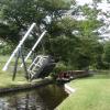
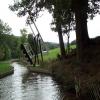
There is a lift bridge here. The bridge is normally left open. The bridge requires a windlass to operate it.
| Llangollen Services | 6 furlongs | |
| C&RT Information Point (Llangollen) | 6 furlongs | |
| Llangollen On-Line Visitor Moorings | 5 furlongs | |
| Llangollen Narrows Section (500m) | 2½ furlongs | |
| Llangollen Road Moorings | 1 furlong | |
| Llanddyn No 2 Lift Bridge No 44W | ||
| Llanddyn No 1 Bridge No 43W | 2½ furlongs | |
| Wenffrwd Bridge No 42W | 5¾ furlongs | |
| Llangollen Narrows Section (300m) | 1 mile, ¼ furlongs | |
| Sun Trevor Bridge No 41W | 1 mile, ¼ furlongs | |
| The Sun Trevor PH & Restaurant | 1 mile, ½ furlongs | |
There are no links to external websites from here.
Why not log in and add some (select "External websites" from the menu (sometimes this is under "Edit"))?
Mouseover for more information or show routes to facility
Nearest water point
In the direction of Hurleston Junction
The Old Wharf — 3 miles, 5¾ furlongs away
Travel to Ruabon Branch Junction, then on the Shropshire Union Canal (Llangollen Canal - Ruabon Branch) to The Old Wharf
Trevor Basin — 3 miles, 6¾ furlongs away
Travel to Ruabon Branch Junction, then on the Shropshire Union Canal (Llangollen Canal - Ruabon Branch) to Trevor Basin
Coedfryn Water Point — 4 miles, ½ furlongs away
On this waterway in the direction of Hurleston Junction
Chirk Marina — 5 miles, 7¼ furlongs away
On this waterway in the direction of Hurleston Junction
New Marton Water Points — 10 miles, 7 furlongs away
On this waterway in the direction of Hurleston Junction
Ellesmere Services — 17 miles, 5¾ furlongs and 2 locks away
On this waterway in the direction of Hurleston Junction
Blackwater Meadow Marina — 17 miles, 7 furlongs and 2 locks away
On this waterway in the direction of Hurleston Junction
Weston Arm Services (C&RT) — 14 miles, 7¾ furlongs and 6 locks away
Travel to Frankton Junction, then on the Shropshire Union Canal (Montgomery Canal - connected and navigable) to Weston Arm Junction, then on the Shropshire Union Canal (Weston Branch) to Weston Arm Services (C&RT)
In the direction of Llantisilio - Horseshoe Falls
Llangollen Services — 6 furlongs away
On this waterway in the direction of Llantisilio - Horseshoe Falls
Llangollen Basin — 1 mile, 1 furlong away
On this waterway in the direction of Llantisilio - Horseshoe FallsNearest rubbish disposal
In the direction of Hurleston Junction
Ellesmere Services — 17 miles, 5¾ furlongs and 2 locks away
On this waterway in the direction of Hurleston Junction
Weston Arm Services (C&RT) — 14 miles, 7¾ furlongs and 6 locks away
Travel to Frankton Junction, then on the Shropshire Union Canal (Montgomery Canal - connected and navigable) to Weston Arm Junction, then on the Shropshire Union Canal (Weston Branch) to Weston Arm Services (C&RT)
In the direction of Llantisilio - Horseshoe Falls
Llangollen Services — 6 furlongs away
On this waterway in the direction of Llantisilio - Horseshoe Falls
Llangollen Basin — 1 mile, 1 furlong away
On this waterway in the direction of Llantisilio - Horseshoe FallsNearest chemical toilet disposal
In the direction of Hurleston Junction
Chirk Marina — 5 miles, 7¼ furlongs away
On this waterway in the direction of Hurleston Junction
Whittington Wharf Narrowboats — 13 miles, 1¼ furlongs and 2 locks away
On this waterway in the direction of Hurleston Junction
Ellesmere Services — 17 miles, 5¾ furlongs and 2 locks away
On this waterway in the direction of Hurleston Junction
Weston Arm Services (C&RT) — 14 miles, 7¾ furlongs and 6 locks away
Travel to Frankton Junction, then on the Shropshire Union Canal (Montgomery Canal - connected and navigable) to Weston Arm Junction, then on the Shropshire Union Canal (Weston Branch) to Weston Arm Services (C&RT)
In the direction of Llantisilio - Horseshoe Falls
Llangollen Services — 6 furlongs away
On this waterway in the direction of Llantisilio - Horseshoe FallsNearest place to turn
In the direction of Hurleston Junction
Bryn Howel Winding Hole — 1 mile, 7¼ furlongs away
On this waterway in the direction of Hurleston Junction
Ruabon Branch Junction — 3 miles, 5¾ furlongs away
On this waterway in the direction of Hurleston Junction
Trevor Basin — 3 miles, 6¾ furlongs away
Travel to Ruabon Branch Junction, then on the Shropshire Union Canal (Llangollen Canal - Ruabon Branch) to Trevor Basin
Coedfryn Winding Hole — 4 miles, 1¾ furlongs away
On this waterway in the direction of Hurleston Junction
Chirk Marina — 5 miles, 7¼ furlongs away
On this waterway in the direction of Hurleston Junction
Chirk Golf Course Winding Hole — 6 miles, 2 furlongs away
On this waterway in the direction of Hurleston Junction
Chirk Pool — 7 miles, 2¼ furlongs away
On this waterway in the direction of Hurleston Junction
Rhoswiel Bridge Winding Hole — 8 miles, 3 furlongs away
On this waterway in the direction of Hurleston Junction
Polletts Bridge Winding Hole — 12 miles, 6½ furlongs and 2 locks away
On this waterway in the direction of Hurleston Junction
Frankton Junction — 14 miles, 2¾ furlongs and 2 locks away
On this waterway in the direction of Hurleston Junction
Sewage Works Winding Hole — 17 miles, 1½ furlongs and 2 locks away
On this waterway in the direction of Hurleston Junction
Ellesmere Branch Junction — 17 miles, 6 furlongs and 2 locks away
On this waterway in the direction of Hurleston Junction
Ellesmere Town Wharf — 18 miles and 2 locks away
Travel to Ellesmere Branch Junction, then on the Shropshire Union Canal (Llangollen Canal - Ellesmere Branch) to Ellesmere Town Wharf
Weston Arm Junction — 14 miles, 6¾ furlongs and 6 locks away
Travel to Frankton Junction, then on the Shropshire Union Canal (Montgomery Canal - connected and navigable) to Weston Arm Junction
Baysil Wood Winding Hole — 19 miles, 3¾ furlongs and 2 locks away
On this waterway in the direction of Hurleston Junction
Hawkswood Winding Hole — 15 miles, 5½ furlongs and 7 locks away
Travel to Frankton Junction, then on the Shropshire Union Canal (Montgomery Canal - connected and navigable) to Hawkswood Winding Hole
Queen's Head Winding Hole — 18 miles, 1¾ furlongs and 7 locks away
Travel to Frankton Junction, then on the Shropshire Union Canal (Montgomery Canal - connected and navigable) to Queen's Head Winding Hole
Park Mill Bridge Winding Hole — 19 miles, 7½ furlongs and 10 locks away
Travel to Frankton Junction, then on the Shropshire Union Canal (Montgomery Canal - connected and navigable) to Park Mill Bridge Winding Hole
In the direction of Llantisilio - Horseshoe Falls
Llangollen Basin — 1 mile, 1 furlong away
On this waterway in the direction of Llantisilio - Horseshoe FallsNearest boatyard pump-out
In the direction of Hurleston Junction
The Old Wharf — 3 miles, 5¾ furlongs away
Travel to Ruabon Branch Junction, then on the Shropshire Union Canal (Llangollen Canal - Ruabon Branch) to The Old Wharf
Chirk Marina — 5 miles, 7¼ furlongs away
On this waterway in the direction of Hurleston Junction
Whittington Wharf Narrowboats — 13 miles, 1¼ furlongs and 2 locks away
On this waterway in the direction of Hurleston Junction
Blackwater Meadow Marina — 17 miles, 7 furlongs and 2 locks away
On this waterway in the direction of Hurleston JunctionNo information
CanalPlan has no information on any of the following facilities within range:self-operated pump-out
Direction of TV transmitter (From Wolfbane Cybernetic)
In to, and out of, Llangollen from Scribblings from the Mintball posted Sunday the 17th of September, 2017
There is no page on Wikipedia called “Llanddyn No 2 Lift Bridge No 44W”
Wikipedia pages that might relate to Llanddyn No 2 Lift Bridge No 44W
[Llangollen Canal]
weighted counterbalance allows the bridge to be opened, and the structure is grade II* listed. Wrenbury lift bridge, No. 20, is automated, with push-button
[Ellesmere Canal]
the canal, and is now infilled. The 5 1⁄2-mile-long (9 km) arm had wharves at Hordley, Dandyford, Pedlar's Bridge, Shade Oak and Weston Lullingfields. At
Results of Google Search
Apr 13, 2016 ... This is Bridge No 44W across the Llangollen Canal. It is a farmer's accommodation bridge with no public right of way. It is normally left raised.
Junction Canal - Main Line) to Jackson's Bridge No 26 on the Shropshire Union Canal (Llangollen Canal ... Also known as Llanddyn No 2 Lift Bridge No 44W.
Mar 10, 2018 ... Oxford Canal Bridge 221‎ (3 F). ▻ Oxford Canal Bridge 231‎ (3 F). ▻ Oxford Canal Bridge 233‎ (2 F) ... Bridge 44W in the snow - geograph.org.uk - 1653960.jpg 640 × 428; ... Hessell's no.1 Lift Bridge, Llangollen Canal - geograph.org.uk ... Llanddyn Bridge Number 2 - geograph.org.uk - 756780.jpg 640 ...
Apr 22, 2010 ... Llanddyn (No 2) Bridge is a lift bridge that is left open and the second set of narrows follow fairly soon. ... Llanddyn Lift Bridge (44W) ... We met a narrowboat ( Nb Thor (ex BCN tug)) at Siambr Wen Bridge (45W); they held back ...
Area 2 Central Southern England ... N Shields Royal Quays ... Area 13 - N Ireland ... Section 2. Marine Supplies and Services Section Adhesives Associations ... They take no account of the characteristics of individual vessels nor the actual or ... A small pedestrian bridge across the marina ent lifts on request, if shut berth on ...
2, No. 3, and tlie 2nd Pen- dant as the Re- peater of the 2nd Flag from tlie Top. ... 9536 1250 Bridget 1253 Archibald 1254 Bridgetown I Bridge water, 768 1256 Brien Boru Bricrley ... Llanddwyn Point, see Carnarvon Loch Ryan, see Ryan 157 Long8hips,la.50.3.58. lo.5.44.45 w. ... 7241 370 IledcBas,la.48.44.45. lo.4.1.44w. r.


![Trees and a lift bridge. The Vale of Llangollen has plenty of trees left despite the losses that occurred during March of 2013. Now that spring is here the whole valley has greened up and the banks of the canal are no exception. The group of young trees on the left lost one tree that split but the other seven are fine.[[[3399529]]] by John Haynes – 07 June 2013](https://s3.geograph.org.uk/geophotos/03/50/66/3506647_ad351adb_120x120.jpg)


![Bridge 44W in the snow. Llanddyn lift bridge on 7th January.[[[1634478]]] by John Haynes – 07 January 2010](https://s0.geograph.org.uk/geophotos/01/65/39/1653960_d522f999_120x120.jpg)


![Bridge 44W in early summer. Llanddyn lift bridge on 16 June 2010.[[[1653960]]][[[1634478]]] by John Haynes – 16 June 2010](https://s2.geograph.org.uk/geophotos/01/91/75/1917550_f4141ce4_120x120.jpg)

![Bridge 44W in mid winter. Llanddyn lift bridge on 21 December.[[[1653960]]] by John Haynes – 21 December 2009](https://s2.geograph.org.uk/geophotos/01/63/44/1634478_65756e93_120x120.jpg)


![Winter mooring for Bena Riamba. A residential canal boat moored on the Shropshire Union Canal (Llangollen Branch) near Llangollen, a much sought after spot as there is a gap in the canal side trees which lets the sun in and also provides a great view. [[[1866805]]] by John Haynes – 19 January 2013](https://s3.geograph.org.uk/geophotos/03/30/28/3302815_7c8fbd9b_120x120.jpg)