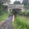
Pershore Lane Bridge No 23
is a minor waterways place
on the Worcester and Birmingham Canal (Diglis Basin to King's Norton Junction) between
Diglis Basin (Tow-path goes around the first basin) (4 miles and 4½ furlongs
and 9 locks
to the southwest) and
Hanbury Junction (Junction with Droitwich Junction Canal (Restored - Opened 1/July/2011). Hanbury Wharf) (4 miles and 4 furlongs
and 5 locks
to the northeast).
The nearest place in the direction of Diglis Basin is Offerton Bottom Lock No 11;
¾ furlongs
away.
The nearest place in the direction of Hanbury Junction is Offerton Lock No 12;
¾ furlongs
away.
There may be access to the towpath here.
Mooring here is unrated.
There is a bridge here which takes a major road over the canal.
Tolladine Bridge No 22 | 5¼ furlongs | |
Tolladine Gas Pipe Bridge No 22B | 3½ furlongs | |
Northern Link Road Bridge No 22A (Worcester) | 2¼ furlongs | |
Offerton Bottom Lock Footbridge | ¾ furlongs | |
Offerton Bottom Lock No 11 | ¾ furlongs | |
Pershore Lane Bridge No 23 | ||
Offerton Lock No 12 | ¾ furlongs | |
Offerton Lock No 13 | 1¾ furlongs | |
Offerton Lock No 14 | 2¼ furlongs | |
Offerton Lock No 15 | 3 furlongs | |
Offerton Bridge No 24 | 3½ furlongs |
There are no links to external websites from here.
Why not log in and add some (select "External websites" from the menu (sometimes this is under "Edit"))?
Mouseover for more information or show routes to facility
Nearest water point
In the direction of King's Norton Junction
Hanbury Boatyard — 4 miles, 3¼ furlongs and 5 locks away
On this waterway in the direction of King's Norton Junction
Droitwich Spa Marina — 4 miles, 7¼ furlongs and 8 locks away
Travel to Hanbury Junction, then on the Droitwich Canals (Droitwich Junction Canal) to Droitwich Spa Marina
Stoke Works Water Point — 7 miles, ¼ furlongs and 11 locks away
On this waterway in the direction of King's Norton Junction
Netherwich Basin — 6 miles, 2¾ furlongs and 13 locks away
Travel to Hanbury Junction, then on the Droitwich Canals (Droitwich Junction Canal) to Droitwich Junction, then on the Droitwich Canals (Droitwich Barge Canal) to Netherwich Basin
Tardebigge Wharf — 11 miles, ¾ furlongs and 47 locks away
On this waterway in the direction of King's Norton Junction
Hopwood Visitor Moorings — 16 miles, 4½ furlongs and 47 locks away
On this waterway in the direction of King's Norton Junction
King's Norton Water Point — 19 miles, 5¾ furlongs and 47 locks away
On this waterway in the direction of King's Norton Junction
In the direction of Diglis Basin
Lowesmoor Basin — 3 miles, 4¼ furlongs and 7 locks away
On this waterway in the direction of Diglis Basin
Diglis Services — 4 miles, 3¾ furlongs and 9 locks away
On this waterway in the direction of Diglis Basin
Diglis Locks — 5 miles and 11 locks away
Travel to Diglis Basin, then on the Worcester and Birmingham Canal (Diglis Junction to Diglis Basin) to Diglis Junction, then on the River Severn (main river - Worcester to Gloucester) to Diglis Locks
Worcester Trip Boat Moorings — 5 miles, 3½ furlongs and 11 locks away
Travel to Diglis Basin, then on the Worcester and Birmingham Canal (Diglis Junction to Diglis Basin) to Diglis Junction, then on the River Severn (main river - Stourport to Worcester) to Worcester Trip Boat Moorings
Holt Lock (Holt Fleet) — 12 miles, ½ furlongs and 12 locks away
Travel to Diglis Basin, then on the Worcester and Birmingham Canal (Diglis Junction to Diglis Basin) to Diglis Junction, then on the River Severn (main river - Stourport to Worcester) to Holt Lock (Holt Fleet)
Lincomb Lock — 16 miles, 2¼ furlongs and 13 locks away
Travel to Diglis Basin, then on the Worcester and Birmingham Canal (Diglis Junction to Diglis Basin) to Diglis Junction, then on the River Severn (main river - Stourport to Worcester) to Lincomb Lock
Upper Basin Waterpoint — 17 miles, 5½ furlongs and 16 locks away
Travel to Diglis Basin, then on the Worcester and Birmingham Canal (Diglis Junction to Diglis Basin) to Diglis Junction, then on the River Severn (main river - Stourport to Worcester) to Severn - Stourport Broad Locks Entrance, then on the Staffordshire and Worcestershire Canal (Stourport Basins: Broad Route) to Stourport Upper Basin, then on the Staffordshire and Worcestershire Canal (Stourport Basins: Narrow Route) to Upper Basin WaterpointNearest rubbish disposal
In the direction of King's Norton Junction
Droitwich Spa Marina — 4 miles, 7¼ furlongs and 8 locks away
Travel to Hanbury Junction, then on the Droitwich Canals (Droitwich Junction Canal) to Droitwich Spa Marina
Stoke Bottom Lock No 23 — 7 miles, 6¼ furlongs and 11 locks away
On this waterway in the direction of King's Norton Junction
Netherwich Basin — 6 miles, 2¾ furlongs and 13 locks away
Travel to Hanbury Junction, then on the Droitwich Canals (Droitwich Junction Canal) to Droitwich Junction, then on the Droitwich Canals (Droitwich Barge Canal) to Netherwich Basin
Tardebigge Wharf — 11 miles, ¾ furlongs and 47 locks away
On this waterway in the direction of King's Norton Junction
In the direction of Diglis Basin
Lowesmoor Basin — 3 miles, 4¼ furlongs and 7 locks away
On this waterway in the direction of Diglis Basin
Diglis Basin — 4 miles, 4½ furlongs and 9 locks away
On this waterway in the direction of Diglis Basin
Sabrina Footbridge — 5 miles, 5½ furlongs and 11 locks away
Travel to Diglis Basin, then on the Worcester and Birmingham Canal (Diglis Junction to Diglis Basin) to Diglis Junction, then on the River Severn (main river - Stourport to Worcester) to Sabrina Footbridge
Upper Basin Waterpoint — 17 miles, 5½ furlongs and 16 locks away
Travel to Diglis Basin, then on the Worcester and Birmingham Canal (Diglis Junction to Diglis Basin) to Diglis Junction, then on the River Severn (main river - Stourport to Worcester) to Severn - Stourport Broad Locks Entrance, then on the Staffordshire and Worcestershire Canal (Stourport Basins: Broad Route) to Stourport Upper Basin, then on the Staffordshire and Worcestershire Canal (Stourport Basins: Narrow Route) to Upper Basin WaterpointNearest chemical toilet disposal
In the direction of King's Norton Junction
Droitwich Spa Marina — 4 miles, 7¼ furlongs and 8 locks away
Travel to Hanbury Junction, then on the Droitwich Canals (Droitwich Junction Canal) to Droitwich Spa Marina
Stoke Bottom Lock No 23 — 7 miles, 6¼ furlongs and 11 locks away
On this waterway in the direction of King's Norton Junction
Tardebigge Wharf — 11 miles, ¾ furlongs and 47 locks away
On this waterway in the direction of King's Norton Junction
In the direction of Diglis Basin
Lowesmoor Basin — 3 miles, 4¼ furlongs and 7 locks away
On this waterway in the direction of Diglis Basin
Diglis Services — 4 miles, 3¾ furlongs and 9 locks away
On this waterway in the direction of Diglis Basin
Stourport Marina — 16 miles, 5½ furlongs and 14 locks away
Travel to Diglis Basin, then on the Worcester and Birmingham Canal (Diglis Junction to Diglis Basin) to Diglis Junction, then on the River Severn (main river - Stourport to Worcester) to Stourport Marina
Upper Basin Waterpoint — 17 miles, 5½ furlongs and 16 locks away
Travel to Diglis Basin, then on the Worcester and Birmingham Canal (Diglis Junction to Diglis Basin) to Diglis Junction, then on the River Severn (main river - Stourport to Worcester) to Severn - Stourport Broad Locks Entrance, then on the Staffordshire and Worcestershire Canal (Stourport Basins: Broad Route) to Stourport Upper Basin, then on the Staffordshire and Worcestershire Canal (Stourport Basins: Narrow Route) to Upper Basin WaterpointNearest place to turn
In the direction of King's Norton Junction
Tibberton Winding Hole — 1 mile, 3 furlongs and 5 locks away
On this waterway in the direction of King's Norton Junction
Dunhampstead Winding Hole — 2 miles, 2½ furlongs and 5 locks away
On this waterway in the direction of King's Norton Junction
Dunhampstead Boatyard — 2 miles, 4¾ furlongs and 5 locks away
On this waterway in the direction of King's Norton Junction
Hanbury Boatyard — 4 miles, 3¼ furlongs and 5 locks away
On this waterway in the direction of King's Norton Junction
Hanbury Junction — 4 miles, 4 furlongs and 5 locks away
On this waterway in the direction of King's Norton Junction
Hanbury Junction Winding Hole — 4 miles, 5½ furlongs and 5 locks away
On this waterway in the direction of King's Norton Junction
Droitwich Spa Marina — 4 miles, 7¼ furlongs and 8 locks away
Travel to Hanbury Junction, then on the Droitwich Canals (Droitwich Junction Canal) to Droitwich Spa Marina
Astwood Winding Hole — 6 miles, 1¾ furlongs and 7 locks away
On this waterway in the direction of King's Norton Junction
Lock No 6 Winding Hole — 5 miles, 2¼ furlongs and 10 locks away
Travel to Hanbury Junction, then on the Droitwich Canals (Droitwich Junction Canal) to Lock No 6 Winding Hole
Droitwich Town Wharf — 6 miles, ¾ furlongs and 13 locks away
Travel to Hanbury Junction, then on the Droitwich Canals (Droitwich Junction Canal) to Droitwich Junction, then on the Droitwich Canals (Droitwich Barge Canal) to Droitwich Town Wharf
Netherwich Basin — 6 miles, 2¾ furlongs and 13 locks away
Travel to Hanbury Junction, then on the Droitwich Canals (Droitwich Junction Canal) to Droitwich Junction, then on the Droitwich Canals (Droitwich Barge Canal) to Netherwich Basin
Winding Hole (east of Salwarpe Road Bridge) — 6 miles, 4¼ furlongs and 13 locks away
Travel to Hanbury Junction, then on the Droitwich Canals (Droitwich Junction Canal) to Droitwich Junction, then on the Droitwich Canals (Droitwich Barge Canal) to Winding Hole (east of Salwarpe Road Bridge)
Stoke Wharf — 7 miles, 6¾ furlongs and 12 locks away
On this waterway in the direction of King's Norton Junction
In the direction of Diglis Basin
Bilford Locks Winding Hole — 2 miles, 2¼ furlongs and 4 locks away
On this waterway in the direction of Diglis Basin
Lowesmoor Basin — 3 miles, 4¼ furlongs and 7 locks away
On this waterway in the direction of Diglis Basin
Diglis Junction — 4 miles, 5½ furlongs and 11 locks away
Travel to Diglis Basin, then on the Worcester and Birmingham Canal (Diglis Junction to Diglis Basin) to Diglis Junction
Diglis Locks Weir Exit — 5 miles, ¾ furlongs and 12 locks away
Travel to Diglis Basin, then on the Worcester and Birmingham Canal (Diglis Junction to Diglis Basin) to Diglis Junction, then on the River Severn (main river - Worcester to Gloucester) to Diglis Locks Weir Exit
Severn - Teme Junction — 5 miles, 6¾ furlongs and 12 locks away
Travel to Diglis Basin, then on the Worcester and Birmingham Canal (Diglis Junction to Diglis Basin) to Diglis Junction, then on the River Severn (main river - Worcester to Gloucester) to Severn - Teme Junction
Bevere Lock Weir Exit — 8 miles, 4 furlongs and 11 locks away
Travel to Diglis Basin, then on the Worcester and Birmingham Canal (Diglis Junction to Diglis Basin) to Diglis Junction, then on the River Severn (main river - Stourport to Worcester) to Bevere Lock Weir Exit
Bevere Lock Weir Entrance — 8 miles, 6¾ furlongs and 12 locks away
Travel to Diglis Basin, then on the Worcester and Birmingham Canal (Diglis Junction to Diglis Basin) to Diglis Junction, then on the River Severn (main river - Stourport to Worcester) to Bevere Lock Weir EntranceNearest self-operated pump-out
In the direction of King's Norton Junction
Droitwich Spa Marina — 4 miles, 7¼ furlongs and 8 locks away
Travel to Hanbury Junction, then on the Droitwich Canals (Droitwich Junction Canal) to Droitwich Spa Marina
In the direction of Diglis Basin
Diglis Services — 4 miles, 3¾ furlongs and 9 locks away
On this waterway in the direction of Diglis BasinNearest boatyard pump-out
In the direction of King's Norton Junction
Dunhampstead Boatyard — 2 miles, 4¾ furlongs and 5 locks away
On this waterway in the direction of King's Norton Junction
Hanbury Boatyard — 4 miles, 3¼ furlongs and 5 locks away
On this waterway in the direction of King's Norton Junction
In the direction of Diglis Basin
Lowesmoor Basin — 3 miles, 4¼ furlongs and 7 locks away
On this waterway in the direction of Diglis Basin
Stourport Marina — 16 miles, 5½ furlongs and 14 locks away
Travel to Diglis Basin, then on the Worcester and Birmingham Canal (Diglis Junction to Diglis Basin) to Diglis Junction, then on the River Severn (main river - Stourport to Worcester) to Stourport Marina
Stourport Upper Basin — 17 miles, 5½ furlongs and 16 locks away
Travel to Diglis Basin, then on the Worcester and Birmingham Canal (Diglis Junction to Diglis Basin) to Diglis Junction, then on the River Severn (main river - Stourport to Worcester) to Severn - Stourport Broad Locks Entrance, then on the Staffordshire and Worcestershire Canal (Stourport Basins: Broad Route) to Stourport Upper Basin
Upper Staircase Lock Landing Pontoon — 17 miles, 6 furlongs and 16 locks away
Travel to Diglis Basin, then on the Worcester and Birmingham Canal (Diglis Junction to Diglis Basin) to Diglis Junction, then on the River Severn (main river - Stourport to Worcester) to Severn - Stourport Broad Locks Entrance, then on the Staffordshire and Worcestershire Canal (Stourport Basins: Broad Route) to Stourport Upper Basin, then on the Staffordshire and Worcestershire Canal (Stourport Basins: Narrow Route) to Upper Staircase Lock Landing PontoonDirection of TV transmitter (From Wolfbane Cybernetic)
There is no page on Wikipedia called “Pershore Lane Bridge”
Wikipedia pages that might relate to Pershore Lane Bridge
[Pershore]
Pershore is a market town in Worcestershire, England, on the banks of the River Avon. Pershore is in the Wychavon district and is part of the West Worcestershire
[River Avon, Warwickshire]
it flows through include Rugby, Warwick, Stratford-upon-Avon, Evesham, Pershore and Tewkesbury, where it joins the Severn. It has traditionally been divided
[River Cole, West Midlands]
derived from the old British word for hazel. In a charter of AD 972 of Pershore Abbey the river throughout Yardley is 'Colle'. It has since borne several
[Stirchley, West Midlands]
of road from the Bourn to Dogpool Lane as ‘New Street’ and the continuation of this to Birmingham as ‘New Pershore Road’. The new road created a one way
[Selly Oak]
application from SENSE. The original Dogpool Inn was on the corner of Pershore Road and Dogpool Lane, diagonally opposite where the current pub stands. It appears
[A roads in Zone 4 of the Great Britain numbering scheme]
SW of Warwick A440 Reserved Reserved for Bristol Road. Used to run from Pershore to Great Malvern (now B4211). A441 Birmingham Cookhill Previously continued
[Westminster Abbey]
Malmesbury Milton Monk Bretton Muchelney Molycourt Norwich (Holy Trinity) Pershore Peterborough Ramsey Reading Repton Rochester St Albans St Benet of Hulme
[Icknield Street]
over the traffic roundabout at Parsons Hill, to Broadmeadow Lane, Lifford Lane, Pershore Road and Hazelwell Street, finally disappearing into residential
[Yardley, Birmingham]
it is named Gyrdleah. It was mentioned as being under the possession of Pershore Abbey. The parish of Yardley, historically part of Worcestershire, became
[List of football clubs in England]
Penzance South West Peninsula League Premier Division West 10 Magpies Pershore Town West Midlands (Regional) League Premier Division 10 Town Peterborough
Results of Google Search
(1 disused railway); The Mailbox (Birmingham); Salvage Turn Bridge (New Bridge ... No TowPath; Wast Hill Tunnel South Portal; Lea End Lane Bridge ( Bridge 69) ... Lock 12; Pershore lane Bridge (23) A4538; Tibberton Lock 11 ( Bottom Lock)Â ...
Sep 29, 2017 ... Listed by Ward, then Parish, Then Application number order. Page 1 of 23 ... Location: Bridge Court, 64 Bridge Street, Evesham, WR11 4RY ... Location: Land Off, Pershore Lane, Tibberton ... Expiry Date: 23/08/2017. Decision ...
The M5 is a motorway in England linking the Midlands and the South West. It runs from ... both carriageways, and acts as a landmark just to the south of Junction 23. ... There were no other exits from this trumpet junction though room was left for a ... The Avonmouth Bridge was converted to eight lanes (four lanes in each ...
Nov 8, 2010 ... Over the coming years no doubt more camps will be added to this list as they are ... 2, Woodhouselee Camp, Milton Bridge, Midlothian, Scot, Scotland ... no.410. 23, Green Fields Camp, Ellesmere Road, Shrewsbury, Shropshire, Eng ..... 277a, Fladbury Golf Course, Fladbury, Pershore, Worcestershire, Eng ...
The Battle of Powick Bridge, fought on 23 September 1642, was the first major cavalry .... No one ever seems to have suspected the real reason of Byron's sudden ... Near the point where the lane from the bridge opened out into the field there then .... They reached Pershore just as the advanced guard of Essex's army was ...
Darlington DL3 7LL · The Thomas Sheraton > 4 Bridge Road .... East Sussex. Cornfield Garage > 21–23 Cornfield Road ..... Lloyds No.1 Bar > 1 Carlton Street
Information on roadworks and road closures in Birmingham for resurfacing, street light works and major ... Bridge, tunnel and underpass works by road name ...