CanalPlanAC

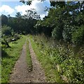
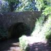
Preacher's Bridge No 77

 
Also known as: Old Abergavenny Road Bridge and Cottage Bridge;
Old Abergavenny Road, Llanover NP7 9EN, United Kingdom
 
Information about the place
Preacher's Bridge No 77 is a minor waterways place on the Monmouthshire and Brecon Canal between Pontymoile Basin (Junction with the Monmouthshire Canal) (5 miles and 7 furlongs to the southwest) and Wooden Bridge No 91 (Footpath to Llanellen a quarter of a mile) (2 miles and 7 furlongs to the northwest).
 
 
The nearest place in the direction of Pontymoile Basin is Lapstone Bridge No 76; ¾ furlongs away.
 
The nearest place in the direction of Wooden Bridge No 91 is Mill Turn Bridge No 78; 2¾ furlongs away.

There may be access to the towpath here.

Mooring here is unrated.

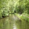
There is a bridge here which takes a minor road over the canal.


Amenities
 
Maps
If you are a user and are logged on, or if you are actively planning a route, a map will be displayed here.
Show on external mapping site: Google | OSM | Bing
 
Additional information

The bridge appears at the start of a 1976 episode of the BBC TV series "Survivors" entitled "Parasites". The canal from here to bridge No 76 also features heavily.

 
Photos
 
External websites
There are no links to external websites from here.
Why not log in and add some (select "External websites" from the menu (sometimes this is under "Edit"))?
 
Nearest facilities

Mouseover for more information or show routes to facility

Nearest water point

In the direction of Five Locks Road

Pontymoile Footbridge No 525 miles, 7 furlongs away
On this waterway in the direction of Five Locks Road

In the direction of Theatre Basin

Govilon Visitor Moorings5 miles, 5¼ furlongs away
On this waterway in the direction of Theatre Basin
Govilon Wharf5 miles, 6 furlongs away
On this waterway in the direction of Theatre Basin

Nearest place to turn

In the direction of Five Locks Road

Jenkin Rosser's Winding Hole2¾ furlongs away
On this waterway in the direction of Five Locks Road
Goytre Arm5¼ furlongs away
On this waterway in the direction of Five Locks Road
Croes-y-Pant Winding Hole1 mile, 6 furlongs away
On this waterway in the direction of Five Locks Road
Cwmoody Winding Hole4 miles, 3¼ furlongs away
On this waterway in the direction of Five Locks Road
Usk Road Winding Hole4 miles, 7¾ furlongs away
On this waterway in the direction of Five Locks Road
Pontymoile Basin5 miles, 7 furlongs away
On this waterway in the direction of Five Locks Road
Lansdowne Winding Hole7 miles, 1 furlong away
On this waterway in the direction of Five Locks Road
Five Locks Basin7 miles, 7 furlongs away
On this waterway in the direction of Five Locks Road

In the direction of Theatre Basin

Llanover Winding Hole5 furlongs away
On this waterway in the direction of Theatre Basin
Llanfoist Wharf4 miles, 4½ furlongs away
On this waterway in the direction of Theatre Basin
Govilon Winding Hole5 miles, 5¾ furlongs away
On this waterway in the direction of Theatre Basin
Malford Grove Winding Hole8 miles, ¾ furlongs away
On this waterway in the direction of Theatre Basin
Pen-Pedair Heol Winding Hole9 miles, 6½ furlongs away
On this waterway in the direction of Theatre Basin
Beacon Park Boats10 miles, 6¼ furlongs away
On this waterway in the direction of Theatre Basin

No information

CanalPlan has no information on any of the following facilities within range:
rubbish disposal
chemical toilet disposal
self-operated pump-out
boatyard pump-out
Direction of TV transmitter (From Wolfbane Cybernetic)
 
 
Geograph
 
Wikipedia

There is no page on Wikipedia called “Preacher's Bridge”

Wikipedia pages that might relate to Preacher's Bridge
[Abergavenny] Abergavenny (/ˌæbərɡəˈvɛni/; Welsh: Y Fenni pronounced [ə ˈvɛnɪ], archaically Abergafenni meaning "mouth of the River Gavenny") is both a market town [Monmouthshire and Brecon Canal] collieries at Gellifelen to Llangrwyney Forge, and on to the Abergavenny to Brecon turnpike road. The line was opened in 1794, and later served the canal [Abergavenny Brecon Road railway station] Abergavenny (Brecon Road) railway station was a station on the London and North Western Railway's Heads of the Valleys line serving the town of Abergavenny [A roads in Zone 4 of the Great Britain numbering scheme] List of A roads in zone 4 in Great Britain starting north of the A4 and south/west of the A5 (roads beginning with 4). Mosalski, Ruth (4 November 2014) [A40 road] 1935, between Ross-on-Wye and Abergavenny. The original route of the A40 was via Skenfrith, avoiding Monmouth; this road was renumbered the B4521. The [Grosmont Railway] was built to the north of the old line, while the tramroad became a road (now part of the main A465 road between Abergavenny and Hereford). At Werngifford [River Gavenny] at Lower Monk Street (B4233), Monmouth Road A40 and Mill Street bridges east of Abergavenny town centre. The old Llanvihangel Railway, a tramroad which [River Usk] once a ferry crossing of the river near Llanwenarth, the next bridge is that at Abergavenny connecting the town with Llanfoist. This grade II* listed structure [Newport, Wales] Pontypool and Abergavenny via M4 junction 25A. The A4051 (Malpas Road) connects Newport to Cwmbran via M4 junction 26. The A4072 (Forge Road) from M4 junction [Bat bridge] A bat bridge is a structure of varying construction crossing a new or altered road to aid the navigation of bats following the destruction of a hedgerow
 
Google

Results of Google Search

Listed Buildings in Goetre Fawr, Monmouthshire
77 Photos Carrying the Old Abergavenny Road over the canal. II Bridge No. 78 Photos Carrying a footpath over the canal about 150m east of Pantglas Mill at the  ...
Bridge No. 76, Abergavenny, Monmouthshire
Jul 18, 2001 ... 76 is a Grade II listed building in Abergavenny, Monmouthshire, Wales. ... II Bridge No. 77. Carrying the Old Abergavenny Road over the canal.
British Listed Buildings
About 150m north of the cross-roads at Pencroesoped in the direction of Llanover village. II Bridge No. 77 Photos Carrying the Old Abergavenny Road over the ...
2020 » Parasites location visit - Terry Nation's survivors 1975
Aug 8, 2017 ... You are not logged in. ... Bridge) and Bridge 77 (The Old Abergavenny Road Bridge) on the Monmouthshire ... This is Bridge 77 then (in 1976):
Every prisoner of war camp in the UK mapped and listed | News ...
Nov 8, 2010 ... The camps where the PoWs were imprisoned have largely (but not all) disappeared. At one time ... 2, Woodhouselee Camp, Milton Bridge, Midlothian, Scot, Scotland ... 29, Claremont, Abergavenny, Monmouthshire, Wales, Wales ... 152, Old Liberal Club, Charnwood Road, Shepshed, Leicestershire, Eng.