CanalPlanAC

Chelburn Bridge

 
The Summit, Todmorden Road, Summit OL15 9QJ, United Kingdom
 
Information about the place
Chelburn Bridge is a minor waterways place on the Rochdale Canal between Littleborough Lower Lock No 48 (1 mile and 5½ furlongs and 10 locks to the southwest) and Hollings Lock No 27 (Walsden) (2 miles and 4 furlongs and 10 locks to the northwest).
 
 
The nearest place in the direction of Littleborough Lower Lock No 48 is Chelbourne Wharfe Visitor Moorings; ½ furlongs away.
 
The nearest place in the direction of Hollings Lock No 27 is West Summit Lock No 37 (You need a handcuff key to operate this lock.); a few yards away.

There may be access to the towpath here.

Mooring here is unrated.

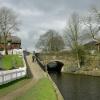
There is a bridge here which takes a minor road over the canal.


Amenities
 
Maps
If you are a user and are logged on, or if you are actively planning a route, a map will be displayed here.
Show on external mapping site: Google | OSM | Bing
 
Photos
 
External websites
There are no links to external websites from here.
Why not log in and add some (select "External websites" from the menu (sometimes this is under "Edit"))?
 
Nearest facilities

Mouseover for more information or show routes to facility

Nearest water point

In the direction of Castlefield Junction

Littleborough Sanitary Station1 mile, 3¼ furlongs and 9 locks away
On this waterway in the direction of Castlefield Junction
New Islington Marina16 miles, 7 furlongs and 44 locks away
Travel to New Islington Marina Entrance, then on the Rochdale Canal (Main Line) to Cotton Field Wharf Marina, then on the Rochdale Canal (New Islington Marina Arm) to New Islington Marina
Staffordshire, Kenworthy and other Arms18 miles, 2 furlongs and 55 locks away
Travel to Castlefield Junction, then on the Bridgewater Canal (Main Line) to Staffordshire, Kenworthy and other Arms
Potato Wharf Arm & The New Basin18 miles, 2¾ furlongs and 55 locks away
Travel to Castlefield Junction, then on the Bridgewater Canal (Main Line) to Potato Wharf Arm & The New Basin

In the direction of Sowerby Bridge Junction

Travis Mill Lock No 282 miles, 2 furlongs and 9 locks away
On this waterway in the direction of Sowerby Bridge Junction
Fielden Wharf & Services3 miles, 7½ furlongs and 19 locks away
On this waterway in the direction of Sowerby Bridge Junction
Baltimore Marina4 miles, 2½ furlongs and 20 locks away
On this waterway in the direction of Sowerby Bridge Junction
Hebden Bridge Services8 miles, 2 furlongs and 29 locks away
On this waterway in the direction of Sowerby Bridge Junction
Sowerby Bridge Basin13 miles, 7¼ furlongs and 36 locks away
Travel to Sowerby Bridge Junction, then on the Calder and Hebble Navigation (Main Line) to Sowerby Bridge Basin
Salterhebble Junction15 miles, 7 furlongs and 36 locks away
Travel to Sowerby Bridge Junction, then on the Calder and Hebble Navigation (Main Line) to Salterhebble Junction
Salterhebble Sanitary Station15 miles, 7½ furlongs and 37 locks away
Travel to Sowerby Bridge Junction, then on the Calder and Hebble Navigation (Main Line) to Salterhebble Junction, then on the Calder and Hebble Navigation (Main Line) to Salterhebble Sanitary Station

Nearest rubbish disposal

In the direction of Castlefield Junction

Littleborough Sanitary Station1 mile, 3¼ furlongs and 9 locks away
On this waterway in the direction of Castlefield Junction

In the direction of Sowerby Bridge Junction

Fielden Wharf & Services3 miles, 7½ furlongs and 19 locks away
On this waterway in the direction of Sowerby Bridge Junction
Hebden Bridge Services8 miles, 2 furlongs and 29 locks away
On this waterway in the direction of Sowerby Bridge Junction
Sowerby Bridge Basin13 miles, 7¼ furlongs and 36 locks away
Travel to Sowerby Bridge Junction, then on the Calder and Hebble Navigation (Main Line) to Sowerby Bridge Basin
Salterhebble Sanitary Station15 miles, 7½ furlongs and 37 locks away
Travel to Sowerby Bridge Junction, then on the Calder and Hebble Navigation (Main Line) to Salterhebble Junction, then on the Calder and Hebble Navigation (Main Line) to Salterhebble Sanitary Station

Nearest chemical toilet disposal

In the direction of Castlefield Junction

Littleborough Sanitary Station1 mile, 3¼ furlongs and 9 locks away
On this waterway in the direction of Castlefield Junction

In the direction of Sowerby Bridge Junction

Baltimore Marina4 miles, 2½ furlongs and 20 locks away
On this waterway in the direction of Sowerby Bridge Junction
Hebden Bridge Services8 miles, 2 furlongs and 29 locks away
On this waterway in the direction of Sowerby Bridge Junction
Sowerby Bridge Basin13 miles, 7¼ furlongs and 36 locks away
Travel to Sowerby Bridge Junction, then on the Calder and Hebble Navigation (Main Line) to Sowerby Bridge Basin
Salterhebble Sanitary Station15 miles, 7½ furlongs and 37 locks away
Travel to Sowerby Bridge Junction, then on the Calder and Hebble Navigation (Main Line) to Salterhebble Junction, then on the Calder and Hebble Navigation (Main Line) to Salterhebble Sanitary Station

Nearest place to turn

In the direction of Castlefield Junction

Bent House Bridge Winding Hole1 mile, ¼ furlongs and 8 locks away
On this waterway in the direction of Castlefield Junction
Bent House Winding Hole1 mile, 1¼ furlongs and 8 locks away
On this waterway in the direction of Castlefield Junction
Littleborough Winding Hole1 mile, 7 furlongs and 11 locks away
On this waterway in the direction of Castlefield Junction
Moss Upper Lock Winding Hole5 miles, 2¼ furlongs and 12 locks away
On this waterway in the direction of Castlefield Junction
Rochdale Junction5 miles, 3 furlongs and 13 locks away
On this waterway in the direction of Castlefield Junction
Dicken Green Winding Hole5 miles, 5¾ furlongs and 13 locks away
On this waterway in the direction of Castlefield Junction
Edinburgh Way Tunnel Winding Hole6 miles, 2 furlongs and 13 locks away
On this waterway in the direction of Castlefield Junction
Boarshaw Bridge Winding Hole9 miles, 3 furlongs and 23 locks away
On this waterway in the direction of Castlefield Junction
Causeway Bridge Winding Hole11 miles, 3¾ furlongs and 27 locks away
On this waterway in the direction of Castlefield Junction

In the direction of Sowerby Bridge Junction

Summit Pound Winding Hole5½ furlongs and 1 lock away
On this waterway in the direction of Sowerby Bridge Junction
Bottomley Road Winding Hole1 mile, 3¾ furlongs and 5 locks away
On this waterway in the direction of Sowerby Bridge Junction
Lightbank Lock Winding Hole1 mile, 5½ furlongs and 6 locks away
On this waterway in the direction of Sowerby Bridge Junction
Winding Hole between Nip Square and Winterbutlee Locks2 miles, ½ furlongs and 8 locks away
On this waterway in the direction of Sowerby Bridge Junction
Todmorden Bridge Winding Hole3 miles, 7¼ furlongs and 19 locks away
On this waterway in the direction of Sowerby Bridge Junction
Baltimore Winding Hole4 miles, 2¾ furlongs and 20 locks away
On this waterway in the direction of Sowerby Bridge Junction
Lobb Mill Lock Winding Hole5 miles, 1¾ furlongs and 22 locks away
On this waterway in the direction of Sowerby Bridge Junction
Stoodley Bridge Winding Hole5 miles, 6½ furlongs and 23 locks away
On this waterway in the direction of Sowerby Bridge Junction
Winding Hole below Holmcoat Lock6 miles, ¾ furlongs and 24 locks away
On this waterway in the direction of Sowerby Bridge Junction
Rawden Mill Lock Winding Hole7 miles, ¼ furlongs and 26 locks away
On this waterway in the direction of Sowerby Bridge Junction
Hebden Bridge Wharf8 miles, 2¼ furlongs and 29 locks away
On this waterway in the direction of Sowerby Bridge Junction

Nearest self-operated pump-out

In the direction of Castlefield Junction

New Islington Marina16 miles, 7 furlongs and 44 locks away
Travel to New Islington Marina Entrance, then on the Rochdale Canal (Main Line) to Cotton Field Wharf Marina, then on the Rochdale Canal (New Islington Marina Arm) to New Islington Marina

In the direction of Sowerby Bridge Junction

Hebden Bridge Services8 miles, 2 furlongs and 29 locks away
On this waterway in the direction of Sowerby Bridge Junction

Nearest boatyard pump-out

In the direction of Sowerby Bridge Junction

Pickwell and Arnold Boatyard5 miles, 4 furlongs and 23 locks away
On this waterway in the direction of Sowerby Bridge Junction
Sowerby Bridge Basin13 miles, 7¼ furlongs and 36 locks away
Travel to Sowerby Bridge Junction, then on the Calder and Hebble Navigation (Main Line) to Sowerby Bridge Basin
Direction of TV transmitter (From Wolfbane Cybernetic)
 
 
Geograph
 
Wikipedia

There is no page on Wikipedia called “Chelburn Bridge”

Wikipedia pages that might relate to Chelburn Bridge
[List of places in Greater Manchester] Lower Chelburn Reservoir Lower Swineshaw Reservoir Manchester, Bolton and Bury Reservoir Naden Reservoirs (Higher, Middle and Lower) New Years Bridge Reservoir [River Roch] tributary of the River Irwell, that gives Rochdale its name. Rising on Chelburn Moor (south of Todmorden in the Pennines), the river flows south through [List of lakes of England] Reservoir - Somerset Chasewater - Staffordshire Cheddar Reservoir - Somerset Chelburn Reservoir - Greater Manchester Chelker Reservoir - North Yorkshire Chelmarsh [Rochdale Canal] pounds in Britain. Blackstone Edge Reservoir, covering 50 acres (20 ha) and Chelburn Reservoir, covering 16 acres (6.5 ha), were the first two reservoirs built [Hollingworth Lake] (14 m) into a 4-mile (6.4 km) channel which fed it into the summit pound at Chelburn. The pumping engine was demolished around 1910. Local mill owners feared [List of dams and reservoirs in the United Kingdom] Reservoir Chelburn Reservoir Greenbooth Reservoir Hanging Lees Reservoir Hollingworth Lake Kitcliffe Reservoir Light Hazzles Reservoir Lower Chelburn Reservoir [Littleborough, Greater Manchester] and suburbs of Calderbrook, Chelburn, Durn, Featherstall, Gale, Hollinworth, Laneside, Rake, Shore, Sladen, Smithy Bridge, Stansfield, Summit and Whitelees [Heywood, Greater Manchester] Heap Bridge, now barely a suburb of the town, when, in the accent (of the locals) and Irish "Navvies" working on the railway, the town was 'Ape bridge. In
 
Google

Results of Google Search

River Roch - Wikipedia
The River Roch /ˈroʊtʃ/ is a river in Greater Manchester in North West England, a tributary of the River Irwell, that gives Rochdale its name. Contents. 1 Course; 2 History; 3 Tributaries; 4 Gallery; 5 References. Course[edit]. Rising on Chelburn Moor (south of Todmorden in the Pennines), the river ... Maintenance work was carried out on the bridge in the 1990s and the river ...
File:Lower Chelburn, Summit - geograph.org.uk - 404752.jpg ...
English: Lower Chelburn, Summit Colourful house on the west bank of the Rochdale Canal near Chelburn Bridge at Summit. The Rochdale Canal was ...
EURO-BRIDGE CHELBURN UK LTD - Officers (free information ...
EURO-BRIDGE CHELBURN UK LTD - Free company information from Companies House including registered office address, filing history, accounts, annual ...
Lock on the Rochdale Canal at Chelburn... © Humphrey Bolton ...
Jul 20, 2017 ... SD9418 : Lock on the Rochdale Canal at Chelburn Bridge, Summit. taken 3 years ago, near to Summit, Rochdale, Great Britain. More sizes.
EURO-BRIDGE CHELBURN UK LTD - Overview (free company ...
EURO-BRIDGE CHELBURN UK LTD - Free company information from Companies House including registered office address, filing history, accounts, annual ...
Unknown Man - Unsolved Murder 1917 - Chelburn Bridge, Summit ...
The body of an unknown man was found in a canal near Chelburn Bridge in Summit.
Higher Chelburn Reservoir, Rochdale - area information, map ...
Higher Chelburn Reservoir, Rochdale - local area information, map, walks and more. ... views, walking and riding on the doorstep. Hebden Bridge 3 miles.
Virtual Journey along the Rochdale Canal - Todmorden to ...
Lock 37, West Summit Lock with Chelburn Bridge beyond. The Summit pub is a short distance away on the main road. West Summit Lock, Rochdale Canal
Bridge 42 on Rochdale Canal – Summit, UK - Arch Bridges on ...
Nov 20, 2011 ... The road over the bridge connects the A6033 with the Lower Chelburn Reservoir. The reservoir is onr of the ones that supply water to the canal.