CanalPlanAC

Diglis Junction

 
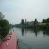
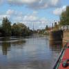
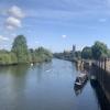
Junction of Worcester and Birmingham Canal with River Severn
Chapter Meadows, Malvern Pedway, Worcester WR1 2NS, United Kingdom
Address is taken from a point 246 yards away.
 
Information about the place
 
It is part of Worcester.
 
The nearest place in the direction of Diglis Lock No 2 is Diglis Bottom Swing Bridge No 1; ¼ furlongs away.
 
The nearest place in the direction of Kempsey is Diglis Visitor Moorings Pontoon (River Severn); ¾ furlongs away.

Mooring here is unrated.

You can wind here.


Amenities

Amenities nearby at Worcester

 Sainsbury's
 Sainsburys
 Caffe Nero
 W H Smith
 Boots Chemist
 Barclays
 Cashpoint
 Cashpoint
 Cashpoint
 Cashpoint
 Cashpoint
 TSB

Amenities in Worcester

 Costcutter
 Lidl
 Tesco
 Tesco
 Postal Order
 Dominos Pizza
 Fish & Chips
 Barclays
 Cashpoint
 Cashpoint
 Cashpoint
 HSBC
 NatWest
 Esso
 Tesco Petrol Station
 Total
 Machine Mart

Amenities at other places in Worcester

 Iceland at Worcester Road Bridge
 Costa Coffee at Worcester Road Bridge
 Patisserie-Valerie at Worcester Road Bridge
 Ask and Zizzi at Worcester Road Bridge
 McDonalds at Worcester Road Bridge
 Anchor Inn at Diglis Services
 Cap 'n Gown at Lansdowne Road Bridge No 11
 Coach & Horses at Lansdowne Road Bridge No 11
 Courtyard at Worcester Road Bridge
 Cricketers at Worcester Road Bridge
 Horn and Trumpet at Worcester Road Bridge
 Slug & Lettuce at Worcester Road Bridge
 The Crown at Worcester Road Bridge
 Ye Olde Talbot at Blockhouse Bridge No 4
 Dunelm Mill at Worcester Road Bridge
 Poundland at Blockhouse Bridge No 4
 Burger King at Worcester Road Bridge
 Subway Sandwich Shop at Worcester Road Bridge
 Boots Chemist at Rainbow Hill Bridge No 9
 Cashpoint at Worcester Road Bridge
 Cashpoint at Worcester Road Bridge
 Cashpoint at Worcester Road Bridge
 Cashpoint at Worcester Road Bridge
 Lloyds Bank at Worcester Road Bridge
 NatWest at Worcester Road Bridge
 Nationwide at Worcester Road Bridge
 Santander at Worcester Road Bridge
 Santander at Worcester Road Bridge
 Forecourt M-F 6pm at Worcester Road Bridge
 Mr Burnside at Diglis Dock
 Mr J D Morris T/A at Worcester Waterworks
 Worcester Calor Centre at Cromwell Street Footbridge Bridge No 6
 Worcester Calor Centre M-F 5pm 01905 28839 at Cromwell Street Footbridge Bridge No 6
 Worcester, Crown Biofuels at Blockhouse Lock No 4
 Buildbase at Diglis Basin Marina
 Jewson at Diglis Locks
 Peddlers - Worcester at Tavern Hill Bridge No 12
 Plumbing Trade Supplies at Cromwell Street Footbridge Bridge No 6
 Worcester Foregate Street Station at Rainbow Hill Bridge No 9
 Worcester Shrub Hill Station at Cromwell Street Footbridge Bridge No 6
 
Maps
If you are a user and are logged on, or if you are actively planning a route, a map will be displayed here.
Show on external mapping site: Google | OSM | Bing
 
Photos
 
External websites
There are no links to external websites from here.
Why not log in and add some (select "External websites" from the menu (sometimes this is under "Edit"))?
 
Nearest facilities

Mouseover for more information or show routes to facility

Nearest water point

In the direction of Limit of Navigation

Worcester Trip Boat Moorings6 furlongs away
On the River Severn (main river - Stourport to Worcester) in the direction of Limit of Navigation
Holt Lock (Holt Fleet)7 miles, 3 furlongs and 1 lock away
On the River Severn (main river - Stourport to Worcester) in the direction of Limit of Navigation
Lincomb Lock11 miles, 4½ furlongs and 2 locks away
On the River Severn (main river - Stourport to Worcester) in the direction of Limit of Navigation
Upper Basin Waterpoint13 miles and 5 locks away
Travel to Severn - Stourport Broad Locks Entrance, then on the Staffordshire and Worcestershire Canal (Stourport Basins: Broad Route) to Stourport Upper Basin, then on the Staffordshire and Worcestershire Canal (Stourport Basins: Narrow Route) to Upper Basin Waterpoint
Netherwich Basin9 miles, 7 furlongs and 9 locks away
Travel to Hawford Junction, then on the Droitwich Canals (Droitwich Barge Canal) to Netherwich Basin
Caldwall Mill Bridge No 1416 miles, 6¼ furlongs and 8 locks away
Travel to Severn - Stourport Broad Locks Entrance, then on the Staffordshire and Worcestershire Canal (Stourport Basins: Broad Route) to Stourport Upper Basin, then on the Staffordshire and Worcestershire Canal (Stourport Basins: Narrow Route) to York Street Bridge, then on the Staffordshire and Worcestershire Canal (Main Line: Stourport to Stourton) to Caldwall Mill Bridge No 14

In the direction of Gloucester / Sharpness - Severn Junction

Diglis Locks2½ furlongs away
On the River Severn (main river - Worcester to Gloucester) in the direction of Gloucester / Sharpness - Severn Junction
Upper Lode Lock No 516 miles, 4¼ furlongs and 1 lock away
On the River Severn (main river - Worcester to Gloucester) in the direction of Gloucester / Sharpness - Severn Junction
Tewkesbury Services16 miles, 2 furlongs and 2 locks away
Travel to Tewkesbury Junction, then on the River Avon - Warwickshire (Lower Avon Navigation) to Tewkesbury Services
Tewkesbury Lower Lode17 miles, 2½ furlongs and 2 locks away
On the River Severn (main river - Worcester to Gloucester) in the direction of Gloucester / Sharpness - Severn Junction
Bredon19 miles, 5¾ furlongs and 2 locks away
Travel to Tewkesbury Junction, then on the River Avon - Warwickshire (Lower Avon Navigation) to Bredon

In the direction of Diglis Basin

Diglis Services1¾ furlongs and 2 locks away
Travel to Diglis Basin, then on the Worcester and Birmingham Canal (Diglis Basin to King's Norton Junction) to Diglis Services
Lowesmoor Basin1 mile, 1¼ furlongs and 4 locks away
Travel to Diglis Basin, then on the Worcester and Birmingham Canal (Diglis Basin to King's Norton Junction) to Lowesmoor Basin
Hanbury Boatyard9 miles, ¾ furlongs and 16 locks away
Travel to Diglis Basin, then on the Worcester and Birmingham Canal (Diglis Basin to King's Norton Junction) to Hanbury Boatyard
Droitwich Spa Marina9 miles, 4¾ furlongs and 19 locks away
Travel to Diglis Basin, then on the Worcester and Birmingham Canal (Diglis Basin to King's Norton Junction) to Hanbury Junction, then on the Droitwich Canals (Droitwich Junction Canal) to Droitwich Spa Marina
Stoke Works Water Point11 miles, 5¾ furlongs and 22 locks away
Travel to Diglis Basin, then on the Worcester and Birmingham Canal (Diglis Basin to King's Norton Junction) to Stoke Works Water Point
Tardebigge Wharf15 miles, 6¼ furlongs and 58 locks away
Travel to Diglis Basin, then on the Worcester and Birmingham Canal (Diglis Basin to King's Norton Junction) to Tardebigge Wharf

Nearest rubbish disposal

In the direction of Limit of Navigation

Sabrina Footbridge1 mile away
On the River Severn (main river - Stourport to Worcester) in the direction of Limit of Navigation
Upper Basin Waterpoint13 miles and 5 locks away
Travel to Severn - Stourport Broad Locks Entrance, then on the Staffordshire and Worcestershire Canal (Stourport Basins: Broad Route) to Stourport Upper Basin, then on the Staffordshire and Worcestershire Canal (Stourport Basins: Narrow Route) to Upper Basin Waterpoint
Netherwich Basin9 miles, 7 furlongs and 9 locks away
Travel to Hawford Junction, then on the Droitwich Canals (Droitwich Barge Canal) to Netherwich Basin

In the direction of Gloucester / Sharpness - Severn Junction

Tewkesbury Services16 miles, 2 furlongs and 2 locks away
Travel to Tewkesbury Junction, then on the River Avon - Warwickshire (Lower Avon Navigation) to Tewkesbury Services

In the direction of Diglis Basin

Diglis Basin1¼ furlongs and 2 locks away
On the Worcester and Birmingham Canal (Diglis Junction to Diglis Basin) in the direction of Diglis Basin
Lowesmoor Basin1 mile, 1¼ furlongs and 4 locks away
Travel to Diglis Basin, then on the Worcester and Birmingham Canal (Diglis Basin to King's Norton Junction) to Lowesmoor Basin
Droitwich Spa Marina9 miles, 4¾ furlongs and 19 locks away
Travel to Diglis Basin, then on the Worcester and Birmingham Canal (Diglis Basin to King's Norton Junction) to Hanbury Junction, then on the Droitwich Canals (Droitwich Junction Canal) to Droitwich Spa Marina
Stoke Bottom Lock No 2312 miles, 3¾ furlongs and 22 locks away
Travel to Diglis Basin, then on the Worcester and Birmingham Canal (Diglis Basin to King's Norton Junction) to Stoke Bottom Lock No 23
Tardebigge Wharf15 miles, 6¼ furlongs and 58 locks away
Travel to Diglis Basin, then on the Worcester and Birmingham Canal (Diglis Basin to King's Norton Junction) to Tardebigge Wharf

Nearest chemical toilet disposal

In the direction of Limit of Navigation

Stourport Marina12 miles and 3 locks away
On the River Severn (main river - Stourport to Worcester) in the direction of Limit of Navigation
Upper Basin Waterpoint13 miles and 5 locks away
Travel to Severn - Stourport Broad Locks Entrance, then on the Staffordshire and Worcestershire Canal (Stourport Basins: Broad Route) to Stourport Upper Basin, then on the Staffordshire and Worcestershire Canal (Stourport Basins: Narrow Route) to Upper Basin Waterpoint
Caldwall Mill Bridge No 1416 miles, 6¼ furlongs and 8 locks away
Travel to Severn - Stourport Broad Locks Entrance, then on the Staffordshire and Worcestershire Canal (Stourport Basins: Broad Route) to Stourport Upper Basin, then on the Staffordshire and Worcestershire Canal (Stourport Basins: Narrow Route) to York Street Bridge, then on the Staffordshire and Worcestershire Canal (Main Line: Stourport to Stourton) to Caldwall Mill Bridge No 14

In the direction of Diglis Basin

Diglis Services1¾ furlongs and 2 locks away
Travel to Diglis Basin, then on the Worcester and Birmingham Canal (Diglis Basin to King's Norton Junction) to Diglis Services
Lowesmoor Basin1 mile, 1¼ furlongs and 4 locks away
Travel to Diglis Basin, then on the Worcester and Birmingham Canal (Diglis Basin to King's Norton Junction) to Lowesmoor Basin
Droitwich Spa Marina9 miles, 4¾ furlongs and 19 locks away
Travel to Diglis Basin, then on the Worcester and Birmingham Canal (Diglis Basin to King's Norton Junction) to Hanbury Junction, then on the Droitwich Canals (Droitwich Junction Canal) to Droitwich Spa Marina
Stoke Bottom Lock No 2312 miles, 3¾ furlongs and 22 locks away
Travel to Diglis Basin, then on the Worcester and Birmingham Canal (Diglis Basin to King's Norton Junction) to Stoke Bottom Lock No 23
Tardebigge Wharf15 miles, 6¼ furlongs and 58 locks away
Travel to Diglis Basin, then on the Worcester and Birmingham Canal (Diglis Basin to King's Norton Junction) to Tardebigge Wharf

Nearest place to turn

In the direction of Limit of Navigation

Bevere Lock Weir Exit3 miles, 6½ furlongs away
On the River Severn (main river - Stourport to Worcester) in the direction of Limit of Navigation
Bevere Lock Weir Entrance4 miles, 1 furlong and 1 lock away
On the River Severn (main river - Stourport to Worcester) in the direction of Limit of Navigation
Holt Lock Weir Exit7 miles, 2 furlongs and 1 lock away
On the River Severn (main river - Stourport to Worcester) in the direction of Limit of Navigation
Holt Lock Weir Entrance7 miles, 5¼ furlongs and 2 locks away
On the River Severn (main river - Stourport to Worcester) in the direction of Limit of Navigation
Ladywood Top Lock Winding Hole7 miles, ¾ furlongs and 9 locks away
Travel to Hawford Junction, then on the Droitwich Canals (Droitwich Barge Canal) to Ladywood Top Lock Winding Hole
Severn - Stourport Narrow Locks Entrance12 miles, 7¼ furlongs and 3 locks away
On the River Severn (main river - Stourport to Worcester) in the direction of Limit of Navigation
Stourport Lower Basin - between Broad Locks12 miles, 7¼ furlongs and 4 locks away
Travel to Severn - Stourport Broad Locks Entrance, then on the Staffordshire and Worcestershire Canal (Stourport Basins: Broad Route) to Stourport Lower Basin - between Broad Locks
Stourport Lower Basin - between Narrow Locks12 miles, 7½ furlongs and 4 locks away
Travel to Severn - Stourport Broad Locks Entrance, then on the Staffordshire and Worcestershire Canal (Stourport Basins: Broad Route) to Stourport Lower Basin - between Broad Locks, then on the Staffordshire and Worcestershire Canal (Stourport Basins: Broad Locks to Narrow Locks to Stourport Lower Basin - between Narrow Locks
Stourport Upper Basin12 miles, 7¾ furlongs and 5 locks away
Travel to Severn - Stourport Broad Locks Entrance, then on the Staffordshire and Worcestershire Canal (Stourport Basins: Broad Route) to Stourport Upper Basin
Stourport Clock Basin13 miles, ¼ furlongs and 5 locks away
Travel to Severn - Stourport Broad Locks Entrance, then on the Staffordshire and Worcestershire Canal (Stourport Basins: Broad Route) to Stourport Upper Basin, then on the Staffordshire and Worcestershire Canal (Stourport Basins: Narrow Route) to Stourport Clock Basin
Winding Hole (east of Salwarpe Road Bridge)9 miles, 5½ furlongs and 9 locks away
Travel to Hawford Junction, then on the Droitwich Canals (Droitwich Barge Canal) to Winding Hole (east of Salwarpe Road Bridge)
Netherwich Basin9 miles, 7 furlongs and 9 locks away
Travel to Hawford Junction, then on the Droitwich Canals (Droitwich Barge Canal) to Netherwich Basin
Droitwich Town Wharf10 miles, 1 furlong and 9 locks away
Travel to Hawford Junction, then on the Droitwich Canals (Droitwich Barge Canal) to Droitwich Town Wharf

In the direction of Gloucester / Sharpness - Severn Junction

Diglis Locks Weir Exit3¼ furlongs and 1 lock away
On the River Severn (main river - Worcester to Gloucester) in the direction of Gloucester / Sharpness - Severn Junction
Severn - Teme Junction1 mile, 1¼ furlongs and 1 lock away
On the River Severn (main river - Worcester to Gloucester) in the direction of Gloucester / Sharpness - Severn Junction
Upper Lode Lock Weir Entrance16 miles, 3¼ furlongs and 1 lock away
On the River Severn (main river - Worcester to Gloucester) in the direction of Gloucester / Sharpness - Severn Junction
Avon Lock Junction16 miles, 1¾ furlongs and 2 locks away
Travel to Tewkesbury Junction, then on the River Avon - Warwickshire (Lower Avon Navigation) to Avon Lock Junction
Abbey Mill Tewkesbury16 miles, 2¾ furlongs and 2 locks away
Travel to Tewkesbury Junction, then on the River Avon - Warwickshire (Lower Avon Navigation) to Avon Lock Junction, then on the River Avon - Warwickshire (Mill Avon) to Abbey Mill Tewkesbury

In the direction of Diglis Basin

Lowesmoor Basin1 mile, 1¼ furlongs and 4 locks away
Travel to Diglis Basin, then on the Worcester and Birmingham Canal (Diglis Basin to King's Norton Junction) to Lowesmoor Basin
Bilford Locks Winding Hole2 miles, 3¼ furlongs and 7 locks away
Travel to Diglis Basin, then on the Worcester and Birmingham Canal (Diglis Basin to King's Norton Junction) to Bilford Locks Winding Hole

Nearest self-operated pump-out

Direction of TV transmitter (From Wolfbane Cybernetic)
 
 
Geograph
 
Wikipedia

There is no page on Wikipedia called “Diglis Junction”

Wikipedia pages that might relate to Diglis Junction
[Diglis Basin] Diglis Basin is a canal basin on the Worcester and Birmingham Canal. It is situated in Diglis in the centre of Worcester, England, near The Commandery [Kings Norton Junction] was then a period of no activity, but the canal was finally completed to Diglis Basin and the River Severn in 1815. An agreement enabled a stop lock to [Worcester, England] occupied a larger area than the subsequent medieval city, but silting of the Diglis Basin caused the abandonment of Sidbury. Industrial production ceased and [M5 motorway] United Kingdom linking the Midlands with South West England. It runs from junction 8 of the M6 at West Bromwich near Birmingham to Exeter in Devon. Heading [Avon Ring] the only lock is located at Diglis, just before the junction with the Worcester and Birmingham Canal. From the junction with the River Severn, there [Worcester and Birmingham Canal] craft access to Diglis Basin. The final 16 miles (26 km) was opened in December 1815. Plans to construct basins at Lowesmoor and Diglis were carried out [Staffordshire and Worcestershire Canal] 2019), to improve the River Severn immediately below Stourport as far as Diglis, to improve navigation to and from the canal. At Stourport there were four [Worcester Foregate Street railway station] constructed in 1860 with the unfulfilled aim of connecting the station to Diglis for the conveyance of freight. Since 1973 the station has had an unusual [River Severn] Worcester and Tewkesbury Queenshill Viaduct – carries the M50 between Junction 1 and 2 Mythe Bridge – designed by Telford and opened in April 1826, located [M42 motorway] junction 4 of the M6 forms – though unsigned as such – a part of Euroroute E05. Beyond junction 11 the route is continued as the A42, the junctions on
 
Google

Results of Google Search

Diglis Basin - Wikipedia
To the north is Tibberton (8.41 miles and 14 locks away) and to the west is Diglis Junction (0.25 miles and 2 locks to the west) where the canal meets the River ...
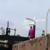
Direction sign at Diglis Junction. Where the canal meets the River ...
Download this stock image: Direction sign at Diglis Junction. Where the canal meets the River Severn, Worcester, England, Europe - P9H4BY from Alamy's ...
Diglis Junction – Waterway Routes
Diglis Junction Signpost. The signpost at Diglis Junction marks the start of the Worcester and Birmingham Canal where it meets the River Severn.
Diglis Junction - Worcester
Diglis Junction Junction of Worcester and Birmingham Canal and River Severn.
Worcester to Hanbury Junction - CanalScene.com
Going North from the canal's juntion with the River Severn in the South of Worcester two double width locks take you up to Diglis Basin with Diglis Basin Marina ...
Canal holiday hire boats on the Avon Ring
The Avon Ring, canals map and guide, hire boats from family firms, junctions, ... especially when levels are high, and when entering and leaving Diglis basin.
Worcester and Birmingham Canal - Canal Cycling Section
Diglis Locks basin; Diglis Lock 1; Diglis Bottom Swing Bridge; DIGLIS JUNCTION (Junction with the River Severn). Birmingham Mailbox, Worcester ...