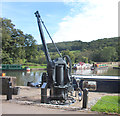
Somerset Coal Canal Junction Services

tollhouse, Warminster Road, Monkton Combe, BA1, United Kingdom

Somerset Coal Canal Junction Services
is a minor waterways place
on the Kennet and Avon Canal (Main Line) between
Somerset Coal Canal Junction (a few yards
to the south) and
Claverton Pumping Station (1 mile and 2 furlongs
to the northeast).
The nearest place in the direction of Claverton Pumping Station is Dundas Bridge No 177;
¼ furlongs
away.
Mooring here is unrated.
Facilities: chemical toilet disposal, boater-operated pump-out, rubbish disposal and water point.
Dundas Aqueduct Visitor Mooring (east) | ¾ furlongs | |
Dundas Aqueduct (eastern end) | ¾ furlongs | |
Dundas Aqueduct (western end) | ¼ furlongs | |
Somerset Coal Canal Junction Visitor Mooring | ¼ furlongs | |
Somerset Coal Canal Junction | a few yards | |
Somerset Coal Canal Junction Services | ||
Dundas Bridge No 177 | ¼ furlongs | |
Dundas Aqueduct Visitor Moorings (west) | ¾ furlongs | |
Claverton Swing Bridge No 178 | 3¾ furlongs | |
Claverton Visitor Mooring | 4¼ furlongs | |
Claverton Bridge No 180 | 1 mile, 1¼ furlongs |
There are no links to external websites from here.
Why not log in and add some (select "External websites" from the menu (sometimes this is under "Edit"))?
Mouseover for more information or show routes to facility
Nearest water point
The nearest water point is here. Others are at:
In the direction of River Avon Junction
Bathampton Bridge No 183 — 3 miles, ¾ furlongs away
On this waterway in the direction of River Avon Junction
Bath Top Lock Visitor Moorings — 4 miles, 7½ furlongs away
On this waterway in the direction of River Avon Junction
Wessex Water Services — 11 miles, 7½ furlongs and 9 locks away
Travel to River Avon Junction, then on the River Avon (Kennet and Avon Navigation) to Wessex Water Services
Hanham Lock No 1 — 16 miles, 5¾ furlongs and 11 locks away
Travel to River Avon Junction, then on the River Avon (Kennet and Avon Navigation) to Hanham Lock No 1
In the direction of Northcroft Lane Arm
Avoncliff Aqueduct Visitor Mooring (east) — 2 miles, 7¼ furlongs away
On this waterway in the direction of Northcroft Lane Arm
Bradford on Avon Services — 4 miles, 2¾ furlongs and 1 lock away
On this waterway in the direction of Northcroft Lane Arm
Seend Wharf — 12 miles, 3¼ furlongs and 5 locks away
On this waterway in the direction of Northcroft Lane Arm
Sells Green Visitor Moorings — 13 miles, 5¼ furlongs and 8 locks away
On this waterway in the direction of Northcroft Lane Arm
Devizes Lock 45 Services — 16 miles, 3¼ furlongs and 31 locks away
On this waterway in the direction of Northcroft Lane Arm
Devizes Wharf — 17 miles, 3¾ furlongs and 37 locks away
On this waterway in the direction of Northcroft Lane ArmNearest rubbish disposal
The nearest rubbish disposal is here. Others are at:
In the direction of River Avon Junction
Abbey View Lock No 11 — 5 miles, ¾ furlongs and 2 locks away
On this waterway in the direction of River Avon Junction
Hanham Lock No 1 — 16 miles, 5¾ furlongs and 11 locks away
Travel to River Avon Junction, then on the River Avon (Kennet and Avon Navigation) to Hanham Lock No 1
In the direction of Northcroft Lane Arm
Bradford on Avon Services — 4 miles, 2¾ furlongs and 1 lock away
On this waterway in the direction of Northcroft Lane Arm
Seend Wharf Bridge No 153 — 12 miles, 3¾ furlongs and 5 locks away
On this waterway in the direction of Northcroft Lane Arm
Sells Green Visitor Moorings — 13 miles, 5¼ furlongs and 8 locks away
On this waterway in the direction of Northcroft Lane Arm
Devizes Lock 45 Services — 16 miles, 3¼ furlongs and 31 locks away
On this waterway in the direction of Northcroft Lane Arm
Devizes Wharf — 17 miles, 3¾ furlongs and 37 locks away
On this waterway in the direction of Northcroft Lane ArmNearest chemical toilet disposal
The nearest chemical toilet disposal is here. Others are at:
In the direction of River Avon Junction
Wessex Water Services — 11 miles, 7½ furlongs and 9 locks away
Travel to River Avon Junction, then on the River Avon (Kennet and Avon Navigation) to Wessex Water Services
In the direction of Northcroft Lane Arm
Bradford on Avon Services — 4 miles, 2¾ furlongs and 1 lock away
On this waterway in the direction of Northcroft Lane Arm
Seend Wharf — 12 miles, 3¼ furlongs and 5 locks away
On this waterway in the direction of Northcroft Lane Arm
Caen Hill Marina — 14 miles, 4¾ furlongs and 8 locks away
On this waterway in the direction of Northcroft Lane Arm
Devizes Lock 45 Services — 16 miles, 3¼ furlongs and 31 locks away
On this waterway in the direction of Northcroft Lane Arm
Devizes Wharf — 17 miles, 3¾ furlongs and 37 locks away
On this waterway in the direction of Northcroft Lane Arm
Devizes Marina — 19 miles, ¼ furlongs and 37 locks away
On this waterway in the direction of Northcroft Lane ArmNearest place to turn
In the direction of River Avon Junction
Claverton Winding Hole — 1 mile, 3 furlongs away
On this waterway in the direction of River Avon Junction
Bathampton Winding Hole — 2 miles, 6 furlongs away
On this waterway in the direction of River Avon Junction
Bathampton Bridge Winding Hole — 3 miles away
On this waterway in the direction of River Avon Junction
Sydney Wharf Winding Hole — 4 miles, 6 furlongs away
On this waterway in the direction of River Avon Junction
Pulteney Gardens Winding Hole — 5 miles, ½ furlongs and 2 locks away
On this waterway in the direction of River Avon Junction
Horseshoe Walk Bridge Winding Hole — 5 miles, 1¼ furlongs and 3 locks away
On this waterway in the direction of River Avon Junction
In the direction of Northcroft Lane Arm
Somerset Coal Canal Junction — a few yards away
On this waterway in the direction of Northcroft Lane Arm
Conkwell Wood Winding Hole — 2¾ furlongs away
On this waterway in the direction of Northcroft Lane Arm
Brassknocker Basin — 2¾ furlongs away
Travel to Somerset Coal Canal Junction, then on the Kennet and Avon Canal (Somersetshire Coal Canal) to Brassknocker Basin
Avoncliffe Aqueduct (northern end) — 2 miles, 5½ furlongs away
On this waterway in the direction of Northcroft Lane Arm
Avoncliffe Aqueduct (southern end) — 2 miles, 6¼ furlongs away
On this waterway in the direction of Northcroft Lane Arm
Bradford on Avon Services — 4 miles, 2¾ furlongs and 1 lock away
On this waterway in the direction of Northcroft Lane Arm
The Old Chandlery Marina — 5 miles, 2¼ furlongs and 1 lock away
On this waterway in the direction of Northcroft Lane Arm
Bradford on Avon Winding Hole — 5 miles, 6 furlongs and 1 lock away
On this waterway in the direction of Northcroft Lane Arm
Hilperton Wharf — 7 miles, ¾ furlongs and 1 lock away
On this waterway in the direction of Northcroft Lane Arm
Hilperton (Staverton) Marina — 7 miles, 1 furlong and 1 lock away
On this waterway in the direction of Northcroft Lane Arm
Whaddon Grove Winding Hole — 9 miles, ¾ furlongs and 1 lock away
On this waterway in the direction of Northcroft Lane Arm
Semington Junction — 10 miles, 1 furlong and 1 lock away
On this waterway in the direction of Northcroft Lane Arm
Seend Wharf — 12 miles, 3¼ furlongs and 5 locks away
On this waterway in the direction of Northcroft Lane Arm
Seend Winding Hole — 12 miles, 4¼ furlongs and 6 locks away
On this waterway in the direction of Northcroft Lane ArmNearest self-operated pump-out
The nearest self-operated pump-out is here. Others are at:
In the direction of Northcroft Lane Arm
Bradford on Avon Services — 4 miles, 2¾ furlongs and 1 lock away
On this waterway in the direction of Northcroft Lane Arm
Seend Wharf — 12 miles, 3¼ furlongs and 5 locks away
On this waterway in the direction of Northcroft Lane Arm
Devizes Lock 45 Services — 16 miles, 3¼ furlongs and 31 locks away
On this waterway in the direction of Northcroft Lane Arm
Devizes Wharf — 17 miles, 3¾ furlongs and 37 locks away
On this waterway in the direction of Northcroft Lane ArmNearest boatyard pump-out
In the direction of Northcroft Lane Arm
Caen Hill Marina — 14 miles, 4¾ furlongs and 8 locks away
On this waterway in the direction of Northcroft Lane Arm
Devizes Marina — 19 miles, ¼ furlongs and 37 locks away
On this waterway in the direction of Northcroft Lane ArmDirection of TV transmitter (From Wolfbane Cybernetic)
There is no page on Wikipedia called “Somerset Coal Canal Junction Services”
Wikipedia pages that might relate to Somerset Coal Canal Junction Services
[Somerset]
international air services. The Somerset Coal Canal was built in the early 19th century to reduce the cost of transportation of coal and other heavy produce
[Transport in Somerset]
the Kennet and Avon Canal. This was completed in 1810 and, enabling narrow boats to work through to London. The Somerset Coal Canal was surveyed under
[Somerset and Dorset Joint Railway]
of the Radstock branch of the Somerset Coal Canal which was little used and had been replaced by a tramway on the canal's towpath in 1815. The S&DR purchased
[Bristol and North Somerset Railway]
it decided to start negotiations with the Somerset Coal Canal Company to get permission to cross its canal. On 24 October 1875 the GWR accepted a tender
[High Littleton]
former Somerset Coal Canal to a junction at Limpley Stoke with the line from Bath to Bradford-on-Avon. In addition to its role as a junction, Hallatrow
[Kennet and Avon Canal]
subsequently made any profit. The Somerset Coal Canal and Wilts & Berks Canal, which each supplied some of the trade from the Somerset Coalfield to the Kennet and
[Bath, Somerset]
Bath (/bɑːθ/ (listen)) is the largest city in the county of Somerset, England, known for and named after its Roman-built baths. In 2019, the population
[Monkland Canal]
The Monkland Canal was a 12+1⁄4-mile-long (19.7 km) canal designed to bring coal from the mining areas of Monklands to Glasgow in Scotland. In the course
[West Somerset Railway]
charitable trust the West Somerset Railway Association (WSRA) and the West Somerset Steam Railway Trust (WSSRT). The WSR plc operates services using both heritage
[Bridgwater]
civil parish in Somerset, England. Its population currently stands at around 41,276 as of 2022. Bridgwater is at the edge of the Somerset Levels, in level