CanalPlanAC

West Bridge No 2

 
St Augustine Road, Leicester LE3 5LU, United Kingdom (A47)
 
Information about the place
West Bridge No 2 is a minor waterways place on the Grand Union Canal (Leicester Section - River Soar Navigation) between River Soar Junction (Junction of GU Leicester Section and River Soar Navigation) (2 miles and 5 furlongs and 3 locks to the southwest) and Soar Lane Bridge No 3 (3 furlongs to the north).
 
 
The nearest place in the direction of River Soar Junction is West Bridge (Leicester); ¼ furlongs away.
 
The nearest place in the direction of Soar Lane Bridge No 3 is Richard III Towpath Bridge No 1A (and return of the Old River Soar); 1¼ furlongs away.

There may be access to the towpath here.

Mooring here is unrated.

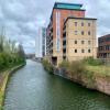
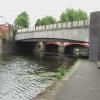
There is a bridge here which takes a major road over the canal.


Amenities

Amenities here

 Patisserie-Valerie
 High Cross
 Ivy House
 Leicester
 Orange Tree
 Wetherspoons
 Boots Chemist
 Cashpoint

Amenities nearby at West Bridge (Leicester)

 Starbucks
 Starbucks
 Ask and Zizzi
 Bella Italia
 McDonalds
 Pizza Hut
 Friary 12 Hotel
 Leicester
 Lloyds No 1
 O'Neills
 Wetherspoons
 Primark
 W H Smith
 Fish & Chips
 Boots Chemist
 Boots Chemist
 Cashpoint
 Cashpoint
 Cashpoint
 Cashpoint
 Cashpoint
 Cashpoint
 Cashpoint
 Cashpoint
 Cashpoint
 Cashpoint
 Cashpoint
 Co-operative Bank
 Coventry
 HSBC
 Lloyds Bank
 NatWest
 Nationwide
 Santander
 Santander
 Santander
 TSB
 TSB
 
Maps
If you are a user and are logged on, or if you are actively planning a route, a map will be displayed here.
Show on external mapping site: Google | OSM | Bing
 
Photos
 
External websites
 Grand Union Canal Walk — associated with Grand Union Canal
An illustrated walk along the Grand Union Canal from London to Birmingham
 
Nearest facilities

Mouseover for more information or show routes to facility

Nearest water point

In the direction of Trent Junction

Friars Mill Visitor Moorings1¾ furlongs away
On this waterway in the direction of Trent Junction
Hope and Anchor Bridge No 196 miles, 1½ furlongs and 5 locks away
On this waterway in the direction of Trent Junction
Barrow Boating11 miles, 6½ furlongs and 9 locks away
On this waterway in the direction of Trent Junction
Loughborough Basin15 miles, 8 furlongs and 11 locks away
Travel to Loughborough Branch Junction, then on the Grand Union Canal (Leicester Section - Loughborough Branch) to Loughborough Basin
Bishop Meadow Lock No 5416 miles, 6½ furlongs and 12 locks away
On this waterway in the direction of Trent Junction

In the direction of River Soar Junction

Kilby Bridge No 878 miles, 2 furlongs and 12 locks away
Travel to River Soar Junction, then on the Grand Union Canal (Leicester Section - Leicestershire and Northamptonshire Union Canal) to Kilby Bridge No 87
Foxton Junction18 miles, ¼ furlongs and 24 locks away
Travel to River Soar Junction, then on the Grand Union Canal (Leicester Section - Leicestershire and Northamptonshire Union Canal) to Foxton Junction
Inclined Plane Upper Access Arm Junction18 miles, 3½ furlongs and 24 locks away
Travel to River Soar Junction, then on the Grand Union Canal (Leicester Section - Leicestershire and Northamptonshire Union Canal) to Foxton Junction, then on the Grand Union Canal (Leicester Section - Market Harborough Branch) to Inclined Plane Lower Access Arm Junction, then on the Grand Union Canal (Leicester Section - Inclined Plane Branch) to Inclined Plane Upper Access Arm Junction

Nearest rubbish disposal

In the direction of Trent Junction

Broome Island11 miles, ¼ furlongs and 9 locks away
On this waterway in the direction of Trent Junction
Barrow Boating11 miles, 6½ furlongs and 9 locks away
On this waterway in the direction of Trent Junction
Loughborough Basin15 miles, 8 furlongs and 11 locks away
Travel to Loughborough Branch Junction, then on the Grand Union Canal (Leicester Section - Loughborough Branch) to Loughborough Basin

In the direction of River Soar Junction

Kilby Bridge No 878 miles, 2 furlongs and 12 locks away
Travel to River Soar Junction, then on the Grand Union Canal (Leicester Section - Leicestershire and Northamptonshire Union Canal) to Kilby Bridge No 87
Foxton Junction Swing Bridge18 miles, ¾ furlongs and 24 locks away
Travel to River Soar Junction, then on the Grand Union Canal (Leicester Section - Leicestershire and Northamptonshire Union Canal) to Foxton Junction, then on the Grand Union Canal (Leicester Section - Market Harborough Branch) to Foxton Junction Swing Bridge

Nearest chemical toilet disposal

In the direction of Trent Junction

Sileby Mill Mooring Basin9 miles, 2¼ furlongs and 8 locks away
On this waterway in the direction of Trent Junction
Barrow Boating11 miles, 6½ furlongs and 9 locks away
On this waterway in the direction of Trent Junction

In the direction of River Soar Junction

Kilby Bridge No 878 miles, 2 furlongs and 12 locks away
Travel to River Soar Junction, then on the Grand Union Canal (Leicester Section - Leicestershire and Northamptonshire Union Canal) to Kilby Bridge No 87
Foxton Junction Swing Bridge18 miles, ¾ furlongs and 24 locks away
Travel to River Soar Junction, then on the Grand Union Canal (Leicester Section - Leicestershire and Northamptonshire Union Canal) to Foxton Junction, then on the Grand Union Canal (Leicester Section - Market Harborough Branch) to Foxton Junction Swing Bridge

Nearest place to turn

In the direction of Trent Junction

Memory Lane Wharf1 mile, 2¼ furlongs and 1 lock away
On this waterway in the direction of Trent Junction
Belgrave Circle Arm (disused)1 mile, 3 furlongs and 2 locks away
On this waterway in the direction of Trent Junction
Entrance to Riverside Lakes2 miles, 5½ furlongs and 3 locks away
On this waterway in the direction of Trent Junction
Birstall Lock Winding Hole3 miles, 7 furlongs and 3 locks away
On this waterway in the direction of Trent Junction
White Horse Lane Junction4 miles, ¼ furlongs and 4 locks away
On this waterway in the direction of Trent Junction
Leicester Marina Entrance4 miles, 6 furlongs and 4 locks away
On this waterway in the direction of Trent Junction
Thurmaston Lock Arm4 miles, 7½ furlongs and 4 locks away
On this waterway in the direction of Trent Junction
MGM Boats Winding Hole5 miles, ¼ furlongs and 5 locks away
On this waterway in the direction of Trent Junction
MGM Boats, Thurmaston5 miles, ¾ furlongs and 5 locks away
On this waterway in the direction of Trent Junction
Old Junction Boatyard (Syston)6 miles, 5¼ furlongs and 5 locks away
On this waterway in the direction of Trent Junction
River Wreake Junction6 miles, 5¾ furlongs and 5 locks away
On this waterway in the direction of Trent Junction
Wreake Outlet by Junction Lock No 477 miles, 2¼ furlongs and 6 locks away
On this waterway in the direction of Trent Junction
Wreake Mouth7 miles, 5¾ furlongs and 6 locks away
On this waterway in the direction of Trent Junction
Cossington Mill Stream Junction7 miles, 7¼ furlongs and 7 locks away
On this waterway in the direction of Trent Junction
Loughborough Road Winding Hole7 miles, 7¾ furlongs and 7 locks away
On this waterway in the direction of Trent Junction
Sileby Mill9 miles, 1¾ furlongs and 8 locks away
On this waterway in the direction of Trent Junction
Sileby Mill Mooring Basin9 miles, 2¼ furlongs and 8 locks away
On this waterway in the direction of Trent Junction
Mountsorrel Lock Junction10 miles, ¾ furlongs and 8 locks away
On this waterway in the direction of Trent Junction

In the direction of River Soar Junction

Blaby Bridge Winding Hole5 miles, ¾ furlongs and 7 locks away
Travel to River Soar Junction, then on the Grand Union Canal (Leicester Section - Leicestershire and Northamptonshire Union Canal) to Blaby Bridge Winding Hole
Bush Lock Winding Hole6 miles, 2 furlongs and 8 locks away
Travel to River Soar Junction, then on the Grand Union Canal (Leicester Section - Leicestershire and Northamptonshire Union Canal) to Bush Lock Winding Hole

Nearest self-operated pump-out

Nearest boatyard pump-out

In the direction of Trent Junction

Sileby Mill Mooring Basin9 miles, 2¼ furlongs and 8 locks away
On this waterway in the direction of Trent Junction
Direction of TV transmitter (From Wolfbane Cybernetic)
 
 
Geograph
 
Wikipedia

Wikipedia has a page about West Bridge

The West Bridge is a growing architectural approach, originally developed by Cypress Semiconductor, which enhances and modularizes a peripheral controller in an embedded computer architecture. Conceptually, the West Bridge parallels and complements the decentralization represented by the North Bridge and the South Bridge. Most notably, it has been used by Research in Motion to permit extremely high data transfer rates in its BlackBerry devices.

Other Wikipedia pages that might relate to West Bridge
[West Gate Bridge] The West Gate Bridge is a steel box girder cable-stayed bridge in Melbourne, Victoria, Australia, spanning the Yarra River just north of its mouth into [West Seattle Bridge] The high-level West Seattle Bridge, officially the Jeanette Williams Memorial Bridge, is a cantilevered segmental bridge that serves as the primary connection [Hebden Bridge] Hebden Bridge is a market town in the Upper Calder Valley in West Yorkshire, England. It is 8 miles (13 km) west of Halifax and 14 miles (21 km) north-east [West Montrose Covered Bridge] West Montrose Covered Bridge, also known as the "Kissing Bridge", is a covered bridge in West Montrose, Ontario, within Waterloo Region, one of the oldest [Guy West Bridge] The Guy West Bridge is a suspension bridge for pedestrian and bicycle traffic spanning the American River in Sacramento in Sacramento County, California [Howrah Bridge] Howrah Bridge is a balanced cantilever bridge over the Hooghly River in West Bengal, India. Commissioned in 1943, the bridge was originally named the [Great Belt Fixed Link] comprised three different tasks: the East Bridge for road transport, the East Tunnel for rail transport and the West Bridge for road and rail transport combined [USS West Bridge] USS West Bridge (ID-2888) was a Design 1013 cargo ship in the United States Navy during World War I. She was begun as War Topaz for the British Government [List of longest bridges in West Bengal] longest Bridges and Flyovers in West Bengal. The bridges include road bridges, railway bridges, rail-cum-road bridges and barrage-cum-bridges. This is
 
Google

Results of Google Search

West Badger Rd/Bertrand Creek Bridge No. 50 | Whatcom County ...
It is anticipated that West Badger Road will be re-opened to traffic in December 2019. Project Update for October 2, 2019. Recently ...
Westbridge Apartment | Little Rock, AR | (501) 224-3122
Welcome To Westbridge Apartments! We offer spacious 1, 2, and 3-apartment homes that are designed for living! Our community is convenient to shopping, ...
Working at WestBridge: Employee Reviews | Indeed.com
Reviews from WestBridge employees about WestBridge culture, salaries, ... up to get told what to say and what to think. Was this review helpful? Yes5. No2.
West Seattle Bridge - CityArchives | seattle.gov
West Seattle Bridge No. 2 (August 30, 1929), Item 73916, Record Series 2613-23 ; West Seattle Bridges Spokane Street #1 and #2 Open and Shut from Pigeon ...
No. 2 Road Bridge - Wikipedia
2 Rd., and easier access to points further west. Formerly, this traffic would divert southeast across the Dinsmore Bridge, follow a rightward curve along Gilbert Rd.,  ...
2020 Message Outlines – Westbridge Community Church
If it is not, please check back towards the end of the week. DECEMBER. Christmas Pt 2 – A God of Details12.19.20————– No Outline ...
Western Bridge and Construction Company - Wikipedia
N, .2 mi. W of Verdigre Verdigre, NE (Western Bridge & Construction Co. Hospital Bridge, Upper Main St. over Downie River, Downieville, ...
Hartman No 2 Covered Bridge – Fairfield County Park District
May 18, 2020 ... Directions from Lancaster: Directions from Lancaster: From the corner of N Memorial Dr (US-33) and W Main St (US-22), drive west toward ...
BRIDGE NO. PB-121
Jan 8, 2018 ... 4TH HOLE WEST BRIDGE. North-South. Rock Creek Tributary. 2x10 timber deck planks (2 layers). N/A. 4x4 posts with 2x4 rails/cap and a 2x6 ...
178 Westbridge Dr, Berea, OH 44017 - realtor.com®
Oct 31, 2020 ... ... 2 bath, 2641 Sq. Ft. recently sold home at 178 Westbridge Dr, Berea, OH 44017 that sold on December 22, 2020 for No Estimate Available.