CanalPlanAC

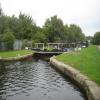
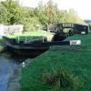
Cromwell Lock No 20

 
You need a handspike to operate the top gates of this lock
Calder Valley Greenway, Lower Edge HD6 2RE, United Kingdom
 
Information about the place
Cromwell Lock No 20 is a minor waterways place on the Calder and Hebble Navigation (Main Line) between Cooper Bridge Junction (Junction of the Huddersfield Broad Canal and the Calder and Hebble Navigation) (3 miles and 4¼ furlongs and 6 locks to the east) and Elland Basin (1 mile and 4½ furlongs and 2 locks to the west).
 
 
The nearest place in the direction of Cooper Bridge Junction is Cromwell Bridge No 5; a few yards away.
 
The nearest place in the direction of Elland Basin is Freemans Bridge No 4; 1¼ furlongs away.

Mooring here is unrated.

This is a lock with a rise of 6 feet.


Amenities

Amenities here

 Food Fair
 Fish & Chips
 
Maps
If you are a user and are logged on, or if you are actively planning a route, a map will be displayed here.
Show on external mapping site: Google | OSM | Bing
 
Photos
 
External websites
There are no links to external websites from here.
Why not log in and add some (select "External websites" from the menu (sometimes this is under "Edit"))?
 
Nearest facilities

Mouseover for more information or show routes to facility

Nearest water point

In the direction of Salterhebble Junction

Salterhebble Sanitary Station3 miles and 7 locks away
On this waterway in the direction of Salterhebble Junction
Salterhebble Junction3 miles, ½ furlongs and 8 locks away
On this waterway in the direction of Salterhebble Junction
Sowerby Bridge Basin5 miles, 2¼ furlongs and 8 locks away
Travel to Salterhebble Junction, then on the Calder and Hebble Navigation (Main Line) to Sowerby Bridge Basin
Hebden Bridge Services10 miles, 5¾ furlongs and 15 locks away
Travel to Salterhebble Junction, then on the Calder and Hebble Navigation (Main Line) to Sowerby Bridge Junction, then on the Rochdale Canal to Hebden Bridge Services
Baltimore Marina14 miles, 5¼ furlongs and 24 locks away
Travel to Salterhebble Junction, then on the Calder and Hebble Navigation (Main Line) to Sowerby Bridge Junction, then on the Rochdale Canal to Baltimore Marina
Fielden Wharf & Services15 miles, ¼ furlongs and 25 locks away
Travel to Salterhebble Junction, then on the Calder and Hebble Navigation (Main Line) to Sowerby Bridge Junction, then on the Rochdale Canal to Fielden Wharf & Services
Travis Mill Lock No 2816 miles, 5½ furlongs and 34 locks away
Travel to Salterhebble Junction, then on the Calder and Hebble Navigation (Main Line) to Sowerby Bridge Junction, then on the Rochdale Canal to Travis Mill Lock No 28

In the direction of Fall Ing Junction

Brighouse Basin1 mile, 2 furlongs and 3 locks away
On this waterway in the direction of Fall Ing Junction
Shepley Bridge Sanitary Station6 miles, 5 furlongs and 9 locks away
On this waterway in the direction of Fall Ing Junction
Aspley Basin (Huddersfield)7 miles, ¼ furlongs and 16 locks away
Travel to Cooper Bridge Junction, then on the Huddersfield Broad Canal to Aspley Basin (Huddersfield)
Broad Cut Low Lock No 313 miles, 2 furlongs and 17 locks away
On this waterway in the direction of Fall Ing Junction
Ramsdens Bridge Sanitary Station18 miles, 5¾ furlongs and 21 locks away
Travel to Fall Ing Junction, then on the Aire and Calder Navigation (Wakefield Section) to Ramsdens Bridge Sanitary Station
Stanley Ferry Water Point18 miles, 6¼ furlongs and 21 locks away
Travel to Fall Ing Junction, then on the Aire and Calder Navigation (Wakefield Section) to Stanley Ferry Water Point
Waterside Lock No 21E11 miles, 6 furlongs and 36 locks away
Travel to Cooper Bridge Junction, then on the Huddersfield Broad Canal to Aspley Basin (Huddersfield), then on the Huddersfield Narrow Canal to Waterside Lock No 21E
Slaithwaite Winding Hole11 miles, 6½ furlongs and 37 locks away
Travel to Cooper Bridge Junction, then on the Huddersfield Broad Canal to Aspley Basin (Huddersfield), then on the Huddersfield Narrow Canal to Slaithwaite Winding Hole
Standedge Tunnel (eastern entrance)15 miles, 1½ furlongs and 58 locks away
Travel to Cooper Bridge Junction, then on the Huddersfield Broad Canal to Aspley Basin (Huddersfield), then on the Huddersfield Narrow Canal to Standedge Tunnel (eastern entrance)
Standedge Tunnel (western entrance)18 miles, 3½ furlongs and 58 locks away
Travel to Cooper Bridge Junction, then on the Huddersfield Broad Canal to Aspley Basin (Huddersfield), then on the Huddersfield Narrow Canal to Standedge Tunnel (western entrance)

Nearest rubbish disposal

In the direction of Salterhebble Junction

Salterhebble Sanitary Station3 miles and 7 locks away
On this waterway in the direction of Salterhebble Junction
Sowerby Bridge Basin5 miles, 2¼ furlongs and 8 locks away
Travel to Salterhebble Junction, then on the Calder and Hebble Navigation (Main Line) to Sowerby Bridge Basin
Hebden Bridge Services10 miles, 5¾ furlongs and 15 locks away
Travel to Salterhebble Junction, then on the Calder and Hebble Navigation (Main Line) to Sowerby Bridge Junction, then on the Rochdale Canal to Hebden Bridge Services
Fielden Wharf & Services15 miles, ¼ furlongs and 25 locks away
Travel to Salterhebble Junction, then on the Calder and Hebble Navigation (Main Line) to Sowerby Bridge Junction, then on the Rochdale Canal to Fielden Wharf & Services

In the direction of Fall Ing Junction

Brighouse Lower Basin Visitor Moorings1 mile, 2¼ furlongs and 4 locks away
On this waterway in the direction of Fall Ing Junction
Shepley Bridge Sanitary Station6 miles, 5 furlongs and 9 locks away
On this waterway in the direction of Fall Ing Junction
Aspley Basin (Huddersfield)7 miles, ¼ furlongs and 16 locks away
Travel to Cooper Bridge Junction, then on the Huddersfield Broad Canal to Aspley Basin (Huddersfield)
Horbury Basin Residential Moorings & Sanitary Station11 miles, 1¼ furlongs and 16 locks away
On this waterway in the direction of Fall Ing Junction
Ramsdens Bridge Visitor Moorings18 miles, 6 furlongs and 21 locks away
Travel to Fall Ing Junction, then on the Aire and Calder Navigation (Wakefield Section) to Ramsdens Bridge Visitor Moorings
Pickle Lock No 22E11 miles, 7 furlongs and 37 locks away
Travel to Cooper Bridge Junction, then on the Huddersfield Broad Canal to Aspley Basin (Huddersfield), then on the Huddersfield Narrow Canal to Pickle Lock No 22E

Nearest chemical toilet disposal

In the direction of Salterhebble Junction

Salterhebble Sanitary Station3 miles and 7 locks away
On this waterway in the direction of Salterhebble Junction
Sowerby Bridge Basin5 miles, 2¼ furlongs and 8 locks away
Travel to Salterhebble Junction, then on the Calder and Hebble Navigation (Main Line) to Sowerby Bridge Basin
Hebden Bridge Services10 miles, 5¾ furlongs and 15 locks away
Travel to Salterhebble Junction, then on the Calder and Hebble Navigation (Main Line) to Sowerby Bridge Junction, then on the Rochdale Canal to Hebden Bridge Services
Baltimore Marina14 miles, 5¼ furlongs and 24 locks away
Travel to Salterhebble Junction, then on the Calder and Hebble Navigation (Main Line) to Sowerby Bridge Junction, then on the Rochdale Canal to Baltimore Marina

In the direction of Fall Ing Junction

Brighouse Basin1 mile, 2 furlongs and 3 locks away
On this waterway in the direction of Fall Ing Junction
Shepley Bridge Sanitary Station6 miles, 5 furlongs and 9 locks away
On this waterway in the direction of Fall Ing Junction
Aspley Basin (Huddersfield)7 miles, ¼ furlongs and 16 locks away
Travel to Cooper Bridge Junction, then on the Huddersfield Broad Canal to Aspley Basin (Huddersfield)
Savile Town Wharf and Basin (Dewsbury)10 miles, ¼ furlongs and 13 locks away
Travel to Dewsbury Arm Junction, then on the Calder and Hebble Navigation (Dewsbury Old Cut) to Savile Town Wharf and Basin (Dewsbury)
Horbury Basin Residential Moorings & Sanitary Station11 miles, 1¼ furlongs and 16 locks away
On this waterway in the direction of Fall Ing Junction
Ramsdens Bridge Sanitary Station18 miles, 5¾ furlongs and 21 locks away
Travel to Fall Ing Junction, then on the Aire and Calder Navigation (Wakefield Section) to Ramsdens Bridge Sanitary Station
Waterside Lock No 21E11 miles, 6 furlongs and 36 locks away
Travel to Cooper Bridge Junction, then on the Huddersfield Broad Canal to Aspley Basin (Huddersfield), then on the Huddersfield Narrow Canal to Waterside Lock No 21E
Pickle Lock No 22E11 miles, 7 furlongs and 37 locks away
Travel to Cooper Bridge Junction, then on the Huddersfield Broad Canal to Aspley Basin (Huddersfield), then on the Huddersfield Narrow Canal to Pickle Lock No 22E

Nearest place to turn

In the direction of Salterhebble Junction

Salterhebble Wharf2 miles, 7½ furlongs and 6 locks away
On this waterway in the direction of Salterhebble Junction
Salterhebble Bottom Basin Visitor Moorings2 miles, 7¾ furlongs and 6 locks away
On this waterway in the direction of Salterhebble Junction
Salterhebble Sanitary Station3 miles and 7 locks away
On this waterway in the direction of Salterhebble Junction
Salterhebble Basin3 miles, 4½ furlongs and 8 locks away
Travel to Salterhebble Junction, then on the Calder and Hebble Navigation (Halifax Branch) to Salterhebble Basin
Sterne Mill Winding Hole4 miles, 3 furlongs and 8 locks away
Travel to Salterhebble Junction, then on the Calder and Hebble Navigation (Main Line) to Sterne Mill Winding Hole
Sowerby Bridge Junction5 miles, 1¼ furlongs and 8 locks away
Travel to Salterhebble Junction, then on the Calder and Hebble Navigation (Main Line) to Sowerby Bridge Junction
Sowerby Bridge Winding Hole5 miles, 3¼ furlongs and 9 locks away
Travel to Salterhebble Junction, then on the Calder and Hebble Navigation (Main Line) to Sowerby Bridge Junction, then on the Rochdale Canal to Sowerby Bridge Winding Hole
Tower Hill Winding Hole5 miles, 5¼ furlongs and 11 locks away
Travel to Salterhebble Junction, then on the Calder and Hebble Navigation (Main Line) to Sowerby Bridge Junction, then on the Rochdale Canal to Tower Hill Winding Hole
Winding Hole below Lock No 58 miles, ¼ furlongs and 11 locks away
Travel to Salterhebble Junction, then on the Calder and Hebble Navigation (Main Line) to Sowerby Bridge Junction, then on the Rochdale Canal to Winding Hole below Lock No 5

In the direction of Fall Ing Junction

Ganny Winding Hole4½ furlongs and 2 locks away
On this waterway in the direction of Fall Ing Junction
Brighouse Basin1 mile, 2 furlongs and 3 locks away
On this waterway in the direction of Fall Ing Junction
Cooper Bridge Junction3 miles, 4¼ furlongs and 7 locks away
On this waterway in the direction of Fall Ing Junction
Battye Weir Entrance4 miles, 1½ furlongs and 8 locks away
On this waterway in the direction of Fall Ing Junction
Deighton Road Bridge Winding Hole4 miles, 6¼ furlongs and 11 locks away
Travel to Cooper Bridge Junction, then on the Huddersfield Broad Canal to Deighton Road Bridge Winding Hole
Shepley Bridge Marina6 miles, 5¼ furlongs and 9 locks away
On this waterway in the direction of Fall Ing Junction
New Road Winding Hole6 miles and 16 locks away
Travel to Cooper Bridge Junction, then on the Huddersfield Broad Canal to New Road Winding Hole
Dewsbury Arm Junction9 miles, ¼ furlongs and 13 locks away
On this waterway in the direction of Fall Ing Junction
Anchor Street Winding Hole6 miles, 3¼ furlongs and 16 locks away
Travel to Cooper Bridge Junction, then on the Huddersfield Broad Canal to Anchor Street Winding Hole
Aspley Basin (Huddersfield)7 miles, ¼ furlongs and 16 locks away
Travel to Cooper Bridge Junction, then on the Huddersfield Broad Canal to Aspley Basin (Huddersfield)
University Arm7 miles, 1 furlong and 16 locks away
Travel to Cooper Bridge Junction, then on the Huddersfield Broad Canal to Aspley Basin (Huddersfield), then on the Huddersfield Narrow Canal to University Arm

Nearest self-operated pump-out

Nearest boatyard pump-out

In the direction of Salterhebble Junction

Sowerby Bridge Basin5 miles, 2¼ furlongs and 8 locks away
Travel to Salterhebble Junction, then on the Calder and Hebble Navigation (Main Line) to Sowerby Bridge Basin
Pickwell and Arnold Boatyard13 miles, 3½ furlongs and 21 locks away
Travel to Salterhebble Junction, then on the Calder and Hebble Navigation (Main Line) to Sowerby Bridge Junction, then on the Rochdale Canal to Pickwell and Arnold Boatyard

In the direction of Fall Ing Junction

Shepley Bridge Marina6 miles, 5¼ furlongs and 9 locks away
On this waterway in the direction of Fall Ing Junction
Aspley Basin (Huddersfield)7 miles, ¼ furlongs and 16 locks away
Travel to Cooper Bridge Junction, then on the Huddersfield Broad Canal to Aspley Basin (Huddersfield)
Direction of TV transmitter (From Wolfbane Cybernetic)
 
 
Geograph
 
Wikipedia

Wikipedia has a page about Cromwell Lock

Cromwell Lock is a large navigation lock on the River Trent in Nottinghamshire, England. The first lock to be built on the site was constructed by the Trent Navigation Company, having been authorised by an Act of Parliament obtained in 1906. Construction began in late 1908, as soon as the Company had raised sufficient capital. The lock was extended in 1935, when an extra pair of gates were added downstream of the main lock, effectively forming a second lock. The lock was further improved in 1960, when the two locks were made into one, capable of holding eight standard Trent barges.

Cromwell Weir by the side of the lock is one of the largest weirs on the Trent and marks the tidal limit of the river. On 28 September 1975, during an eighty-mile, night navigation exercise in extreme weather conditions, ten members of the 131 Parachute Squadron, Royal Engineers were killed after a power failure caused the navigation lights on the weir to go out and their boat went over the crest. A memorial garden with a block of Scottish granite bearing the names of the men who died, lies next to the lock.

The site is defined by the Ordnance Survey as the nearest tidal location to Coton in the Elms in Derbyshire, which is the furthest point from the sea in Great Britain, 72 kilometres (45 mi) away.

Other Wikipedia pages that might relate to Cromwell Lock
[Cromwell, Nottinghamshire] of the village is Cromwell Lock the point where the non-tidal River Trent ends and the so-called Tideway starts. From Cromwell lock commercial traffic [River Trent] Mills lock, and the construction of four new locks. An extra set of gates were added to Cromwell lock in 1935, effectively creating a second lock, while [Nottinghamshire] Peat Carr, east of Blaxton, at sea level; the Trent is tidal below Cromwell Lock. Nottinghamshire is sheltered by the Pennines to the west, so receives [Fred West] dismembered bodies were typically buried in the cellar or garden of the Wests' Cromwell Street home in Gloucester, which became known as the "House of Horrors" [Coton in the Elms] (70 mi) away. The nearest high tide point is on the River Trent at Cromwell Lock, north of Newark-on-Trent, in Nottinghamshire, 72 kilometres (45 mi) [Cromwell (computing)] Cromwell is a replacement firmware for the Microsoft Xbox gaming console that has been developed by the Xbox Linux Project. If programmed onto the onboard [List of crossings of the River Trent] Mills to Holme Lock". iGreens. iGreens. Archived from the original on 17 March 2015. Retrieved 7 January 2019. "Holme Lock to Cromwell Weir". iGreens [Calder and Hebble Navigation] windlass, in order to lever open the simple lock gear which lifts the lock paddles to allow a full lock to empty or an empty one to fill. Because the [Rose West] The majority of these murders took place at the Wests' residence at 25 Cromwell Street, Gloucester. Rose is now an inmate at HM Prison New Hall, Flockton
 
Google