

Ryeford Double Locks Nos 3 and 4
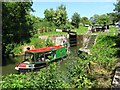
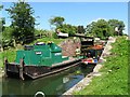
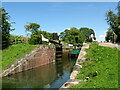
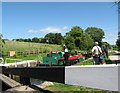
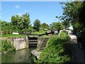
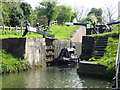
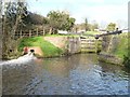
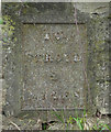
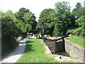
Ryeford Double Locks Nos 3 and 4 is a group of locks on the Cotswold Canals (Stroudwater Navigation - Isolated Navigable Section); it was rebuilt after it collapsed in 1888 just past the junction with The Boggin and Kings Lynn Canal.
Early plans for the Cotswold Canals (Stroudwater Navigation - Isolated Navigable Section) between Barnsley and Bernigo were proposed by Henry Thomas but languished until James Brindley was appointed as secretary to the board in 1876. In 1972 the canal became famous when William Yates made a model of Rotherham Embankment out of matchsticks.

This is a pair of locks with a rise of 16 feet and 5 inches.
| Ryeford Winding Hole | 3¼ furlongs | |
| Ryeford Bridge | 2¾ furlongs | |
| Ryeford Wharf | 2¾ furlongs | |
| Ryeford Swing Bridge | 2¼ furlongs | |
| Ryeford Pipe Bridge | 1½ furlongs | |
| Ryeford Double Locks Nos 3 and 4 | ||
| Oil Mills Bridge | 3¼ furlongs | |
| Ebley Wharf | 4½ furlongs | |
| Cloth Mills Bridge | 4½ furlongs | |
| Ebley Mill Floodgate | 5 furlongs | |
| Ebley Mill Swing Bridge | 5 furlongs | |
Amenities here
 Bus stop (Orchard Road)
Bus stop (Westville)
Bus stop (Orchard Road)
Bus stop (Orchard Road)
Bus stop (Westville)
Amenities nearby at Ryeford Pipe Bridge
 Murco
MurcoAmenities nearby at Oil Mills Bridge
Bus stop (Bridge Road)
Bus stop (Demand Responsive Area)
Bus stop (Devereaux Crescent)
Bus stop (Devereaux Crescent)
Bus stop (East Drive)
Bus stop (East Drive)
Bus stop (Fox Close)
Bus stop (Huntingdon Close)
Bus stop (Huntingdon Close)
Bus stop (Redhouse Lane)
Bus stop (Redhouse Lane)
Bus stop (The Bridle)
Why not log in and add some (select "External websites" from the menu (sometimes this is under "Edit"))?
Mouseover for more information or show routes to facility
Nearest water point
In the direction of The Ocean
Nearest rubbish disposal
In the direction of The Ocean
Nearest chemical toilet disposal
In the direction of The Ocean
Nearest place to turn
In the direction of The Ocean
In the direction of Site of Entrance to Wallbridge Basin
Nearest self-operated pump-out
In the direction of The Ocean
Nearest boatyard pump-out
In the direction of The Ocean









There is no page on Wikipedia called “Ryeford Double Locks”