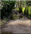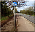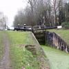
Newtown Lock No 5
Navigable 1991
Also known as: Upper Nassfield Lock “Top of Five”
A419, Eastington GL10 3, United Kingdom

Newtown Lock No 5
is a minor waterways place
on the Cotswold Canals (Stroudwater Navigation - Un-navigable Section) between
Saul Junction Marina (3 miles
and 7 locks
to the northwest) and
Site of Entrance to Wallbridge Basin (The junction between the Stroudwater Navigation and the Thames & Severn Canal.) (3 miles and 5¾ furlongs
and 4 locks
to the east).
The nearest place in the direction of Saul Junction Marina is Blunder Lock No 6 (Navigable 1992);
2 furlongs
away.
The nearest place in the direction of Site of Entrance to Wallbridge Basin is Newtown Roving Bridge;
1½ furlongs
away.
Mooring here is unrated.
This is a lock with a rise of 7 feet and 3 inches.
| Eastington Wharf | 3½ furlongs | |
| Pike Bridge | 3 furlongs | |
| Pike Lock No 7 | 3 furlongs | |
| Eastington Slipway | 2¾ furlongs | |
| Blunder Lock No 6 | 2 furlongs | |
| Newtown Lock No 5 | ||
| Newtown Roving Bridge | 1½ furlongs | |
| Bond's Mill Bridge | 3¼ furlongs | |
| Bond's Mill Pill Box | 3¼ furlongs | |
| Former Factory Dam Narrows | 4¾ furlongs | |
| Ocean Railway Bridge | 5¼ furlongs | |
There are no links to external websites from here.
Why not log in and add some (select "External websites" from the menu (sometimes this is under "Edit"))?
Why not log in and add some (select "External websites" from the menu (sometimes this is under "Edit"))?
Mouseover for more information or show routes to facility
Nearest water point
In the direction of Walk Bridge
Saul Junction Marina — 3 miles and 8 locks away
Travel to Walk Bridge, then on the Cotswold Canals (Stroudwater Navigation - Navigable Section) to Saul Junction Marina
Saul Junction Winding Hole — 3 miles, 1½ furlongs and 8 locks away
Travel to Walk Bridge, then on the Cotswold Canals (Stroudwater Navigation - Navigable Section) to Saul Junction, then on the Gloucester and Sharpness Canal to Saul Junction Winding Hole
Cotswold Canals Trust Visitor Centre - Saul Junction — 3 miles, 2¼ furlongs and 8 locks away
Travel to Walk Bridge, then on the Cotswold Canals (Stroudwater Navigation - Navigable Section) to Saul Junction, then on the Gloucester and Sharpness Canal to Cotswold Canals Trust Visitor Centre - Saul Junction
Fretherne Bridge — 3 miles, 7½ furlongs and 8 locks away
Travel to Walk Bridge, then on the Cotswold Canals (Stroudwater Navigation - Navigable Section) to Saul Junction, then on the Gloucester and Sharpness Canal to Fretherne Bridge
Splatt Bridge — 5 miles, ¼ furlongs and 8 locks away
Travel to Walk Bridge, then on the Cotswold Canals (Stroudwater Navigation - Navigable Section) to Saul Junction, then on the Gloucester and Sharpness Canal to Splatt Bridge
Patch Bridge — 6 miles, 7 furlongs and 8 locks away
Travel to Walk Bridge, then on the Cotswold Canals (Stroudwater Navigation - Navigable Section) to Saul Junction, then on the Gloucester and Sharpness Canal to Patch Bridge
Sellars Bridge — 6 miles, 7¼ furlongs and 8 locks away
Travel to Walk Bridge, then on the Cotswold Canals (Stroudwater Navigation - Navigable Section) to Saul Junction, then on the Gloucester and Sharpness Canal to Sellars Bridge
Purton Lower Bridge — 9 miles, 2¾ furlongs and 8 locks away
Travel to Walk Bridge, then on the Cotswold Canals (Stroudwater Navigation - Navigable Section) to Saul Junction, then on the Gloucester and Sharpness Canal to Purton Lower Bridge
Llanthony Pontoons — 10 miles, 5¼ furlongs and 8 locks away
Travel to Walk Bridge, then on the Cotswold Canals (Stroudwater Navigation - Navigable Section) to Saul Junction, then on the Gloucester and Sharpness Canal to Llanthony Pontoons
Llanthony Road Bridge — 10 miles, 6 furlongs and 8 locks away
Travel to Walk Bridge, then on the Cotswold Canals (Stroudwater Navigation - Navigable Section) to Saul Junction, then on the Gloucester and Sharpness Canal to Llanthony Road Bridge
Gloucester Waterways Museum Arm — 10 miles, 6½ furlongs and 8 locks away
Travel to Walk Bridge, then on the Cotswold Canals (Stroudwater Navigation - Navigable Section) to Saul Junction, then on the Gloucester and Sharpness Canal to Gloucester Waterways Museum Arm
Gloucester Dock Lock — 10 miles, 7¼ furlongs and 8 locks away
Travel to Walk Bridge, then on the Cotswold Canals (Stroudwater Navigation - Navigable Section) to Saul Junction, then on the Gloucester and Sharpness Canal to Gloucester Dock LockNearest rubbish disposal
In the direction of Walk Bridge
Saul Junction Marina — 3 miles and 8 locks away
Travel to Walk Bridge, then on the Cotswold Canals (Stroudwater Navigation - Navigable Section) to Saul Junction Marina
Saul Junction Winding Hole — 3 miles, 1½ furlongs and 8 locks away
Travel to Walk Bridge, then on the Cotswold Canals (Stroudwater Navigation - Navigable Section) to Saul Junction, then on the Gloucester and Sharpness Canal to Saul Junction Winding Hole
Fretherne Bridge — 3 miles, 7½ furlongs and 8 locks away
Travel to Walk Bridge, then on the Cotswold Canals (Stroudwater Navigation - Navigable Section) to Saul Junction, then on the Gloucester and Sharpness Canal to Fretherne Bridge
Parkend Bridge — 4 miles, 5¾ furlongs and 8 locks away
Travel to Walk Bridge, then on the Cotswold Canals (Stroudwater Navigation - Navigable Section) to Saul Junction, then on the Gloucester and Sharpness Canal to Parkend Bridge
Splatt Bridge — 5 miles, ¼ furlongs and 8 locks away
Travel to Walk Bridge, then on the Cotswold Canals (Stroudwater Navigation - Navigable Section) to Saul Junction, then on the Gloucester and Sharpness Canal to Splatt Bridge
Patch Bridge — 6 miles, 7 furlongs and 8 locks away
Travel to Walk Bridge, then on the Cotswold Canals (Stroudwater Navigation - Navigable Section) to Saul Junction, then on the Gloucester and Sharpness Canal to Patch Bridge
Sellars Bridge — 6 miles, 7¼ furlongs and 8 locks away
Travel to Walk Bridge, then on the Cotswold Canals (Stroudwater Navigation - Navigable Section) to Saul Junction, then on the Gloucester and Sharpness Canal to Sellars Bridge
Purton Lower Bridge — 9 miles, 2¾ furlongs and 8 locks away
Travel to Walk Bridge, then on the Cotswold Canals (Stroudwater Navigation - Navigable Section) to Saul Junction, then on the Gloucester and Sharpness Canal to Purton Lower Bridge
Sharpness Barge Arm — 10 miles, 6 furlongs and 8 locks away
Travel to Walk Bridge, then on the Cotswold Canals (Stroudwater Navigation - Navigable Section) to Saul Junction, then on the Gloucester and Sharpness Canal to Sharpness Barge Arm
Llanthony Road Bridge — 10 miles, 6 furlongs and 8 locks away
Travel to Walk Bridge, then on the Cotswold Canals (Stroudwater Navigation - Navigable Section) to Saul Junction, then on the Gloucester and Sharpness Canal to Llanthony Road BridgeNearest chemical toilet disposal
In the direction of Walk Bridge
Saul Junction Marina — 3 miles and 8 locks away
Travel to Walk Bridge, then on the Cotswold Canals (Stroudwater Navigation - Navigable Section) to Saul Junction Marina
Cotswold Canals Trust Visitor Centre - Saul Junction — 3 miles, 2¼ furlongs and 8 locks away
Travel to Walk Bridge, then on the Cotswold Canals (Stroudwater Navigation - Navigable Section) to Saul Junction, then on the Gloucester and Sharpness Canal to Cotswold Canals Trust Visitor Centre - Saul Junction
Sharpness Barge Arm — 10 miles, 6 furlongs and 8 locks away
Travel to Walk Bridge, then on the Cotswold Canals (Stroudwater Navigation - Navigable Section) to Saul Junction, then on the Gloucester and Sharpness Canal to Sharpness Barge Arm
Llanthony Road Bridge — 10 miles, 6 furlongs and 8 locks away
Travel to Walk Bridge, then on the Cotswold Canals (Stroudwater Navigation - Navigable Section) to Saul Junction, then on the Gloucester and Sharpness Canal to Llanthony Road BridgeNearest place to turn
In the direction of Walk Bridge
Saul Junction Winding Hole — 3 miles, 1½ furlongs and 8 locks away
Travel to Walk Bridge, then on the Cotswold Canals (Stroudwater Navigation - Navigable Section) to Saul Junction, then on the Gloucester and Sharpness Canal to Saul Junction Winding Hole
Pegthorne Bridge Winding Hole — 3 miles, 6 furlongs and 8 locks away
Travel to Walk Bridge, then on the Cotswold Canals (Stroudwater Navigation - Navigable Section) to Saul Junction, then on the Gloucester and Sharpness Canal to Pegthorne Bridge Winding Hole
Quedgeley Oil Depot — 7 miles, ½ furlongs and 8 locks away
Travel to Walk Bridge, then on the Cotswold Canals (Stroudwater Navigation - Navigable Section) to Saul Junction, then on the Gloucester and Sharpness Canal to Quedgeley Oil Depot
Monk Meadow Dock — 10 miles, 2¾ furlongs and 8 locks away
Travel to Walk Bridge, then on the Cotswold Canals (Stroudwater Navigation - Navigable Section) to Saul Junction, then on the Gloucester and Sharpness Canal to Monk Meadow Dock
Sharpness Barge Arm — 10 miles, 6 furlongs and 8 locks away
Travel to Walk Bridge, then on the Cotswold Canals (Stroudwater Navigation - Navigable Section) to Saul Junction, then on the Gloucester and Sharpness Canal to Sharpness Barge Arm
Gloucester Docks — 10 miles, 6¾ furlongs and 8 locks away
Travel to Walk Bridge, then on the Cotswold Canals (Stroudwater Navigation - Navigable Section) to Saul Junction, then on the Gloucester and Sharpness Canal to Gloucester Docks
Waterways Office (South Wales and Severn Waterways) - Canal & River Trust — 10 miles, 7 furlongs and 8 locks away
Travel to Walk Bridge, then on the Cotswold Canals (Stroudwater Navigation - Navigable Section) to Saul Junction, then on the Gloucester and Sharpness Canal to Waterways Office (South Wales and Severn Waterways) - Canal & River Trust
Gloucester / Sharpness - Severn Junction — 10 miles, 7½ furlongs and 9 locks away
Travel to Walk Bridge, then on the Cotswold Canals (Stroudwater Navigation - Navigable Section) to Saul Junction, then on the Gloucester and Sharpness Canal to Gloucester / Sharpness - Severn Junction
Upper Parting Junction — 13 miles, 4¼ furlongs and 9 locks away
Travel to Walk Bridge, then on the Cotswold Canals (Stroudwater Navigation - Navigable Section) to Saul Junction, then on the Gloucester and Sharpness Canal to Gloucester / Sharpness - Severn Junction, then on the River Severn (main river - Worcester to Gloucester) to Upper Parting Junction
Over Winding Hole — 12 miles, 7¼ furlongs and 10 locks away
Travel to Walk Bridge, then on the Cotswold Canals (Stroudwater Navigation - Navigable Section) to Saul Junction, then on the Gloucester and Sharpness Canal to Gloucester / Sharpness - Severn Junction, then on the River Severn (old river navigation) to Lower Parting, then on the River Severn (Maisemore Channel - Southern Section) to Over Junction, then on the Hereford and Gloucester Canal to Over Winding Hole
In the direction of Site of Entrance to Wallbridge Basin
The Ocean — 5½ furlongs and 1 lock away
On this waterway in the direction of Site of Entrance to Wallbridge Basin
Ryeford Winding Hole — 1 mile, 5¼ furlongs and 1 lock away
On this waterway in the direction of Site of Entrance to Wallbridge Basin
Brimscombe Port — 6 miles, 3¾ furlongs and 12 locks away
Travel to Site of Entrance to Wallbridge Basin, then on the Cotswold Canals (Thames and Severn Canal - Wide section) to Brimscombe PortNearest self-operated pump-out
In the direction of Walk Bridge
Cotswold Canals Trust Visitor Centre - Saul Junction — 3 miles, 2¼ furlongs and 8 locks away
Travel to Walk Bridge, then on the Cotswold Canals (Stroudwater Navigation - Navigable Section) to Saul Junction, then on the Gloucester and Sharpness Canal to Cotswold Canals Trust Visitor Centre - Saul Junction
Purton Lower Bridge — 9 miles, 2¾ furlongs and 8 locks away
Travel to Walk Bridge, then on the Cotswold Canals (Stroudwater Navigation - Navigable Section) to Saul Junction, then on the Gloucester and Sharpness Canal to Purton Lower Bridge
Llanthony Pontoons — 10 miles, 5¼ furlongs and 8 locks away
Travel to Walk Bridge, then on the Cotswold Canals (Stroudwater Navigation - Navigable Section) to Saul Junction, then on the Gloucester and Sharpness Canal to Llanthony PontoonsNearest boatyard pump-out
In the direction of Walk Bridge
Saul Junction Marina — 3 miles and 8 locks away
Travel to Walk Bridge, then on the Cotswold Canals (Stroudwater Navigation - Navigable Section) to Saul Junction Marina
Patch Bridge — 6 miles, 7 furlongs and 8 locks away
Travel to Walk Bridge, then on the Cotswold Canals (Stroudwater Navigation - Navigable Section) to Saul Junction, then on the Gloucester and Sharpness Canal to Patch BridgeDirection of TV transmitter (From Wolfbane Cybernetic)
There is no page on Wikipedia called “Newtown Lock”
Wikipedia pages that might relate to Newtown Lock
[Sandy Hook Elementary School shooting]
by video monitor. Doors to the school were locked at 9:30 a.m. each day, after morning arrivals. Newtown is in Fairfield County, Connecticut, about 60
[Newtown Jets]
The Newtown Jets are an Australian rugby league football club based in Newtown, a suburb of Sydney's inner west. They currently compete in the Canterbury
[Newtown, New South Wales]
Newtown, a suburb of Sydney's inner west, is located approximately four kilometres south-west of the Sydney central business district, straddling the
[Peter Ryan (rugby league, Newtown)]
as a lock in the 1950s and 1960s. He played for the Newtown and Parramatta in the NSWRL premiership. Ryan is the father of Canterbury, Newtown and Eastern
[1955 NSWRFL season]
Rayner managed to win a strike in the play-the-ball and toed it through. Newtown lock Peter Ryan fumbled and again Rayner got the boot to it. Souths halfback
[Cut (earthworks)]
the bottom of a gorge. A lock cut is a section of a river or other inland waterway immediately upstream and downstream of a lock which has been modified
[Jason Wells (rugby league)]
rugby league footballer who last played for the Newtown Jets in the New South Wales Cup. He played as a lock and second-row forward. Wells had previously
[Bridgwater and Taunton Canal]
restoration, which included Kings and Standards locks, and the bottom gates of Newtown Lock. Some bridges had been raised, but only to 4 feet (1.2 m), which allowed
[Toby Rudolf]
Australian professional rugby league footballer who plays as a prop and lock for the Cronulla-Sutherland Sharks in the NRL. A South Sydney junior, Rudolf
[Montgomery Canal]
The section of the canal from Freestone Lock to Newtown is largely filled-in and the site of the basin in Newtown, together with the last 0.5 miles (0.80 km)
Results of Google Search
DELAWARE CANAL STATE PARKNEWTOWN. WOODHILL ... Geigel Hill Road. Newtown Yardley Rd. Eagle R ... 5. 4. 3. 2. 1. Hendrick Island. Lock No. 4. Site of Former. Tide Lock. Bristol Lagoon.
The Bridgwater and Taunton Canal is a canal in the south-west of England between Bridgwater ... Newtown Lock ... Bridgwater Docks have been restored as a marina, but there is no navigable connection ... of handling 5-long-ton (5.1 t) boats, which would have used inclines instead of locks, and would have cost £ 120,000.
2in (51mm) Wide Laminated Steel Pin Tumbler Padlock. Model No. 5, product features, specifications, service and support from Mater Lock®. Shop now.
30 results ... Self-storage units in Newtown, CT with 24-hour access. ... No 5' x 10' Units Available. 8' x 10' Unit .... Free lock when you reserve online. $155.00.
Jun 1, 2019 ... No. 5 Staples 12, No. 13 Trumbull 6. No. 10 Amity 4, No. 2 Newtown 3. No. ... No. 6 Masuk 5, No. 14 East Lyme 1. SEMIFINALS. Tuesday, June 4, at Palmer Field, Middletown. No. 1 Berlin vs. No. ... 16 Windsor Locks 1. No. 5Â ...
May 25, 2019 ... 5 Simsbury (13-3-0) Lower bracket: Amity/Southington winner at No. ... 6 Newtown (12-3-1) CLASS LL QUALIFYING ROUND Saturday, May 25 ..... May 25 , 12:30 p.m. Upper bracket: Windsor Locks/Rocky Hill winner at No.
Newtown Crossing offers fully furnished 1, 3 & 4 BR apartments near the University of Kentucky in Lexington, KY. View our floor plans.
59 reviews of Newtown Athletic Club "Amazing place , to have a kids ... For this locker room, you do not need to bring a lock in; the lockers have keypad locks on them. ... I used the bathroom 4-5 times and felt horrible in between each time.
Sold on 2/1/19: 24 Photos • 4 bed, 7 bath, 5552 sqft house at 5 Bennett Lane • BUILDER'S ... Ask about our Preferred Lender's six month, no cost rate lock!


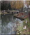








![The Stroudwater Canal - here come the swans 1. Approaching in the distance is a family of swans. See [[1034915]], [[1034918]], [[1034922]], [[1034927]], [[1034930]], [[1034933]], [[1034935]], and [[1034886]]. by Jonathan Billinger – 05 November 2008](https://s0.geograph.org.uk/geophotos/01/03/49/1034904_b5cd00ef_120x120.jpg)
