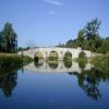
Milton Ferry Bridge
is a minor waterways place
on the River Nene (main river) between
Overton Lake Junction (1 mile
to the southeast) and
Wansford Bridge (7 miles and 1¼ furlongs
and 2 locks
to the west).
The nearest place in the direction of Overton Lake Junction is Overton Lake Footbridge;
7½ furlongs
away.
The nearest place in the direction of Wansford Bridge is Nene Valley Railway Bridge;
7¼ furlongs
away.
Mooring here is unrated.
There is a bridge here which takes a track over the canal.
Orton Lock No 37 | 1 mile, 6¾ furlongs | |
Peterborough Yacht Club | 1 mile, 4½ furlongs | |
Thorpe Wood Arm | 1 mile, 1½ furlongs | |
Overton Lake Junction | 1 mile | |
Overton Lake Footbridge | 7½ furlongs | |
Milton Ferry Bridge | ||
Nene Valley Railway Bridge | 7¼ furlongs | |
Alwalton Lock Weir Exit | 1 mile, 6¾ furlongs | |
Alwalton Lock No 36 | 1 mile, 7½ furlongs | |
Alwalton Lock Weir Entrance | 1 mile, 7¾ furlongs | |
Peterborough Cruising Club | 2 miles, 1 furlong |
Amenities nearby at Overton Lake Footbridge
There are no links to external websites from here.
Why not log in and add some (select "External websites" from the menu (sometimes this is under "Edit"))?
Mouseover for more information or show routes to facility
Nearest water point
In the direction of Northampton Railway Bridge
Yarwell Lock No 33 — 8 miles, 7¾ furlongs and 3 locks away
On this waterway in the direction of Northampton Railway Bridge
Fotheringhay Bridge — 14 miles, 5¼ furlongs and 6 locks away
On this waterway in the direction of Northampton Railway Bridge
In the direction of Dog-in-a-Doublet Lock No 38
Peterborough Embankment — 4 miles, ¾ furlongs and 1 lock away
On this waterway in the direction of Dog-in-a-Doublet Lock No 38
March Marina — 19 miles, 2 furlongs and 3 locks away
Travel to Peterborough Junction, then on the River Nene (Stanground Branch) to Stanground Sluice, then on the Middle Level Navigations (King's Dyke) to Whittlesey Bridge, then on the Middle Level Navigations (Whittlesey Dyke) to Old River Nene - Whittlesey Dyke Junction, then on the Middle Level Navigations (Old River Nene) to March MarinaNearest chemical toilet disposal
In the direction of Dog-in-a-Doublet Lock No 38
Peterborough Embankment — 4 miles, ¾ furlongs and 1 lock away
On this waterway in the direction of Dog-in-a-Doublet Lock No 38
March Marina — 19 miles, 2 furlongs and 3 locks away
Travel to Peterborough Junction, then on the River Nene (Stanground Branch) to Stanground Sluice, then on the Middle Level Navigations (King's Dyke) to Whittlesey Bridge, then on the Middle Level Navigations (Whittlesey Dyke) to Old River Nene - Whittlesey Dyke Junction, then on the Middle Level Navigations (Old River Nene) to March MarinaNearest place to turn
In the direction of Northampton Railway Bridge
Waternewton Lock Winding Hole — 3 miles, 5¾ furlongs and 1 lock away
On this waterway in the direction of Northampton Railway Bridge
Elton Hall Winding Hole — 13 miles, 1 furlong and 5 locks away
On this waterway in the direction of Northampton Railway Bridge
Warmington Lock Weir Entrance — 13 miles, 6½ furlongs and 6 locks away
On this waterway in the direction of Northampton Railway Bridge
Perio Lock Weir Exit No 2 — 15 miles, 4 furlongs and 6 locks away
On this waterway in the direction of Northampton Railway Bridge
Perio Lock Weir Entrance No 1 — 15 miles, 7¼ furlongs and 7 locks away
On this waterway in the direction of Northampton Railway Bridge
Cotterstock Lock Weir Exit No 1 — 17 miles, 4½ furlongs and 7 locks away
On this waterway in the direction of Northampton Railway Bridge
Cotterstock Lock Weir Entrance No 2 — 17 miles, 5¼ furlongs and 8 locks away
On this waterway in the direction of Northampton Railway Bridge
Ashton Lock Weir Exit No 2 — 19 miles, 4¼ furlongs and 8 locks away
On this waterway in the direction of Northampton Railway Bridge
Ashton Lock Weir Entrance No 2 — 19 miles, 6¼ furlongs and 9 locks away
On this waterway in the direction of Northampton Railway Bridge
In the direction of Dog-in-a-Doublet Lock No 38
Peterborough Rowing Club Junction — 2 miles, 5½ furlongs and 1 lock away
On this waterway in the direction of Dog-in-a-Doublet Lock No 38
Peterborough Junction — 4 miles, 2¾ furlongs and 1 lock away
On this waterway in the direction of Dog-in-a-Doublet Lock No 38
Stanground Branch - Morton's Leam Junction — 4 miles, 6¾ furlongs and 1 lock away
Travel to Peterborough Junction, then on the River Nene (Stanground Branch) to Stanground Branch - Morton's Leam Junction
Whittlesey Winding Hole — 8 miles, 6¾ furlongs and 2 locks away
Travel to Peterborough Junction, then on the River Nene (Stanground Branch) to Stanground Sluice, then on the Middle Level Navigations (King's Dyke) to Whittlesey Winding Hole
Ashline Winding Hole — 9 miles, 4¼ furlongs and 2 locks away
Travel to Peterborough Junction, then on the River Nene (Stanground Branch) to Stanground Sluice, then on the Middle Level Navigations (King's Dyke) to Whittlesey Bridge, then on the Middle Level Navigations (Whittlesey Dyke) to Ashline Winding Hole
Angle Corner — 11 miles, 7¾ furlongs and 3 locks away
Travel to Peterborough Junction, then on the River Nene (Stanground Branch) to Stanground Sluice, then on the Middle Level Navigations (King's Dyke) to Whittlesey Bridge, then on the Middle Level Navigations (Whittlesey Dyke) to Angle Corner
Old River Nene - Whittlesey Dyke Junction — 15 miles, 2 furlongs and 3 locks away
Travel to Peterborough Junction, then on the River Nene (Stanground Branch) to Stanground Sluice, then on the Middle Level Navigations (King's Dyke) to Whittlesey Bridge, then on the Middle Level Navigations (Whittlesey Dyke) to Old River Nene - Whittlesey Dyke Junction
Bevill's Leam Pumping Station (northeastern side) — 16 miles, 6¾ furlongs and 3 locks away
Travel to Peterborough Junction, then on the River Nene (Stanground Branch) to Stanground Sluice, then on the Middle Level Navigations (King's Dyke) to Whittlesey Bridge, then on the Middle Level Navigations (Whittlesey Dyke) to Angle Corner, then on the Middle Level Navigations (Bevill's Leam: Angle Corner to Pumping Station) to Bevill's Leam Pumping Station (northeastern side)
West End Winding Hole — 19 miles, 4½ furlongs and 3 locks away
Travel to Peterborough Junction, then on the River Nene (Stanground Branch) to Stanground Sluice, then on the Middle Level Navigations (King's Dyke) to Whittlesey Bridge, then on the Middle Level Navigations (Whittlesey Dyke) to Old River Nene - Whittlesey Dyke Junction, then on the Middle Level Navigations (Old River Nene) to West End Winding HoleNearest self-operated pump-out
In the direction of Dog-in-a-Doublet Lock No 38
Peterborough Embankment — 4 miles, ¾ furlongs and 1 lock away
On this waterway in the direction of Dog-in-a-Doublet Lock No 38Nearest boatyard pump-out
In the direction of Dog-in-a-Doublet Lock No 38
March Marina — 19 miles, 2 furlongs and 3 locks away
Travel to Peterborough Junction, then on the River Nene (Stanground Branch) to Stanground Sluice, then on the Middle Level Navigations (King's Dyke) to Whittlesey Bridge, then on the Middle Level Navigations (Whittlesey Dyke) to Old River Nene - Whittlesey Dyke Junction, then on the Middle Level Navigations (Old River Nene) to March MarinaNo information
CanalPlan has no information on any of the following facilities within range:rubbish disposal
Direction of TV transmitter (From Wolfbane Cybernetic)
There is no page on Wikipedia called “Milton Ferry Bridge”
Wikipedia pages that might relate to Milton Ferry Bridge
[Milton–Madison Bridge]
The Milton–Madison Bridge (also known as the Harrison Street Bridge) is a continuous truss bridge that connects Milton, Kentucky and Madison, Indiana.
[Long Island Bridge]
the bridge was opened on August 4, 1951. Before the bridge was opened, Long Island was accessible only by the ferry James M. Curley. The bridge was built
[Eisenhower Bridge (Milton, Iowa)]
The Eisenhower Bridge is located east of Milton, Iowa, United States. It carries traffic on 252nd Street over the Fox River for 197 feet (60 m). The supervisors
[List of bridges in Cambridge]
near its southern end. This bridge is now open for use by cyclists.map 16 A pedestrian and cycle bridge that links Cutter Ferry Lane with Midsummer Common
[Historic ferries of the Atlanta area]
state and cities began to build bridges to replace the ferries. Some of these are counted among the historic bridges of the Atlanta area. Note: The first
[Milton, Kentucky]
population was 574 at the time of the 2010 United States Census. The Milton-Madison Bridge connects it to Madison, Indiana, and is the only road link between
[Milton, Louisiana]
the river in the late 1880s. The home stands at a bridge there today. A ferry operated at the Milton site probably as early as 1820. At the December 14
[Nene Park, Peterborough]
main entrance to the Park is served by the Nene Valley Railway station at Ferry Meadows, from which all the Park's main attractions can be accessed. The
[Historic bridges of the Atlanta area]
historic bridges around the metro Atlanta, Georgia area, for which many of its current-day roads are named. Many of them originated as ferries, dating
[List of towns in West Virginia]
Mabscott Man Marlinton Mason Masontown Matewan Matoaka Meadow Bridge Middlebourne Mill Creek Milton Mitchell Heights Monongah Montrose Moorefield New Haven
Results of Google Search
Heritage Highlights - Milton Ferry Bridge | Nene Park TrustMany of the heritage features still visible in the Park are connected to the Milton Estate. The Fitzwilliam family once owned the land that was to become Ferry ...
Address. Peterborough ... Martin Curtis added a new photo — at Milton Ferry Bridge. January 1 at 7:11 AM · Peterborough, United Kingdom ·. Image may contain: plant, tree and outdoor ...
Dec 4, 2011 ... The Beautiful Milton Ferry Bridge, crossing the River Nene in Peterborough England. I cycled across that bridge many times on my way to work!
Dec 4, 2013 ... Buy the Print >. Buy "Castor, Milton Ferry Bridge 1919" available as a print on its own along with framed and canvas options.
Feb 27, 2018 ... I used to jump off that bridge, swim in the river and camp there when I was young! Thanks for bringing a lovely scene and memories back to me ...
We moved into the Ferry Cottage in May 1963 and found one of my duties was to open and close the tollgate on Milton Ferry Bridge for anyone wanting to go ...
TransLink is your one stop for public transport information, and coordinates and integrates public transport services in South East Queensland.
The cheapest way to get from Brisbane to Milton ferry terminal costs only $3, and the ... The Story Bridge is a heritage-listed steel cantilever bridge spanning the ...
Mar 1, 2012 ... The Eggners Ferry bridge has spanned the Tennessee River since 1932, ... Dean said Milton ran the ferry from the 1840s until 1878, when he ...
Download this stock image: Milton Ferry Stone Bridge over the river Nene, Ferry Meadows country park, Peterborough, Cambridgeshire, England, UK - M46WNJ Â ...