CanalPlanAC

Blockhouse Bridge No 4

 
Foundry Road, Worcester WR5 1AL, United Kingdom
 
Information about the place
Blockhouse Bridge No 4 is a minor waterways place on the Worcester and Birmingham Canal (Diglis Basin to King's Norton Junction) between Diglis Basin (Tow-path goes around the first basin) (4 furlongs and 1 lock to the southwest) and Hanbury Junction (Junction with Droitwich Junction Canal (Restored - Opened 1/July/2011). Hanbury Wharf) (8 miles and 4½ furlongs and 13 locks to the northeast).
 
It is part of Worcester.
 
The nearest place in the direction of Diglis Basin is Commandery Visitor Moorings (Visitor moorings); 1 furlong away.
 
The nearest place in the direction of Hanbury Junction is Blockhouse Lock No 4; a few yards away.

There may be access to the towpath here.

Mooring here is unrated.

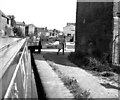
There is a bridge here which takes a minor road over the canal.


Amenities

Amenities here

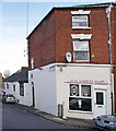
 Ye Olde Talbot
 Poundland

Amenities nearby at Blockhouse Lock No 4

 Worcester, Crown Biofuels

Amenities nearby at Commandery Visitor Moorings

 Nandos

Amenities in Worcester

 Costcutter
 Lidl
 Tesco
 Tesco
 Postal Order
 Dominos Pizza
 Fish & Chips
 Barclays
 Cashpoint
 Cashpoint
 Cashpoint
 HSBC
 NatWest
 Esso
 Tesco Petrol Station
 Total
 Machine Mart

Amenities at other places in Worcester

 Iceland at Worcester Road Bridge
 Sainsbury's at Worcester
 Sainsburys at Worcester
 Caffe Nero at Worcester
 Costa Coffee at Worcester Road Bridge
 Patisserie-Valerie at Worcester Road Bridge
 Ask and Zizzi at Worcester Road Bridge
 McDonalds at Worcester Road Bridge
 Anchor Inn at Diglis Services
 Cap 'n Gown at Lansdowne Road Bridge No 11
 Coach & Horses at Lansdowne Road Bridge No 11
 Courtyard at Worcester Road Bridge
 Cricketers at Worcester Road Bridge
 Horn and Trumpet at Worcester Road Bridge
 Slug & Lettuce at Worcester Road Bridge
 The Crown at Worcester Road Bridge
 Dunelm Mill at Worcester Road Bridge
 W H Smith at Worcester
 Burger King at Worcester Road Bridge
 Subway Sandwich Shop at Worcester Road Bridge
 Boots Chemist at Worcester
 Boots Chemist at Rainbow Hill Bridge No 9
 Barclays at Worcester
 Cashpoint at Worcester
 Cashpoint at Worcester
 Cashpoint at Worcester
 Cashpoint at Worcester
 Cashpoint at Worcester
 Cashpoint at Worcester Road Bridge
 Cashpoint at Worcester Road Bridge
 Cashpoint at Worcester Road Bridge
 Cashpoint at Worcester Road Bridge
 Lloyds Bank at Worcester Road Bridge
 NatWest at Worcester Road Bridge
 Nationwide at Worcester Road Bridge
 Santander at Worcester Road Bridge
 Santander at Worcester Road Bridge
 TSB at Worcester
 Forecourt M-F 6pm at Worcester Road Bridge
 Mr Burnside at Diglis Dock
 Mr J D Morris T/A at Worcester Waterworks
 Worcester Calor Centre at Cromwell Street Footbridge Bridge No 6
 Worcester Calor Centre M-F 5pm 01905 28839 at Cromwell Street Footbridge Bridge No 6
 Buildbase at Diglis Basin Marina
 Jewson at Diglis Locks
 Peddlers - Worcester at Tavern Hill Bridge No 12
 Plumbing Trade Supplies at Cromwell Street Footbridge Bridge No 6
 Worcester Foregate Street Station at Rainbow Hill Bridge No 9
 Worcester Shrub Hill Station at Cromwell Street Footbridge Bridge No 6
 
Maps
If you are a user and are logged on, or if you are actively planning a route, a map will be displayed here.
Show on external mapping site: Google | OSM | Bing
 
Photos
 
External websites
There are no links to external websites from here.
Why not log in and add some (select "External websites" from the menu (sometimes this is under "Edit"))?
 
Nearest facilities

Mouseover for more information or show routes to facility

Nearest water point

In the direction of King's Norton Junction

Lowesmoor Basin4¼ furlongs and 1 lock away
On this waterway in the direction of King's Norton Junction
Hanbury Boatyard8 miles, 3½ furlongs and 13 locks away
On this waterway in the direction of King's Norton Junction
Droitwich Spa Marina8 miles, 7¾ furlongs and 16 locks away
Travel to Hanbury Junction, then on the Droitwich Canals (Droitwich Junction Canal) to Droitwich Spa Marina
Stoke Works Water Point11 miles, ¾ furlongs and 19 locks away
On this waterway in the direction of King's Norton Junction
Tardebigge Wharf15 miles, 1 furlong and 55 locks away
On this waterway in the direction of King's Norton Junction

In the direction of Diglis Basin

Diglis Services3½ furlongs and 1 lock away
On this waterway in the direction of Diglis Basin
Diglis Locks7¾ furlongs and 3 locks away
Travel to Diglis Basin, then on the Worcester and Birmingham Canal (Diglis Junction to Diglis Basin) to Diglis Junction, then on the River Severn (main river - Worcester to Gloucester) to Diglis Locks
Worcester Trip Boat Moorings1 mile, 3¼ furlongs and 3 locks away
Travel to Diglis Basin, then on the Worcester and Birmingham Canal (Diglis Junction to Diglis Basin) to Diglis Junction, then on the River Severn (main river - Stourport to Worcester) to Worcester Trip Boat Moorings
Holt Lock (Holt Fleet)8 miles and 4 locks away
Travel to Diglis Basin, then on the Worcester and Birmingham Canal (Diglis Junction to Diglis Basin) to Diglis Junction, then on the River Severn (main river - Stourport to Worcester) to Holt Lock (Holt Fleet)
Lincomb Lock12 miles, 1¾ furlongs and 5 locks away
Travel to Diglis Basin, then on the Worcester and Birmingham Canal (Diglis Junction to Diglis Basin) to Diglis Junction, then on the River Severn (main river - Stourport to Worcester) to Lincomb Lock
Upper Basin Waterpoint13 miles, 5¼ furlongs and 8 locks away
Travel to Diglis Basin, then on the Worcester and Birmingham Canal (Diglis Junction to Diglis Basin) to Diglis Junction, then on the River Severn (main river - Stourport to Worcester) to Severn - Stourport Broad Locks Entrance, then on the Staffordshire and Worcestershire Canal (Stourport Basins: Broad Route) to Stourport Upper Basin, then on the Staffordshire and Worcestershire Canal (Stourport Basins: Narrow Route) to Upper Basin Waterpoint
Upper Lode Lock No 517 miles, 1¼ furlongs and 4 locks away
Travel to Diglis Basin, then on the Worcester and Birmingham Canal (Diglis Junction to Diglis Basin) to Diglis Junction, then on the River Severn (main river - Worcester to Gloucester) to Upper Lode Lock No 5
Tewkesbury Services16 miles, 7 furlongs and 5 locks away
Travel to Diglis Basin, then on the Worcester and Birmingham Canal (Diglis Junction to Diglis Basin) to Diglis Junction, then on the River Severn (main river - Worcester to Gloucester) to Tewkesbury Junction, then on the River Avon - Warwickshire (Lower Avon Navigation) to Tewkesbury Services
Netherwich Basin10 miles, 4 furlongs and 12 locks away
Travel to Diglis Basin, then on the Worcester and Birmingham Canal (Diglis Junction to Diglis Basin) to Diglis Junction, then on the River Severn (main river - Stourport to Worcester) to Hawford Junction, then on the Droitwich Canals (Droitwich Barge Canal) to Netherwich Basin
Tewkesbury Lower Lode17 miles, 7½ furlongs and 5 locks away
Travel to Diglis Basin, then on the Worcester and Birmingham Canal (Diglis Junction to Diglis Basin) to Diglis Junction, then on the River Severn (main river - Worcester to Gloucester) to Tewkesbury Lower Lode
Caldwall Mill Bridge No 1417 miles, 3½ furlongs and 11 locks away
Travel to Diglis Basin, then on the Worcester and Birmingham Canal (Diglis Junction to Diglis Basin) to Diglis Junction, then on the River Severn (main river - Stourport to Worcester) to Severn - Stourport Broad Locks Entrance, then on the Staffordshire and Worcestershire Canal (Stourport Basins: Broad Route) to Stourport Upper Basin, then on the Staffordshire and Worcestershire Canal (Stourport Basins: Narrow Route) to York Street Bridge, then on the Staffordshire and Worcestershire Canal (Main Line: Stourport to Stourton) to Caldwall Mill Bridge No 14

Nearest rubbish disposal

In the direction of King's Norton Junction

Lowesmoor Basin4¼ furlongs and 1 lock away
On this waterway in the direction of King's Norton Junction
Droitwich Spa Marina8 miles, 7¾ furlongs and 16 locks away
Travel to Hanbury Junction, then on the Droitwich Canals (Droitwich Junction Canal) to Droitwich Spa Marina
Stoke Bottom Lock No 2311 miles, 6½ furlongs and 19 locks away
On this waterway in the direction of King's Norton Junction
Tardebigge Wharf15 miles, 1 furlong and 55 locks away
On this waterway in the direction of King's Norton Junction

In the direction of Diglis Basin

Diglis Basin4 furlongs and 1 lock away
On this waterway in the direction of Diglis Basin
Sabrina Footbridge1 mile, 5 furlongs and 3 locks away
Travel to Diglis Basin, then on the Worcester and Birmingham Canal (Diglis Junction to Diglis Basin) to Diglis Junction, then on the River Severn (main river - Stourport to Worcester) to Sabrina Footbridge
Upper Basin Waterpoint13 miles, 5¼ furlongs and 8 locks away
Travel to Diglis Basin, then on the Worcester and Birmingham Canal (Diglis Junction to Diglis Basin) to Diglis Junction, then on the River Severn (main river - Stourport to Worcester) to Severn - Stourport Broad Locks Entrance, then on the Staffordshire and Worcestershire Canal (Stourport Basins: Broad Route) to Stourport Upper Basin, then on the Staffordshire and Worcestershire Canal (Stourport Basins: Narrow Route) to Upper Basin Waterpoint
Tewkesbury Services16 miles, 7 furlongs and 5 locks away
Travel to Diglis Basin, then on the Worcester and Birmingham Canal (Diglis Junction to Diglis Basin) to Diglis Junction, then on the River Severn (main river - Worcester to Gloucester) to Tewkesbury Junction, then on the River Avon - Warwickshire (Lower Avon Navigation) to Tewkesbury Services
Netherwich Basin10 miles, 4 furlongs and 12 locks away
Travel to Diglis Basin, then on the Worcester and Birmingham Canal (Diglis Junction to Diglis Basin) to Diglis Junction, then on the River Severn (main river - Stourport to Worcester) to Hawford Junction, then on the Droitwich Canals (Droitwich Barge Canal) to Netherwich Basin

Nearest chemical toilet disposal

In the direction of King's Norton Junction

Lowesmoor Basin4¼ furlongs and 1 lock away
On this waterway in the direction of King's Norton Junction
Droitwich Spa Marina8 miles, 7¾ furlongs and 16 locks away
Travel to Hanbury Junction, then on the Droitwich Canals (Droitwich Junction Canal) to Droitwich Spa Marina
Stoke Bottom Lock No 2311 miles, 6½ furlongs and 19 locks away
On this waterway in the direction of King's Norton Junction
Tardebigge Wharf15 miles, 1 furlong and 55 locks away
On this waterway in the direction of King's Norton Junction

In the direction of Diglis Basin

Diglis Services3½ furlongs and 1 lock away
On this waterway in the direction of Diglis Basin
Stourport Marina12 miles, 5¼ furlongs and 6 locks away
Travel to Diglis Basin, then on the Worcester and Birmingham Canal (Diglis Junction to Diglis Basin) to Diglis Junction, then on the River Severn (main river - Stourport to Worcester) to Stourport Marina
Upper Basin Waterpoint13 miles, 5¼ furlongs and 8 locks away
Travel to Diglis Basin, then on the Worcester and Birmingham Canal (Diglis Junction to Diglis Basin) to Diglis Junction, then on the River Severn (main river - Stourport to Worcester) to Severn - Stourport Broad Locks Entrance, then on the Staffordshire and Worcestershire Canal (Stourport Basins: Broad Route) to Stourport Upper Basin, then on the Staffordshire and Worcestershire Canal (Stourport Basins: Narrow Route) to Upper Basin Waterpoint
Caldwall Mill Bridge No 1417 miles, 3½ furlongs and 11 locks away
Travel to Diglis Basin, then on the Worcester and Birmingham Canal (Diglis Junction to Diglis Basin) to Diglis Junction, then on the River Severn (main river - Stourport to Worcester) to Severn - Stourport Broad Locks Entrance, then on the Staffordshire and Worcestershire Canal (Stourport Basins: Broad Route) to Stourport Upper Basin, then on the Staffordshire and Worcestershire Canal (Stourport Basins: Narrow Route) to York Street Bridge, then on the Staffordshire and Worcestershire Canal (Main Line: Stourport to Stourton) to Caldwall Mill Bridge No 14

Nearest place to turn

In the direction of King's Norton Junction

Lowesmoor Basin4¼ furlongs and 1 lock away
On this waterway in the direction of King's Norton Junction
Bilford Locks Winding Hole1 mile, 6 furlongs and 4 locks away
On this waterway in the direction of King's Norton Junction
Tibberton Winding Hole5 miles, 3½ furlongs and 13 locks away
On this waterway in the direction of King's Norton Junction
Dunhampstead Winding Hole6 miles, 3 furlongs and 13 locks away
On this waterway in the direction of King's Norton Junction
Dunhampstead Boatyard6 miles, 5 furlongs and 13 locks away
On this waterway in the direction of King's Norton Junction
Hanbury Boatyard8 miles, 3½ furlongs and 13 locks away
On this waterway in the direction of King's Norton Junction
Hanbury Junction8 miles, 4½ furlongs and 13 locks away
On this waterway in the direction of King's Norton Junction
Hanbury Junction Winding Hole8 miles, 5¾ furlongs and 13 locks away
On this waterway in the direction of King's Norton Junction

In the direction of Diglis Basin

Diglis Junction5¼ furlongs and 3 locks away
Travel to Diglis Basin, then on the Worcester and Birmingham Canal (Diglis Junction to Diglis Basin) to Diglis Junction
Diglis Locks Weir Exit1 mile, ¼ furlongs and 4 locks away
Travel to Diglis Basin, then on the Worcester and Birmingham Canal (Diglis Junction to Diglis Basin) to Diglis Junction, then on the River Severn (main river - Worcester to Gloucester) to Diglis Locks Weir Exit
Severn - Teme Junction1 mile, 6¼ furlongs and 4 locks away
Travel to Diglis Basin, then on the Worcester and Birmingham Canal (Diglis Junction to Diglis Basin) to Diglis Junction, then on the River Severn (main river - Worcester to Gloucester) to Severn - Teme Junction
Bevere Lock Weir Exit4 miles, 3¾ furlongs and 3 locks away
Travel to Diglis Basin, then on the Worcester and Birmingham Canal (Diglis Junction to Diglis Basin) to Diglis Junction, then on the River Severn (main river - Stourport to Worcester) to Bevere Lock Weir Exit
Bevere Lock Weir Entrance4 miles, 6¼ furlongs and 4 locks away
Travel to Diglis Basin, then on the Worcester and Birmingham Canal (Diglis Junction to Diglis Basin) to Diglis Junction, then on the River Severn (main river - Stourport to Worcester) to Bevere Lock Weir Entrance
Holt Lock Weir Exit7 miles, 7 furlongs and 4 locks away
Travel to Diglis Basin, then on the Worcester and Birmingham Canal (Diglis Junction to Diglis Basin) to Diglis Junction, then on the River Severn (main river - Stourport to Worcester) to Holt Lock Weir Exit
Holt Lock Weir Entrance8 miles, 2½ furlongs and 5 locks away
Travel to Diglis Basin, then on the Worcester and Birmingham Canal (Diglis Junction to Diglis Basin) to Diglis Junction, then on the River Severn (main river - Stourport to Worcester) to Holt Lock Weir Entrance
Ladywood Top Lock Winding Hole7 miles, 6 furlongs and 12 locks away
Travel to Diglis Basin, then on the Worcester and Birmingham Canal (Diglis Junction to Diglis Basin) to Diglis Junction, then on the River Severn (main river - Stourport to Worcester) to Hawford Junction, then on the Droitwich Canals (Droitwich Barge Canal) to Ladywood Top Lock Winding Hole
Severn - Stourport Narrow Locks Entrance13 miles, 4½ furlongs and 6 locks away
Travel to Diglis Basin, then on the Worcester and Birmingham Canal (Diglis Junction to Diglis Basin) to Diglis Junction, then on the River Severn (main river - Stourport to Worcester) to Severn - Stourport Narrow Locks Entrance
Stourport Lower Basin - between Broad Locks13 miles, 4¼ furlongs and 7 locks away
Travel to Diglis Basin, then on the Worcester and Birmingham Canal (Diglis Junction to Diglis Basin) to Diglis Junction, then on the River Severn (main river - Stourport to Worcester) to Severn - Stourport Broad Locks Entrance, then on the Staffordshire and Worcestershire Canal (Stourport Basins: Broad Route) to Stourport Lower Basin - between Broad Locks
Stourport Lower Basin - between Narrow Locks13 miles, 4¾ furlongs and 7 locks away
Travel to Diglis Basin, then on the Worcester and Birmingham Canal (Diglis Junction to Diglis Basin) to Diglis Junction, then on the River Severn (main river - Stourport to Worcester) to Severn - Stourport Broad Locks Entrance, then on the Staffordshire and Worcestershire Canal (Stourport Basins: Broad Route) to Stourport Lower Basin - between Broad Locks, then on the Staffordshire and Worcestershire Canal (Stourport Basins: Broad Locks to Narrow Locks to Stourport Lower Basin - between Narrow Locks
Upper Lode Lock Weir Entrance17 miles, ½ furlongs and 4 locks away
Travel to Diglis Basin, then on the Worcester and Birmingham Canal (Diglis Junction to Diglis Basin) to Diglis Junction, then on the River Severn (main river - Worcester to Gloucester) to Upper Lode Lock Weir Entrance

Nearest self-operated pump-out

In the direction of King's Norton Junction

Droitwich Spa Marina8 miles, 7¾ furlongs and 16 locks away
Travel to Hanbury Junction, then on the Droitwich Canals (Droitwich Junction Canal) to Droitwich Spa Marina

In the direction of Diglis Basin

Diglis Services3½ furlongs and 1 lock away
On this waterway in the direction of Diglis Basin

Nearest boatyard pump-out

In the direction of King's Norton Junction

Lowesmoor Basin4¼ furlongs and 1 lock away
On this waterway in the direction of King's Norton Junction
Dunhampstead Boatyard6 miles, 5 furlongs and 13 locks away
On this waterway in the direction of King's Norton Junction
Hanbury Boatyard8 miles, 3½ furlongs and 13 locks away
On this waterway in the direction of King's Norton Junction

In the direction of Diglis Basin

Stourport Marina12 miles, 5¼ furlongs and 6 locks away
Travel to Diglis Basin, then on the Worcester and Birmingham Canal (Diglis Junction to Diglis Basin) to Diglis Junction, then on the River Severn (main river - Stourport to Worcester) to Stourport Marina
Stourport Upper Basin13 miles, 5 furlongs and 8 locks away
Travel to Diglis Basin, then on the Worcester and Birmingham Canal (Diglis Junction to Diglis Basin) to Diglis Junction, then on the River Severn (main river - Stourport to Worcester) to Severn - Stourport Broad Locks Entrance, then on the Staffordshire and Worcestershire Canal (Stourport Basins: Broad Route) to Stourport Upper Basin
Upper Staircase Lock Landing Pontoon13 miles, 5¾ furlongs and 8 locks away
Travel to Diglis Basin, then on the Worcester and Birmingham Canal (Diglis Junction to Diglis Basin) to Diglis Junction, then on the River Severn (main river - Stourport to Worcester) to Severn - Stourport Broad Locks Entrance, then on the Staffordshire and Worcestershire Canal (Stourport Basins: Broad Route) to Stourport Upper Basin, then on the Staffordshire and Worcestershire Canal (Stourport Basins: Narrow Route) to Upper Staircase Lock Landing Pontoon
Direction of TV transmitter (From Wolfbane Cybernetic)
 
 
Geograph
 
Wikipedia

There is no page on Wikipedia called “Blockhouse Bridge”

Wikipedia pages that might relate to Blockhouse Bridge
[Blockhouse] A blockhouse is a small fortification, usually consisting of one or more rooms with loopholes, allowing its defenders to fire in various directions. It [Blockhouse No. 1] Blockhouse No. 1, colloquially known as The Blockhouse, is a small fort in the North Woods section of Central Park, Manhattan, New York City. Finished [Blockhouses of the Second Anglo-Boer War] Timeball Hill Blockhouse The Warrenton Railway Bridge Blockhouse Warmbaths Blockhouse Witkop Blockhouse South Africa portal South African Heritage Resources [The Bridge on the Drina] construct a blockhouse on the bridge, decorating it with stakes on which they pin the heads of suspected rebels. One evening, the blockhouse burns down [List of castles and fortifications in South Africa] Timeball Hill Blockhouse The Warrenton Railway Bridge Blockhouse Warmbaths Blockhouse Witkop Blockhouse South Africa portal South African Heritage Resources [The Gates] Ballplayers House Belvedere Castle Bethesda Terrace and Fountain Blockhouse Bridges Bow Carousel Central Park Casino (demolished) Cherry Hill Fountain [Gananoque] of the Gananoque Blockhouse was started, with completion in 1813. It had an octagonal log parapet containing five guns. The blockhouse was abandoned after [Battle of Manila (1899)] direction of the insurgents' lines which lie between blockhouses 6 and 7 and the San Juan Bridge and order them back to their lines. If they refused to [Seneca Village] site of a Hessian encampment during the American Revolutionary War, and Blockhouse No. 1, a still-extant fortification built during the War of 1812. Mount [John Basilone] the invasion of Iwo Jima, after he single-handedly destroyed an enemy blockhouse and led a Marine tank under fire safely through a minefield. He has received
 
Google

Results of Google Search

AZL architects: CIPEA number 4 blockhouse, nanjing, china
May 16, 2013 ... AZL architects: CIPEA number 4 blockhouse in nanjing, china abstracts the form of a pagoda with sculpted concrete cubes.
War of the Rebellion: Serial 077 Page 0508 KY., SW. VA., TENN ...
4, Bridge No. ... 3,4, and 5 are burned to the ground; also Bridges Nos. 3 and 4. It is learned Carter's ... 3 was garrisoned with thirty-two men, Block-house No. 4 ...
Blockhouse Point Conservation Park & Trails - Montgomery Parks
May 15, 2019 ... Many of the existing trails in Blockhouse Point Conservation Park are part of the historic Civil War complex for which the park is named. ... the eastern edge of the park across a bridge to connect with the C&O Canal towpath.
Blockhouse - Wikipedia
In military science, a blockhouse is a small fortification, usually consisting of one or more rooms ... Of the four tour-reduits that were built, only the Vendôme Tower survives today. ... These blockhouses played a vital role in the protection of the railway lines and bridges that were key to the British military supply lines.
Blockhouse - Central Park Conservancy
The oldest building in Central Park, the Blockhouse was constructed far ... The stone structure was one of several built to defend New. ... 110th Street Bridge ... The Central Park Conservancy is a private, not-for-profit organization, and is tax ...
Tellico Blockhouse - Wikipedia
The Tellico Blockhouse was an early American outpost located along the Little Tennessee River in Vonore, Monroe County, Tennessee. Completed in 1794, the blockhouse operated until 1807 with the purpose of ... As there were no bridges spanning the Little Tennessee until the late 19th century, blockhouse officials ...
Ruins of the High Bridge, Middle Block House, Cascades.
Apr 17, 2017 ... Ruins of the High Bridge, Middle Block House, Cascades. ... No. 4" (Stereograph 1217) · [Item] ba014155 - "Panorama of Oregon City and the ...
Numbered Blockhouses in New York City
Feb 20, 2006 ... Blockhouse 4 : 1814, NYC, South side of 123rd Street near 10th Avenue in Morningside Park. The ruins of Blockhouse #4 marked Morningside ...
A Survey of Civil War Period Military Sites in Middle Tennessee
4 7. References Cited. 55. Appendix A - Glossary of Civil War Period Military Terms. Relating to Middle ... 9 View of a Union stockade protecting a railroad bridge at Franklin ... blockhouses typical of those built in Middle Tennessee. 39.
Skirmish at Patterson's Creek, 1864
No. 4. Report of Col. Jacob M. Campbell, Fifty-fourth Pennsylvania Infantry, ... or injured; whether such bridges were protected by blockhouses or otherwise, and ...