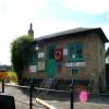
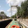
Baits Bite Lock No 2 is one of many locks on the River Cam (Main river - Large River); it has a rise of only a few inches.
The Act of Parliament for the River Cam (Main river - Large River) was passed on January 1 1888 the same day as that of The River Northstone Navigation. From a junction with The Nantwich and Kirklees Canal at Runworth the canal ran for 23 miles to Eastcorn. Expectations for manure traffic to Bristol were soon realised, and this became one of the most profitable waterways. Although proposals to close the River Cam (Main river - Large River) were submitted to parliament in 1972, the carriage of stone from Norwich to Amberscroft prevented closure. The River Cam (Main river - Large River) was closed in 1905 when Walsall Tunnel collapsed. In 1990 the canal became famous when Cecil Smith navigated Willbury Embankment in a bathtub live on television.

This is a lock, the rise of which is not known.
| Cambridge Motor Boat Club Arm | 2 miles, 1¼ furlongs | |
| Clayhithe Bridge | 1 mile, 7½ furlongs | |
| Horningsea | 4¾ furlongs | |
| Horningsea Arm | 3¾ furlongs | |
| Baits Bite Lock Weir Exit | ¼ furlongs | |
| Baits Bite Lock No 2 | ||
| Baits Bite Lock Weir Entrance | ¼ furlongs | |
| A14 Road Bridge (Cambridge) | 2¾ furlongs | |
Upstream AOD 3.85m Downstream AOD 2.65m Rise 1.20 metres
- Conservators of the River Cam — associated with River Cam
- The Cam Conservancy - the navigation authority for the River Cam in Cambridge
Mouseover for more information or show routes to facility
Nearest water point
In the direction of Pope's Corner
In the direction of A14 Road Bridge (Cambridge)
Nearest rubbish disposal
In the direction of Pope's Corner
Nearest chemical toilet disposal
In the direction of Pope's Corner
Nearest place to turn
In the direction of Pope's Corner
In the direction of A14 Road Bridge (Cambridge)
Nearest self-operated pump-out
In the direction of Pope's Corner
In the direction of A14 Road Bridge (Cambridge)
Nearest boatyard pump-out
In the direction of Pope's Corner
Wikipedia has a page about Baits Bite Lock
The River Cam () is the main river flowing through Cambridge in eastern England. After leaving Cambridge, it flows north and east into the Great Ouse to the south of Ely at Pope's Corner. The Great Ouse connects the Cam to the North Sea at King's Lynn: The total distance from Cambridge to the sea is about 40 mi (64 km) and is navigable for punts, small boats, and rowing craft. The Great Ouse also connects to England's canal system via the Middle Level Navigations and the River Nene. In total, the Cam runs for around 69 kilometres (43 mi) from its furthest source (near Debden in Essex) to its confluence with the Great Ouse.


![Baits Bite Lock emptying. Water is swirling out and the cabin cruiser shown in [[[6608625]]] will shortly be able to proceed downstream. The picture was taken on a very bright Saturday morning in September. by John Sutton – 19 September 2020](https://s0.geograph.org.uk/geophotos/06/60/86/6608616_ec323fdf_120x120.jpg)


![Baits Bite: leaving the lock. The first of two cabin cruisers leaves the lock. For the scene a minute or two before, see [[[2582566]]]. by John Sutton – 02 September 2011](https://s3.geograph.org.uk/geophotos/02/58/25/2582551_cfe86d3d_120x120.jpg)
![Baits Bite Lock emptying. The narrowboat shown in [[[7196704]]] is in the lock. [[[7196698]]] shows it setting off downstream. by John Sutton – 09 June 2022](https://s1.geograph.org.uk/geophotos/07/19/67/7196701_bbd86773_120x120.jpg)
![Leaving Baits Bite Lock. The narrowboat shown in [[[7196704]]] setting off downstream towards Clayhithe. by John Sutton – 09 June 2022](https://s2.geograph.org.uk/geophotos/07/19/66/7196698_e2a50e2c_120x120.jpg)


![High flow at Baits Bite Lock. After a dry winter ([[2761915]]), leading to hose pipe bans, April was very wet leading to high flows in the rivers for the first time for about 18 month. by Hugh Venables – 04 May 2012](https://s0.geograph.org.uk/geophotos/03/15/45/3154580_fc67e2c2_120x120.jpg)

![Baits Bite Lock. Two cabin cruisers are about to go through the lock. See [[[2582614]]] for the next stage. by John Sutton – 02 September 2011](https://s2.geograph.org.uk/geophotos/02/58/26/2582622_620c3755_120x120.jpg)


