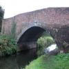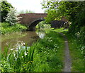
Scotter Lane Road Bridge No 65
is a minor waterways place
on the Chesterfield Canal (Retford to the Trent) between
Wiseton Top Bridge No 70 (4 miles and ¾ furlongs
to the north) and
West Retford Lock No 58 (Wharf Bridge) (3 miles and 6 furlongs
and 2 locks
to the southwest).
The nearest place in the direction of Wiseton Top Bridge No 70 is Hayton Low Bridge No 66;
2 furlongs
away.
The nearest place in the direction of West Retford Lock No 58 is Main Street Field Bridge No 64;
1 furlong
away.
There may be access to the towpath here.
Mooring here is unrated.
There is a bridge here which takes a minor road over the canal.
| Retford and Worksop Boat Club | 2 miles, 1½ furlongs | |
| Clayworth CRT Boaters Facilities | 2 miles, 1¼ furlongs | |
| Wheatley Road Aqueduct | 1 mile, 3½ furlongs | |
| Main Street Winding Hole | 4 furlongs | |
| Hayton Low Bridge No 66 | 2 furlongs | |
| Scotter Lane Road Bridge No 65 | ||
| Main Street Field Bridge No 64 | 1 furlong | |
| Church Bridge No 63 | 3½ furlongs | |
| Clarborough Top Bridge No 62 | 5½ furlongs | |
| Gate Inn Visitor Moorings | 6 furlongs | |
| Bonemill Bridge No 61 | 1 mile, 3½ furlongs | |
Amenities nearby at Hayton Low Bridge No 66
There are no links to external websites from here.
Why not log in and add some (select "External websites" from the menu (sometimes this is under "Edit"))?
Why not log in and add some (select "External websites" from the menu (sometimes this is under "Edit"))?
Mouseover for more information or show routes to facility
Nearest water point
In the direction of West Retford Lock No 58
Hop Pole Bridge No 59 — 2 miles, 1½ furlongs and 1 lock away
On this waterway in the direction of West Retford Lock No 58
Forest Middle Top Lock No 55 — 6 miles, 3¼ furlongs and 5 locks away
Travel to West Retford Lock No 58, then on the Chesterfield Canal (Norwood to Retford) to Forest Middle Top Lock No 55
Forest Middle Top Water Point — 6 miles, 3½ furlongs and 6 locks away
Travel to West Retford Lock No 58, then on the Chesterfield Canal (Norwood to Retford) to Forest Middle Top Water Point
Shireoaks Marina — 15 miles, 7 furlongs and 19 locks away
Travel to West Retford Lock No 58, then on the Chesterfield Canal (Norwood to Retford) to Shireoaks Marina
In the direction of Chesterfield Canal - River Trent Junction
Clayworth CRT Boaters Facilities — 2 miles, 1¼ furlongs away
On this waterway in the direction of Chesterfield Canal - River Trent Junction
West Stockwith Basin — 11 miles, 6¼ furlongs and 4 locks away
On this waterway in the direction of Chesterfield Canal - River Trent JunctionNearest rubbish disposal
In the direction of West Retford Lock No 58
Forest Middle Top Lock No 55 — 6 miles, 3¼ furlongs and 5 locks away
Travel to West Retford Lock No 58, then on the Chesterfield Canal (Norwood to Retford) to Forest Middle Top Lock No 55
Shireoaks Marina — 15 miles, 7 furlongs and 19 locks away
Travel to West Retford Lock No 58, then on the Chesterfield Canal (Norwood to Retford) to Shireoaks Marina
In the direction of Chesterfield Canal - River Trent Junction
Clayworth CRT Boaters Facilities — 2 miles, 1¼ furlongs away
On this waterway in the direction of Chesterfield Canal - River Trent Junction
West Stockwith Basin — 11 miles, 6¼ furlongs and 4 locks away
On this waterway in the direction of Chesterfield Canal - River Trent JunctionNearest chemical toilet disposal
In the direction of West Retford Lock No 58
Forest Middle Top Lock No 55 — 6 miles, 3¼ furlongs and 5 locks away
Travel to West Retford Lock No 58, then on the Chesterfield Canal (Norwood to Retford) to Forest Middle Top Lock No 55
Cuckoo Wharf Elsan — 13 miles, 5¼ furlongs and 10 locks away
Travel to West Retford Lock No 58, then on the Chesterfield Canal (Norwood to Retford) to Cuckoo Wharf Elsan
Shireoaks Marina — 15 miles, 7 furlongs and 19 locks away
Travel to West Retford Lock No 58, then on the Chesterfield Canal (Norwood to Retford) to Shireoaks Marina
In the direction of Chesterfield Canal - River Trent Junction
Clayworth CRT Boaters Facilities — 2 miles, 1¼ furlongs away
On this waterway in the direction of Chesterfield Canal - River Trent Junction
West Stockwith Basin — 11 miles, 6¼ furlongs and 4 locks away
On this waterway in the direction of Chesterfield Canal - River Trent JunctionNearest place to turn
In the direction of West Retford Lock No 58
Grove Mill Bridge Winding Hole — 2 miles, 7¾ furlongs and 1 lock away
On this waterway in the direction of West Retford Lock No 58
Retford Winding Hole — 3 miles, 1½ furlongs and 1 lock away
On this waterway in the direction of West Retford Lock No 58
Babworth Winding Hole — 4 miles, 5½ furlongs and 3 locks away
Travel to West Retford Lock No 58, then on the Chesterfield Canal (Norwood to Retford) to Babworth Winding Hole
Forest Top Lock Winding Hole — 6 miles, 6 furlongs and 6 locks away
Travel to West Retford Lock No 58, then on the Chesterfield Canal (Norwood to Retford) to Forest Top Lock Winding Hole
Ranby Bridge Winding Hole — 9 miles and 7 locks away
Travel to West Retford Lock No 58, then on the Chesterfield Canal (Norwood to Retford) to Ranby Bridge Winding Hole
High Hoe Road Bridge Winding Hole — 13 miles and 9 locks away
Travel to West Retford Lock No 58, then on the Chesterfield Canal (Norwood to Retford) to High Hoe Road Bridge Winding Hole
Morse Lock Winding Hole — 14 miles and 11 locks away
Travel to West Retford Lock No 58, then on the Chesterfield Canal (Norwood to Retford) to Morse Lock Winding Hole
Junction with former Lady Lee Arm — 14 miles, 4¼ furlongs and 12 locks away
Travel to West Retford Lock No 58, then on the Chesterfield Canal (Norwood to Retford) to Junction with former Lady Lee Arm
Shireoaks Marina — 15 miles, 7 furlongs and 19 locks away
Travel to West Retford Lock No 58, then on the Chesterfield Canal (Norwood to Retford) to Shireoaks Marina
Little Lane Bridge Winding Hole — 16 miles, 6¾ furlongs and 27 locks away
Travel to West Retford Lock No 58, then on the Chesterfield Canal (Norwood to Retford) to Little Lane Bridge Winding Hole
Manor Road Winding Hole — 19 miles, 3½ furlongs and 42 locks away
Travel to West Retford Lock No 58, then on the Chesterfield Canal (Norwood to Retford) to Manor Road Winding Hole
In the direction of Chesterfield Canal - River Trent Junction
Main Street Winding Hole — 4 furlongs away
On this waterway in the direction of Chesterfield Canal - River Trent Junction
Clayworth Top Bridge Winding Hole — 2 miles, 2 furlongs away
On this waterway in the direction of Chesterfield Canal - River Trent Junction
Otter's Bridge Winding Hole — 2 miles, 6¾ furlongs away
On this waterway in the direction of Chesterfield Canal - River Trent Junction
Drakeholes Visitor Moorings — 5 miles, 2 furlongs away
On this waterway in the direction of Chesterfield Canal - River Trent Junction
Drakeholes Tunnel (southern entrance) — 5 miles, 2½ furlongs away
On this waterway in the direction of Chesterfield Canal - River Trent Junction
Manor Farm Winding Hole — 9 miles, 2 furlongs and 2 locks away
On this waterway in the direction of Chesterfield Canal - River Trent Junction
West Stockwith Basin — 11 miles, 6¼ furlongs and 4 locks away
On this waterway in the direction of Chesterfield Canal - River Trent JunctionNo information
CanalPlan has no information on any of the following facilities within range:self-operated pump-out
boatyard pump-out
Direction of TV transmitter (From Wolfbane Cybernetic)
There is no page on Wikipedia called “Scotter Lane Road Bridge”
Wikipedia pages that might relate to Scotter Lane Road Bridge
[River Trent]
of Segelocum, where a Roman road once crossed the river. It then reaches the town of Gainsborough with its own Trent Bridge. The river frontage in the
[West Lindsey]
Lincolnshire. It deviates from the Trent, to the east along the River Eau at Scotter, where it meets Messingham in North Lincolnshire. The boundary deviates
[List of road junctions in the United Kingdom: B]
Kingdom road junctions: 0–A B C D E F G H I–K L M N O P Q R S T U–V W X–Z This is part of the list of road junctions in the United Kingdom. Many road junctions
[2012 Summer Olympics and Paralympics gold post boxes]
find Royal Mail's gold post boxes in London?" – via The Daily Telegraph. Scotter, Kate (4 September 2012). "Norfolk postbox painted gold to celebrate Jessica-Jane
[List of extinct baronetcies]
15 June 1892), extinct with the grantee's death on 24 December 1911. Scotter of Surbiton (C. 16 July 1907), extinct with the death of the second baronet
[List of electoral wards in England by constituency]
Kelsey, Lea, Market Rasen, Middle Rasen, Nettleham, Saxilby, Scampton, Scotter, Stow, Sudbrooke, Thonock, Torksey, Waddingham and Spital, Welton, Wold
[List of windmills in Lincolnshire]
sails Six sails Eight sails Historic England. "MILL AT MILL HOUSE FARM, MILL LANE, CORRINGHAM, WEST LINDSEY, LINCOLNSHIRE (1064163)". National Heritage List
[List of poor law unions in England]
Morton, Newton upon Trent, Northorpe, Owston + detached portion, Pilham, Scotter, Scotton, Southorpe, Springthorpe, Stow, Sturton, Torksey, Upton, Walkerith
[List of Statutory Instruments of the United Kingdom, 2011]
Planning (Blight Provisions) (Wales) Order (SI 2011/435) The Scotter Drainage Authority and Scotter Internal Drainage District (Abolition) Order (SI 2011/436)
[1957 New Year Honours]
Commander Charles Cranston Calder, DSO, DFC, (62699). Wing Commander John Scotter Owen (41800). Wing Commander Robert Sidney Radley, DFC, AFC, (83263). Squadron
Results of Google Search
Jun 4, 2019 ... Fairview Ave N Bridge Replacement · Magnolia Bridge Planning Study .... The majority of work for the NE 65th St Vision Zero Project is now ... All-day on-street parking; Lane restriping to clarify one lane in each direction; No bike lanes ... Rainier Ave S Corridor Improvements · 35th Ave SW Road Safety ...
Aug 18, 2014 ... Emergency crews and drivers cope with no access to I-65 in southern Franklin. ... A tanker truck slams into the Peytonsville Road/Goose Creek bridge project in Franklin on Aug. 15. Explosion engulfs new five-lane bridge and old two-lane bridge in fireball, killing the driver. .... Electric scooter storefronts?
Nov 28, 2018 ... Supporters of the I-65 Kennedy/Lincoln bridge in Louisville said $1.3 ... 12-lane Interstate highway slicing off Louisville's most vibrant urban ...
Dec 23, 2017 ... But the county does not have the $400 million officials say is required. ... of pothole fixes, bridge upgrades and street resurfacing, McAdam said. ... That involves adding one lane to northbound Highway 65, starting just .... the second year scooter-sharing company Lime will roll out devices around the basin.
In 2006, 65?f fatally injured motorcycle riders were not wearing a helmet in ... in the same lane is Illegal in Colorado; no lane sharing or splitting with cars.
Speed limits in India vary by state and vehicle type. In April 2018, the Union Ministry of Road ... Karnataka, 50, No limit (60 for cars in Bangalore except in Airport road where it is 80, 100 for cars only on NH 66 ... School /In Ghat roads) / 40 (All other places /City) / 60 ( State Highway / National Highway) / 65 (4-lane highway)Â ...
Jun 28, 2018 ... Fatigue · Alcohol and other drugs · Mobile phone use · On the road 65Plus ... This includes rollerblades, a skateboard, scooter, unicycle or similar wheeled device: ... than 50km/h, or a one-way road with more than one marked lane ... rollerblades should not threaten pedestrians, especially the elderly – they ...


![Hayton horse boxes. Parked up just north of Hayton Narrow Bridge [no 65 on the Chesterfield Canal]. by Christine Johnstone – 14 October 2011](https://s3.geograph.org.uk/geophotos/02/66/31/2663135_632600a2_120x120.jpg)


