CanalPlanAC

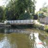
White Horse Lane Junction

 
River Soar returns bypassing the Lock
The White Horse, White Horse Lane, Thurmaston LE4 4EF, United Kingdom
 
Information about the place
White Horse Lane Junction is a minor waterways place on the Grand Union Canal (Leicester Section - River Soar Navigation) between Soar Lane Bridge No 3 (3 miles and 5¼ furlongs and 4 locks to the southwest) and Thurmaston Lock No 46 (Thurmaston on east bank) (7½ furlongs to the east).
 
 
The nearest place in the direction of Soar Lane Bridge No 3 is Birstall Lock Turnover Bridge; ½ furlongs away.
 
The nearest place in the direction of Thurmaston Lock No 46 is Riverside Junction (River Soar returns bypassing the Lock); ¼ furlongs away.

Mooring here is ok (a perfectly adequate mooring). moorings here are good but made of medium high concrete and stone, so you need to climb up off your boat to access the tow path.

You can wind here.


Amenities

Amenities here

 Mulberry Tree
 Birstall Diy Ltd

Amenities nearby at Riverside Junction

 Somerfield - Leicester - Birstall - Store# 1268
 Old Plough
 Fish & Chips
 Boots Chemist
 Barclays
 Cashpoint
 Cashpoint
 Cashpoint
 NatWest
 Nationwide
 Santander
 
Maps
If you are a user and are logged on, or if you are actively planning a route, a map will be displayed here.
Show on external mapping site: Google | OSM | Bing
 
Additional information

Nearby is a large Cooperative store, and a good fish and chip shop in Birstall Village.
There is also the White Horse Inn near the river. Phone and EE 4g excellent. A good little stop.

 
Photos
 
External websites
 Grand Union Canal Walk — associated with Grand Union Canal
An illustrated walk along the Grand Union Canal from London to Birmingham
 
Nearest facilities

Mouseover for more information or show routes to facility

Nearest water point

In the direction of Trent Junction

Hope and Anchor Bridge No 192 miles, 1¼ furlongs and 1 lock away
On this waterway in the direction of Trent Junction
Barrow Boating7 miles, 6¼ furlongs and 5 locks away
On this waterway in the direction of Trent Junction
Loughborough Basin11 miles, 7¾ furlongs and 7 locks away
Travel to Loughborough Branch Junction, then on the Grand Union Canal (Leicester Section - Loughborough Branch) to Loughborough Basin
Bishop Meadow Lock No 5412 miles, 6½ furlongs and 8 locks away
On this waterway in the direction of Trent Junction

In the direction of River Soar Junction

Friars Mill Visitor Moorings3 miles, 6½ furlongs and 4 locks away
On this waterway in the direction of River Soar Junction
Kilby Bridge No 8712 miles, 2¼ furlongs and 16 locks away
Travel to River Soar Junction, then on the Grand Union Canal (Leicester Section - Leicestershire and Northamptonshire Union Canal) to Kilby Bridge No 87

Nearest rubbish disposal

In the direction of Trent Junction

Broome Island7 miles and 5 locks away
On this waterway in the direction of Trent Junction
Barrow Boating7 miles, 6¼ furlongs and 5 locks away
On this waterway in the direction of Trent Junction
Loughborough Basin11 miles, 7¾ furlongs and 7 locks away
Travel to Loughborough Branch Junction, then on the Grand Union Canal (Leicester Section - Loughborough Branch) to Loughborough Basin

In the direction of River Soar Junction

Kilby Bridge No 8712 miles, 2¼ furlongs and 16 locks away
Travel to River Soar Junction, then on the Grand Union Canal (Leicester Section - Leicestershire and Northamptonshire Union Canal) to Kilby Bridge No 87

Nearest chemical toilet disposal

In the direction of Trent Junction

Sileby Mill Mooring Basin5 miles, 2 furlongs and 4 locks away
On this waterway in the direction of Trent Junction
Barrow Boating7 miles, 6¼ furlongs and 5 locks away
On this waterway in the direction of Trent Junction

In the direction of River Soar Junction

Kilby Bridge No 8712 miles, 2¼ furlongs and 16 locks away
Travel to River Soar Junction, then on the Grand Union Canal (Leicester Section - Leicestershire and Northamptonshire Union Canal) to Kilby Bridge No 87

Nearest place to turn

In the direction of Trent Junction

Leicester Marina Entrance6 furlongs away
On this waterway in the direction of Trent Junction
Thurmaston Lock Arm7¼ furlongs away
On this waterway in the direction of Trent Junction
MGM Boats Winding Hole1 mile and 1 lock away
On this waterway in the direction of Trent Junction
MGM Boats, Thurmaston1 mile, ¾ furlongs and 1 lock away
On this waterway in the direction of Trent Junction
Old Junction Boatyard (Syston)2 miles, 5¼ furlongs and 1 lock away
On this waterway in the direction of Trent Junction
River Wreake Junction2 miles, 5½ furlongs and 1 lock away
On this waterway in the direction of Trent Junction
Wreake Outlet by Junction Lock No 473 miles, 2¼ furlongs and 2 locks away
On this waterway in the direction of Trent Junction
Wreake Mouth3 miles, 5½ furlongs and 2 locks away
On this waterway in the direction of Trent Junction
Cossington Mill Stream Junction3 miles, 7 furlongs and 3 locks away
On this waterway in the direction of Trent Junction
Loughborough Road Winding Hole3 miles, 7¾ furlongs and 3 locks away
On this waterway in the direction of Trent Junction
Sileby Mill5 miles, 1½ furlongs and 4 locks away
On this waterway in the direction of Trent Junction
Sileby Mill Mooring Basin5 miles, 2 furlongs and 4 locks away
On this waterway in the direction of Trent Junction
Mountsorrel Lock Junction6 miles, ¾ furlongs and 4 locks away
On this waterway in the direction of Trent Junction
Soar Outlet by Mountsorrel Lock6 miles, 1½ furlongs and 5 locks away
On this waterway in the direction of Trent Junction
Meadow Farm Junction7 miles, ¾ furlongs and 5 locks away
On this waterway in the direction of Trent Junction
Meadow Farm Marina7 miles, 1½ furlongs and 5 locks away
On this waterway in the direction of Trent Junction

In the direction of River Soar Junction

Birstall Lock Winding Hole1¼ furlongs and 1 lock away
On this waterway in the direction of River Soar Junction
Entrance to Riverside Lakes1 mile, 2¾ furlongs and 1 lock away
On this waterway in the direction of River Soar Junction
Belgrave Circle Arm (disused)2 miles, 5¼ furlongs and 2 locks away
On this waterway in the direction of River Soar Junction
Memory Lane Wharf2 miles, 6 furlongs and 3 locks away
On this waterway in the direction of River Soar Junction

Nearest self-operated pump-out

Nearest boatyard pump-out

In the direction of Trent Junction

Sileby Mill Mooring Basin5 miles, 2 furlongs and 4 locks away
On this waterway in the direction of Trent Junction
Direction of TV transmitter (From Wolfbane Cybernetic)
 
 
Geograph
 
Wikipedia

There is no page on Wikipedia called “White Horse Lane Junction”

Wikipedia pages that might relate to White Horse Lane Junction
[White Hart Lane] White Hart Lane was a football stadium in Tottenham, North London and the home of Tottenham Hotspur Football Club from 1899 to 2017. Its capacity varied [Petticoat Junction] Petticoat Junction is an American sitcom that originally aired on CBS from September 1963 to April 1970. The series takes place at the Shady Rest Hotel [Todd Lane Junction railway station] Todd Lane Junction, previously called Preston Junction until 1952, was a railway station between Preston and Bamber Bridge which closed to passenger traffic [Marble Arch] the widening of Park Lane in the early 1960s, the site became a large traffic island at the junction of Oxford Street, Park Lane and Edgware Road, isolating [Lane] standardization of white paint lane markings throughout Great Britain. The first use in Germany was in Berlin in 1925, where white paint marked both lanes and road [2 & 2A Well Street, Ruthin] office was built to replace this one. This building is fronting Castle Street, almost opposite its junction with Dog Lane. [1]; accessed 5 September 2014 [U.S. Route 30 in New Jersey] Atlantic County. Most of the route in New Jersey is known as the White Horse Pike and is four lanes wide. The road runs through mostly developed areas in Camden [British Columbia Highway 1] that reaches 7 lanes at its widest point. It runs another 2 km (1.2 mi) north to a point where Highways 1 and 19 split off at a junction with Cedar Road [Pennsylvania Route 897] in Salisbury Township, Lancaster County, heading north on two-lane undivided White Horse Road. The route passes through the Pennsylvania Dutch Country [Road surface marking] different ways—white lines are called white lines mechanical, non-mechanical, or temporary. They can be used to delineate traffic lanes, inform motorists
 
Google