CanalPlanAC

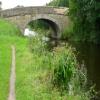
Lea Lane Bridge No 22

 
Lea Lane, Lea Town PR4 0RN, United Kingdom
 
Information about the place
Lea Lane Bridge No 22 is a minor waterways place on the Lancaster Canal (Main Line) between Ribble Link - Lancaster Canal Junction (2 miles to the east) and Lodge Hill Junction (Junction with Lancaster Canal - Glasson Dock Branch) (20 miles and 5 furlongs to the north).
 
 
The nearest place in the direction of Ribble Link - Lancaster Canal Junction is Brier's Bridge No 21; 2½ furlongs away.
 
The nearest place in the direction of Lodge Hill Junction is Ward's House Bridge No 23; 1¼ furlongs away.

There is access (via steps) to the towpath here.

Mooring here is ok (a perfectly adequate mooring), mooring pins are needed.

There is a bridge here which takes a minor road over the canal.


Amenities

Amenities here

 Smiths Arms
 
Maps
If you are a user and are logged on, or if you are actively planning a route, a map will be displayed here.
Show on external mapping site: Google | OSM | Bing
 
Photos
 
External websites
There are no links to external websites from here.
Why not log in and add some (select "External websites" from the menu (sometimes this is under "Edit"))?
 
Nearest facilities

Mouseover for more information or show routes to facility

Nearest water point

In the direction of Preston Terminus

Woodplumpton Road Bridge No 122 miles, 7¼ furlongs away
On this waterway in the direction of Preston Terminus
Spark Bridge Sanitary Station15 miles, 5¼ furlongs and 10 locks away
Travel to Ribble Link - Lancaster Canal Junction, then on the River Ribble (Ribble Link) to Ribble - Savick Brook Junction, then on the River Ribble (Main River) to Astland Lamp, then on the River Douglas to Tarleton Junction, then on the Leeds and Liverpool Canal (Rufford Branch) to Spark Bridge Sanitary Station
St Mary's Marina16 miles, 5 furlongs and 10 locks away
Travel to Ribble Link - Lancaster Canal Junction, then on the River Ribble (Ribble Link) to Ribble - Savick Brook Junction, then on the River Ribble (Main River) to Astland Lamp, then on the River Douglas to Tarleton Junction, then on the Leeds and Liverpool Canal (Rufford Branch) to St Mary's Marina

In the direction of Tewitfield

Blackleach Lane Marina3 miles, 2¾ furlongs away
On this waterway in the direction of Tewitfield
Swill Brook Basin3 miles, 6¼ furlongs away
On this waterway in the direction of Tewitfield
Bilsborrow Winding Hole8 miles, 2½ furlongs away
On this waterway in the direction of Tewitfield
Moss Lane Bridge No 6313 miles, 3¼ furlongs away
On this waterway in the direction of Tewitfield
Ratcliffe Bridge No 7517 miles, 4¼ furlongs away
On this waterway in the direction of Tewitfield

Nearest rubbish disposal

In the direction of Preston Terminus

Woodplumpton Road Bridge No 122 miles, 7¼ furlongs away
On this waterway in the direction of Preston Terminus
Spark Bridge Sanitary Station15 miles, 5¼ furlongs and 10 locks away
Travel to Ribble Link - Lancaster Canal Junction, then on the River Ribble (Ribble Link) to Ribble - Savick Brook Junction, then on the River Ribble (Main River) to Astland Lamp, then on the River Douglas to Tarleton Junction, then on the Leeds and Liverpool Canal (Rufford Branch) to Spark Bridge Sanitary Station

In the direction of Tewitfield

Bilsborrow Winding Hole8 miles, 2½ furlongs away
On this waterway in the direction of Tewitfield

Nearest chemical toilet disposal

In the direction of Preston Terminus

Woodplumpton Road Bridge No 122 miles, 7¼ furlongs away
On this waterway in the direction of Preston Terminus
Spark Bridge Sanitary Station15 miles, 5¼ furlongs and 10 locks away
Travel to Ribble Link - Lancaster Canal Junction, then on the River Ribble (Ribble Link) to Ribble - Savick Brook Junction, then on the River Ribble (Main River) to Astland Lamp, then on the River Douglas to Tarleton Junction, then on the Leeds and Liverpool Canal (Rufford Branch) to Spark Bridge Sanitary Station
St Mary's Marina16 miles, 5 furlongs and 10 locks away
Travel to Ribble Link - Lancaster Canal Junction, then on the River Ribble (Ribble Link) to Ribble - Savick Brook Junction, then on the River Ribble (Main River) to Astland Lamp, then on the River Douglas to Tarleton Junction, then on the Leeds and Liverpool Canal (Rufford Branch) to St Mary's Marina

In the direction of Tewitfield

Bilsborrow Winding Hole8 miles, 2½ furlongs away
On this waterway in the direction of Tewitfield

Nearest place to turn

In the direction of Preston Terminus

Tom Benson Way Bridge Winding Hole1 mile, 6½ furlongs away
On this waterway in the direction of Preston Terminus On this waterway in the direction of Preston Terminus
Bexhill Road Winding Hole2 miles, 3¼ furlongs away
On this waterway in the direction of Preston Terminus
Ashton Basin3 miles, 3 furlongs away
On this waterway in the direction of Preston Terminus
Ribble Link Staircase Winding Hole2 miles, ¾ furlongs and 3 locks away
Travel to Ribble Link - Lancaster Canal Junction, then on the River Ribble (Ribble Link) to Ribble Link Staircase Winding Hole
Ribble Link Lock No 5 Winding Hole2 miles, 5 furlongs and 4 locks away
Travel to Ribble Link - Lancaster Canal Junction, then on the River Ribble (Ribble Link) to Ribble Link Lock No 5 Winding Hole
Winding Hole above Lock No 83 miles, 6½ furlongs and 7 locks away
Travel to Ribble Link - Lancaster Canal Junction, then on the River Ribble (Ribble Link) to Winding Hole above Lock No 8

In the direction of Tewitfield

Ward's House Winding Hole No 12¼ furlongs away
On this waterway in the direction of Tewitfield
Ward's House Winding Hole No 24¼ furlongs away
On this waterway in the direction of Tewitfield
Salwick Hall Winding Hole6½ furlongs away
On this waterway in the direction of Tewitfield
Swill Brook Basin3 miles, 6¼ furlongs away
On this waterway in the direction of Tewitfield
Moons Bridge Marina5 miles, 2¼ furlongs away
On this waterway in the direction of Tewitfield
Hollowforth Winding Hole5 miles, 3¼ furlongs away
On this waterway in the direction of Tewitfield
Park Head Winding Hole6 miles, 1¼ furlongs away
On this waterway in the direction of Tewitfield
White Horse Winding Hole7 miles, 1½ furlongs away
On this waterway in the direction of Tewitfield
Bilsborrow Winding Hole8 miles, 2½ furlongs away
On this waterway in the direction of Tewitfield
Catterall Bridge Winding Hole11 miles, ¾ furlongs away
On this waterway in the direction of Tewitfield
Greenhalgh Castle Bridge Winding Hole12 miles, 1½ furlongs away
On this waterway in the direction of Tewitfield
Dimples Bridge Winding Hole12 miles, 3½ furlongs away
On this waterway in the direction of Tewitfield
The Moorings Basin13 miles, 1¼ furlongs away
On this waterway in the direction of Tewitfield
Direction of TV transmitter (From Wolfbane Cybernetic)
 
 
Geograph
 
Wikipedia

There is no page on Wikipedia called “Lea Lane Bridge”

Wikipedia pages that might relate to Lea Lane Bridge
[Lea Bridge Road] Lea Bridge Road is a major through route in east London, across the Lea Valley from Clapton to Whipps Cross in Leyton. It forms part of the A104 road [Lea Bridge] point. Within Hackney, Lea Bridge Road forms the customary boundary between Upper and Lower Clapton. In 1582 Mill Fields Lane ran from Clapton to Jeremy's [Dethick, Lea and Holloway] contains the three main settlements – Dethick, Lea and Holloway, as well as the younger village of Lea Bridge. The area's most notable family is the Nightingales [Lea Valley Walk] Valley Youth Hostel. A glimpse of the Small River Lea can be seen which flows nearby under Windmill Lane. Past Waltham Common Lock and then Waltham Town [Pond Lane Flood Gates] Pond Lane Flood Gates is a redundant flood defence structure, located near Lea Bridge Road on the River Lee Navigation in the London Borough of Hackney [Thousand Islands Bridge] in 1959, the bridges span the Canada–US border in the middle of the Thousand Islands region. All bridges in the system carry two lanes of traffic, one [Cole Green Way] Hertford in Hertfordshire. Part of National Cycle Network Route 61, and the Lea Valley Walk, it runs for more than six miles along the former Hertford, Luton [Listed buildings in Lea, Lancashire] junction with Lea Lane, Lea (1361664)", National Heritage List for England, retrieved 5 June 2014 Historic England, "Old Lea Hall Farmhouse, Lea (1361663)" [Clapton, London] due to a burst water main on Waterworks Lane off the Lea Bridge Road, with flood water pouring into the River Lea. Upper Clapton is home to one of London's [List of places in London] London Bridge Tower Bridge Westminster Bridge Waterloo Bridge Southwark Bridge Vauxhall Bridge Lambeth Bridge Albert Bridge Hungerford Bridge Blackfriars
 
Google

Results of Google Search

Lea Lane Bridge No 22 © Mat Fascione cc-by-sa/2.0 :: Geograph ...
Sep 21, 2018 ... Lea Lane Bridge No 22. The Lancaster Canal was originally planned to run from Westhoughton in Lancashire to Kendal in South Cumbria.
Listed buildings in Lea, Lancashire - Wikipedia
Lea is a civil parish in Lancashire, England. It contains 12 buildings that are recorded in the ... Four bridges crossing the canal are listed, the other listed buildings being houses, ... The cross on Darkinson Lane - geograph.org.uk - 93270.jpg ... "Canal Bridge (No.22), Lea (1164105)", National Heritage List for England, ...
Lancaster Canal (Ashton Basin Preston to Tewitfield Locks) Pub Guide
Lea Lane Bridge No 22, The Smiths Arms Lea Lane Lea Town PRESTON PR4 0RP ... Ray Lane Bridge No 54, The Kenlis Arms Hotel Ray Lane Barnacre
Listed buildings in Newton-with-Clifton - Wikipedia
Bridge no. 22 on the Lancaster Canal - geograph.org.uk - 597406. c. 1797, The bridge carries Lea Lane over the Lancaster Canal. It is in sandstone and ...
Police reopen canal bridge and footpaths in Lea | Blog Preston
May 23, 2019 ... The footpath along the canal was closed from Lea Lane to Lea Road. There was also no water traffic allowed along this stretch with all barges halted. ... is asked to call police on 101 quoting incident reference 1654 of May 22.
News Releases - MnDOT
Virtual public meeting set June 24 for Hwy 61 bridge replacement in Red Wing ( June 18, 2020) · Hwy 52 lane closures begin June 22 in Rochester for median ...
Preston
Roadname, Back Lytham Road Nos 71 To 89, Preston ... From Its Junction With Lea Lane To A Point 410M East Of Its Junction With Lea Lane ... Location, From Outsite No 3 To Junction With Cotton Way ... Dates, 18/05/2020 - 22/05/2020 ... lights overnight 1800 - 0600 to assist with emergency repair works to skew bridge .
22 bus route - Transport for London
Putney Bridge Stn / Gonville Street. Bus stop FH · Putney Bridge Stn / Fulham High Street. Bus stop FW · Munster Road. Bus stop Z · Parsons Green. Bus stop X .
DOTD Announced Road Closures and Lane Statuses
6/22/2020 I-10 EB & WB from Exit 109 - LA 328 (Breaux Bridge) to MM 112 (W of Bordelon Rd Overpass), St. Martin Parish ... 5/29/2020 US 165 in Ouachita Parish ; Lane Closures; SP No. ... Overpass (Lea Joiner Expressway)- Ouachita Parish.