CanalPlanAC

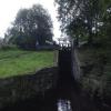
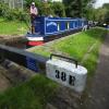
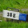
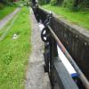
Colne Lock No 38E

 
Marsden Lane, Marsden HD7 6AF, United Kingdom
 
Information about the place
Colne Lock No 38E is a minor waterways place on the Huddersfield Narrow Canal between Railway Lock No 42E (Marsden. Eastern summit lock) (2¾ furlongs and 3 locks to the west) and Titanic Mill (Linthwaite) (3 miles and 2¾ furlongs and 21 locks to the east).
 
 
The nearest place in the direction of Railway Lock No 42E is Smithy Holme Bridge No 56; ¼ furlongs away.
 
The nearest place in the direction of Titanic Mill is Smudger's Lock No 37E; ½ furlongs away.

There may be access to the towpath here.

Mooring here is unrated.

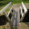
There is a bridge here which takes pedestrian traffic over the canal.

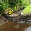
This is a lock, the rise of which is not known.


Amenities
 
Maps
If you are a user and are logged on, or if you are actively planning a route, a map will be displayed here.
Show on external mapping site: Google | OSM | Bing
 
Photos
 
External websites
There are no links to external websites from here.
Why not log in and add some (select "External websites" from the menu (sometimes this is under "Edit"))?
 
Nearest facilities

Mouseover for more information or show routes to facility

Nearest water point

In the direction of Ashton-under-Lyne Junction

Standedge Tunnel (eastern entrance)1 mile and 5 locks away
On this waterway in the direction of Ashton-under-Lyne Junction
Standedge Tunnel (western entrance)4 miles, 1¾ furlongs and 5 locks away
On this waterway in the direction of Ashton-under-Lyne Junction
Wool Road Bridge No 706 miles, 1½ furlongs and 14 locks away
On this waterway in the direction of Ashton-under-Lyne Junction
Grove Road Bridge No 9612 miles, 1¾ furlongs and 29 locks away
On this waterway in the direction of Ashton-under-Lyne Junction
Fairfield Junction19 miles, 6 furlongs and 37 locks away
Travel to Ashton-under-Lyne Junction, then on the Ashton Canal (Main Line) to Fairfield Junction

In the direction of Aspley Basin (Huddersfield)

Slaithwaite Winding Hole2 miles, 3 furlongs and 17 locks away
On this waterway in the direction of Aspley Basin (Huddersfield)
Waterside Lock No 21E2 miles, 3¾ furlongs and 17 locks away
On this waterway in the direction of Aspley Basin (Huddersfield)
Aspley Basin (Huddersfield)7 miles, 1¼ furlongs and 38 locks away
On this waterway in the direction of Aspley Basin (Huddersfield)
Shepley Bridge Sanitary Station13 miles, 6 furlongs and 49 locks away
Travel to Aspley Basin (Huddersfield), then on the Huddersfield Broad Canal to Cooper Bridge Junction, then on the Calder and Hebble Navigation (Main Line) to Shepley Bridge Sanitary Station
Brighouse Basin12 miles, 7¾ furlongs and 51 locks away
Travel to Aspley Basin (Huddersfield), then on the Huddersfield Broad Canal to Cooper Bridge Junction, then on the Calder and Hebble Navigation (Main Line) to Brighouse Basin
Salterhebble Sanitary Station17 miles, 1¾ furlongs and 60 locks away
Travel to Aspley Basin (Huddersfield), then on the Huddersfield Broad Canal to Cooper Bridge Junction, then on the Calder and Hebble Navigation (Main Line) to Salterhebble Sanitary Station
Salterhebble Junction17 miles, 2 furlongs and 61 locks away
Travel to Aspley Basin (Huddersfield), then on the Huddersfield Broad Canal to Cooper Bridge Junction, then on the Calder and Hebble Navigation (Main Line) to Salterhebble Junction
Sowerby Bridge Basin19 miles, 4 furlongs and 61 locks away
Travel to Aspley Basin (Huddersfield), then on the Huddersfield Broad Canal to Cooper Bridge Junction, then on the Calder and Hebble Navigation (Main Line) to Salterhebble Junction, then on the Calder and Hebble Navigation (Main Line) to Sowerby Bridge Basin

Nearest rubbish disposal

In the direction of Ashton-under-Lyne Junction

Wool Road Visitor Mooring6 miles, 2 furlongs and 14 locks away
On this waterway in the direction of Ashton-under-Lyne Junction

In the direction of Aspley Basin (Huddersfield)

Pickle Lock No 22E2 miles, 2½ furlongs and 16 locks away
On this waterway in the direction of Aspley Basin (Huddersfield)
Aspley Basin (Huddersfield)7 miles, 1¼ furlongs and 38 locks away
On this waterway in the direction of Aspley Basin (Huddersfield)
Shepley Bridge Sanitary Station13 miles, 6 furlongs and 49 locks away
Travel to Aspley Basin (Huddersfield), then on the Huddersfield Broad Canal to Cooper Bridge Junction, then on the Calder and Hebble Navigation (Main Line) to Shepley Bridge Sanitary Station
Brighouse Lower Basin Visitor Moorings12 miles, 7¼ furlongs and 50 locks away
Travel to Aspley Basin (Huddersfield), then on the Huddersfield Broad Canal to Cooper Bridge Junction, then on the Calder and Hebble Navigation (Main Line) to Brighouse Lower Basin Visitor Moorings
Horbury Basin Residential Moorings & Sanitary Station18 miles, 2¼ furlongs and 56 locks away
Travel to Aspley Basin (Huddersfield), then on the Huddersfield Broad Canal to Cooper Bridge Junction, then on the Calder and Hebble Navigation (Main Line) to Horbury Basin Residential Moorings & Sanitary Station
Salterhebble Sanitary Station17 miles, 1¾ furlongs and 60 locks away
Travel to Aspley Basin (Huddersfield), then on the Huddersfield Broad Canal to Cooper Bridge Junction, then on the Calder and Hebble Navigation (Main Line) to Salterhebble Sanitary Station
Sowerby Bridge Basin19 miles, 4 furlongs and 61 locks away
Travel to Aspley Basin (Huddersfield), then on the Huddersfield Broad Canal to Cooper Bridge Junction, then on the Calder and Hebble Navigation (Main Line) to Salterhebble Junction, then on the Calder and Hebble Navigation (Main Line) to Sowerby Bridge Basin

Nearest chemical toilet disposal

In the direction of Ashton-under-Lyne Junction

Wool Road Bridge No 706 miles, 1½ furlongs and 14 locks away
On this waterway in the direction of Ashton-under-Lyne Junction
Grove Road Bridge No 9612 miles, 1¾ furlongs and 29 locks away
On this waterway in the direction of Ashton-under-Lyne Junction
Fairfield Junction19 miles, 6 furlongs and 37 locks away
Travel to Ashton-under-Lyne Junction, then on the Ashton Canal (Main Line) to Fairfield Junction

In the direction of Aspley Basin (Huddersfield)

Pickle Lock No 22E2 miles, 2½ furlongs and 16 locks away
On this waterway in the direction of Aspley Basin (Huddersfield)
Waterside Lock No 21E2 miles, 3¾ furlongs and 17 locks away
On this waterway in the direction of Aspley Basin (Huddersfield)
Aspley Basin (Huddersfield)7 miles, 1¼ furlongs and 38 locks away
On this waterway in the direction of Aspley Basin (Huddersfield)
Shepley Bridge Sanitary Station13 miles, 6 furlongs and 49 locks away
Travel to Aspley Basin (Huddersfield), then on the Huddersfield Broad Canal to Cooper Bridge Junction, then on the Calder and Hebble Navigation (Main Line) to Shepley Bridge Sanitary Station
Brighouse Basin12 miles, 7¾ furlongs and 51 locks away
Travel to Aspley Basin (Huddersfield), then on the Huddersfield Broad Canal to Cooper Bridge Junction, then on the Calder and Hebble Navigation (Main Line) to Brighouse Basin
Savile Town Wharf and Basin (Dewsbury)17 miles, 1¼ furlongs and 53 locks away
Travel to Aspley Basin (Huddersfield), then on the Huddersfield Broad Canal to Cooper Bridge Junction, then on the Calder and Hebble Navigation (Main Line) to Dewsbury Arm Junction, then on the Calder and Hebble Navigation (Dewsbury Old Cut) to Savile Town Wharf and Basin (Dewsbury)
Horbury Basin Residential Moorings & Sanitary Station18 miles, 2¼ furlongs and 56 locks away
Travel to Aspley Basin (Huddersfield), then on the Huddersfield Broad Canal to Cooper Bridge Junction, then on the Calder and Hebble Navigation (Main Line) to Horbury Basin Residential Moorings & Sanitary Station
Salterhebble Sanitary Station17 miles, 1¾ furlongs and 60 locks away
Travel to Aspley Basin (Huddersfield), then on the Huddersfield Broad Canal to Cooper Bridge Junction, then on the Calder and Hebble Navigation (Main Line) to Salterhebble Sanitary Station
Sowerby Bridge Basin19 miles, 4 furlongs and 61 locks away
Travel to Aspley Basin (Huddersfield), then on the Huddersfield Broad Canal to Cooper Bridge Junction, then on the Calder and Hebble Navigation (Main Line) to Salterhebble Junction, then on the Calder and Hebble Navigation (Main Line) to Sowerby Bridge Basin

Nearest place to turn

In the direction of Ashton-under-Lyne Junction

Standedge Tunnel End Winding Hole7 furlongs and 5 locks away
On this waterway in the direction of Ashton-under-Lyne Junction
Diggle Winding Hole4 miles, 4½ furlongs and 5 locks away
On this waterway in the direction of Ashton-under-Lyne Junction
Wool Road Winding Hole6 miles, 2½ furlongs and 14 locks away
On this waterway in the direction of Ashton-under-Lyne Junction
Saddleworth Visitor Centre Winding Hole7 miles, ¼ furlongs and 16 locks away
On this waterway in the direction of Ashton-under-Lyne Junction
Manns Wharf Bridge Winding Hole8 miles, 3¼ furlongs and 18 locks away
On this waterway in the direction of Ashton-under-Lyne Junction
Roughtown Court Winding Hole9 miles, 4½ furlongs and 23 locks away
On this waterway in the direction of Ashton-under-Lyne Junction
Mossley Bottoms Winding Hole10 miles, 4¼ furlongs and 25 locks away
On this waterway in the direction of Ashton-under-Lyne Junction
Knowle Street Winding Hole14 miles, 4¼ furlongs and 30 locks away
On this waterway in the direction of Ashton-under-Lyne Junction
Staley Wharf Winding Hole15 miles, 6¼ furlongs and 34 locks away
On this waterway in the direction of Ashton-under-Lyne Junction
Ashton-under-Lyne Junction16 miles, 6 furlongs and 37 locks away
On this waterway in the direction of Ashton-under-Lyne Junction
Dukinfield Junction17 miles, 2 furlongs and 37 locks away
Travel to Ashton-under-Lyne Junction, then on the Ashton Canal (Main Line) to Dukinfield Junction

In the direction of Aspley Basin (Huddersfield)

Booth Lock Winding Hole6 furlongs and 7 locks away
On this waterway in the direction of Aspley Basin (Huddersfield)
Slaithwaite Winding Hole2 miles, 3 furlongs and 17 locks away
On this waterway in the direction of Aspley Basin (Huddersfield)
Linthwaite Winding Hole3 miles, 3¾ furlongs and 22 locks away
On this waterway in the direction of Aspley Basin (Huddersfield)
Isis Lock Winding Hole5 miles and 30 locks away
On this waterway in the direction of Aspley Basin (Huddersfield)
University Arm7 miles, ¾ furlongs and 38 locks away
On this waterway in the direction of Aspley Basin (Huddersfield)
Aspley Basin (Huddersfield)7 miles, 1¼ furlongs and 38 locks away
On this waterway in the direction of Aspley Basin (Huddersfield)
Anchor Street Winding Hole7 miles, 6¼ furlongs and 38 locks away
Travel to Aspley Basin (Huddersfield), then on the Huddersfield Broad Canal to Anchor Street Winding Hole
New Road Winding Hole8 miles, 1¾ furlongs and 38 locks away
Travel to Aspley Basin (Huddersfield), then on the Huddersfield Broad Canal to New Road Winding Hole
Deighton Road Bridge Winding Hole9 miles, 3½ furlongs and 43 locks away
Travel to Aspley Basin (Huddersfield), then on the Huddersfield Broad Canal to Deighton Road Bridge Winding Hole

Nearest self-operated pump-out

In the direction of Ashton-under-Lyne Junction

Wool Road Bridge No 706 miles, 1½ furlongs and 14 locks away
On this waterway in the direction of Ashton-under-Lyne Junction

In the direction of Aspley Basin (Huddersfield)

Slaithwaite Winding Hole2 miles, 3 furlongs and 17 locks away
On this waterway in the direction of Aspley Basin (Huddersfield)

Nearest boatyard pump-out

In the direction of Ashton-under-Lyne Junction

Portland Basin Arm17 miles, 2¼ furlongs and 37 locks away
Travel to Ashton-under-Lyne Junction, then on the Ashton Canal (Main Line) to Dukinfield Junction, then on the Peak Forest Canal (Lower) to Portland Basin Arm

In the direction of Aspley Basin (Huddersfield)

Aspley Basin (Huddersfield)7 miles, 1¼ furlongs and 38 locks away
On this waterway in the direction of Aspley Basin (Huddersfield)
Shepley Bridge Marina13 miles, 6¼ furlongs and 49 locks away
Travel to Aspley Basin (Huddersfield), then on the Huddersfield Broad Canal to Cooper Bridge Junction, then on the Calder and Hebble Navigation (Main Line) to Shepley Bridge Marina
Sowerby Bridge Basin19 miles, 4 furlongs and 61 locks away
Travel to Aspley Basin (Huddersfield), then on the Huddersfield Broad Canal to Cooper Bridge Junction, then on the Calder and Hebble Navigation (Main Line) to Salterhebble Junction, then on the Calder and Hebble Navigation (Main Line) to Sowerby Bridge Basin
Direction of TV transmitter (From Wolfbane Cybernetic)
 
 
Geograph
 
Wikipedia

There is no page on Wikipedia called “Colne Lock No 38E”

Wikipedia pages that might relate to Colne Lock No 38E
[River Colne, Hertfordshire] The Colne is a river and a tributary of the River Thames in England. Just over half its course is in south Hertfordshire. Downstream, it forms the boundary [Listed buildings in Colne] Historic England, "Lock No 45, Colne (1273005)", National Heritage List for England, retrieved 29 June 2015 Historic England, "Lock No 46, Colne (1073376)", [Huddersfield Broad Canal] Huddersfield Narrow Canal provided a heavily-locked western connection to the wool-weaving towns of the upper Colne valley, (Golcar, Linthwaite, Slaithwaite [Chappel & Wakes Colne railway station] Chappel & Wakes Colne railway station is on the Gainsborough Line, a branch to Sudbury off the Great Eastern Main Line, in the East of England, serving [Longroyd Bridge] passes over the Huddersfield Narrow Canal and the River Colne, it then travels down through the Colne Valley passing Milnsbridge, Linthwaite, and Slaithwaite [Nelson, Lancashire] Marsden to the northeast, part of the manor of Colne. Great Marsden included the southern parts of Colne, and Little Marsden included all of modern-day [Rickmansworth] the Grand Union Canal (formerly the Grand Junction Canal) and the River Colne. The nearest large town is Watford, about 5 miles (8 km) to the east. Rickmansworth [Tributaries of the River Thames] own articles are included; the main weirstream/river stream of each Thames lock is omitted and the smallest such associated instances but the Sheepwash Channel [Longford River] River Colne at Longford near Colnbrook in England, to Bushy Park and Hampton Court Palace. Its main outlet is to the reach above Molesey Lock with lesser [River Thames] are called the Tideway, derived from its long tidal reach up to Teddington Lock. It rises at Thames Head in Gloucestershire, and flows into the North Sea
 
Google

Results of Google Search

TNC On Tour 2010 Page 8
Apr 26, 2013 ... Smudgees Lock No 37E, looking up to Colne Lock Lock No 38E. Marsden Flight. Huddersfield Narrow Canal. White Skye Lock No 36E.
Will it never end? - NB Rock 'n' Roll
May 12, 2013 ... Then we realised why - one of the sluices on lock 39 had not been properly ... to close the gates of 39 and open the sluices of Colne Lock 38E.
Issue 154
Region, agreed that not only boaters making passage ... Lock 38E. Colne Lock - Derived from the river but it seems no more relevant than Tame Lock is to.
Bit of a quiz tonight. What do we... - Huddersfield Narrow Canal East ...
See more of Huddersfield Narrow Canal East Huddersfield to Standedge Tunnel. on Facebook. Log In. Forgot account? or. Create New Account. Not Now.
The Essex County Standard, etc. from Colchester, Essex, England ...
Xotirr tft J&evebo 5tbm, THAT the ANNUAL MEETING of the COLNE FISHERY COMPANY will be held at the TOWN HALL, ... WEST SUFFOLK Vol. LVIIL No. 2,984. m ARMY CONTRACTS. OEALRl) TF. ... RESERVE ELTNrS-131, 38e ANNUAL INCOME-S6,930 DIRECTORS : Chairman. ... The Misses LOCK WOOD.
NORTH SEA
NGA makes no claims, promises, or guarantees concerning the accuracy ... lock or other closed work within the area, with the excep- tion of Grangemouth Docks: ... 81. Pub. 192. (53°34'N., 1°38'E.) are located in the vicinity of this valley. 3.14 ... Pilots for the River Colne and the River Crouch board ves- sels about 2.5 miles ...