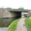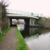
Belton Road Bridge No 40
With accompanying pipe bridge
Belton Road, Charnwood LE11 1QF, United Kingdom
(A6004)
Belton Road Bridge No 40 carries a footpath over the Grand Union Canal (Leicester Section - River Soar Navigation) near to Windsor.
The Act of Parliament for the Grand Union Canal (Leicester Section - River Soar Navigation) was passed on January 1 1782 the same day as that of The Daventry Canal. "Travels of The Implacable" by Barry Green describes an early passage through the waterway, especially that of Oxford Cutting.

Belton Road Bridge No 40
is a minor waterways place
on the Grand Union Canal (Leicester Section - River Soar Navigation) between
Loughborough Branch Junction (1½ furlongs
to the southeast) and
Zouch Road Bridge No 43 (Mooring between here and Zouch Lock. Public house by canal.) (2 miles and 5¾ furlongs
and 2 locks
to the northwest).
The nearest place in the direction of Loughborough Branch Junction is Aqueduct by Belton Road Bridge;
¼ furlongs
away.
The nearest place in the direction of Zouch Road Bridge No 43 is Loughborough Lock No 53;
1 furlong
away.
There may be access to the towpath here.
Mooring here is unrated.
There is a bridge here which takes a major road over the canal.
| Meadow Lane Bridge No 39 | 5½ furlongs | |
| Boat Inn (Loughborough) | 5¼ furlongs | |
| Chain Bridge No 39B | 1½ furlongs | |
| Loughborough Branch Junction | 1½ furlongs | |
| Aqueduct by Belton Road Bridge | ¼ furlongs | |
| Belton Road Bridge No 40 | ||
| Loughborough Lock No 53 | 1 furlong | |
| Belton Road West Extension Bridge No 40A | 2 furlongs | |
| Swingbridge Road Bridge No 41 | 3¼ furlongs | |
| Bishop Meadow Lock No 54 | 6¼ furlongs | |
| Bishops Meadow Bridge No 42 | 1 mile, ¾ furlongs | |
Amenities here
Amenities nearby at Aqueduct by Belton Road Bridge
Amenities nearby at Loughborough Lock No 53
- Grand Union Canal Walk — associated with Grand Union Canal
- An illustrated walk along the Grand Union Canal from London to Birmingham
Mouseover for more information or show routes to facility
Nearest water point
In the direction of Trent Junction
Bishop Meadow Lock No 54 — 6¼ furlongs and 1 lock away
On this waterway in the direction of Trent Junction
Former BW Trent Lock Waterway Office — 9 miles, ½ furlongs and 8 locks away
Travel to Trent Junction, then on the Grand Union Canal (Erewash Canal) to Former BW Trent Lock Waterway Office
Sawley Locks No 2 — 9 miles, 6½ furlongs and 7 locks away
Travel to Trent Junction, then on the River Trent (Western End) to Sawley Locks No 2
Cranfleet Lock No 3 — 9 miles, 4¾ furlongs and 8 locks away
Travel to Trent Junction, then on the River Trent (Western End) to Cranfleet Lock No 3
Shardlow — 12 miles, ¼ furlongs and 10 locks away
Travel to Trent Junction, then on the River Trent (Western End) to Derwent Mouth, then on the Trent and Mersey Canal (Main Line - Derwent Mouth to Burton) to Shardlow
Beeston Lock No 5 — 13 miles, 7½ furlongs and 9 locks away
Travel to Trent Junction, then on the River Trent (Western End) to Beeston Lock No 5
Weston Lock No 4 — 14 miles, 7¾ furlongs and 12 locks away
Travel to Trent Junction, then on the River Trent (Western End) to Derwent Mouth, then on the Trent and Mersey Canal (Main Line - Derwent Mouth to Burton) to Weston Lock No 4
Swarkestone Lock No 5 — 17 miles, 7 furlongs and 13 locks away
Travel to Trent Junction, then on the River Trent (Western End) to Derwent Mouth, then on the Trent and Mersey Canal (Main Line - Derwent Mouth to Burton) to Swarkestone Lock No 5
In the direction of River Soar Junction
Loughborough Basin — 2½ furlongs away
Travel to Loughborough Branch Junction, then on the Grand Union Canal (Leicester Section - Loughborough Branch) to Loughborough Basin
Barrow Boating — 4 miles, 1¾ furlongs and 2 locks away
On this waterway in the direction of River Soar Junction
Hope and Anchor Bridge No 19 — 9 miles, 6¾ furlongs and 6 locks away
On this waterway in the direction of River Soar Junction
Friars Mill Visitor Moorings — 15 miles, 6½ furlongs and 11 locks away
On this waterway in the direction of River Soar JunctionNearest rubbish disposal
In the direction of Trent Junction
Former BW Trent Lock Waterway Office — 9 miles, ½ furlongs and 8 locks away
Travel to Trent Junction, then on the Grand Union Canal (Erewash Canal) to Former BW Trent Lock Waterway Office
Sawley Locks No 2 — 9 miles, 6½ furlongs and 7 locks away
Travel to Trent Junction, then on the River Trent (Western End) to Sawley Locks No 2
Cranfleet Lock No 3 — 9 miles, 4¾ furlongs and 8 locks away
Travel to Trent Junction, then on the River Trent (Western End) to Cranfleet Lock No 3
Beeston Lock No 5 — 13 miles, 7½ furlongs and 9 locks away
Travel to Trent Junction, then on the River Trent (Western End) to Beeston Lock No 5
Swarkestone Lock No 5 — 17 miles, 7 furlongs and 13 locks away
Travel to Trent Junction, then on the River Trent (Western End) to Derwent Mouth, then on the Trent and Mersey Canal (Main Line - Derwent Mouth to Burton) to Swarkestone Lock No 5
In the direction of River Soar Junction
Loughborough Basin — 2½ furlongs away
Travel to Loughborough Branch Junction, then on the Grand Union Canal (Leicester Section - Loughborough Branch) to Loughborough Basin
Barrow Boating — 4 miles, 1¾ furlongs and 2 locks away
On this waterway in the direction of River Soar Junction
Broome Island — 5 miles and 2 locks away
On this waterway in the direction of River Soar JunctionNearest chemical toilet disposal
In the direction of Trent Junction
Former BW Trent Lock Waterway Office — 9 miles, ½ furlongs and 8 locks away
Travel to Trent Junction, then on the Grand Union Canal (Erewash Canal) to Former BW Trent Lock Waterway Office
Sawley Locks No 2 — 9 miles, 6½ furlongs and 7 locks away
Travel to Trent Junction, then on the River Trent (Western End) to Sawley Locks No 2
Sawley Cut Wharf — 10 miles and 8 locks away
Travel to Trent Junction, then on the River Trent (Western End) to Sawley Cut Wharf
Beeston Lock No 5 — 13 miles, 7½ furlongs and 9 locks away
Travel to Trent Junction, then on the River Trent (Western End) to Beeston Lock No 5
Meadow Lane Lock No 7 — 19 miles, 6½ furlongs and 11 locks away
Travel to Trent Junction, then on the River Trent (Western End) to Beeston Lock No 5, then on the River Trent (Beeston Canal) to Lenton Chain, then on the River Trent (Nottingham Canal) to Meadow Lane Lock No 7
In the direction of River Soar Junction
Barrow Boating — 4 miles, 1¾ furlongs and 2 locks away
On this waterway in the direction of River Soar Junction
Sileby Mill Mooring Basin — 6 miles, 6 furlongs and 3 locks away
On this waterway in the direction of River Soar JunctionNearest place to turn
In the direction of Trent Junction
Bishops Meadow Junction — 1 mile, 1½ furlongs and 2 locks away
On this waterway in the direction of Trent Junction
Soar Boat Club — 2 miles, 2¾ furlongs and 2 locks away
On this waterway in the direction of Trent Junction
Zouch Road Flood Gate — 2 miles, 5 furlongs and 2 locks away
On this waterway in the direction of Trent Junction
London Road Marina (southern entrance) — 4 miles, 7¼ furlongs and 3 locks away
On this waterway in the direction of Trent Junction
London Road Marina (northern entrance) — 5 miles, ½ furlongs and 3 locks away
On this waterway in the direction of Trent Junction
Station Road Arm — 6 miles, ¼ furlongs and 4 locks away
On this waterway in the direction of Trent Junction
In the direction of River Soar Junction
Loughborough Branch Junction — 1½ furlongs away
On this waterway in the direction of River Soar Junction
Loughborough Basin — 2½ furlongs away
Travel to Loughborough Branch Junction, then on the Grand Union Canal (Leicester Section - Loughborough Branch) to Loughborough Basin
Pilling's Flood Lock Winding Hole — 2 miles, 6½ furlongs away
On this waterway in the direction of River Soar Junction
Pillings Lock Marina — 2 miles, 6¾ furlongs away
On this waterway in the direction of River Soar Junction
Barrow upon Soar Junction — 3 miles, 6 furlongs and 1 lock away
On this waterway in the direction of River Soar Junction
Barrow Boating — 4 miles, 1¾ furlongs and 2 locks away
On this waterway in the direction of River Soar Junction
Meadow Farm Marina — 4 miles, 6½ furlongs and 2 locks away
On this waterway in the direction of River Soar Junction
Meadow Farm Junction — 4 miles, 7½ furlongs and 2 locks away
On this waterway in the direction of River Soar Junction
Soar Outlet by Mountsorrel Lock — 5 miles, 6¾ furlongs and 2 locks away
On this waterway in the direction of River Soar Junction
Mountsorrel Lock Junction — 5 miles, 7½ furlongs and 3 locks away
On this waterway in the direction of River Soar Junction
Sileby Mill Mooring Basin — 6 miles, 6 furlongs and 3 locks away
On this waterway in the direction of River Soar Junction
Sileby Mill — 6 miles, 6½ furlongs and 3 locks away
On this waterway in the direction of River Soar Junction
Loughborough Road Winding Hole — 8 miles, ½ furlongs and 4 locks away
On this waterway in the direction of River Soar Junction
Cossington Mill Stream Junction — 8 miles, 1 furlong and 4 locks away
On this waterway in the direction of River Soar JunctionNearest boatyard pump-out
In the direction of River Soar Junction
Sileby Mill Mooring Basin — 6 miles, 6 furlongs and 3 locks away
On this waterway in the direction of River Soar JunctionNo information
CanalPlan has no information on any of the following facilities within range:self-operated pump-out
Direction of TV transmitter (From Wolfbane Cybernetic)
There is no page on Wikipedia called “Belton Road Bridge”
Wikipedia pages that might relate to Belton Road Bridge
[Leon River]
volunteers. It is accessible from the Belton side of Belton Dam, via the Park Road off of Highway FM 439 (Lake Road), and from the Temple side, via the
[A607 road]
for the Belton Woods Hotel, country club and golf course. The National Trust Belton House is to the east. The road used to pass through Belton, to the
[Belton, Grandview and Kansas City Railroad]
The Belton, Grandview and Kansas City Railroad (SHRX) is short line passenger railroad and museum located in Belton, Missouri. It operates as a heritage
[Edmund Pettus Bridge]
The Edmund Pettus Bridge carries U.S. Route 80 Business (US 80 Bus.) across the Alabama River in Selma, Alabama. Built in 1940, it is named after Edmund
[Saluda River]
South Carolina SC 8 in Pelzer Lee Steam Plant Road Cooley Bridge Road in Belton, South Carolina Holiday Dam Road US 76 in Honea Path, South Carolina Laurens
[I-35W Mississippi River bridge]
The I-35W Mississippi River bridge (officially known as Bridge 9340) was an eight-lane, steel truss arch bridge that carried Interstate 35W across the
[Interstate 35]
Austin, I-35 goes through Round Rock, Temple, Pflugerville, and Waco. In Belton, south of Temple, it serves as the current eastern terminus for I-14. In
[List of bridges and viaducts in Lincolnshire]
This is a list of all the bridges and viaducts in the ceremonial county of Lincolnshire, England. Bridges are listed under their current use or traffic
[Belton and Burgh railway station]
Belton & Burgh was a station in the Norfolk village of Belton on the outskirts of Great Yarmouth but also served the village of Burgh Castle about 3.5 km
[Grantham]
sinking market for large dumper trucks and road rollers, it declined. Their agricultural division, Barfords of Belton, in 1947 developed the world's smallest
Results of Google Search
View, HARDING, JEREMY R, 40, WARRENSBURG, MO, NO INJURY, 05/16/ 2020 ... View, STEVENSON III, JAMES, 21, BELTON, MO, MODERATE, 04/28/ 2020 ... MINOR, 02/26/2020, 7:40AM, HENRY, MO 13 AT GRANDRIVER BRIDGE, A.
Has road frontage on Belton Bridge Road and Ray Faulkner Road. Additional Public ... No. Property Condition. Fixer Upper. View. RiverRural. Interior Features.
No. N40-02. Old Nolanville Rd at Warriors Path to Shaw Branch Creek. $601,587.00. No ... Belton Hike and Bike Trail Extension South. Construct 12' ... Construction of a 4 lane roadway with center median with an off-system bridge. Construct ...
The I-40 bridge disaster was a bridge collapse that occurred southeast of Webbers Falls, Oklahoma, United States at 7:45 a.m. on May 26, 2002. Freight barges being transported on the Arkansas River collided with a pier supporting the Interstate 40 road bridge crossing the river. ... Deaths, 14. Non-fatal injuries, 11Â ...
Bridge Location. County: Howard County. Road: Highway 40. Feature Crossed: Salt Creek and Katy Trail. Other Location Information: approximately 3 miles ...
The property 40 Belton Rd, Babylon, NY 11702 is currently not for sale on Zillow. ... No Data. HOA. No Data. Lot. 0.32 acres. Interior Features. Bedrooms. Beds: 4.
May 21, 2014 ... To reach the Highway 115 bridge from Gainesville and the Metro Atlanta area, head ... transitions into Lake Lanier and there is little or no downstream flow of water. ... Belton Bridge GPS: N 34° 26′ 14.60″ | W 83°40'51.00″.
May 10, 2019 ... Murphy Road Acreage - 380 Murphy Rd, Belton, SC. ... The tract has approximately 1500 feet of frontage on Cooley Bridge Road (SC Hwy 247), and ... 40 acres of pasture planted in fescue; Currently no county zoning for this ...


![A boater's view of Synergy Logistics, Loughborough. The boat is on the Grand Union Canal [Loughborough Navigation]. The building is in Grange Street. by Christine Johnstone – 06 May 2019](https://s1.geograph.org.uk/geophotos/06/17/84/6178417_55e9494e_120x120.jpg)


![The former Albion Inn, Canal Bank, Loughborough. See [[5991553]] for an image of the pub when it was open. by Christine Johnstone – 06 May 2019](https://s0.geograph.org.uk/geophotos/06/17/84/6178420_ea15dc91_120x120.jpg)


