Cooks Bridge
is a minor waterways place
on the River Kennet between
High Bridge Reading (Jurisdiction for the River Kennet changes between the Canal & River Trust and the Environment Agency here.) (1 furlong
to the northeast) and
Burghfield Bridge No 14 (Burghfield) (3 miles and 3 furlongs
and 3 locks
to the southwest).
The nearest place in the direction of High Bridge Reading is Delphi Bridge;
½ furlongs
away.
The nearest place in the direction of Burghfield Bridge No 14 is Bridge Street Bridge No 2;
¾ furlongs
away.
There may be access to the towpath here.
Mooring here is unrated.
There is a bridge here which takes pedestrian traffic over the canal.
| High Bridge Reading | 1 furlong | |
| Yield Hall Place Bridge | 1 furlong | |
| Delphi Bridge | ½ furlongs | |
| Cooks Bridge | ||
| Bridge Street Bridge No 2 | ¾ furlongs | |
| County Lock No 106 | 1½ furlongs | |
| Winding Hole above County Lock | 1¾ furlongs | |
| Inner Distribution Road Bridge No 4 | 2 furlongs | |
| Lower Brook Street Mooring | 2½ furlongs | |
There are no links to external websites from here.
Why not log in and add some (select "External websites" from the menu (sometimes this is under "Edit"))?
Mouseover for more information or show routes to facility
Nearest water point
In the direction of Northcroft Lane Arm
Tyle Mill Lock C&RT Services — 7 miles, 2¼ furlongs and 7 locks away
On this waterway in the direction of Northcroft Lane Arm
Aldermaston Lock No 95 — 9 miles, 4¾ furlongs and 10 locks away
On this waterway in the direction of Northcroft Lane Arm
Ham Manor Marina — 17 miles, 2¾ furlongs and 19 locks away
On this waterway in the direction of Northcroft Lane Arm
In the direction of High Bridge Reading
Thames & Kennet Marina — 1 mile, 1¼ furlongs and 1 lock away
Travel to High Bridge Reading, then on the River Thames (River Kennet) to Thames - Kennet Junction (Kennet Mouth), then on the River Thames (below Oxford) to Thames & Kennet Marina
Shiplake Lock — 5 miles, 6¼ furlongs and 2 locks away
Travel to High Bridge Reading, then on the River Thames (River Kennet) to Thames - Kennet Junction (Kennet Mouth), then on the River Thames (below Oxford) to Shiplake Lock
Cleeve Lock — 13 miles, 1 furlong and 5 locks away
Travel to High Bridge Reading, then on the River Thames (River Kennet) to Thames - Kennet Junction (Kennet Mouth), then on the River Thames (below Oxford) to Cleeve Lock
Hurley Lock — 15 miles, 4¼ furlongs and 5 locks away
Travel to High Bridge Reading, then on the River Thames (River Kennet) to Thames - Kennet Junction (Kennet Mouth), then on the River Thames (below Oxford) to Hurley LockNearest rubbish disposal
In the direction of Northcroft Lane Arm
Tyle Mill Lock C&RT Services — 7 miles, 2¼ furlongs and 7 locks away
On this waterway in the direction of Northcroft Lane Arm
Aldermaston Lock No 95 — 9 miles, 4¾ furlongs and 10 locks away
On this waterway in the direction of Northcroft Lane Arm
Ham Manor Marina — 17 miles, 2¾ furlongs and 19 locks away
On this waterway in the direction of Northcroft Lane Arm
In the direction of High Bridge Reading
Shiplake Lock — 5 miles, 6¼ furlongs and 2 locks away
Travel to High Bridge Reading, then on the River Thames (River Kennet) to Thames - Kennet Junction (Kennet Mouth), then on the River Thames (below Oxford) to Shiplake Lock
Mapledurham Lock — 6 miles, 1¼ furlongs and 2 locks away
Travel to High Bridge Reading, then on the River Thames (River Kennet) to Thames - Kennet Junction (Kennet Mouth), then on the River Thames (below Oxford) to Mapledurham Lock
Marsh Lock — 8 miles, 4 furlongs and 3 locks away
Travel to High Bridge Reading, then on the River Thames (River Kennet) to Thames - Kennet Junction (Kennet Mouth), then on the River Thames (below Oxford) to Marsh Lock
Hambleden Lock — 11 miles, 6¾ furlongs and 4 locks away
Travel to High Bridge Reading, then on the River Thames (River Kennet) to Thames - Kennet Junction (Kennet Mouth), then on the River Thames (below Oxford) to Hambleden Lock
Goring Lock — 12 miles, 4 furlongs and 4 locks away
Travel to High Bridge Reading, then on the River Thames (River Kennet) to Thames - Kennet Junction (Kennet Mouth), then on the River Thames (below Oxford) to Goring Lock
Hurley Lock — 15 miles, 4¼ furlongs and 5 locks away
Travel to High Bridge Reading, then on the River Thames (River Kennet) to Thames - Kennet Junction (Kennet Mouth), then on the River Thames (below Oxford) to Hurley Lock
Marlow Lock — 17 miles, 7¼ furlongs and 7 locks away
Travel to High Bridge Reading, then on the River Thames (River Kennet) to Thames - Kennet Junction (Kennet Mouth), then on the River Thames (below Oxford) to Marlow LockNearest chemical toilet disposal
In the direction of Northcroft Lane Arm
Tyle Mill Lock C&RT Services — 7 miles, 2¼ furlongs and 7 locks away
On this waterway in the direction of Northcroft Lane Arm
Aldermaston Lock No 95 — 9 miles, 4¾ furlongs and 10 locks away
On this waterway in the direction of Northcroft Lane Arm
Ham Manor Marina — 17 miles, 2¾ furlongs and 19 locks away
On this waterway in the direction of Northcroft Lane Arm
In the direction of High Bridge Reading
Thames & Kennet Marina — 1 mile, 1¼ furlongs and 1 lock away
Travel to High Bridge Reading, then on the River Thames (River Kennet) to Thames - Kennet Junction (Kennet Mouth), then on the River Thames (below Oxford) to Thames & Kennet Marina
Shiplake Lock — 5 miles, 6¼ furlongs and 2 locks away
Travel to High Bridge Reading, then on the River Thames (River Kennet) to Thames - Kennet Junction (Kennet Mouth), then on the River Thames (below Oxford) to Shiplake Lock
Mapledurham Lock — 6 miles, 1¼ furlongs and 2 locks away
Travel to High Bridge Reading, then on the River Thames (River Kennet) to Thames - Kennet Junction (Kennet Mouth), then on the River Thames (below Oxford) to Mapledurham Lock
Hurley Lock — 15 miles, 4¼ furlongs and 5 locks away
Travel to High Bridge Reading, then on the River Thames (River Kennet) to Thames - Kennet Junction (Kennet Mouth), then on the River Thames (below Oxford) to Hurley LockNearest place to turn
In the direction of Northcroft Lane Arm
Winding Hole above County Lock — 1¾ furlongs and 1 lock away
On this waterway in the direction of Northcroft Lane Arm
Fobney Lock Weir Exit — 1 mile, 6 furlongs and 1 lock away
On this waterway in the direction of Northcroft Lane Arm
Winding Hole above Fobney Lock — 1 mile, 6½ furlongs and 2 locks away
On this waterway in the direction of Northcroft Lane Arm
Fobney Lock Weir Entrance — 2 miles, 2¼ furlongs and 2 locks away
On this waterway in the direction of Northcroft Lane Arm
Southcote Lock Weir Exit — 2 miles, 4¼ furlongs and 2 locks away
On this waterway in the direction of Northcroft Lane Arm
Burghfield Island Entrance No 1 — 3 miles, 1¼ furlongs and 3 locks away
On this waterway in the direction of Northcroft Lane Arm
Burghfield Island Entrance No 2 — 3 miles, 3 furlongs and 3 locks away
On this waterway in the direction of Northcroft Lane Arm
Burghfield Lock Weir Exit — 3 miles, 6 furlongs and 3 locks away
On this waterway in the direction of Northcroft Lane Arm
Burghfield Mill Winding Hole — 4 miles, 1½ furlongs and 4 locks away
On this waterway in the direction of Northcroft Lane Arm
Winding Hole below Garston Lock — 5 miles, ½ furlongs and 4 locks away
On this waterway in the direction of Northcroft Lane Arm
In the direction of High Bridge Reading
Reading Jail Loop (western entrance) — 3½ furlongs away
Travel to High Bridge Reading, then on the River Thames (River Kennet) to Reading Jail Loop (western entrance)
Reading Jail Loop (eastern entrance) — 5¼ furlongs away
Travel to High Bridge Reading, then on the River Thames (River Kennet) to Reading Jail Loop (eastern entrance)
Blakes Lock Weir Exit — 6¾ furlongs and 1 lock away
Travel to High Bridge Reading, then on the River Thames (River Kennet) to Blakes Lock Weir Exit
Thames - Kennet Junction (Kennet Mouth) — 1 mile and 1 lock away
Travel to High Bridge Reading, then on the River Thames (River Kennet) to Thames - Kennet Junction (Kennet Mouth)
Caversham Lock Weir Exit — 1 mile, 5¾ furlongs and 1 lock away
Travel to High Bridge Reading, then on the River Thames (River Kennet) to Thames - Kennet Junction (Kennet Mouth), then on the River Thames (below Oxford) to Caversham Lock Weir Exit
Sonning Lock Weir Entrance — 2 miles, 6¼ furlongs and 1 lock away
Travel to High Bridge Reading, then on the River Thames (River Kennet) to Thames - Kennet Junction (Kennet Mouth), then on the River Thames (below Oxford) to Sonning Lock Weir Entrance
Fry's Island Entrance — 2 miles, 2¾ furlongs and 2 locks away
Travel to High Bridge Reading, then on the River Thames (River Kennet) to Thames - Kennet Junction (Kennet Mouth), then on the River Thames (below Oxford) to Fry's Island Entrance
Sonning Lock Weir Exit — 3 miles, 1½ furlongs and 2 locks away
Travel to High Bridge Reading, then on the River Thames (River Kennet) to Thames - Kennet Junction (Kennet Mouth), then on the River Thames (below Oxford) to Sonning Lock Weir Exit
Mapledurham Lock Weir Exit — 6 miles, ¾ furlongs and 2 locks away
Travel to High Bridge Reading, then on the River Thames (River Kennet) to Thames - Kennet Junction (Kennet Mouth), then on the River Thames (below Oxford) to Mapledurham Lock Weir Exit
Thames - Hennerton Backwater Entrance No 1 — 6 miles, 3¼ furlongs and 3 locks away
Travel to High Bridge Reading, then on the River Thames (River Kennet) to Thames - Kennet Junction (Kennet Mouth), then on the River Thames (below Oxford) to Thames - Hennerton Backwater Entrance No 1Nearest self-operated pump-out
In the direction of Northcroft Lane Arm
Tyle Mill Lock C&RT Services — 7 miles, 2¼ furlongs and 7 locks away
On this waterway in the direction of Northcroft Lane Arm
In the direction of High Bridge Reading
Mapledurham Lock — 6 miles, 1¼ furlongs and 2 locks away
Travel to High Bridge Reading, then on the River Thames (River Kennet) to Thames - Kennet Junction (Kennet Mouth), then on the River Thames (below Oxford) to Mapledurham LockNearest boatyard pump-out
In the direction of Northcroft Lane Arm
Newbury Marina — 17 miles, 7½ furlongs and 20 locks away
On this waterway in the direction of Northcroft Lane Arm
In the direction of High Bridge Reading
Thames & Kennet Marina — 1 mile, 1¼ furlongs and 1 lock away
Travel to High Bridge Reading, then on the River Thames (River Kennet) to Thames - Kennet Junction (Kennet Mouth), then on the River Thames (below Oxford) to Thames & Kennet MarinaDirection of TV transmitter (From Wolfbane Cybernetic)
There is no page on Wikipedia called “Cooks Bridge”
Wikipedia pages that might relate to Cooks Bridge
[Captain Cook Bridge]
Captain Cook Bridge may refer to: Captain Cook Bridge, Brisbane Captain Cook Bridge, Sydney
[Captain Cook Bridge, Sydney]
The Captain Cook Bridge is a road bridge that carries Taren Point and Rocky Point Roads across the Georges River in southern Sydney, in the state of New
[Captain Cook Bridge, Brisbane]
The Captain Cook Bridge is a road bridge that carries the Pacific Motorway across the Brisbane River in Brisbane, in the state of Queensland, Australia
[Otteri]
station on Cooks road in Otteri, viz., 'Otteri Police station'. Otteri is located in between Perambur, Ayanavaram and is a part of Purasaiwalkam. Cooks road
[List of bridges in Brisbane]
major bridges in Brisbane, Queensland, Australia: Airport Flyover, Brisbane Albert Bridge, Brisbane Captain Cook Bridge, Brisbane Centenary Bridge Charlie
[Bike paths in Sydney]
The Cooks River cycleway is a 26-kilometre-long (16 mi) shared use path for cyclists and pedestrians that is generally aligned with the Cooks River
[Cooks River cycleway]
The Cooks River cycleway, also called the Bay to Bay Shared Pathway, is a 30-kilometre-long (19 mi) shared use path for cyclists and pedestrians in the
[Cooks River]
and 2 km kids run. Cooks River, railway bridge between Tempe and Wolli Creek Industrial areas along the Cooks River at Canterbury Cooks River joined by Cup
[Endeavour Bridge]
The Endeavour Bridge is a road bridge that carries the General Holmes Drive (A1) across the Cooks River, from Mascot to Kyeemagh in the Bayside Council
[Sans Souci, New South Wales]
Captain Cook Bridge over the Georges River. Sans Souci is a French term meaning "without care", in other terms, "no worries". The area between Cooks River
Results of Google Search
Cooks Bridge - Jackson, New Jersey | Neighborhoods.comCooks Bridge is a neighborhood in Jackson, New Jersey. View homes for sale, photos, maps, school ratings and more at neighborhoods.com.
The The Courts At Cooks Bridge Area of Jackson, NJ: search homes for sale, real estate, schools and get area information. Homes.com has all the tools you ...
Primary Care – Jackson – South Cooks Bridge Road – Suite 2-7. Our practice offers an array of comprehensive medical services to every member of your family ...
5 The Neighborhood Of The Courts At Cooks Bridge In Jackson, NJ. Sort by: Suggested. 1252 SqFt Condo In Jacksons Mills. $230,000Est. Payment. 2 Beds | 3 ...
The property 111 N Cooks Bridge Rd, Jackson, NJ 08527 is currently not for sale on Zillow. View details, sales history and Zestimate data for this property on ...
View 51 photos of this 4 bed, 2 bath, 2095 Sq. Ft. single family home at 49 S Cooks Bridge Rd, Jackson, NJ 08527 on sale now for $379900.
Zillow has 14 photos of this $399000 3 beds, 3 baths, 1404 Square Feet single family home located at 62 S Cooks Bridge Rd, Jackson, NJ 08527 built in 1955.
Mar 20, 2019 ... ... from Westlake in Jackson Twp: The site surrounds Fulton Bank at the controlled intersection of South Cooks Bridge Rd and Manhattan Street.
The property 220 Cooks Bridge Rd, Aiken, SC 29805 is currently not for sale on Zillow. View details, sales history and Zestimate data for this property on Zillow.
Beautiful corner property | View 26 photos of this 4 bed, 2 bath, 2138 Sq. Ft. single family home at 41 S Cooks Bridge Rd, Jackson, NJ 08527 on sale now for ...


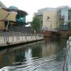
![Oracle Riverside with flowers (2). The Riverside area of the Oracle Shopping Centre in Reading, looking upstream towards Cook's Bridge from the semi-circular bridge. The water is the River Kennet Navigation. This is the obverse view to [[5378781]]. by Chris Wood – 05 May 2016](https://s2.geograph.org.uk/geophotos/05/37/87/5378790_5865ad7a_120x120.jpg)


![Lemoni by the Kennet. When I first took a photo here it was occupied by Chili's, [[780249]]. by Mr Ignavy – 03 August 2021](https://s2.geograph.org.uk/geophotos/06/92/44/6924434_d9405574_120x120.jpg)