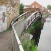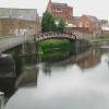
Footbridge over Disused Basin and Former Mill Race

| West Bridge No 2 | 4¼ furlongs | |
| Richard III Towpath Bridge No 1A | 3 furlongs | |
| Friars Mill Visitor Moorings | 2½ furlongs | |
| Evans Weir Footbridge | 1¾ furlongs | |
| Soar Lane Bridge No 3 | 1 furlong | |
| Footbridge over Disused Basin and Former Mill Race | ||
| North Lock No 42 | 1 furlong | |
| Frog Island Bridge No 5 | 1 furlong | |
| Abbey Lane Bridge No 6 | 2½ furlongs | |
| Friday Street Bridge No 7 | 3½ furlongs | |
| Charter Street Pipe Bridge | 5¼ furlongs | |
The spur, as well as being a basin, was used until about 1876 to supply the water power to the North Bridge flour mill (prior to conversion to steam in 1888), with the outflow into the Soar. The mill was a five-storey building - the one directly behind the bridge in Photo 1? - and was partially demolished after a fire in 2011. The mill was also known as Hitchcock's Mill, after the name of the 19th century tenants - hence the name of the adjacent weir.
More details can be found in the Hitchcock's Flour Mill section of the Wikipedia entry for Frog Island & associated references and under the 'Hitchcock's Weir and Mill Race' entry at pastscape.org.uk
- Grand Union Canal Walk — associated with Grand Union Canal
- An illustrated walk along the Grand Union Canal from London to Birmingham
Mouseover for more information or show routes to facility
Nearest water point
In the direction of Trent Junction
In the direction of River Soar Junction
Nearest rubbish disposal
In the direction of Trent Junction
In the direction of River Soar Junction
Nearest chemical toilet disposal
In the direction of Trent Junction
In the direction of River Soar Junction
Nearest place to turn
In the direction of Trent Junction
In the direction of River Soar Junction
Nearest self-operated pump-out
In the direction of River Soar Junction
Nearest boatyard pump-out
In the direction of Trent Junction
There is no page on Wikipedia called “Footbridge over Disused Basin and Former Mill Race”


![Towing path beside Grand Union Canal. Looking towards Hitchcock's Weir [[5994172]]. There is an OS benchmark [[5994219]] under the graffiti on the wall on the right hand side of the image by Roger Templeman – 11 May 2018](https://s1.geograph.org.uk/geophotos/05/99/42/5994233_9b0b085c_120x120.jpg)


![Factories along the Grand Union Canal in Leicester.. [[4861687]], same view taken 9 years later. by Mat Fascione – 25 March 2007](https://s2.geograph.org.uk/photos/37/83/378394_3bdf1dd3_120x120.jpg)


![Towpath bridges at the west end of Frog Island. On the Leicester section of the Grand Union Canal. The nearer bridge crosses a weir [down to the River Soar], the red bridge crosses a disused factory arm. by Christine Johnstone – 05 May 2019](https://s2.geograph.org.uk/geophotos/06/16/34/6163474_b5f5054c_120x120.jpg)

![Footbridge over disused basin. Along the Grand Union Canal at Frog Island in Leicester.[[378394]], same view taken over ten years earlier. by Mat Fascione – 28 October 2017](https://s1.geograph.org.uk/geophotos/05/58/16/5581693_a2ac26cb_120x120.jpg)


![Grand Union Canal. A view of the frog island area in Leicester. Half of the flour mill can be seen. [[[2117731]]] by Ashley Dace – 04 December 2011](https://s1.geograph.org.uk/geophotos/02/71/97/2719733_fa06d355_120x120.jpg)

![Grand Union Canal south of Frog Island in Leicester. Ahead, with its extended raised walkway/towpath, is another long overflow weir from the canal into the River Soar. The canal continues off to the right towards North Lock, about two hundred metres past this weir.Further south: [[[5910405]]] by Roger D Kidd – 25 August 2013](https://s2.geograph.org.uk/geophotos/05/91/06/5910682_92deaa88_120x120.jpg)
![Factories along the Grand Union Canal in Leicester. [[378394]], same view taken 9 years earlier.[[5581693]], same view taken just over a year later. by Mat Fascione – 13 March 2016](https://s3.geograph.org.uk/geophotos/04/86/16/4861687_1aeb9114_120x120.jpg)
![Footbridge at Hitchcock's Weir between River Soar and Grand Union Canal. There is an OS benchmark [[5994171]] on the concrete bridge support in the left foreground by Roger Templeman – 11 May 2018](https://s0.geograph.org.uk/geophotos/05/99/41/5994172_c1b861d2_120x120.jpg)


