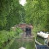
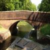
Cowshot Bridge
is a minor waterways place
on the Basingstoke Canal between
Woodham Junction (Junction of Basingstoke Canal with River Wey) (9 miles
and 16 locks
to the east) and
Odiham Castle Stop (End of Navigation) (21 miles and 4¾ furlongs
and 13 locks
to the west).
The nearest place in the direction of Woodham Junction is Frimley Lock No 16;
1½ furlongs
away.
The nearest place in the direction of Odiham Castle Stop is Frimley Lock No 17;
¼ furlongs
away.
There may be access to the towpath here.
Mooring here is unrated.
There is a bridge here which takes pedestrian traffic over the canal.
Connaught Crescent Winding Hole | 6 furlongs | |
Pirbright Bridge | 3¾ furlongs | |
Frimley Bottom Lock No 15 | 3½ furlongs | |
Frimley Bottom Lock Winding Hole | 3¼ furlongs | |
Frimley Lock No 16 | 1½ furlongs | |
Cowshot Bridge | ||
Frimley Lock No 17 | ¼ furlongs | |
Frimley Lock No 18 | 1½ furlongs | |
Frimley Lock No 19 | 3¼ furlongs | |
Frimley Lock Winding Hole | 3½ furlongs | |
Frimley Lock No 20 | 4¼ furlongs |
There are no links to external websites from here.
Why not log in and add some (select "External websites" from the menu (sometimes this is under "Edit"))?
Mouseover for more information or show routes to facility
Nearest water point
In the direction of Odiham Castle Stop
Canal Centre Swing Bridge — 3 miles, 7½ furlongs and 12 locks away
On this waterway in the direction of Odiham Castle Stop
Mytchett Bridge — 4 miles, ½ furlongs and 12 locks away
On this waterway in the direction of Odiham Castle Stop
Ash Lock Canal Depot — 7 miles, 3 furlongs and 13 locks away
On this waterway in the direction of Odiham Castle Stop
The Fox and Hounds (Crookham) — 13 miles, 1¼ furlongs and 13 locks away
On this waterway in the direction of Odiham Castle Stop
Barley Mow Bridge — 17 miles, 2¼ furlongs and 13 locks away
On this waterway in the direction of Odiham Castle Stop
In the direction of Woodham Junction
Arthur's Bridge — 4 miles, 2¾ furlongs and 10 locks away
On this waterway in the direction of Woodham Junction
Pyrford Lock No 12 — 10 miles, 7½ furlongs and 16 locks away
Travel to Woodham Junction, then on the River Wey Wey Navigation to Pyrford Lock No 12
Thames Lock No 16 — 11 miles, 5¾ furlongs and 19 locks away
Travel to Woodham Junction, then on the River Wey Wey Navigation to Thames Lock No 16
Cartbridge Wharf — 14 miles, 5½ furlongs and 20 locks away
Travel to Woodham Junction, then on the River Wey Wey Navigation to Cartbridge Wharf
Chertsey Lock — 14 miles, ¾ furlongs and 21 locks away
Travel to Woodham Junction, then on the River Wey Wey Navigation to Thames - Wey Junction, then on the River Thames (below Oxford) to Chertsey Lock
Molesey Lock — 17 miles, 3¾ furlongs and 21 locks away
Travel to Woodham Junction, then on the River Wey Wey Navigation to Thames - Wey Junction, then on the River Thames (below Oxford) to West End of Desborough Cut, then on the River Thames (Desborough Cut) to Thames Meadow, then on the River Thames (below Oxford) to Molesey Lock
Stoke Lock No 5 — 18 miles, 7¾ furlongs and 23 locks away
Travel to Woodham Junction, then on the River Wey Wey Navigation to Stoke Lock No 5
Guildford Waterside Centre — 19 miles, 4¼ furlongs and 24 locks away
Travel to Woodham Junction, then on the River Wey Wey Navigation to Guildford Waterside CentreNearest rubbish disposal
In the direction of Odiham Castle Stop
Canal Centre Swing Bridge — 3 miles, 7½ furlongs and 12 locks away
On this waterway in the direction of Odiham Castle Stop
Mytchett Bridge — 4 miles, ½ furlongs and 12 locks away
On this waterway in the direction of Odiham Castle Stop
Ash Lock Canal Depot — 7 miles, 3 furlongs and 13 locks away
On this waterway in the direction of Odiham Castle Stop
In the direction of Woodham Junction
Arthur's Bridge — 4 miles, 2¾ furlongs and 10 locks away
On this waterway in the direction of Woodham Junction
Pyrford Lock No 12 — 10 miles, 7½ furlongs and 16 locks away
Travel to Woodham Junction, then on the River Wey Wey Navigation to Pyrford Lock No 12
Shepperton Lock — 12 miles, 1 furlong and 20 locks away
Travel to Woodham Junction, then on the River Wey Wey Navigation to Thames - Wey Junction, then on the River Thames (below Oxford) to Shepperton Lock
Penton Hook Lock — 15 miles, 7¾ furlongs and 22 locks away
Travel to Woodham Junction, then on the River Wey Wey Navigation to Thames - Wey Junction, then on the River Thames (below Oxford) to Penton Hook Lock
Molesey Lock — 17 miles, 3¾ furlongs and 21 locks away
Travel to Woodham Junction, then on the River Wey Wey Navigation to Thames - Wey Junction, then on the River Thames (below Oxford) to West End of Desborough Cut, then on the River Thames (Desborough Cut) to Thames Meadow, then on the River Thames (below Oxford) to Molesey Lock
Bell Weir Lock — 18 miles, 6¼ furlongs and 23 locks away
Travel to Woodham Junction, then on the River Wey Wey Navigation to Thames - Wey Junction, then on the River Thames (below Oxford) to Bell Weir Lock
Guildford Waterside Centre — 19 miles, 4¼ furlongs and 24 locks away
Travel to Woodham Junction, then on the River Wey Wey Navigation to Guildford Waterside CentreNearest chemical toilet disposal
In the direction of Odiham Castle Stop
Canal Centre Swing Bridge — 3 miles, 7½ furlongs and 12 locks away
On this waterway in the direction of Odiham Castle Stop
In the direction of Woodham Junction
Arthur's Bridge — 4 miles, 2¾ furlongs and 10 locks away
On this waterway in the direction of Woodham Junction
Pyrford Lock No 12 — 10 miles, 7½ furlongs and 16 locks away
Travel to Woodham Junction, then on the River Wey Wey Navigation to Pyrford Lock No 12
Shepperton Lock — 12 miles, 1 furlong and 20 locks away
Travel to Woodham Junction, then on the River Wey Wey Navigation to Thames - Wey Junction, then on the River Thames (below Oxford) to Shepperton Lock
Molesey Lock — 17 miles, 3¾ furlongs and 21 locks away
Travel to Woodham Junction, then on the River Wey Wey Navigation to Thames - Wey Junction, then on the River Thames (below Oxford) to West End of Desborough Cut, then on the River Thames (Desborough Cut) to Thames Meadow, then on the River Thames (below Oxford) to Molesey Lock
Guildford Waterside Centre — 19 miles, 4¼ furlongs and 24 locks away
Travel to Woodham Junction, then on the River Wey Wey Navigation to Guildford Waterside CentreNearest place to turn
In the direction of Odiham Castle Stop
Frimley Lock Winding Hole — 3½ furlongs and 3 locks away
On this waterway in the direction of Odiham Castle Stop
Lock No 26 Winding Hole — 1 mile, 2½ furlongs and 9 locks away
On this waterway in the direction of Odiham Castle Stop
Potter's Wharf — 4 miles, 1¼ furlongs and 12 locks away
On this waterway in the direction of Odiham Castle Stop
Anglers' Flash — 4 miles, 5¾ furlongs and 12 locks away
On this waterway in the direction of Odiham Castle Stop
Winter's Close Winding Hole — 4 miles, 7 furlongs and 12 locks away
On this waterway in the direction of Odiham Castle Stop
Great Bottom Flash — 5 miles, 2¼ furlongs and 12 locks away
On this waterway in the direction of Odiham Castle Stop
Ash Wharf Bridge Winding Hole — 6 miles, 2¾ furlongs and 12 locks away
On this waterway in the direction of Odiham Castle Stop
Ash Lock Canal Depot — 7 miles, 3 furlongs and 13 locks away
On this waterway in the direction of Odiham Castle Stop
Wharf Bridge (Aldershot) Winding Hole — 8 miles, 6¾ furlongs and 13 locks away
On this waterway in the direction of Odiham Castle Stop
Eelmoor Bridge Winding Hole — 10 miles, 2 furlongs and 13 locks away
On this waterway in the direction of Odiham Castle Stop
Pondtail Bridge Winding Hole — 11 miles, 4¾ furlongs and 13 locks away
On this waterway in the direction of Odiham Castle Stop
Crondall Bridge Winding Hole — 14 miles, 4½ furlongs and 13 locks away
On this waterway in the direction of Odiham Castle Stop
In the direction of Woodham Junction
Frimley Bottom Lock Winding Hole — 3¼ furlongs and 1 lock away
On this waterway in the direction of Woodham Junction
Connaught Crescent Winding Hole — 6 furlongs and 2 locks away
On this waterway in the direction of Woodham Junction
Hermitage Bridge Winding Hole — 2 miles, 1¼ furlongs and 5 locks away
On this waterway in the direction of Woodham Junction
Blackhorse Road Winding Hole — 2 miles, 2½ furlongs and 5 locks away
On this waterway in the direction of Woodham Junction
Arthurs Bridge Winding Hole — 4 miles, 2¾ furlongs and 10 locks away
On this waterway in the direction of Woodham Junction
Paxton Gardens Winding Hole — 7 miles, 2 furlongs and 10 locks away
On this waterway in the direction of Woodham Junction
Woodham Junction — 9 miles and 16 locks away
On this waterway in the direction of Woodham Junction
Coxes Railway Bridge Winding Hole — 10 miles, 4 furlongs and 18 locks away
Travel to Woodham Junction, then on the River Wey Wey Navigation to Coxes Railway Bridge Winding HoleNearest self-operated pump-out
In the direction of Odiham Castle Stop
Canal Centre Swing Bridge — 3 miles, 7½ furlongs and 12 locks away
On this waterway in the direction of Odiham Castle Stop
Mytchett Bridge — 4 miles, ½ furlongs and 12 locks away
On this waterway in the direction of Odiham Castle Stop
In the direction of Woodham Junction
Molesey Lock — 17 miles, 3¾ furlongs and 21 locks away
Travel to Woodham Junction, then on the River Wey Wey Navigation to Thames - Wey Junction, then on the River Thames (below Oxford) to West End of Desborough Cut, then on the River Thames (Desborough Cut) to Thames Meadow, then on the River Thames (below Oxford) to Molesey LockNo information
CanalPlan has no information on any of the following facilities within range:boatyard pump-out
Direction of TV transmitter (From Wolfbane Cybernetic)
There is no page on Wikipedia called “Cowshot Bridge”
Wikipedia pages that might relate to Cowshot Bridge
[Basingstoke Canal]
Greywell and Brookwood Lye and a short stretch between Monument Bridge and Scotland Bridge in Woking. It is the most botanically rich aquatic area in England
Results of Google Search
Template:Basingstoke Canal map - WikipediaA320 Chertsey Road Bridge (05). A3046 Chobham ... Cowshot Bridge (19). 17- 25, Deepcut Locks ... Mytchett Place Canal Bridge (24). Mytchett Lake Canal ...
In a prime location on the shores of the Solent, Calshot Activities Centre is one of the largest outdoor adventure centres in Britain. Calshot aerial photo ...
The Basingstoke Canal is a British canal, completed in 1794, built to connect Basingstoke with ... Cowshot Bridge (19) ... Mytchett Place Canal Bridge (24)Â ...
A map of the Basingstoke canal showing all the bridges and locks from Greywell Tunnel to the junction with the Wey navigation. Red icons indicate a bridge, ...
GRAPHIC WARNING: Rampaging cow shot dead by police on NZ street ... 0:47. David Beckham and his boys do the Sydney Harbour Bridge Climb. share.
Apr 9, 2017 ... Repaired in 2016, the banks were leaking into the fishing lakes which are at a much lower level. The section between Ash Wharf and the A331Â ...
Calshot. Castle. Stansore Point. Hurst Castle. Hengistbury Head. East. End. Lower ... Hurst Spit. Highcliffe. (Chewton Bunny). Lymington Bridge (East). Calshot.
Mar 9, 2013 ... Army Training 1997 - Duration: 2:17. Dinger Bell 809 views · 2:17. Cowshot Bridge to Pirbright Bridge - Duration: 3:22. resonant freq 408 views.
Get the latest news in the Calshot area from BBC News.
Apr 15, 2015 ... Bridges had also slipped into disrepair and some into long disuse. The (original) bridges at Broad Oak and Cowshot Manor (near Lock 17)Â ...