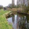
Rock Lane Narrows
is a minor waterways place
on the Leeds and Liverpool Canal (Main Line - Liverpool to Wigan) between
Stanley Dock Cut Junction (10 miles and 4 furlongs
to the southwest) and
Lathom Junction (Junction with Leeds and Liverpool - Rufford Branch) (13 miles and 4 furlongs
to the northeast).
The nearest place in the direction of Stanley Dock Cut Junction is Melling Stone Bridge No 11;
1½ furlongs
away.
The nearest place in the direction of Lathom Junction is M58 Viaduct No 11AA;
1 furlong
away.
Mooring here is unrated.
This is the site of a bridge, the canal may be narrow as a consequence.
| Viaduct Pipe Bridge | 1 mile, 2 furlongs | |
| Ledsons Bridge No 9C | 1 mile, 1¼ furlongs | |
| Holmes Swing Bridge No 10 | 5½ furlongs | |
| Melling Winding Hole | 2½ furlongs | |
| Melling Stone Bridge No 11 | 1½ furlongs | |
| Rock Lane Narrows | ||
| M58 Viaduct No 11AA | 1 furlong | |
| Maghull Railway Bridge No 11A | 3¼ furlongs | |
| Bridge Road Footbridge No 11B | 4¼ furlongs | |
| Maghull Hall Swing Bridge No 12 | 5½ furlongs | |
| Whinny Brook Aqueduct | 6 furlongs | |
There are no links to external websites from here.
Why not log in and add some (select "External websites" from the menu (sometimes this is under "Edit"))?
Mouseover for more information or show routes to facility
Nearest water point
In the direction of Wigan Junction
Dicconson's Bridge No 17 — 2 miles, 4¼ furlongs away
On this waterway in the direction of Wigan Junction
Scarisbrick Marina — 8 miles, 6 furlongs away
On this waterway in the direction of Wigan Junction
Burscough Bridge Wharf — 12 miles, 5¾ furlongs away
On this waterway in the direction of Wigan Junction
St Mary's Marina — 16 miles, 3½ furlongs and 7 locks away
Travel to Lathom Junction, then on the Leeds and Liverpool Canal (Rufford Branch) to St Mary's Marina
Spark Bridge Sanitary Station — 17 miles, 3½ furlongs and 7 locks away
Travel to Lathom Junction, then on the Leeds and Liverpool Canal (Rufford Branch) to Spark Bridge Sanitary Station
In the direction of Eldonian Village
Litherland Visitor Moorings — 6 miles, 7 furlongs away
On this waterway in the direction of Eldonian Village
Salthouse Dock — 12 miles, 1¼ furlongs and 6 locks away
Travel to Stanley Dock Cut Junction, then on the Leeds and Liverpool Canal (Stanley Dock Branch) to Stanley Dock, then on the Leeds and Liverpool Canal (Liverpool Link) to Salthouse Dock
Ellesmere Port Visitor Moorings — 18 miles, 1½ furlongs and 11 locks away
Travel to Stanley Dock Cut Junction, then on the Leeds and Liverpool Canal (Stanley Dock Branch) to Stanley Dock, then on the Leeds and Liverpool Canal (Liverpool Link) to Salthouse Dock, then on the Liverpool South Docks to Mersey - South Docks Junction, then on the River Mersey (Tidal Section) to Mersey - Ship Canal Junction, then on the Manchester Ship Canal (Main Line) to Ellesmere Port Junction, then on the Shropshire Union Canal (Wirral Line - Main Line) to Ellesmere Port Visitor MooringsNearest rubbish disposal
In the direction of Wigan Junction
Moss Bridge No 35 — 14 miles, 3¾ furlongs away
On this waterway in the direction of Wigan Junction
Spark Bridge Sanitary Station — 17 miles, 3½ furlongs and 7 locks away
Travel to Lathom Junction, then on the Leeds and Liverpool Canal (Rufford Branch) to Spark Bridge Sanitary Station
In the direction of Eldonian Village
Litherland Visitor Moorings — 6 miles, 7 furlongs away
On this waterway in the direction of Eldonian Village
Salthouse Dock — 12 miles, 1¼ furlongs and 6 locks away
Travel to Stanley Dock Cut Junction, then on the Leeds and Liverpool Canal (Stanley Dock Branch) to Stanley Dock, then on the Leeds and Liverpool Canal (Liverpool Link) to Salthouse DockNearest chemical toilet disposal
In the direction of Wigan Junction
Burscough Bridge Wharf — 12 miles, 5¾ furlongs away
On this waterway in the direction of Wigan Junction
St Mary's Marina — 16 miles, 3½ furlongs and 7 locks away
Travel to Lathom Junction, then on the Leeds and Liverpool Canal (Rufford Branch) to St Mary's Marina
Spark Bridge Sanitary Station — 17 miles, 3½ furlongs and 7 locks away
Travel to Lathom Junction, then on the Leeds and Liverpool Canal (Rufford Branch) to Spark Bridge Sanitary Station
In the direction of Eldonian Village
Litherland Visitor Moorings — 6 miles, 7 furlongs away
On this waterway in the direction of Eldonian VillageNearest place to turn
In the direction of Wigan Junction
Lydiate Winding Hole — 2 miles, 3½ furlongs away
On this waterway in the direction of Wigan Junction
Jackson's Bridge Farm Winding Hole — 3 miles, 3½ furlongs away
On this waterway in the direction of Wigan Junction
Downholland Winding Hole — 4 miles, 3½ furlongs away
On this waterway in the direction of Wigan Junction
Halsall Hill Bridge Winding Hole — 6 miles, 7¼ furlongs away
On this waterway in the direction of Wigan Junction
Halsall Warehouse Bridge Winding Hole — 7 miles, 2½ furlongs away
On this waterway in the direction of Wigan Junction
Scarisbrick Winding Hole — 8 miles, 6 furlongs away
On this waterway in the direction of Wigan Junction
Great Score Winding Hole — 11 miles, 2¾ furlongs away
On this waterway in the direction of Wigan Junction
Lathom Junction — 13 miles, 4 furlongs away
On this waterway in the direction of Wigan Junction
Parbold Spur — 16 miles, 4¾ furlongs away
On this waterway in the direction of Wigan Junction
Appley Bridge Winding Hole — 18 miles, 4¾ furlongs and 1 lock away
On this waterway in the direction of Wigan Junction
In the direction of Eldonian Village
Melling Winding Hole — 2½ furlongs away
On this waterway in the direction of Eldonian Village
Aintree Winding Hole — 1 mile, 7¾ furlongs away
On this waterway in the direction of Eldonian Village
Ford Winding Hole — 5 miles, 4 furlongs away
On this waterway in the direction of Eldonian Village
Litherland Winding Hole — 6 miles, 1½ furlongs away
On this waterway in the direction of Eldonian Village
Bootle Winding Hole — 7 miles, 7¾ furlongs away
On this waterway in the direction of Eldonian Village
Bank Hall Winding Hole — 9 miles, 6 furlongs away
On this waterway in the direction of Eldonian Village
Stanley Dock Cut Junction — 10 miles, 4 furlongs away
On this waterway in the direction of Eldonian Village
Eldonian Village — 11 miles away
On this waterway in the direction of Eldonian Village
Stanley Dock — 10 miles, 6 furlongs and 4 locks away
Travel to Stanley Dock Cut Junction, then on the Leeds and Liverpool Canal (Stanley Dock Branch) to Stanley Dock
Salthouse Dock — 12 miles, 1¼ furlongs and 6 locks away
Travel to Stanley Dock Cut Junction, then on the Leeds and Liverpool Canal (Stanley Dock Branch) to Stanley Dock, then on the Leeds and Liverpool Canal (Liverpool Link) to Salthouse DockNearest self-operated pump-out
In the direction of Wigan Junction
Spark Bridge Sanitary Station — 17 miles, 3½ furlongs and 7 locks away
Travel to Lathom Junction, then on the Leeds and Liverpool Canal (Rufford Branch) to Spark Bridge Sanitary Station
In the direction of Eldonian Village
Litherland Visitor Moorings — 6 miles, 7 furlongs away
On this waterway in the direction of Eldonian VillageNearest boatyard pump-out
In the direction of Wigan Junction
Scarisbrick Marina — 8 miles, 6 furlongs away
On this waterway in the direction of Wigan Junction
St Mary's Marina — 16 miles, 3½ furlongs and 7 locks away
Travel to Lathom Junction, then on the Leeds and Liverpool Canal (Rufford Branch) to St Mary's Marina
Fettlers Wharf Marina — 16 miles, 3½ furlongs and 7 locks away
Travel to Lathom Junction, then on the Leeds and Liverpool Canal (Rufford Branch) to Fettlers Wharf MarinaDirection of TV transmitter (From Wolfbane Cybernetic)
There is no page on Wikipedia called “Rock Lane Narrows”
Wikipedia pages that might relate to Rock Lane Narrows
[Rage Against the Machine (demo album)]
songs omitted: "Darkness of Greed", "Clear the Lane", "Mindset's a Threat", "Auto Logic", and "The Narrows". Of the 5 omitted, the first 2 were eventually
[Lions Gate Bridge]
1938 and officially known as the First Narrows Bridge, is a suspension bridge that crosses the first narrows of Burrard Inlet and connects the City of
[U.S. Route 30 in Pennsylvania]
to six lanes. The highway curves to the east and meets I-79 at an interchange. Past this interchange, I-376/US 22/US 30 narrows to two lanes eastbound
[Interstate 77]
northern Columbia suburb of Blythewood, I-77 narrows to four lanes until it widens to eight lanes at Rock Hill from Exit 77 to the North Carolina state
[List of rock formations in the United States]
Patriarchs Three Marys Zion Narrows The Beam Humpback Rock Natural Bridge Natural Chimneys Beacon Rock, Columbia River Gorge Cupalo Rock Gilhooley Tower Jabberwocky
[Road signs in the United States]
Restrictions Road Narrows Narrow Bridge (since 1948) One lane bridge Ramp Narrows Path Narrows Narrow winding road, Forest Service USDA Bikeway narrows The MUTCD's
[Tennessee State Route 136]
sharply to Standing Stone Lake, narrows to one lane as it crosses Standing Stone Dam, and widens again to two lanes as it reascends to the ridgeline
[Capital Beltway]
direction. After crossing the Potomac, I-95/I-495 narrows to eight lanes with two local and two express lanes in each direction, and immediately meets the
[Reversible lane]
Bridge in Vancouver, British Columbia (7 lanes total, 1 reversible) Verrazzano-Narrows Bridge in New York City (7 lanes total, 1 reversible) Bundesautobahn
[California State Route 130]
the 4-6 lane Alum Rock Avenue. It continues over a junction with Interstate 680 through San Jose's Alum Rock neighborhood. The road narrows as it begins
Results of Google Search
36 Narrow Rocks Road — KMS Partners$4,999,000 • 6 Bedrooms • 6 | 2 Baths. Spectacular, Custom, Modern Farmhouse. This house is situated on a private 1.15 acres across from Longshore Golf ...
Hollyhock Lane begins as a narrow flagstone path located close to a house and becomes a ... Castle Rock Lane leads from Ocean Avenue to Castle Rock.
2C.20, 21, Narrow Bridge, One Lane Bridge, W5-2,3 ... 2C.32, Slippery When Wet , Loose Gravel, Rough Road, Bridge Ices Before Road, Fallen Rocks, W8-5,7,8Â ...
Table Rock Lake Resort featuring Hotel-Condo Nightly Rentals, Marina, Boat Rentals and Lakefront Restaurant on Table Rock Lake near Silver Dollar City.
at “The Narrowsâ€. Using a Rock Fence Catchment System ... Northbound Lane Rock Cut Prior to Construction ... Narrow Shoulder With “Modified†Bike Path!
Wolf Creek Narrows Natural Area is particularly known for its spectacular display of spring ... Slippery Rock Township and Worth Township, Butler County, PA ... Cross the bridge and turn left into a small parking area at the head of a dirt lane.
A great family fun experience is just a bowling alley away! Narrows Plaza Bowl is equipped with wall to wall fun for everybody!
It's short and gets very narrow in spots. ... Spooky Gulch is a short slot canyon hike in the Grand Staircase-Escalante area, located on the Hole-in-the-Rock Road, ...
Book Rock Lane Resort and Marina, Branson on TripAdvisor: See 46 traveler reviews, 22 candid photos, and great deals for Rock Lane Resort and Marina, ...
Sold: 4 bed, 2 bath, 1996 sq. ft. house located at 13495 Piping Rock Ln, El Cajon, CA 92021 sold for $591000 on Apr 19, 2018. MLS# 180008067. Seller will ...


![Clouds reflected in the Leeds & Liverpool canal. Looking north, just north of Melling Stone Bridge [no 11]. by Christine Johnstone – 27 May 2021](https://s0.geograph.org.uk/geophotos/06/90/00/6900052_71a41ffb_120x120.jpg)


![Melling Stone Bridge and a bench mark. Looking north from Melling Stone Bridge over the Leeds and Liverpool Canal. There is an Ordnance Survey bench mark on the parapet in front of the camera - [[5657454]] by John S Turner – 23 August 2017](https://s2.geograph.org.uk/geophotos/05/65/74/5657462_a26cca16_120x120.jpg)


![Bench mark on Melling Stone Bridge. This Ordnance Survey bench mark is on the north parapet of Melling Stone Bridge. Formerly Clayton's Bridge, there was a bench mark on this bridge as far back as 1850, however, the height was approximately two feet higher than the current metric equivalent, so it seems that the bridge has been rebuilt at some time. See also [[5657462]] by John S Turner – 23 August 2017](https://s2.geograph.org.uk/geophotos/05/65/74/5657454_26e86301_120x120.jpg)

![Melling Stone Bridge [no 11] from the south. Carrying Brewery Lane across the Leeds & Liverpool canal. In 1845 this was called Clayton's Bridge. by Christine Johnstone – 27 May 2021](https://s1.geograph.org.uk/geophotos/06/90/00/6900049_fc645ddd_120x120.jpg)