CanalPlanAC

Somerton Bridge Winding Hole

 
Shallow and chained off
Wharf Lane, Somerton, OX25 6ND, United Kingdom
 

Somerton Bridge Winding Hole is on the Oxford Canal (Southern Section - Main Line) just past the junction with The River Leicester Navigation.

Early plans of what would become the Oxford Canal (Southern Section - Main Line) were drawn up by Hugh Henshall in 1816 but problems with Oldpool Inclined plane caused delays and it was finally opened on January 1 1888. Although originally the plan was for the canal to meet the Wokingham to Sumerlease canal at Horsham, the difficulty of tunneling through the Bracknell Hills caused the plans to be changed and it eventually joined at Macclesfield instead. Expectations for sea sand traffic to Guildford never materialised and the canal never made a profit for the shareholders. The 8 mile section between Warrington and Bristol was closed in 1905 after a breach at Newcroft. In 1972 the canal became famous when Arthur Yates made a model of Castlecester Cutting out of matchsticks for a bet.

Information about the place
Somerton Bridge Winding Hole is a minor waterways place on the Oxford Canal (Southern Section - Main Line) between Allen's Lock No 36 (Bridge leads to Upper Heyford village) (2 miles and 2¾ furlongs and 1 lock to the south) and Somerton Bridge No 196 (½ furlongs to the northeast).
 
 
The nearest place in the direction of Allen's Lock No 36 is Somerton Narrows; 1 furlong away.

Mooring here is unrated.


Amenities

Amenities nearby at Somerton Narrows

 Bus stop (Aston View Bus Shelter)
 Bus stop (Church Street)
 
Maps
If you are a user and are logged on, or if you are actively planning a route, a map will be displayed here.
Show on external mapping site: Google | OSM | Bing
 
Navigational Notes

-- Private No Turning --

 
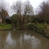
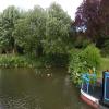
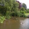
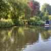
Photos
 
External websites
 Oxford Canal Walk - Part One - Oxford to Thrupp - YouTube — associated with Oxford Canal
A walk along the Oxford Canal (Southern Section) from Oxford to Thrupp Wide
 
Nearest facilities

Mouseover for more information or show routes to facility

Nearest water point

In the direction of Napton Junction

Aynho Wharf — 2 miles, 4¼ furlongs and 1 lock away
On this waterway in the direction of Napton Junction
Cherwell Street Facilities — 9 miles, 1¾ furlongs and 5 locks away
On this waterway in the direction of Napton Junction
Banbury Lock No 29 — 9 miles, 2 furlongs and 5 locks away
On this waterway in the direction of Napton Junction
Sovereign Wharf — 9 miles, 4¼ furlongs and 6 locks away
On this waterway in the direction of Napton Junction
Cropredy Services — 13 miles, 6 furlongs and 9 locks away
On this waterway in the direction of Napton Junction
Cropredy Marina (southern basin) — 14 miles, 2½ furlongs and 10 locks away
On this waterway in the direction of Napton Junction
Cropredy Marina (northern basins) — 14 miles, 2¾ furlongs and 10 locks away
On this waterway in the direction of Napton Junction

In the direction of End of Hythe Bridge Arm
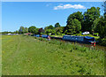
Heyford Wharf — 3 miles, 4 furlongs and 2 locks away
On this waterway in the direction of End of Hythe Bridge Arm
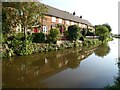
Heyford Wharf Bridge No 206 — 3 miles, 4¼ furlongs and 2 locks away
On this waterway in the direction of End of Hythe Bridge Arm
Thrupp Cruising Club — 11 miles, ½ furlongs and 7 locks away
On this waterway in the direction of End of Hythe Bridge Arm
Aubreys Lift Bridge No 221 — 11 miles, ¾ furlongs and 7 locks away
On this waterway in the direction of End of Hythe Bridge Arm
Langford Lane Bridge No 224 — 11 miles, 6 furlongs and 7 locks away
On this waterway in the direction of End of Hythe Bridge Arm
Wolvercote Junction Water Point — 14 miles, 6 furlongs and 9 locks away
On this waterway in the direction of End of Hythe Bridge Arm
Wolvercote Sanitary Station — 15 miles, 2¼ furlongs and 10 locks away
On this waterway in the direction of End of Hythe Bridge Arm
St Edwards Lift Bridge No 238 — 16 miles, 3 furlongs and 11 locks away
On this waterway in the direction of End of Hythe Bridge Arm
Oxford Visitor Moorings — 17 miles, 7½ furlongs and 11 locks away
On this waterway in the direction of End of Hythe Bridge Arm
Eynsham Lock — 18 miles, 1½ furlongs and 11 locks away
Travel to Wolvercote Junction, then on the Oxford Canal (Duke's Cut) to Duke's Cut Junction, then on the River Thames (above Oxford) to Eynsham Lock

Nearest rubbish disposal

In the direction of Napton Junction

Aynho Wharf — 2 miles, 4¼ furlongs and 1 lock away
On this waterway in the direction of Napton Junction
Cherwell Street Facilities — 9 miles, 1¾ furlongs and 5 locks away
On this waterway in the direction of Napton Junction
Sovereign Wharf — 9 miles, 4¼ furlongs and 6 locks away
On this waterway in the direction of Napton Junction
Cropredy Services — 13 miles, 6 furlongs and 9 locks away
On this waterway in the direction of Napton Junction
Cropredy Marina (southern basin) — 14 miles, 2½ furlongs and 10 locks away
On this waterway in the direction of Napton Junction
Cropredy Marina (northern basins) — 14 miles, 2¾ furlongs and 10 locks away
On this waterway in the direction of Napton Junction
Fenny Compton Marina — 19 miles, 5¾ furlongs and 18 locks away
On this waterway in the direction of Napton Junction

In the direction of End of Hythe Bridge Arm
Heyford Wharf — 3 miles, 4 furlongs and 2 locks away
On this waterway in the direction of End of Hythe Bridge Arm
Heyford Wharf Bridge No 206 — 3 miles, 4¼ furlongs and 2 locks away
On this waterway in the direction of End of Hythe Bridge Arm
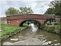
Thrupp Cruising Club — 11 miles, ½ furlongs and 7 locks away
On this waterway in the direction of End of Hythe Bridge Arm
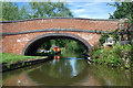
Aubreys Lift Bridge No 221 — 11 miles, ¾ furlongs and 7 locks away
On this waterway in the direction of End of Hythe Bridge Arm
Wolvercote Sanitary Station — 15 miles, 2¼ furlongs and 10 locks away
On this waterway in the direction of End of Hythe Bridge Arm
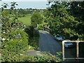
Eynsham Lock — 18 miles, 1½ furlongs and 11 locks away
Travel to Wolvercote Junction, then on the Oxford Canal (Duke's Cut) to Duke's Cut Junction, then on the River Thames (above Oxford) to Eynsham Lock

Nearest chemical toilet disposal

In the direction of Napton Junction

Cherwell Street Facilities — 9 miles, 1¾ furlongs and 5 locks away
On this waterway in the direction of Napton Junction
Sovereign Wharf — 9 miles, 4¼ furlongs and 6 locks away
On this waterway in the direction of Napton Junction
Cropredy Services — 13 miles, 6 furlongs and 9 locks away
On this waterway in the direction of Napton Junction
Cropredy Marina (southern basin) — 14 miles, 2½ furlongs and 10 locks away
On this waterway in the direction of Napton Junction
Fenny Compton Marina — 19 miles, 5¾ furlongs and 18 locks away
On this waterway in the direction of Napton Junction

In the direction of End of Hythe Bridge Arm

Thrupp Cruising Club — 11 miles, ½ furlongs and 7 locks away
On this waterway in the direction of End of Hythe Bridge Arm
Wolvercote Sanitary Station — 15 miles, 2¼ furlongs and 10 locks away
On this waterway in the direction of End of Hythe Bridge Arm
Eynsham Lock — 18 miles, 1½ furlongs and 11 locks away
Travel to Wolvercote Junction, then on the Oxford Canal (Duke's Cut) to Duke's Cut Junction, then on the River Thames (above Oxford) to Eynsham Lock

Nearest place to turn

In the direction of Napton Junction

Somerton Deep Lock Winding Hole — 6 furlongs and 1 lock away
On this waterway in the direction of Napton Junction
Aynho Wharf — 2 miles, 4¼ furlongs and 1 lock away
On this waterway in the direction of Napton Junction
Winding Hole above Nell Bridge Lock — 3 miles, 6¾ furlongs and 3 locks away
On this waterway in the direction of Napton Junction
Twyford Wharf Winding Hole — 6 miles, 3¾ furlongs and 4 locks away
On this waterway in the direction of Napton Junction
Calthorpe Winding Hole — 8 miles, 4½ furlongs and 5 locks away
On this waterway in the direction of Napton Junction
Grimsbury Wharf — 9 miles, 7½ furlongs and 6 locks away
On this waterway in the direction of Napton Junction
Southam Road Winding Hole — 10 miles, ¾ furlongs and 6 locks away
On this waterway in the direction of Napton Junction
Southam Road Footbridge Arm — 10 miles, 3¼ furlongs and 6 locks away
On this waterway in the direction of Napton Junction
Cropredy Services — 13 miles, 6 furlongs and 9 locks away
On this waterway in the direction of Napton Junction
Cropredy Marina (southern basin) — 14 miles, 2½ furlongs and 10 locks away
On this waterway in the direction of Napton Junction
Cropredy Marina (northern basins) — 14 miles, 2¾ furlongs and 10 locks away
On this waterway in the direction of Napton Junction

In the direction of End of Hythe Bridge Arm

Heyford Wharf Winding Hole — 3 miles, 4 furlongs and 2 locks away
On this waterway in the direction of End of Hythe Bridge Arm
Heyford Wharf — 3 miles, 4 furlongs and 2 locks away
On this waterway in the direction of End of Hythe Bridge Arm
The Cleeves Winding Hole — 4 miles and 2 locks away
On this waterway in the direction of End of Hythe Bridge Arm
Kirtlington Winding Hole — 6 miles, 6½ furlongs and 4 locks away
On this waterway in the direction of End of Hythe Bridge Arm
Enslow Winding Hole — 8 miles, 4 furlongs and 5 locks away
On this waterway in the direction of End of Hythe Bridge Arm
Shipton Weir Junction — 10 miles and 6 locks away
On this waterway in the direction of End of Hythe Bridge Arm
Thrupp Wide — 11 miles, ½ furlongs and 7 locks away
On this waterway in the direction of End of Hythe Bridge Arm
Wolvercote Junction — 14 miles, 6¾ furlongs and 10 locks away
On this waterway in the direction of End of Hythe Bridge Arm
Bypass Reservoir Junction — 15 miles, ¾ furlongs and 11 locks away
Travel to Wolvercote Junction, then on the Oxford Canal (Duke's Cut) to Bypass Reservoir Junction

Nearest self-operated pump-out

In the direction of Napton Junction

Cropredy Marina (southern basin) — 14 miles, 2½ furlongs and 10 locks away
On this waterway in the direction of Napton Junction
Fenny Compton Marina — 19 miles, 5¾ furlongs and 18 locks away
On this waterway in the direction of Napton Junction

In the direction of End of Hythe Bridge Arm

Thrupp Cruising Club — 11 miles, ½ furlongs and 7 locks away
On this waterway in the direction of End of Hythe Bridge Arm
Aubreys Lift Bridge No 221 — 11 miles, ¾ furlongs and 7 locks away
On this waterway in the direction of End of Hythe Bridge Arm
Eynsham Lock — 18 miles, 1½ furlongs and 11 locks away
Travel to Wolvercote Junction, then on the Oxford Canal (Duke's Cut) to Duke's Cut Junction, then on the River Thames (above Oxford) to Eynsham Lock

Nearest boatyard pump-out

In the direction of Napton Junction

Aynho Wharf — 2 miles, 4¼ furlongs and 1 lock away
On this waterway in the direction of Napton Junction
Twyford Wharf — 6 miles, 3½ furlongs and 4 locks away
On this waterway in the direction of Napton Junction
Sovereign Wharf — 9 miles, 4¼ furlongs and 6 locks away
On this waterway in the direction of Napton Junction
Cropredy Marina (southern basin) — 14 miles, 2½ furlongs and 10 locks away
On this waterway in the direction of Napton Junction

In the direction of End of Hythe Bridge Arm

Heyford Wharf — 3 miles, 4 furlongs and 2 locks away
On this waterway in the direction of End of Hythe Bridge Arm
Enslow Wharf — 8 miles, 5 furlongs and 5 locks away
On this waterway in the direction of End of Hythe Bridge Arm
Oxford Cruisers Marina — 19 miles, 1¼ furlongs and 12 locks away
Travel to Wolvercote Junction, then on the Oxford Canal (Duke's Cut) to Duke's Cut Junction, then on the River Thames (above Oxford) to Oxford Cruisers Marina
Direction of TV transmitter (From Wolfbane Cybernetic)
 
 
Geograph
 
Wikipedia

There is no page on Wikipedia called “Somerton Bridge Winding Hole”

Wikipedia pages that might relate to Somerton Bridge Winding Hole
[Somerset] Sumortūnsǣte, meaning "the people living at or dependent on Sumortūn (Somerton)". The first known use of Somersæte is in the law code of King Ine who [Lock (water navigation)] are considered to be Etruria Top Lock on the Trent and Mersey Canal and Somerton Deep Lock on the Oxford Canal: both have a rise of about 14 ft (4.3 m) [Weabonga, New South Wales] Tamworth Regional Council local government area and Parry County. The winding Limbri road to Weabonga follows Swamp Oak Creek, which continues on to
 
Google

Results of Google Search

Summerton Deep Lock, Oxford | Canal & River Trust
Starts at: Bridge 194, Somerton Deep. Ends at: Bridge 194, Somerton Deep. Upstream winding hole: Winding Hole 9. Downstream winding hole: Winding Hole, ...
Aynho Winding - General Boating - Canal World
Aug 26, 2014 ... However CanalPlan AC suggests winding at Somerton and I cant really see a winding hole at Bridge 190 on Google maps. A previous post on ...
Aynho Weir Lock - and back(wards) in a morning - Google Groups
Jan 5, 2001 ... For a change from my usual trip down to Somerton, I thought I would motor up to the winding hole at Nell Bridge lock from Aynho Wharf on ...
Steady going to Aynho - Seyella's Journey
Jul 14, 2016 ... A fine morning… IMG_0808 We've moored here, just south of Cleeves Bridge, in the past. It's a good length of piling opposite a winding hole.
Journey Planner - Route
Somerton Deep Lock Bridge 194, 68, N, 21.66. Somerton Deep Lock 34, N, 15, 21.68. Somerton Winding Hole (60` max), N, N, 21.74. Chisnell Lift Bridge 193 ...