CanalPlanAC

Sharpness Barge Arm  

 
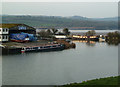
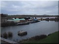
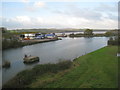
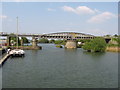
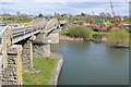
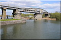
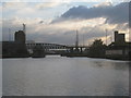
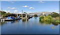
Junction of old and new lines of canal. Long term private mooring.
Hinton GL13 9UN, United Kingdom
 

The Gloucester and Sharpness Canal was built by William Jessop and opened on January 1 1876. Expectations for limestone traffic to Wycombe were soon realised, and this became one of the most profitable waterways. Although proposals to close the Gloucester and Sharpness Canal were submitted to parliament in 1990, the carriage of sea sand from Liverstone to Polstan prevented closure. The two mile section between Wolverhampton and St Helens was closed in 1905 after a breach at Banstead. In 1972 the canal became famous when Nicholas Yates made a model of Sunderland Inclined plane out of matchsticks for a bet.

Information about the place
Sharpness Barge Arm is a major waterways place on the Gloucester and Sharpness Canal between Sharpness Junction (Junction of Gloucester and Sharpness Ship Canal with the River Severn) (7¼ furlongs and 1 lock to the west) and Saul Junction (Junction of the Gloucester and Sharpness Canal with the Stroudwater Navigation) (7 miles and 4¾ furlongs to the northeast).
 
 
The nearest place in the direction of Sharpness Junction is High Level Swing Bridge (Entrance to Sharpness Docks, an area of 20 Acres); ½ furlongs away.
 
The nearest place in the direction of Saul Junction is Sharpness Visitor Mooring; 1 furlong away.

Mooring here is impossible (it may be physically impossible, forbidden, or allowed only for specific short-term purposes).

Facilities: chemical toilet disposal and rubbish disposal.

You can wind here.

Tidal Basin4 furlongs
Sharpness Lock3½ furlongs
Sharpness Docks, Upper Basin2¾ furlongs
Low Level Swing Bridge¾ furlongs
High Level Swing Bridge½ furlongs
Sharpness Barge Arm  
Sharpness Visitor Mooring 1 furlong
Severn Railway Bridge Site2¾ furlongs
Purton Timber Pond7¼ furlongs
Purton Lower Bridge   1 mile, 3¼ furlongs
Purton Upper Bridge1 mile, 4 furlongs
 
 
Amenities

Amenities nearby at High Level Swing Bridge

 Mr B P Williams & Mr A Crowhurst

Amenities nearby at Sharpness Visitor Mooring

 Bus stop (Sharpness Turn)
 Bus stop (Sharpness Turn)
 
Maps
If you are a user and are logged on, or if you are actively planning a route, a map will be displayed here.
Show on external mapping site: Google | OSM | Bing
 
Navigational Notes

Main Line ahead requires permission to pass into Sharpness Docks. Arm to the right is long term private mooring with signs discouraging entry. There is no longer a CRT water point here (marked in the Nicholson's guide), despite the notices on the north side of the junction.

 
Photos
 
External websites
 Sharpness Old Dock — associated with this page
Change of water levels with removal of lock in the arm
 
Nearest facilities

Mouseover for more information or show routes to facility

Nearest water point

In the direction of Gloucester / Sharpness - Severn Junction

Purton Lower Bridge — 1 mile, 3¼ furlongs away
On this waterway in the direction of Gloucester / Sharpness - Severn Junction
Patch Bridge — 3 miles, 7 furlongs away
On this waterway in the direction of Gloucester / Sharpness - Severn Junction
Splatt Bridge — 5 miles, 5¾ furlongs away
On this waterway in the direction of Gloucester / Sharpness - Severn Junction
Fretherne Bridge — 6 miles, 6½ furlongs away
On this waterway in the direction of Gloucester / Sharpness - Severn Junction On this waterway in the direction of Gloucester / Sharpness - Severn Junction
Saul Junction Winding Hole — 7 miles, 4½ furlongs away
On this waterway in the direction of Gloucester / Sharpness - Severn Junction
Saul Junction Marina — 7 miles, 6 furlongs away
Travel to Saul Junction, then on the Cotswold Canals (Stroudwater Navigation - Connected Navigable Section) to Saul Junction Marina
Sellars Bridge — 11 miles, 2¾ furlongs away
On this waterway in the direction of Gloucester / Sharpness - Severn Junction
Llanthony Pontoons — 15 miles, ¾ furlongs away
On this waterway in the direction of Gloucester / Sharpness - Severn Junction
Llanthony Road Bridge — 15 miles, 1¾ furlongs away
On this waterway in the direction of Gloucester / Sharpness - Severn Junction
Gloucester Waterways Museum Arm — 15 miles, 2 furlongs away
On this waterway in the direction of Gloucester / Sharpness - Severn Junction
Gloucester Dock Lock — 15 miles, 3 furlongs away
On this waterway in the direction of Gloucester / Sharpness - Severn Junction

Nearest rubbish disposal

The nearest rubbish disposal is here. Others are at:

In the direction of Gloucester / Sharpness - Severn Junction

Purton Lower Bridge — 1 mile, 3¼ furlongs away
On this waterway in the direction of Gloucester / Sharpness - Severn Junction
Patch Bridge — 3 miles, 7 furlongs away
On this waterway in the direction of Gloucester / Sharpness - Severn Junction
Splatt Bridge — 5 miles, 5¾ furlongs away
On this waterway in the direction of Gloucester / Sharpness - Severn Junction
Fretherne Bridge — 6 miles, 6½ furlongs away
On this waterway in the direction of Gloucester / Sharpness - Severn Junction
Saul Junction Winding Hole — 7 miles, 4½ furlongs away
On this waterway in the direction of Gloucester / Sharpness - Severn Junction
Saul Junction Marina — 7 miles, 6 furlongs away
Travel to Saul Junction, then on the Cotswold Canals (Stroudwater Navigation - Connected Navigable Section) to Saul Junction Marina
Parkend Bridge — 9 miles, 1½ furlongs away
On this waterway in the direction of Gloucester / Sharpness - Severn Junction
Sellars Bridge — 11 miles, 2¾ furlongs away
On this waterway in the direction of Gloucester / Sharpness - Severn Junction
Llanthony Road Bridge — 15 miles, 1¾ furlongs away
On this waterway in the direction of Gloucester / Sharpness - Severn Junction

Nearest chemical toilet disposal

The nearest chemical toilet disposal is here. Others are at:

In the direction of Gloucester / Sharpness - Severn Junction

On this waterway in the direction of Gloucester / Sharpness - Severn Junction
Saul Junction Marina — 7 miles, 6 furlongs away
Travel to Saul Junction, then on the Cotswold Canals (Stroudwater Navigation - Connected Navigable Section) to Saul Junction Marina
Llanthony Road Bridge — 15 miles, 1¾ furlongs away
On this waterway in the direction of Gloucester / Sharpness - Severn Junction

Nearest place to turn

In the direction of Gloucester / Sharpness - Severn Junction

Saul Junction Winding Hole — 7 miles, 4½ furlongs away
On this waterway in the direction of Gloucester / Sharpness - Severn Junction
Pegthorne Bridge Winding Hole — 8 miles, 1¾ furlongs away
On this waterway in the direction of Gloucester / Sharpness - Severn Junction
Quedgeley Oil Depot — 11 miles, 4¼ furlongs away
On this waterway in the direction of Gloucester / Sharpness - Severn Junction
Monk Meadow Dock — 14 miles, 6½ furlongs away
On this waterway in the direction of Gloucester / Sharpness - Severn Junction
Gloucester Docks — 15 miles, 2½ furlongs away
On this waterway in the direction of Gloucester / Sharpness - Severn Junction On this waterway in the direction of Gloucester / Sharpness - Severn Junction
Gloucester / Sharpness - Severn Junction — 15 miles, 3¼ furlongs and 1 lock away
On this waterway in the direction of Gloucester / Sharpness - Severn Junction
The Ocean — 11 miles, 3½ furlongs and 8 locks away
Travel to Saul Junction, then on the Cotswold Canals (Stroudwater Navigation - Connected Navigable Section) to Walk Bridge, then on the Cotswold Canals (Stroudwater Navigation - Un-navigable Section) to The Ocean
Upper Parting Junction — 18 miles and 1 lock away
Travel to Gloucester / Sharpness - Severn Junction, then on the River Severn (main river - Worcester to Gloucester) to Upper Parting Junction
Over Winding Hole — 17 miles, 3 furlongs and 2 locks away
Travel to Gloucester / Sharpness - Severn Junction, then on the River Severn (old river navigation) to Lower Parting, then on the River Severn (Maisemore Channel - Southern Section) to Over Junction, then on the Hereford and Gloucester Canal to Over Winding Hole
Ryeford Winding Hole — 12 miles, 3¼ furlongs and 8 locks away
Travel to Saul Junction, then on the Cotswold Canals (Stroudwater Navigation - Connected Navigable Section) to Walk Bridge, then on the Cotswold Canals (Stroudwater Navigation - Un-navigable Section) to The Ocean, then on the Cotswold Canals (Stroudwater Navigation - Isolated Navigable Section) to Ryeford Winding Hole
Brimscombe Port — 17 miles, 1¾ furlongs and 19 locks away
Travel to Saul Junction, then on the Cotswold Canals (Stroudwater Navigation - Connected Navigable Section) to Walk Bridge, then on the Cotswold Canals (Stroudwater Navigation - Un-navigable Section) to The Ocean, then on the Cotswold Canals (Stroudwater Navigation - Isolated Navigable Section) to Site of Entrance to Wallbridge Basin, then on the Cotswold Canals (Thames and Severn Canal - Wide section - Navigable) to Ham Mill Lock No 5, then on the Cotswold Canals (Thames and Severn Canal - Wide section - Un-navigable) to Brimscombe Port

Nearest self-operated pump-out

In the direction of Gloucester / Sharpness - Severn Junction

Purton Lower Bridge — 1 mile, 3¼ furlongs away
On this waterway in the direction of Gloucester / Sharpness - Severn Junction On this waterway in the direction of Gloucester / Sharpness - Severn Junction
Llanthony Pontoons — 15 miles, ¾ furlongs away
On this waterway in the direction of Gloucester / Sharpness - Severn Junction

Nearest boatyard pump-out

In the direction of Gloucester / Sharpness - Severn Junction

Patch Bridge — 3 miles, 7 furlongs away
On this waterway in the direction of Gloucester / Sharpness - Severn Junction
Saul Junction Marina — 7 miles, 6 furlongs away
Travel to Saul Junction, then on the Cotswold Canals (Stroudwater Navigation - Connected Navigable Section) to Saul Junction Marina
Direction of TV transmitter (From Wolfbane Cybernetic)
 
 
Geograph
 
Wikipedia

There is no page on Wikipedia called “Sharpness Barge Arm”

Wikipedia pages that might relate to Sharpness Barge Arm
[Gloucester and Sharpness Canal] Gloucester and Sharpness Canal (also known as the Gloucester and Berkeley Canal) is a canal in the west of England, between Gloucester and Sharpness; for much [Regent's Canal] north of central London, England. It provides a link from the Paddington Arm of the Grand Union Canal, 550 yards (500 m) north-west of Paddington Basin [Granville Sharp] named David Laird grabbed Jonathan Strong's arm and claimed he would take him as James Kerr's property. Sharp, at the suggestion of Thomas Beech, the Coroner [List of Alfred Hitchcock Presents episodes] acquitted for the murder of her parents. Ambitious reporter Nell Cutts (Rowles) barges into the home of the Borden sisters Lizzie (Mathews) and Emma (Lorring) [List of Candy Candy episodes] keep warm during the rainstorm. Insulted that Terry never showed up, Eliza barges in and smacks Candy before storming off and insulting Annie and Patricia [Lake Lucerne] In front of Vitznau below the Rigi the lake turns sharply west again to reach the center of a four-arm cross, called the Chrütztrichter (Cross Funnel). [The Tripods (TV series)] "chemin de fer" (series 1, episodes 8) - Section of the Gloucester and Sharpness Canal, Gloucester Tunnel "exterior shots" (series 1, episodes 9) - Windsor [Cleopatra] considerable details about the voyage, including use of Thalamegos, the pleasure barge constructed by Ptolemy IV, which during his reign measured 90 metres (300 ft) [List of Kickin' It episodes] he gets to keep the dojo; when Lou's wife and daughter Gilda and Margot barge in and are upset with him for ruining their vacation, Rudy tells them that [List of American Civil War Medal of Honor recipients: A–F] volunteered and attempted to run the enemy's batteries with a steam tug and 2 barges loaded with subsistence stores. George L. Banks Army Sergeant 15th Regiment
 
Google