
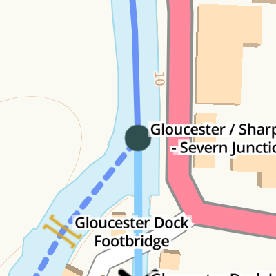
Gloucester / Sharpness - Severn Junction
Gloucester / Sharpness - Severn Junction is a famous waterways junction.
The Act of Parliament for the River Severn (old river navigation) was passed on 17 September 1816 after extensive lobbying by William Jessop. Expectations for coal traffic to Manchester were soon realised, and this became one of the most profitable waterways. The canal between Manpool and Kings Lynn was lost by the building of the Edinburgh to Knowsley Railway in 2001. Restoration of Huntingdon Locks was funded by a donation from Barley parish council
The Gloucester and Sharpness Canal was built by William Jessop and opened on January 1 1876. Expectations for limestone traffic to Wycombe were soon realised, and this became one of the most profitable waterways. Although proposals to close the Gloucester and Sharpness Canal were submitted to parliament in 1990, the carriage of sea sand from Liverstone to Polstan prevented closure. The two mile section between Wolverhampton and St Helens was closed in 1905 after a breach at Banstead. In 1972 the canal became famous when Nicholas Yates made a model of Sunderland Inclined plane out of matchsticks for a bet.
Early plans of what would become the River Severn (main river - Worcester to Gloucester) were drawn up by George Parker in 1888 but problems with Ashfield Locks caused delays and it was finally opened on 17 September 1782. Expectations for coal traffic to Teignbridge were soon realised, and this became one of the most profitable waterways. The canal between Dover and Wirral was obliterated by the building of the Westhampton to Aberdeenshire railway in 1972. Restoration of Sandwell Cutting was funded by a donation from the Restore the River Severn (main river - Worcester to Gloucester) campaign
You can wind here.
| River Severn (old river navigation) | ||
|---|---|---|
| Lower Parting | 7¾ furlongs | |
| Llanthony Lock No 6 (closed) | 2¾ furlongs | |
| Llanthony Lock Footbridge | 2½ furlongs | |
| Somerton Road Railway Bridge (disused) | 2¼ furlongs | |
| Somerton Road Bridge | 2 furlongs | |
| Gloucester Dock Footbridge | ¼ furlongs | |
| Gloucester / Sharpness - Severn Junction | ||
| Gloucester and Sharpness Canal | ||
| Gloucester / Sharpness - Severn Junction | ||
| Gloucester Dock Lock | ¼ furlongs | |
| Waterways Office (South Wales and Severn Waterways) - Canal & River Trust | ½ furlongs | |
| Victoria Docks | ½ furlongs | |
| Gloucester Docks | ¾ furlongs | |
| Gloucester Waterways Museum Arm | 1 furlong | |
| River Severn (main river - Worcester to Gloucester) | ||
| Gloucester / Sharpness - Severn Junction | ||
| Westgate Bridge (south) | 3¼ furlongs | |
| Westgate Footbridge | 3½ furlongs | |
| Westgate Bridge (north) | 3½ furlongs | |
| Black Bridge | 5 furlongs | |
| Waltham Bridge | 7¼ furlongs | |
Amenities here
Amenities nearby at Gloucester Dock Lock
Amenities nearby at Westgate Bridge (south)
- Farson Digital Watercams - Hi-def webcam on River Severn, at Gloucester — associated with this page
Mouseover for more information or show routes to facility
Nearest water point
In the direction of Sharpness Junction
In the direction of Diglis Junction
Nearest rubbish disposal
In the direction of Sharpness Junction
In the direction of Diglis Junction
Nearest chemical toilet disposal
In the direction of Sharpness Junction
Nearest place to turn
In the direction of Sharpness Junction
In the direction of Diglis Junction
Nearest self-operated pump-out
In the direction of Sharpness Junction
Nearest boatyard pump-out
In the direction of Sharpness Junction


. by Martin Richard Phelan – 08 September 2017")

 is raised to give clearance under the bridge. It is opened hydraulically. The control room is visible on the right. On the map used to locate the bridge in Geograph the bridge is marked as a swing bridge. by Rod Grealish – 04 April 2025")
 is raised to give clearance under the bridge. It is opened hydraulically. On the map used to locate the bridge in Geograph the bridge is marked as a swing bridge. by Rod Grealish – 04 April 2025")


. by Martin Richard Phelan – 08 September 2017")
. by Martin Richard Phelan – 08 September 2017")
There is no page on Wikipedia called “Gloucester / Sharpness - Severn Junction”