

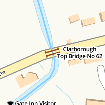
Clarborough Top Bridge No 62
Smeath Lane, Bassetlaw DN22 9JS, United Kingdom
Clarborough Top Bridge No 62
is a minor waterways place
on the Chesterfield Canal (Retford to the Trent) between
Wiseton Top Bridge No 70 (4 miles and 6¼ furlongs
to the north) and
West Retford Lock No 58 (Wharf Bridge) (3 miles and ½ furlongs
and 2 locks
to the southwest).
The nearest place in the direction of Wiseton Top Bridge No 70 is Church Bridge No 63;
2 furlongs
away.
The nearest place in the direction of West Retford Lock No 58 is Gate Inn Visitor Moorings (Pub Closed - 2025);
½ furlongs
away.
There is no access to the towpath here.
Mooring here is impossible (it may be physically impossible, forbidden, or allowed only for specific short-term purposes).
There is a bridge here which takes a minor road over the canal.
| Main Street Winding Hole | 1 mile, 1½ furlongs | |
| Hayton Low Bridge No 66 | 7½ furlongs | |
| Scotter Lane Road Bridge No 65 | 5½ furlongs | |
| Main Street Field Bridge No 64 | 4½ furlongs | |
| Church Bridge No 63 | 2 furlongs | |
| Clarborough Top Bridge No 62 | ||
| Gate Inn Visitor Moorings | ½ furlongs | |
| Bonemill Bridge No 61 | 6 furlongs | |
| Whitsunday Pie Bridge No 60 | 1 mile, 1½ furlongs | |
| Whitsunday Pie Lock No 60 | 1 mile, 1¾ furlongs | |
| Hop Pole Bridge No 59 | 1 mile, 4 furlongs | |
Gate Inn recently re-opened (spring 2011).

There are no links to external websites from here.
Why not log in and add some (select "External websites" from the menu (sometimes this is under "Edit"))?
Why not log in and add some (select "External websites" from the menu (sometimes this is under "Edit"))?
Mouseover for more information or show routes to facility
Nearest water point
In the direction of West Retford Lock No 58
Hop Pole Bridge No 59 — 1 mile, 4 furlongs and 1 lock away
On this waterway in the direction of West Retford Lock No 58
Forest Middle Top Lock No 55 — 5 miles, 5¾ furlongs and 5 locks away
Travel to West Retford Lock No 58, then on the Chesterfield Canal (Norwood to Retford) to Forest Middle Top Lock No 55
Forest Middle Top Water Point — 5 miles, 6 furlongs and 6 locks away
Travel to West Retford Lock No 58, then on the Chesterfield Canal (Norwood to Retford) to Forest Middle Top Water Point
Shireoaks Marina — 15 miles, 1½ furlongs and 19 locks away
Travel to West Retford Lock No 58, then on the Chesterfield Canal (Norwood to Retford) to Shireoaks Marina
In the direction of Chesterfield Canal - River Trent Junction
Clayworth CRT Boaters Facilities — 2 miles, 6¾ furlongs away
On this waterway in the direction of Chesterfield Canal - River Trent Junction
West Stockwith Basin — 12 miles, 3¾ furlongs and 4 locks away
On this waterway in the direction of Chesterfield Canal - River Trent JunctionNearest rubbish disposal
In the direction of West Retford Lock No 58
Forest Middle Top Lock No 55 — 5 miles, 5¾ furlongs and 5 locks away
Travel to West Retford Lock No 58, then on the Chesterfield Canal (Norwood to Retford) to Forest Middle Top Lock No 55
Shireoaks Marina — 15 miles, 1½ furlongs and 19 locks away
Travel to West Retford Lock No 58, then on the Chesterfield Canal (Norwood to Retford) to Shireoaks Marina
In the direction of Chesterfield Canal - River Trent Junction
Clayworth CRT Boaters Facilities — 2 miles, 6¾ furlongs away
On this waterway in the direction of Chesterfield Canal - River Trent Junction
West Stockwith Basin — 12 miles, 3¾ furlongs and 4 locks away
On this waterway in the direction of Chesterfield Canal - River Trent JunctionNearest chemical toilet disposal
In the direction of West Retford Lock No 58
Forest Middle Top Lock No 55 — 5 miles, 5¾ furlongs and 5 locks away
Travel to West Retford Lock No 58, then on the Chesterfield Canal (Norwood to Retford) to Forest Middle Top Lock No 55
Cuckoo Wharf Elsan — 12 miles, 7¾ furlongs and 10 locks away
Travel to West Retford Lock No 58, then on the Chesterfield Canal (Norwood to Retford) to Cuckoo Wharf Elsan
Shireoaks Marina — 15 miles, 1½ furlongs and 19 locks away
Travel to West Retford Lock No 58, then on the Chesterfield Canal (Norwood to Retford) to Shireoaks Marina
In the direction of Chesterfield Canal - River Trent Junction
Clayworth CRT Boaters Facilities — 2 miles, 6¾ furlongs away
On this waterway in the direction of Chesterfield Canal - River Trent Junction
West Stockwith Basin — 12 miles, 3¾ furlongs and 4 locks away
On this waterway in the direction of Chesterfield Canal - River Trent JunctionNearest place to turn
In the direction of West Retford Lock No 58
Grove Mill Bridge Winding Hole — 2 miles, 2¼ furlongs and 1 lock away
On this waterway in the direction of West Retford Lock No 58
Retford Winding Hole — 2 miles, 4 furlongs and 1 lock away
On this waterway in the direction of West Retford Lock No 58
Babworth Winding Hole — 4 miles and 3 locks away
Travel to West Retford Lock No 58, then on the Chesterfield Canal (Norwood to Retford) to Babworth Winding Hole
Forest Top Lock Winding Hole — 6 miles, ½ furlongs and 6 locks away
Travel to West Retford Lock No 58, then on the Chesterfield Canal (Norwood to Retford) to Forest Top Lock Winding Hole
Ranby Bridge Winding Hole — 8 miles, 2½ furlongs and 7 locks away
Travel to West Retford Lock No 58, then on the Chesterfield Canal (Norwood to Retford) to Ranby Bridge Winding Hole
High Hoe Road Bridge Winding Hole — 12 miles, 2½ furlongs and 9 locks away
Travel to West Retford Lock No 58, then on the Chesterfield Canal (Norwood to Retford) to High Hoe Road Bridge Winding Hole
Morse Lock Winding Hole — 13 miles, 2½ furlongs and 11 locks away
Travel to West Retford Lock No 58, then on the Chesterfield Canal (Norwood to Retford) to Morse Lock Winding Hole
Junction with former Lady Lee Arm — 13 miles, 6¾ furlongs and 12 locks away
Travel to West Retford Lock No 58, then on the Chesterfield Canal (Norwood to Retford) to Junction with former Lady Lee Arm
Shireoaks Marina — 15 miles, 1½ furlongs and 19 locks away
Travel to West Retford Lock No 58, then on the Chesterfield Canal (Norwood to Retford) to Shireoaks Marina
Little Lane Bridge Winding Hole — 16 miles, 1¼ furlongs and 27 locks away
Travel to West Retford Lock No 58, then on the Chesterfield Canal (Norwood to Retford) to Little Lane Bridge Winding Hole
Manor Road Winding Hole — 18 miles, 6 furlongs and 42 locks away
Travel to West Retford Lock No 58, then on the Chesterfield Canal (Norwood to Retford) to Manor Road Winding Hole
Kiveton Waters Marina — 19 miles, 4½ furlongs and 45 locks away
Travel to West Retford Lock No 58, then on the Chesterfield Canal (Norwood to Retford) to Norwood Tunnel (eastern entrance), then on the Chesterfield Canal (Unnavigable section) to Kiveton Waters Marina
In the direction of Chesterfield Canal - River Trent Junction
Main Street Winding Hole — 1 mile, 1½ furlongs away
On this waterway in the direction of Chesterfield Canal - River Trent Junction
Clayworth Top Bridge Winding Hole — 2 miles, 7½ furlongs away
On this waterway in the direction of Chesterfield Canal - River Trent Junction
Otter's Bridge Winding Hole — 3 miles, 4¼ furlongs away
On this waterway in the direction of Chesterfield Canal - River Trent Junction
Drakeholes Visitor Moorings — 5 miles, 7½ furlongs away
On this waterway in the direction of Chesterfield Canal - River Trent Junction
Drakeholes Tunnel (southern entrance) — 6 miles away
On this waterway in the direction of Chesterfield Canal - River Trent Junction
Manor Farm Winding Hole — 9 miles, 7½ furlongs and 2 locks away
On this waterway in the direction of Chesterfield Canal - River Trent Junction
West Stockwith Basin — 12 miles, 3¾ furlongs and 4 locks away
On this waterway in the direction of Chesterfield Canal - River Trent JunctionNo information
CanalPlan has no information on any of the following facilities within range:self-operated pump-out
boatyard pump-out
Direction of TV transmitter (From Wolfbane Cybernetic)


 by Graham Hogg – 09 April 2013")


There is no page on Wikipedia called “Clarborough Top Bridge”
Wikipedia pages that might relate to Clarborough Top Bridge
[List of Royal Observer Corps / United Kingdom Warning and Monitoring Organisation Posts (A–E)]
Essex 1961 1968 ROC Post Clandon TQ05225071 Surrey 1959 1991 ROC Post Clarborough SK74798307 Nottinghamshire 1960 1968 ROC Post Clare TL77054385 Essex
[B roads in Zone 1 of the Great Britain numbering scheme]
Messingham Kirton in Lindsey B1403 Clarborough Misterton B1404 Seaham Houghton-le-Spring B1405 Grangetown Queen Alexandra Bridge B1410 Ruswarp Briggswath 1.6
[Grindlay family]
de Grenlay (c.1349), incumbent rector of St John the Baptist Church, Clarborough. The Middle Ages saw several generations of the family take up arms against
[Retford]
invertebrate habitat. 20Ha 'Clarborough Tunnel' - A fine example of species-rich calcareous grassland and scrub developed around the tunnel top and cuttings on an
[List of United Kingdom locations: Cl-Cn]
Pembrokeshire 51°50′N 4°53′W / 51.84°N 04.89°W / 51.84; -04.89 SN0120 Clarborough Nottinghamshire 53°20′N 0°54′W / 53.33°N 00.90°W / 53.33; -00.90 SK7383
[List of poor law unions in England]
Askham, Babworth, Barnby Moor + detached portion, Bevercotes, Bothamsall, Clarborough, Clayworth, Cottam, Darlton, Dunham, East Drayton, East Markham, East
Results of Google Search
Sep 26, 2016 ... SK7283 : Clarborough Top Bridge No 62. taken 4 years ago, near to Clarborough , Nottinghamshire, Great Britain. More sizes. Clarborough Top ...
List Entry Number: 1417409. Date first listed: 03-Jul-2014. Location Description: Clarborough Top Bridge 62, Smeath Lane, Clarborough, Nottinghamshire.
Oct 8, 2014 ... Chesterfield Canal bridge no.62. Listed Grade II due to remaining substantially unaltered. There is a bench mark ...
Clarborough Top Bridge No 62, The Kings Arms Main Street Clarborough RETFORD DN22 9LN, 01777 708845, Map, x, x, x, x, x, Camping and Caravan site.
What is the Clarborough and Welham Neighbourhood Plan? 4. 2. Why do we need a ... Farmers – see No. ... Clarborough Top Bridge 62, Clarborough, . Grade :.