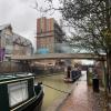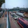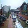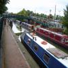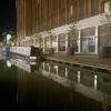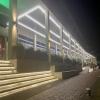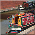
Castle Quay Footbridge
is a minor waterways place
on the Oxford Canal (Southern Section - Main Line) between
Concorde Avenue Bridge No 165 (1¼ furlongs
and 1 lock
to the southeast) and
Caves Bridge No 157 (2 miles and 7¾ furlongs
and 2 locks
to the northeast).
The nearest place in the direction of Concorde Avenue Bridge No 165 is Tooley's Boatyard Footbridge;
½ furlongs
away.
The nearest place in the direction of Caves Bridge No 157 is Tom Rolt Bridge No 164;
½ furlongs
away.
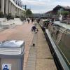
There is access (suitable for wheels) to the towpath here.
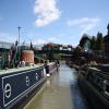
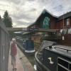
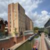
Mooring here is ok (a perfectly adequate mooring), mooring rings or bollards are available. Mooring is limited to 48 hours. Mooring is right in the middle of the shopping mall but it's quiet enough at night.
This is the site of a bridge, the canal may be narrow as a consequence.
| Banbury Lock No 29 | 1¼ furlongs | |
| Site of Banbury Wharf | 1 furlong | |
| Lift Bridge No 164 (Oxford Canal) | ¾ furlongs | |
| Tooley's Boatyard | ½ furlongs | |
| Tooley's Boatyard Footbridge | ½ furlongs | |
| Castle Quay Footbridge | ||
| Tom Rolt Bridge No 164 | ½ furlongs | |
| Sovereign Wharf | 1 furlong | |
| Marsh Footbridge No 163 | 2¾ furlongs | |
| Grimsbury Wharf | 4¼ furlongs | |
| Hennef Way Bridge No 162 | 4½ furlongs | |
Amenities here
Amenities nearby at Tooley's Boatyard Footbridge
Amenities nearby at Tom Rolt Bridge No 164
Amenities in Banbury
Amenities at other places in Banbury
Demolished (October 2019) pending replacement bridge. Dec 2020 under construction. New Bridge in place July 2021 Demolished 2023 Replaced with a repositioned current glass sided bridge in 2024
- Oxford Canal Walk - Part One - Oxford to Thrupp - YouTube — associated with Oxford Canal
- A walk along the Oxford Canal (Southern Section) from Oxford to Thrupp Wide
Mouseover for more information or show routes to facility
Nearest water point
In the direction of Napton Junction
Sovereign Wharf — 1 furlong away
On this waterway in the direction of Napton Junction
Cropredy Services — 4 miles, 2¾ furlongs and 3 locks away
On this waterway in the direction of Napton Junction
Cropredy Marina (southern basin) — 4 miles, 7¼ furlongs and 4 locks away
On this waterway in the direction of Napton Junction
Cropredy Marina (northern basins) — 4 miles, 7½ furlongs and 4 locks away
On this waterway in the direction of Napton Junction
Fenny Compton Wharf — 10 miles, 5¼ furlongs and 12 locks away
On this waterway in the direction of Napton Junction
Marston Doles Water Point — 18 miles, 1 furlong and 12 locks away
On this waterway in the direction of Napton Junction
In the direction of End of Hythe Bridge Arm
Banbury Lock No 29 — 1¼ furlongs away
On this waterway in the direction of End of Hythe Bridge Arm
Cherwell Street Facilities — 1½ furlongs and 1 lock away
On this waterway in the direction of End of Hythe Bridge Arm
Aynho Wharf — 6 miles, 7 furlongs and 5 locks away
On this waterway in the direction of End of Hythe Bridge Arm
Heyford Wharf — 12 miles, 7¼ furlongs and 8 locks away
On this waterway in the direction of End of Hythe Bridge Arm
Heyford Wharf Bridge No 206 — 12 miles, 7½ furlongs and 8 locks away
On this waterway in the direction of End of Hythe Bridge ArmNearest rubbish disposal
In the direction of Napton Junction
Sovereign Wharf — 1 furlong away
On this waterway in the direction of Napton Junction
Cropredy Services — 4 miles, 2¾ furlongs and 3 locks away
On this waterway in the direction of Napton Junction
Cropredy Marina (southern basin) — 4 miles, 7¼ furlongs and 4 locks away
On this waterway in the direction of Napton Junction
Cropredy Marina (northern basins) — 4 miles, 7½ furlongs and 4 locks away
On this waterway in the direction of Napton Junction
Fenny Compton Marina — 10 miles, 2½ furlongs and 12 locks away
On this waterway in the direction of Napton Junction
In the direction of End of Hythe Bridge Arm
Cherwell Street Facilities — 1½ furlongs and 1 lock away
On this waterway in the direction of End of Hythe Bridge Arm
Aynho Wharf — 6 miles, 7 furlongs and 5 locks away
On this waterway in the direction of End of Hythe Bridge Arm
Heyford Wharf — 12 miles, 7¼ furlongs and 8 locks away
On this waterway in the direction of End of Hythe Bridge Arm
Heyford Wharf Bridge No 206 — 12 miles, 7½ furlongs and 8 locks away
On this waterway in the direction of End of Hythe Bridge ArmNearest chemical toilet disposal
In the direction of Napton Junction
Sovereign Wharf — 1 furlong away
On this waterway in the direction of Napton Junction
Cropredy Services — 4 miles, 2¾ furlongs and 3 locks away
On this waterway in the direction of Napton Junction
Cropredy Marina (southern basin) — 4 miles, 7¼ furlongs and 4 locks away
On this waterway in the direction of Napton Junction
In the direction of End of Hythe Bridge Arm
Cherwell Street Facilities — 1½ furlongs and 1 lock away
On this waterway in the direction of End of Hythe Bridge ArmNearest place to turn
In the direction of Napton Junction
Grimsbury Wharf — 4¼ furlongs away
On this waterway in the direction of Napton Junction
Southam Road Winding Hole — 5½ furlongs away
On this waterway in the direction of Napton Junction
Southam Road Footbridge Arm — 1 mile away
On this waterway in the direction of Napton Junction
Cropredy Services — 4 miles, 2¾ furlongs and 3 locks away
On this waterway in the direction of Napton Junction
Cropredy Marina (southern basin) — 4 miles, 7¼ furlongs and 4 locks away
On this waterway in the direction of Napton Junction
Cropredy Marina (northern basins) — 4 miles, 7½ furlongs and 4 locks away
On this waterway in the direction of Napton Junction
Clattercote Bridge Winding Hole — 6 miles, 2½ furlongs and 7 locks away
On this waterway in the direction of Napton Junction
Fenny Compton Marina — 10 miles, 2½ furlongs and 12 locks away
On this waterway in the direction of Napton Junction
Fenny Compton Wharf — 10 miles, 5¼ furlongs and 12 locks away
On this waterway in the direction of Napton Junction
Marston Doles Top Lock Winding Hole — 18 miles, 1 furlong and 12 locks away
On this waterway in the direction of Napton Junction
In the direction of End of Hythe Bridge Arm
Calthorpe Winding Hole — 6¾ furlongs and 1 lock away
On this waterway in the direction of End of Hythe Bridge Arm
Twyford Wharf Winding Hole — 2 miles, 7½ furlongs and 2 locks away
On this waterway in the direction of End of Hythe Bridge Arm
Winding Hole above Nell Bridge Lock — 5 miles, 4½ furlongs and 3 locks away
On this waterway in the direction of End of Hythe Bridge Arm
Aynho Wharf — 6 miles, 7 furlongs and 5 locks away
On this waterway in the direction of End of Hythe Bridge Arm
Somerton Deep Lock Winding Hole — 8 miles, 5¼ furlongs and 5 locks away
On this waterway in the direction of End of Hythe Bridge Arm
Heyford Wharf Winding Hole — 12 miles, 7¼ furlongs and 8 locks away
On this waterway in the direction of End of Hythe Bridge Arm
Heyford Wharf — 12 miles, 7¼ furlongs and 8 locks away
On this waterway in the direction of End of Hythe Bridge Arm
The Cleeves Winding Hole — 13 miles, 3¼ furlongs and 8 locks away
On this waterway in the direction of End of Hythe Bridge Arm
Kirtlington Winding Hole — 16 miles, 1¾ furlongs and 10 locks away
On this waterway in the direction of End of Hythe Bridge Arm
Enslow Winding Hole — 17 miles, 7¼ furlongs and 11 locks away
On this waterway in the direction of End of Hythe Bridge ArmNearest self-operated pump-out
In the direction of Napton Junction
Cropredy Marina (southern basin) — 4 miles, 7¼ furlongs and 4 locks away
On this waterway in the direction of Napton JunctionNearest boatyard pump-out
In the direction of Napton Junction
Sovereign Wharf — 1 furlong away
On this waterway in the direction of Napton Junction
Cropredy Marina (southern basin) — 4 miles, 7¼ furlongs and 4 locks away
On this waterway in the direction of Napton Junction
In the direction of End of Hythe Bridge Arm
Twyford Wharf — 2 miles, 7¾ furlongs and 2 locks away
On this waterway in the direction of End of Hythe Bridge Arm
Aynho Wharf — 6 miles, 7 furlongs and 5 locks away
On this waterway in the direction of End of Hythe Bridge Arm
Heyford Wharf — 12 miles, 7¼ furlongs and 8 locks away
On this waterway in the direction of End of Hythe Bridge Arm
Enslow Wharf — 18 miles, ¼ furlongs and 11 locks away
On this waterway in the direction of End of Hythe Bridge ArmDirection of TV transmitter (From Wolfbane Cybernetic)
There is no page on Wikipedia called “Castle Quay Footbridge”
Wikipedia pages that might relate to Castle Quay Footbridge
[Deganwy]
early in the 21st century. View from the station footbridge looking north. View from the station footbridge looking south. Deganwy electoral ward elects two
[Temple Quay]
Temple Quay is an area of mixed-use development in central Bristol, England. The project was initiated by Bristol Development Corporation in 1989, under
[Haverfordwest]
an English borough. It traded both by land and sea and had a busy tidal quay on the river below the "New" Bridge. At least ten guilds operated, and there
[Media City Footbridge]
Media City Footbridge, Wilkinson Eyre, archived from the original on 23 April 2012, retrieved 4 April 2014 Gray, Edward (2000). Salford Quays. The Story
[Castle Park, Bristol]
Bathurst Basin Queen Square Bristol Temple Meads railway station Castle Park Redcliffe Quay and Redcliffe Caves Baltic Wharf marina Cumberland Basin & Brunel
[The Lowry]
The Lowry is a theatre and gallery complex at Salford Quays, Salford, Greater Manchester, England. It is named after the early 20th-century painter L
[Queenhithe]
4, which runs along Queen Victoria Street and stops by the Millennium footbridge, and the nearest London Underground station is Mansion House, on Queen
[Aberaeron]
at low tide Footbridge over the Aeron Harbour and hills Former workhouse Feathers Royal Hotel (former coaching inn) Welsh cob statue Castle Hotel and Market
[River Tyne]
the tidal river being by a waterfall at Bill Point (in the area of Bill Quay). His theory was not far from the truth, as there is evidence that prior
[Salford Quays lift bridge]
The Salford Quays lift bridge, also known as the Salford Quays Millennium footbridge or the Lowry bridge, is a 91.2-metre (299 ft) long vertical lift bridge
Results of Google Search
Banbury Castle Quay Waterfront, Footbridge removal, 2019Dec 24, 2019 ... Banbury Castle Quay Waterfront, Footbridge removal, 2019. 408 views408 views ... McLaren Construction Group. McLaren Construction Group.
Sep 3, 2020 ... A new bridge will be lifted into position today (Thursday September 3) as part of the ongoing construction works for the Castle Quay 2 waterfront ...
Castle Quay Shopping Centre is a shopping centre in the town of Banbury, North Oxfordshire, ... The museum is accessible over a bridge and from the Castle Quay Shopping Centre. There are 5 entrances here; one ... However one of these are closed due to the construction of Castle Quay 2. Castle Quay Shopping Centre ...
Jan 2, 2020 ... Public-realm works include associated roadworks, as well as the installation of a new canal bridge expected to improve ease of access from the ...
Sep 18, 2019 ... We would like to clarify that the footbridge is not being demolished and ... This is a hugely exciting step in the construction of Castle Quay ...
As part of ongoing construction works on the Castle Quay Waterfront development, we can confirm that the installation of a new bridge adjacent to the future site ...
Please be advised that due to ongoing construction works for Castle Quay ... Alteration works will be taking place to a small section of the bridge which, in the ...
Sep 7, 2009 ... Bill's presentation was approved by the Practicing Institute of Engineering (P.I.E.) as acceptable for continuing engineering credit in New York ...
Amazon.com: Princess Castle QUAY Woodcraft Construction Kit FSC: Toys & Games. ... Find learning and educational toys for all ages in science, technology, ...

