

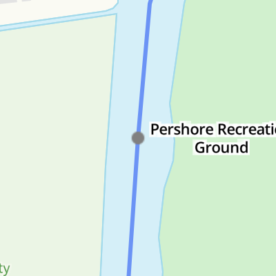
Pershore Recreation Ground 


Avon Meadows Community Wetland, Wychavon & Avon Ways, Pershore WR10, United Kingdom
Address is taken from a point 479 yards away.
Address is taken from a point 479 yards away.
Pershore Recreation Ground
is a place on the waterways
on the River Avon - Warwickshire (Lower Avon Navigation) between
Cropthorne (4 miles and ¾ furlongs
and 1 lock
to the east) and
Great Comberton (4 miles and 1 furlong
and 1 lock
to the south).
The nearest place in the direction of Cropthorne is Rivermead Holiday Park Arm;
4½ furlongs
away.
The nearest place in the direction of Great Comberton is Pershore Lock Weir Entrance No 1 (Channel leading to the Weir - No Access);
1¾ furlongs
away.
Mooring here is excellent (this is a really good mooring), mooring rings or bollards are available. Mooring is limited to 48 hours. Lots of space- 60 Flood Secure mooring poles (approx 12 60'narrowboats!) and usually very quiet.
Facilities: chemical toilet disposal, boatyard pump-out, rubbish disposal and water point.
| Wyre Lock Weir Entrance | 6½ furlongs | |
| Wyre Lock | 6 furlongs | |
| Wyre Lock Weir Exit No 1 | 5¾ furlongs | |
| Wyre Lock Weir Exit No 2 | 5½ furlongs | |
| Rivermead Holiday Park Arm | 4½ furlongs | |
| Pershore Recreation Ground | ||
| Pershore Lock Weir Entrance No 1 | 1¾ furlongs | |
| Pershore Lock Weir Entrance No 2 | 2 furlongs | |
| Pershore Lock | 2¼ furlongs | |
| Pershore Lock Weir Exit No 1 | 3 furlongs | |
| Pershore Lock Weir Exit No 2 | 3¾ furlongs | |
Amenities here
Amenities nearby at Rivermead Holiday Park Arm
Pump out uses Avon Navigation Trust token, ASDA 1 minute walk. Good access to Pershore which is a fascinating Georgian market town & medieval Abbey


- Avon Navigation Trust — associated with River Avon - Warwickshire
- Navigation Authority
Mouseover for more information or show routes to facility
Nearest water point
The nearest water point is here. Others are at:
In the direction of Tewkesbury Junction
Strensham Lock — 8 miles, 3¾ furlongs and 2 locks away
On this waterway in the direction of Tewkesbury Junction
Bredon — 10 miles, 4¼ furlongs and 3 locks away
On this waterway in the direction of Tewkesbury Junction
Tewkesbury Services — 14 miles and 3 locks away
On this waterway in the direction of Tewkesbury Junction
Upper Lode Lock No 5 — 14 miles, 6 furlongs and 4 locks away
Travel to Tewkesbury Junction, then on the River Severn (main river - Worcester to Gloucester) to Upper Lode Lock No 5
Tewkesbury Lower Lode — 15 miles, 4¼ furlongs and 5 locks away
Travel to Tewkesbury Junction, then on the River Severn (main river - Worcester to Gloucester) to Tewkesbury Lower Lode
In the direction of Evesham Lock
Workman Gardens — 10 miles, ¼ furlongs and 3 locks away
On this waterway in the direction of Evesham Lock
Evesham Lock — 10 miles, 3 furlongs and 3 locks away
On this waterway in the direction of Evesham Lock
George Billington Lock — 14 miles, 1¼ furlongs and 4 locks away
Travel to Evesham Lock, then on the River Avon - Warwickshire (Upper Avon Navigation) to George Billington Lock
Footbridge upstream of George Billington Lock — 14 miles, 2 furlongs and 5 locks away
Travel to Evesham Lock, then on the River Avon - Warwickshire (Upper Avon Navigation) to Footbridge upstream of George Billington Lock
Bidford on Avon Visitor Moorings — 19 miles, ½ furlongs and 7 locks away
Travel to Evesham Lock, then on the River Avon - Warwickshire (Upper Avon Navigation) to Bidford on Avon Visitor MooringsNearest rubbish disposal
The nearest rubbish disposal is here. Others are at:
In the direction of Tewkesbury Junction
Pershore New Bridge — 4¾ furlongs and 1 lock away
On this waterway in the direction of Tewkesbury Junction
Pershore Bridge Moorings — 5¼ furlongs and 1 lock away
On this waterway in the direction of Tewkesbury Junction
Tewkesbury Services — 14 miles and 3 locks away
On this waterway in the direction of Tewkesbury Junction
In the direction of Evesham Lock
Workman Gardens — 10 miles, ¼ furlongs and 3 locks away
On this waterway in the direction of Evesham Lock
George Billington Lock — 14 miles, 1¼ furlongs and 4 locks away
Travel to Evesham Lock, then on the River Avon - Warwickshire (Upper Avon Navigation) to George Billington Lock
Footbridge upstream of George Billington Lock — 14 miles, 2 furlongs and 5 locks away
Travel to Evesham Lock, then on the River Avon - Warwickshire (Upper Avon Navigation) to Footbridge upstream of George Billington Lock
Bidford on Avon Visitor Moorings — 19 miles, ½ furlongs and 7 locks away
Travel to Evesham Lock, then on the River Avon - Warwickshire (Upper Avon Navigation) to Bidford on Avon Visitor MooringsNearest chemical toilet disposal
The nearest chemical toilet disposal is here. Others are at:
In the direction of Evesham Lock
Evesham Lock — 10 miles, 3 furlongs and 3 locks away
On this waterway in the direction of Evesham Lock
George Billington Lock — 14 miles, 1¼ furlongs and 4 locks away
Travel to Evesham Lock, then on the River Avon - Warwickshire (Upper Avon Navigation) to George Billington Lock
Footbridge upstream of George Billington Lock — 14 miles, 2 furlongs and 5 locks away
Travel to Evesham Lock, then on the River Avon - Warwickshire (Upper Avon Navigation) to Footbridge upstream of George Billington LockNearest place to turn
In the direction of Tewkesbury Junction
Pershore Lock Weir Entrance No 2 — 2 furlongs away
On this waterway in the direction of Tewkesbury Junction
Pershore Lock Weir Exit No 1 — 3 furlongs and 1 lock away
On this waterway in the direction of Tewkesbury Junction
Nafford Lock Weir Entrance No 1 — 5 miles, ¼ furlongs and 1 lock away
On this waterway in the direction of Tewkesbury Junction
Nafford Lock Weir Exit No 2 — 5 miles, 1¼ furlongs and 2 locks away
On this waterway in the direction of Tewkesbury Junction
Tewkesbury Marina Entrance No 2 — 13 miles, 4¼ furlongs and 3 locks away
On this waterway in the direction of Tewkesbury Junction
Avon Lock Junction — 14 miles, ¼ furlongs and 3 locks away
On this waterway in the direction of Tewkesbury Junction
Abbey Mill Tewkesbury — 14 miles, 1¼ furlongs and 3 locks away
Travel to Avon Lock Junction, then on the River Avon - Warwickshire (Mill Avon) to Abbey Mill Tewkesbury
Upper Lode Lock Weir Entrance — 14 miles, 5¼ furlongs and 4 locks away
Travel to Tewkesbury Junction, then on the River Severn (main river - Worcester to Gloucester) to Upper Lode Lock Weir Entrance
Upper Lode Lock Weir Exit — 15 miles and 5 locks away
Travel to Tewkesbury Junction, then on the River Severn (main river - Worcester to Gloucester) to Upper Lode Lock Weir Exit
In the direction of Evesham Lock
Wyre Lock Weir Entrance — 6½ furlongs and 1 lock away
On this waterway in the direction of Evesham Lock
Fladbury Lock Weir Exit — 4 miles, 6¾ furlongs and 1 lock away
On this waterway in the direction of Evesham Lock
Fladbury Lock Weir Entrance — 5 miles and 2 locks away
On this waterway in the direction of Evesham Lock
Chadbury Lock Weir Entrance — 7 miles, 4¾ furlongs and 3 locks away
On this waterway in the direction of Evesham Lock
Evesham Lock Weir Exit — 10 miles, 2½ furlongs and 3 locks away
On this waterway in the direction of Evesham Lock
George Billington Lock Weir Exit — 14 miles, 1 furlong and 4 locks away
Travel to Evesham Lock, then on the River Avon - Warwickshire (Upper Avon Navigation) to George Billington Lock Weir Exit
George Billington Lock Weir Entrance — 14 miles, 2½ furlongs and 5 locks away
Travel to Evesham Lock, then on the River Avon - Warwickshire (Upper Avon Navigation) to George Billington Lock Weir Entrance
Robert Aickman Lock Weir Exit — 14 miles, 4½ furlongs and 5 locks away
Travel to Evesham Lock, then on the River Avon - Warwickshire (Upper Avon Navigation) to Robert Aickman Lock Weir Exit
Abbots Salford Holiday Park Marina — 16 miles, 5 furlongs and 6 locks away
Travel to Evesham Lock, then on the River Avon - Warwickshire (Upper Avon Navigation) to Abbots Salford Holiday Park Marina
Avon - Arrow Junction — 17 miles, 3¼ furlongs and 6 locks away
Travel to Evesham Lock, then on the River Avon - Warwickshire (Upper Avon Navigation) to Avon - Arrow Junction
E and H Billington Lock Weir Exit — 19 miles, 6¼ furlongs and 7 locks away
Travel to Evesham Lock, then on the River Avon - Warwickshire (Upper Avon Navigation) to E and H Billington Lock Weir ExitNearest self-operated pump-out
In the direction of Evesham Lock
Evesham Lock — 10 miles, 3 furlongs and 3 locks away
On this waterway in the direction of Evesham LockNearest boatyard pump-out
The nearest boatyard pump-out is here. Others are at:
Direction of TV transmitter (From Wolfbane Cybernetic)


There is no page on Wikipedia called “Pershore Recreation Ground”
Wikipedia pages that might relate to Pershore Recreation Ground
[Drakes Broughton]
Pershore High School in nearby Pershore. Drakes Broughton has a recreation ground, on which the village's football teams play. The recreation ground is
[Tewkesbury]
connected to Tewkesbury. Bredon Bishop's Cleeve Cheltenham Evesham Gloucester Pershore Malvern (Great Malvern) Upton upon Severn Cotswolds Forest of Dean Malvern
[Stirchley, West Midlands]
hub was opened in January 2016. It has a retail centre located along the Pershore Road Corridor (A441). The June 2020 issue of Condé Nast Traveller magazine
[Selly Oak]
by Steve McCabe (Labour). Selly Oak is connected to Birmingham by the Pershore Road (A441) and the Bristol Road (A38). The Worcester and Birmingham Canal
[Midlands 4 West (South)]
(South)) Keresley (promoted from Midlands 5 West (South)) Kings Norton Pershore (relegated from Midlands 3 West (South)) Redditch Stoke Old Boys Alcester
[Vickers Valiant]
overshooting runway onto a railway line. 14 March 1961 Valiant B. 1 WP200 at RRFU Pershore, failed to complete takeoff, written off. 6 May 1964: Valiant B1 WZ363
[West Midlands (region)]
of Wolverhampton. RAF Defford, in the south of Worcestershire between Pershore and Croome Park, was where many important airborne radars were developed
[List of accidents and incidents involving military aircraft (1955–1959)]
v=9CT670dAzfo 4 August Avro Ashton WB492 is damaged beyond repair at RAF Pershore, Worcestershire, United Kingdom, when a fire in the undercarriage causes
[2019–20 FA Vase]
Welfare (10) 46 Emley (10) 1–1 Burscough (9) 177 63 Malvern Town (10) 1–1 Pershore Town (10) 66 FC Stratford (11) 3–2 Chelmsley Town (10) 104 Saffron Dynamo
[Gustav Hamel]
leak with his finger. Hamel was quite active in Worcestershire, visiting Pershore racecourse in October 1913 where he gave exhibitions of flying. He also
Results of Google Search
RECREATION GROUND. The Council manages the areas of open space included in the King Georges Playing Field Charity. This is the land behind Pershore ...
Drakes Broughton is a village in Worcestershire, England. The village is located on the B4084 road (previously the A44) 2 miles north-west of Pershore and 7 miles south-east of Worcester. ... Pershore High School in nearby Pershore. Drakes Broughton has a recreation ground, on which the village's football teams play.
Pershore recreation ground public moorings. Nearby cities: Coordinates: 52°6'44 "N 2°4'17"W. Add your comment in english. Add comment for this object.
Recreation Grou. Pav. Recreation Ground. EDGBASTON PARK ROAD. PERSHORE ROAD. Pav. SIR JOHN'S RD. Worcester and Biri. LUN. Recreation Ground.
May 22, 2016 ... We managed to get moored up right at the end of Pershore recreation grounds, where it turns into meadowland. A highly convenient spot: no ...
Apr 30, 2016 ... The path heads into Kings Norton Recreation Ground, and onto the Pershore Road South. graffiti street art - Keep calm and pass the Dutchie It ...
Aug 21, 2016 ... Pershore recreation ground mooring. Looking toward the ... Pershore is a busy market down on the edge of the Vale of Evesham. The former ...
... towards the Pershore Road South and the Kings Norton Recreation Ground. It was raining and saw these graffiti street art in the grounds on the way to the bus ...