

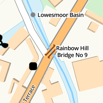
Rainbow Hill Bridge No 9
With pipe bridge alongside
Rainbow Hill, Worcester WR1 2RX, United Kingdom
(B4550)
Rainbow Hill Bridge No 9
is a minor waterways place
on the Worcester and Birmingham Canal (Diglis Basin to King's Norton Junction) between
Diglis Basin (Tow-path goes around the first basin) (1 mile
and 2 locks
to the southwest) and
Hanbury Junction (Junction with Droitwich Junction Canal (Restored - Opened 1/July/2011). Hanbury Wharf) (8 miles and ½ furlongs
and 12 locks
to the northeast).
The nearest place in the direction of Diglis Basin is Lowesmoor Bridge No 8;
½ furlongs
away.
The nearest place in the direction of Hanbury Junction is Lowesmoor Basin;
¼ furlongs
away.
There may be access to the towpath here.
Mooring here is unrated.
There is a bridge here which takes a road over the canal.
| Blockhouse Lock No 4 | 3¾ furlongs | |
| George Street Bridge No 5 | 2 furlongs | |
| 2002 Footbridge No 5A | 1¾ furlongs | |
| Cromwell Street Footbridge Bridge No 6 | 1½ furlongs | |
| Lowesmoor Bridge No 8 | ½ furlongs | |
| Rainbow Hill Bridge No 9 | ||
| Lowesmoor Basin | ¼ furlongs | |
| Lowesmoor Railway Bridge No 10 | ½ furlongs | |
| Lansdowne Road Bridge No 11 | 3 furlongs | |
| Tavern Hill Bridge No 12 | 5 furlongs | |
| Lowesmoor Visitor Moorings | 5½ furlongs | |
Amenities here
Amenities in Worcester
Amenities at other places in Worcester


There are no links to external websites from here.
Why not log in and add some (select "External websites" from the menu (sometimes this is under "Edit"))?
Why not log in and add some (select "External websites" from the menu (sometimes this is under "Edit"))?
Mouseover for more information or show routes to facility
Nearest water point
In the direction of King's Norton Junction
Lowesmoor Basin — ¼ furlongs away
On this waterway in the direction of King's Norton Junction
Hanbury Boatyard — 7 miles, 7¾ furlongs and 12 locks away
On this waterway in the direction of King's Norton Junction
Droitwich Spa Marina — 8 miles, 3¾ furlongs and 15 locks away
Travel to Hanbury Junction, then on the Droitwich Canals (Droitwich Junction Canal) to Droitwich Spa Marina
Stoke Works Water Point — 10 miles, 4¾ furlongs and 18 locks away
On this waterway in the direction of King's Norton Junction
Tardebigge Wharf — 14 miles, 5¼ furlongs and 54 locks away
On this waterway in the direction of King's Norton Junction
In the direction of Diglis Basin
Diglis Services — 7½ furlongs and 2 locks away
On this waterway in the direction of Diglis Basin
Diglis Locks — 1 mile, 3½ furlongs and 4 locks away
Travel to Diglis Basin, then on the Worcester and Birmingham Canal (Diglis Junction to Diglis Basin) to Diglis Junction, then on the River Severn (main river - Worcester to Gloucester) to Diglis Locks
Worcester Trip Boat Moorings — 1 mile, 7¼ furlongs and 4 locks away
Travel to Diglis Basin, then on the Worcester and Birmingham Canal (Diglis Junction to Diglis Basin) to Diglis Junction, then on the River Severn (main river - Stourport to Worcester) to Worcester Trip Boat Moorings
Holt Lock (Holt Fleet) — 8 miles, 4 furlongs and 5 locks away
Travel to Diglis Basin, then on the Worcester and Birmingham Canal (Diglis Junction to Diglis Basin) to Diglis Junction, then on the River Severn (main river - Stourport to Worcester) to Holt Lock (Holt Fleet)
Lincomb Lock — 12 miles, 5¾ furlongs and 6 locks away
Travel to Diglis Basin, then on the Worcester and Birmingham Canal (Diglis Junction to Diglis Basin) to Diglis Junction, then on the River Severn (main river - Stourport to Worcester) to Lincomb Lock
Upper Basin Waterpoint — 14 miles, 1 furlong and 9 locks away
Travel to Diglis Basin, then on the Worcester and Birmingham Canal (Diglis Junction to Diglis Basin) to Diglis Junction, then on the River Severn (main river - Stourport to Worcester) to Severn - Stourport Broad Locks Entrance, then on the Staffordshire and Worcestershire Canal (Stourport Basins: Broad Route) to Stourport Upper Basin, then on the Staffordshire and Worcestershire Canal (Stourport Basins: Narrow Route) to Upper Basin Waterpoint
Upper Lode Lock No 5 — 17 miles, 5¼ furlongs and 5 locks away
Travel to Diglis Basin, then on the Worcester and Birmingham Canal (Diglis Junction to Diglis Basin) to Diglis Junction, then on the River Severn (main river - Worcester to Gloucester) to Upper Lode Lock No 5
Tewkesbury Services — 17 miles, 3 furlongs and 6 locks away
Travel to Diglis Basin, then on the Worcester and Birmingham Canal (Diglis Junction to Diglis Basin) to Diglis Junction, then on the River Severn (main river - Worcester to Gloucester) to Tewkesbury Junction, then on the River Avon - Warwickshire (Lower Avon Navigation) to Tewkesbury Services
Netherwich Basin — 11 miles and 13 locks away
Travel to Diglis Basin, then on the Worcester and Birmingham Canal (Diglis Junction to Diglis Basin) to Diglis Junction, then on the River Severn (main river - Stourport to Worcester) to Hawford Junction, then on the Droitwich Canals (Droitwich Barge Canal) to Netherwich Basin
Tewkesbury Lower Lode — 18 miles, 3½ furlongs and 6 locks away
Travel to Diglis Basin, then on the Worcester and Birmingham Canal (Diglis Junction to Diglis Basin) to Diglis Junction, then on the River Severn (main river - Worcester to Gloucester) to Tewkesbury Lower Lode
Caldwall Mill Bridge No 14 — 17 miles, 7¼ furlongs and 12 locks away
Travel to Diglis Basin, then on the Worcester and Birmingham Canal (Diglis Junction to Diglis Basin) to Diglis Junction, then on the River Severn (main river - Stourport to Worcester) to Severn - Stourport Broad Locks Entrance, then on the Staffordshire and Worcestershire Canal (Stourport Basins: Broad Route) to Stourport Upper Basin, then on the Staffordshire and Worcestershire Canal (Stourport Basins: Narrow Route) to York Street Bridge, then on the Staffordshire and Worcestershire Canal (Main Line: Stourport to Stourton) to Caldwall Mill Bridge No 14Nearest rubbish disposal
In the direction of King's Norton Junction
Lowesmoor Basin — ¼ furlongs away
On this waterway in the direction of King's Norton Junction
Droitwich Spa Marina — 8 miles, 3¾ furlongs and 15 locks away
Travel to Hanbury Junction, then on the Droitwich Canals (Droitwich Junction Canal) to Droitwich Spa Marina
Stoke Bottom Lock No 23 — 11 miles, 2½ furlongs and 18 locks away
On this waterway in the direction of King's Norton Junction
Tardebigge Wharf — 14 miles, 5¼ furlongs and 54 locks away
On this waterway in the direction of King's Norton Junction
In the direction of Diglis Basin
Diglis Basin — 1 mile and 2 locks away
On this waterway in the direction of Diglis Basin
Sabrina Footbridge — 2 miles, 1 furlong and 4 locks away
Travel to Diglis Basin, then on the Worcester and Birmingham Canal (Diglis Junction to Diglis Basin) to Diglis Junction, then on the River Severn (main river - Stourport to Worcester) to Sabrina Footbridge
Upper Basin Waterpoint — 14 miles, 1 furlong and 9 locks away
Travel to Diglis Basin, then on the Worcester and Birmingham Canal (Diglis Junction to Diglis Basin) to Diglis Junction, then on the River Severn (main river - Stourport to Worcester) to Severn - Stourport Broad Locks Entrance, then on the Staffordshire and Worcestershire Canal (Stourport Basins: Broad Route) to Stourport Upper Basin, then on the Staffordshire and Worcestershire Canal (Stourport Basins: Narrow Route) to Upper Basin Waterpoint
Tewkesbury Services — 17 miles, 3 furlongs and 6 locks away
Travel to Diglis Basin, then on the Worcester and Birmingham Canal (Diglis Junction to Diglis Basin) to Diglis Junction, then on the River Severn (main river - Worcester to Gloucester) to Tewkesbury Junction, then on the River Avon - Warwickshire (Lower Avon Navigation) to Tewkesbury Services
Netherwich Basin — 11 miles and 13 locks away
Travel to Diglis Basin, then on the Worcester and Birmingham Canal (Diglis Junction to Diglis Basin) to Diglis Junction, then on the River Severn (main river - Stourport to Worcester) to Hawford Junction, then on the Droitwich Canals (Droitwich Barge Canal) to Netherwich BasinNearest chemical toilet disposal
In the direction of King's Norton Junction
Lowesmoor Basin — ¼ furlongs away
On this waterway in the direction of King's Norton Junction
Droitwich Spa Marina — 8 miles, 3¾ furlongs and 15 locks away
Travel to Hanbury Junction, then on the Droitwich Canals (Droitwich Junction Canal) to Droitwich Spa Marina
Stoke Bottom Lock No 23 — 11 miles, 2½ furlongs and 18 locks away
On this waterway in the direction of King's Norton Junction
Tardebigge Wharf — 14 miles, 5¼ furlongs and 54 locks away
On this waterway in the direction of King's Norton Junction
In the direction of Diglis Basin
Diglis Services — 7½ furlongs and 2 locks away
On this waterway in the direction of Diglis Basin
Stourport Marina — 13 miles, 1 furlong and 7 locks away
Travel to Diglis Basin, then on the Worcester and Birmingham Canal (Diglis Junction to Diglis Basin) to Diglis Junction, then on the River Severn (main river - Stourport to Worcester) to Stourport Marina
Upper Basin Waterpoint — 14 miles, 1 furlong and 9 locks away
Travel to Diglis Basin, then on the Worcester and Birmingham Canal (Diglis Junction to Diglis Basin) to Diglis Junction, then on the River Severn (main river - Stourport to Worcester) to Severn - Stourport Broad Locks Entrance, then on the Staffordshire and Worcestershire Canal (Stourport Basins: Broad Route) to Stourport Upper Basin, then on the Staffordshire and Worcestershire Canal (Stourport Basins: Narrow Route) to Upper Basin Waterpoint
Caldwall Mill Bridge No 14 — 17 miles, 7¼ furlongs and 12 locks away
Travel to Diglis Basin, then on the Worcester and Birmingham Canal (Diglis Junction to Diglis Basin) to Diglis Junction, then on the River Severn (main river - Stourport to Worcester) to Severn - Stourport Broad Locks Entrance, then on the Staffordshire and Worcestershire Canal (Stourport Basins: Broad Route) to Stourport Upper Basin, then on the Staffordshire and Worcestershire Canal (Stourport Basins: Narrow Route) to York Street Bridge, then on the Staffordshire and Worcestershire Canal (Main Line: Stourport to Stourton) to Caldwall Mill Bridge No 14Nearest place to turn
In the direction of King's Norton Junction
Lowesmoor Basin — ¼ furlongs away
On this waterway in the direction of King's Norton Junction
Bilford Locks Winding Hole — 1 mile, 2¼ furlongs and 3 locks away
On this waterway in the direction of King's Norton Junction
Tibberton Winding Hole — 4 miles, 7½ furlongs and 12 locks away
On this waterway in the direction of King's Norton Junction
Dunhampstead Winding Hole — 5 miles, 7 furlongs and 12 locks away
On this waterway in the direction of King's Norton Junction
Dunhampstead Boatyard — 6 miles, 1¼ furlongs and 12 locks away
On this waterway in the direction of King's Norton Junction
Hanbury Boatyard — 7 miles, 7¾ furlongs and 12 locks away
On this waterway in the direction of King's Norton Junction
Hanbury Junction — 8 miles, ½ furlongs and 12 locks away
On this waterway in the direction of King's Norton Junction
Hanbury Junction Winding Hole — 8 miles, 1¾ furlongs and 12 locks away
On this waterway in the direction of King's Norton Junction
In the direction of Diglis Basin
Diglis Junction — 1 mile, 1 furlong and 4 locks away
Travel to Diglis Basin, then on the Worcester and Birmingham Canal (Diglis Junction to Diglis Basin) to Diglis Junction
Diglis Locks Weir Exit — 1 mile, 4¼ furlongs and 5 locks away
Travel to Diglis Basin, then on the Worcester and Birmingham Canal (Diglis Junction to Diglis Basin) to Diglis Junction, then on the River Severn (main river - Worcester to Gloucester) to Diglis Locks Weir Exit
Severn - Teme Junction — 2 miles, 2¼ furlongs and 5 locks away
Travel to Diglis Basin, then on the Worcester and Birmingham Canal (Diglis Junction to Diglis Basin) to Diglis Junction, then on the River Severn (main river - Worcester to Gloucester) to Severn - Teme Junction
Bevere Lock Weir Exit — 4 miles, 7½ furlongs and 4 locks away
Travel to Diglis Basin, then on the Worcester and Birmingham Canal (Diglis Junction to Diglis Basin) to Diglis Junction, then on the River Severn (main river - Stourport to Worcester) to Bevere Lock Weir Exit
Bevere Lock Weir Entrance — 5 miles, 2¼ furlongs and 5 locks away
Travel to Diglis Basin, then on the Worcester and Birmingham Canal (Diglis Junction to Diglis Basin) to Diglis Junction, then on the River Severn (main river - Stourport to Worcester) to Bevere Lock Weir Entrance
Holt Lock Weir Exit — 8 miles, 3 furlongs and 5 locks away
Travel to Diglis Basin, then on the Worcester and Birmingham Canal (Diglis Junction to Diglis Basin) to Diglis Junction, then on the River Severn (main river - Stourport to Worcester) to Holt Lock Weir Exit
Holt Lock Weir Entrance — 8 miles, 6¼ furlongs and 6 locks away
Travel to Diglis Basin, then on the Worcester and Birmingham Canal (Diglis Junction to Diglis Basin) to Diglis Junction, then on the River Severn (main river - Stourport to Worcester) to Holt Lock Weir Entrance
Ladywood Top Lock Winding Hole — 8 miles, 2 furlongs and 13 locks away
Travel to Diglis Basin, then on the Worcester and Birmingham Canal (Diglis Junction to Diglis Basin) to Diglis Junction, then on the River Severn (main river - Stourport to Worcester) to Hawford Junction, then on the Droitwich Canals (Droitwich Barge Canal) to Ladywood Top Lock Winding Hole
Severn - Stourport Narrow Locks Entrance — 14 miles, ¼ furlongs and 7 locks away
Travel to Diglis Basin, then on the Worcester and Birmingham Canal (Diglis Junction to Diglis Basin) to Diglis Junction, then on the River Severn (main river - Stourport to Worcester) to Severn - Stourport Narrow Locks Entrance
Stourport Lower Basin - between Broad Locks — 14 miles, ¼ furlongs and 8 locks away
Travel to Diglis Basin, then on the Worcester and Birmingham Canal (Diglis Junction to Diglis Basin) to Diglis Junction, then on the River Severn (main river - Stourport to Worcester) to Severn - Stourport Broad Locks Entrance, then on the Staffordshire and Worcestershire Canal (Stourport Basins: Broad Route) to Stourport Lower Basin - between Broad Locks
Stourport Lower Basin - between Narrow Locks — 14 miles, ¾ furlongs and 8 locks away
Travel to Diglis Basin, then on the Worcester and Birmingham Canal (Diglis Junction to Diglis Basin) to Diglis Junction, then on the River Severn (main river - Stourport to Worcester) to Severn - Stourport Broad Locks Entrance, then on the Staffordshire and Worcestershire Canal (Stourport Basins: Broad Route) to Stourport Lower Basin - between Broad Locks, then on the Staffordshire and Worcestershire Canal (Stourport Basins: Broad Locks to Narrow Locks to Stourport Lower Basin - between Narrow Locks
Upper Lode Lock Weir Entrance — 17 miles, 4½ furlongs and 5 locks away
Travel to Diglis Basin, then on the Worcester and Birmingham Canal (Diglis Junction to Diglis Basin) to Diglis Junction, then on the River Severn (main river - Worcester to Gloucester) to Upper Lode Lock Weir EntranceNearest self-operated pump-out
In the direction of King's Norton Junction
Droitwich Spa Marina — 8 miles, 3¾ furlongs and 15 locks away
Travel to Hanbury Junction, then on the Droitwich Canals (Droitwich Junction Canal) to Droitwich Spa Marina
In the direction of Diglis Basin
Diglis Services — 7½ furlongs and 2 locks away
On this waterway in the direction of Diglis BasinNearest boatyard pump-out
In the direction of King's Norton Junction
Lowesmoor Basin — ¼ furlongs away
On this waterway in the direction of King's Norton Junction
Dunhampstead Boatyard — 6 miles, 1¼ furlongs and 12 locks away
On this waterway in the direction of King's Norton Junction
Hanbury Boatyard — 7 miles, 7¾ furlongs and 12 locks away
On this waterway in the direction of King's Norton Junction
In the direction of Diglis Basin
Stourport Marina — 13 miles, 1 furlong and 7 locks away
Travel to Diglis Basin, then on the Worcester and Birmingham Canal (Diglis Junction to Diglis Basin) to Diglis Junction, then on the River Severn (main river - Stourport to Worcester) to Stourport Marina
Stourport Upper Basin — 14 miles, 1 furlong and 9 locks away
Travel to Diglis Basin, then on the Worcester and Birmingham Canal (Diglis Junction to Diglis Basin) to Diglis Junction, then on the River Severn (main river - Stourport to Worcester) to Severn - Stourport Broad Locks Entrance, then on the Staffordshire and Worcestershire Canal (Stourport Basins: Broad Route) to Stourport Upper Basin
Upper Staircase Lock Landing Pontoon — 14 miles, 1½ furlongs and 9 locks away
Travel to Diglis Basin, then on the Worcester and Birmingham Canal (Diglis Junction to Diglis Basin) to Diglis Junction, then on the River Severn (main river - Stourport to Worcester) to Severn - Stourport Broad Locks Entrance, then on the Staffordshire and Worcestershire Canal (Stourport Basins: Broad Route) to Stourport Upper Basin, then on the Staffordshire and Worcestershire Canal (Stourport Basins: Narrow Route) to Upper Staircase Lock Landing PontoonDirection of TV transmitter (From Wolfbane Cybernetic)
. Bridge 7 is missing. by Chris Allen – 02 April 2011")


. by Chris Allen – 02 April 2011")


, Lowesmoor Terrace, Worcester. A Marston's house, near a bridge over the Worcester & Birmingham Canal, which connects with the River Severn in Worcester. The building dates from 1935 and was designed by J.R. Wilkins of Oxford.[[3164563]].Update August 2017:- It is no longer a Marston's house. [[5507796]]. by P L Chadwick – 13 July 2012")
, Lowesmoor Terrace, Worcester. Not as old as it looks, the building dates from 1935 and was designed by J.R. Wilkins of Oxford. Until fairly recently this was a Marston's house but then it closed for a while. When it re-opened it was no longer run by them. Externally there isn't much change, except it has a completely different sign, see:- [[5507818]].Photographed in July 2012, when it was a Marston's house:- [[3164552]]. by P L Chadwick – 11 August 2017")

 - sign, Lowesmoor Terrace, Worcester. Since the pub re-opened, and no longer a Marston's house, it has been given a completely new sign. This refers to the pub as The Bridge, although the external signage on the building, at present, still says Bridge Inn.[[5507796]].The previous Marston's sign:- [[3164563]]. by P L Chadwick – 11 August 2017")

 - sign, Lowesmoor Terrace, Worcester. The bridge in question, which bears no resemblance whatsoever to the pretty scene depicted on the sign, crosses the nearby Worcester & Birmingham Canal.[[3164552]].Update August 2017:- The pub is no longer a Marston's house. It has a new sign:- [[5507818]]. by P L Chadwick – 13 July 2012")


There is no page on Wikipedia called “Rainbow Hill Bridge”
Wikipedia pages that might relate to Rainbow Hill Bridge
[Birch Hill Nightclub]
Maiden, Rainbow and Slayer. Hatala, Greg (2017-02-10). "Glimpse of History: A nightclub in Old Bridge". NJ.com. Retrieved 2017-09-22. "Birch Hill Nite Club
[Rainbow Bar and Grill]
border of Beverly Hills, California. Its address is 9015 Sunset Boulevard. The bottom level of the building is the restaurant, The Rainbow Bar and Grill.
[Reading Rainbow]
Reading Rainbow is an American half-hour educational children's television series that premiered nationally on PBS Kids on July 11, 1983 and broadcast
[Scammonden Bridge]
Scammonden Bridge, also known as Rainbow Bridge or, locally, Brown Cow Bridge (after the nearby Brown Cow Inn, now closed), spans the Deanhead cutting
[Ontario Highway 420]
limited-access expressway named Niagara Regional Road 420 to connect with the Rainbow Bridge international crossing between Canada and the United States over the
[Natural arch]
canyons, the largest of which is named Sipapu Bridge with a span of 225 feet (69 m). The Rainbow Bridge National Monument's namesake was also formed by
[Bixby Creek Bridge]
for the road. After the bridge was completed, it was at times known as the Rainbow Bridge, due to the presence of the Rainbow Lodge resort on the creek
[List of ECM Records albums]
Seddiki Rivages 2020 ECM 2618 Jakob Bro (Thomas Morgan, Joey Baron) Bay Of Rainbows 2018 ECM 2619 Mats Eilertsen Trio And Then Comes The Night 2019 ECM 2620
[List of Reading Rainbow episodes]
This is a list of Reading Rainbow episodes, hosted by longtime executive producer LeVar Burton. The show premiered on PBS on June 6, 1983. The final episode
[Arch bridge]
An arch bridge is a bridge with abutments at each end shaped as a curved arch. Arch bridges work by transferring the weight of the bridge and its loads
Results of Google Search
9 Facts About Bridges You Probably Don't KnowDec 23, 2016 ... Check out these 9 amazing facts about bridges. ... The Rainbow Bridge is an arch bridge over the Niagara River gorge that connects the cities ...
Answer 1 of 9: OK, so I just got back from a Niagara trip (and had a blast) but am ... So I have 2 questions: 1) Can you walk on the rainbow bridge and... ... No. To get on the Rainbow Bridge, you have to leave the US, and you can't get back into  ...
Oct 2, 2019 ... The Rainbow Hills of China. People's Daily ... Grandpa Amu creates a wooden arch bridge,no nails,very powerful craftsman - Duration: 13:54.
Everyday Free Shipping on Orders over $50 - No Coupon Code Needed. Free Returns to our 1000+ Stores. Visit us Daily - 100s of New Affordable Clothing ...
Apr 29, 1990 ... April 29, 1990, Section 10, Page 9Buy Reprints ... ON barren high land with views of the Verrazano Bridge and the World Trade Center, the ... Many of Staten Island's new town houses will win no design prizes. ... The name ''Celebration at Rainbow Hill'' was coined on the advice of marketing consultants.
Route by Number; Route by Name; Route by Station. Routes 1 through 20 ... 2 Ponce de Leon Avenue / Druid Hills ... Druid Hills Road · 9 Boulevard / Tilson Road ... 27 Cheshire Bridge Road · 30 LaVista ... 186 Rainbow Drive / South DeKalb
Dec 20, 2019 ... TROUT PARKS: The Mohegan Park Pond (350 9-12 inch Rainbow Trout), ... Trout), Tyler Pond (600 9-12 inch Rainbow Trout), West Hill Pond (500 9-12 ... River TMA (from the Satan's Kingdom to the Route 177 bridge was.
On Rainbow Boulevard about 37th Steer was The Godfrey and Stimson Brick Plant. The clay in this ... Three years later, (August 9, 1880), Ordinance No. ... straightening of the creek in Rosedale and a new bridge across Southwest Boulevard.
Spectrum News Bay News 9 is your source for local and breaking news in the greater Tampa Bay area. ... A Florida native, Saundra is no stranger to the heat and loves the water. She attended Florida A&M and ... Beverly Hills2 weeks ago ...
Old Bridge Road (cul-du-sac) will be closed and additionally there will be no access to the Old Drake Hill Flower Bridge from Riverside Road (east side).