
Point of Rocks Bridge
Catoctin Mountain Highway, Point of Rocks, Frederick County, MD 21777, United States of America
Point of Rocks Bridge carries the M2 motorway over the Chesapeake and Ohio Canal.
The Act of Parliament for the Chesapeake and Ohio Canal was passed on January 1 1888 and 17 thousand shares were sold the same day. Expectations for coal traffic to Newbury never materialised and the canal never made a profit for the shareholders. In 1990 the canal became famous when John Edwards swam through Wolverhampton Embankment in 17 minutes live on television.
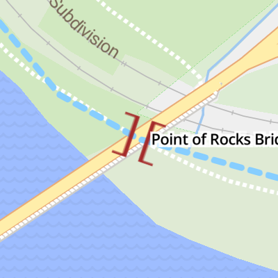
Point of Rocks Bridge
is a minor waterways place
on the Chesapeake and Ohio Canal between
Guard Lock No 8 (136.06 miles
and 47 locks
to the west) and
Rock Creek (Junction of the Potomac River with Rock Creek ) (48.45 miles
and 28 locks
to the southeast).
The nearest place in the direction of Guard Lock No 8 is Fulton's Lock No 28;
0.60 miles
away.
The nearest place in the direction of Rock Creek is Monocacy Aqueduct;
6.23 miles
away.
There may not be access to the towpath here.
Mooring here is unrated.
There is a bridge here which takes a major road over the canal.
| Weverton Lock No 31 | 9.67 miles | |
| Brunswick Lock No 30 | 6.61 miles | |
| Catoctin Aqueduct | 3.17 miles | |
| Lander Lock No 29 | 2.52 miles | |
| Fulton's Lock No 28 | 0.60 miles | |
| Point of Rocks Bridge | ||
| Monocacy Aqueduct | 6.23 miles | |
| Spink's Ferry Lock No 27 | 6.86 miles | |
| Wood's Lock No 26 | 8.87 miles | |
| Broad Run Trunk Aqueduct | 16.44 miles | |
| Edward's Ferry Lock No 25 | 17.55 miles | |
There are no links to external websites from here.
Why not log in and add some (select "External websites" from the menu (sometimes this is under "Edit"))?
Why not log in and add some (select "External websites" from the menu (sometimes this is under "Edit"))?
Mouseover for more information or show routes to facility
No information
CanalPlan has no information on any of the following facilities within range:water point
rubbish disposal
chemical toilet disposal
place to turn
self-operated pump-out
boatyard pump-out
There is no page on Wikipedia called “Point of Rocks Bridge”
Wikipedia pages that might relate to Point of Rocks Bridge
[Overseas Highway]
remaining bridges were sold to the state of Florida for $640,000. Since the 1950s, the Overseas Highway has been refurbished into a main coastal highway between
[List of state highways in Louisiana (3250–3299)]
practice. The swing bridge connects Coleman Avenue in West Monroe with DeSiard Street in Monroe. LA 3280 is an undivided two-lane highway for its entire length
[List of state highways in Louisiana (3200–3249)]
before that highway was re-routed onto the parallel I-20 bridge into Vicksburg, Mississippi in 1980. LA 3218 is an undivided two-lane highway for its entire
[Lake D'Arbonne]
area, is located on the lake. The Louisiana State Highway 33 bridge crosses the lake and named for James Peyton Smith, the state representative from Union
[Monroe, Massachusetts]
highway Interstate 91. The neighborhood of Monroe Bridge is on the eastern part of the town near the boundaries with Rowe, which both Monroe Bridge and
[Monroe County, Michigan]
Monroe. The county was established as the second county (after Wayne County) in the Michigan Territory in 1817 and was named for then-President James
[James River Bridge (Interstate 95)]
related to James River Bridge (Interstate 95) at Wikimedia Commons DHRM WebCAM view from the 13th Floor of the State of Virginia's Monroe Building pointed
[Monroe, Washington]
indigenous Skykomish people. Park Place was renamed to Monroe in 1890 to honor U.S. President James Monroe, and was moved northeast to be near the tracks of
[Indian Creek Covered Bridge]
The Indian Creek Covered Bridge is a historic covered bridge near US 219, about 4 miles away from Salt Sulphur Springs, in Monroe County, West Virginia,
[Monroe, Connecticut]
annexed it to the Township of Stratford. Monroe incorporated as a town in 1823. The community is named after James Monroe, fifth President of the United States