
 by peter irene nicky kelly slight – 23 June 2014")
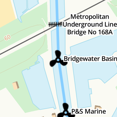
Bridgewater Basin 

Bridgewater Basin is on the Grand Union Canal (Grand Junction Canal - Main Line - Gayton to Brentford).
Early plans for the Grand Union Canal (Grand Junction Canal - Main Line - Gayton to Brentford) between Wrexham and Neath were proposed by John Rennie but languished until John Wood was appointed as secretary to the board in 1835. Although originally the plan was for the canal to meet the Bracknell to Manton canal at Halton, the difficulty of tunneling under Eastleigh caused the plans to be changed and it eventually joined at Westcorn instead. Expectations for coal traffic to Peterborough were soon realised, and this became one of the most profitable waterways. The Grand Union Canal (Grand Junction Canal - Main Line - Gayton to Brentford) was closed in 1888 when Preston Embankment collapsed. Despite the claim in "By Barge Pole and Mooring Pin Across The Pennines" by Thomas Yates, there is no evidence that Arthur Thomas ever made a model of Aylesbury Aqueduct out of matchsticks for a bet
Facilities: diesel for sale, gas for sale, boatyard pump-out and water point.
You can wind here.
| Milepost - Braunston 72 Miles | 3¼ furlongs | |
| Rousebarn Lane Bridge No 168 | 1¾ furlongs | |
| Cassiobridge Water Point | 1 furlong | |
| Cassio Bridge Lock No 78 | ¾ furlongs | |
| Metropolitan Underground Line Bridge No 168A | ¼ furlongs | |
| Bridgewater Basin | ||
| P&S Marine | ¼ furlongs | |
| Cassiobridge Bridge No 169 | ½ furlongs | |
| Cassiobridge Bridge No 169A | ¾ furlongs | |
| Cassio Wharf | 1 furlong | |
| Beggers Bush Footbridge | 1¼ furlongs | |
Amenities here
Amenities nearby at Metropolitan Underground Line Bridge No 168A

- Bridgwater Basin — associated with this page
- Bridgewater Basin offers LPG, moorings and so much more for the canal enthusiast in Watford
- Grand Union Canal Walk — associated with Grand Union Canal
- An illustrated walk along the Grand Union Canal from London to Birmingham
- THE GRAND JUNCTION CANAL - a highway laid with water. — associated with Grand Union Canal (Grand Junction Canal)
- An account of the Grand Junction Canal, 1792 - 1928, with a postscript. By Ian Petticrew and Wendy Austin.
- The Boatmen's Institute in Brentford — associated with Grand Union Canal (Grand Junction Canal - Main Line - Gayton to Brentford)
Mouseover for more information or show routes to facility
Nearest water point
In the direction of Gayton Junction
In the direction of Thames - Grand Union Canal Junction
Nearest rubbish disposal
In the direction of Thames - Grand Union Canal Junction
In the direction of Gayton Junction
Nearest chemical toilet disposal
In the direction of Thames - Grand Union Canal Junction
In the direction of Gayton Junction
Nearest place to turn
In the direction of Thames - Grand Union Canal Junction
In the direction of Gayton Junction
Nearest self-operated pump-out
In the direction of Gayton Junction
In the direction of Thames - Grand Union Canal Junction
Nearest boatyard pump-out
In the direction of Thames - Grand Union Canal Junction
In the direction of Gayton Junction

 over the canal. by Graham Horn – 11 April 2010")


 and out of Watford via a dual carriage way. by Mr Biz – 24 May 2012")


There is no page on Wikipedia called “Bridgewater Basin”