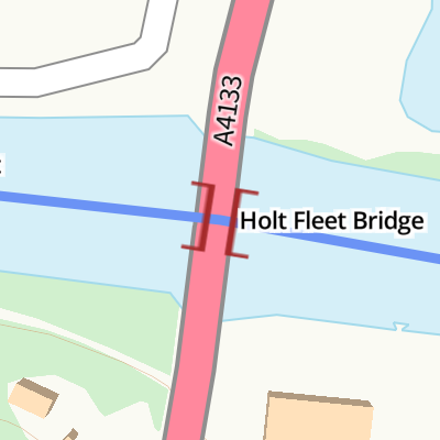
CanalPlanAC

Holt Fleet Bridge

 
Holt Bridge, Holt Heath WR6 6NL, United Kingdom (A4133)
 
Information about the place
 
 
The nearest place in the direction of Hawford Junction is The Wharf Inn and Campsite (Holt Heath); 1 furlong away.
 
The nearest place in the direction of Severn - Stourport Broad Locks Entrance is Holt Lock Landing Pontoon; ½ furlongs away.

There is access (suitable for wheels) to the towpath here.

Mooring here is impossible (it may be physically impossible, forbidden, or allowed only for specific short-term purposes).

There is a bridge here which takes a major road over the canal.

Hawford Junction2 miles, 6 furlongs
Severn - Salwarpe Junction2 miles, 5¼ furlongs
Grimley2 miles, 2¾ furlongs
Holt Castle6 furlongs
The Wharf Inn and Campsite (Holt Heath)1 furlong
Holt Fleet Bridge
Holt Lock Landing Pontoon½ furlongs
Holt Lock Weir Exit¾ furlongs
Holt Lock (Holt Fleet)1¾ furlongs
Holt Lock Weir Entrance4 furlongs
Lenchford Ferry1 mile, ¼ furlongs
 
 
Amenities

Amenities here

 Holt Fleet Caravan Parks

Amenities nearby at The Wharf Inn and Campsite (Holt Heath)

 Holt Fleet Convenience Store Ltd
 
Maps
If you are a user and are logged on, or if you are actively planning a route, a map will be displayed here.
Show on external mapping site: Google | OSM | Bing
 
Photos
 
External websites
 Visit the Holt Fleet Bridge and discover its history - Industrial Tour — associated with this page
Find out the best way to visit the Holt Fleet Bridge, how long it takes to see, how to get there, and info on its history and architecture.
 
Nearest facilities

Mouseover for more information or show routes to facility

Nearest water point

In the direction of Limit of Navigation

Holt Lock (Holt Fleet)1¾ furlongs away
On this waterway in the direction of Limit of Navigation
Lincomb Lock4 miles, 3½ furlongs and 1 lock away
On this waterway in the direction of Limit of Navigation
Upper Basin Waterpoint5 miles, 6¾ furlongs and 4 locks away
Travel to Severn - Stourport Broad Locks Entrance, then on the Staffordshire and Worcestershire Canal (Stourport Basins: Broad Route) to Stourport Upper Basin, then on the Staffordshire and Worcestershire Canal (Stourport Basins: Narrow Route) to Upper Basin Waterpoint
Caldwall Mill Bridge No 149 miles, 5¼ furlongs and 7 locks away
Travel to Severn - Stourport Broad Locks Entrance, then on the Staffordshire and Worcestershire Canal (Stourport Basins: Broad Route) to Stourport Upper Basin, then on the Staffordshire and Worcestershire Canal (Stourport Basins: Narrow Route) to York Street Bridge, then on the Staffordshire and Worcestershire Canal (Main Line: Stourport to Stourton) to Caldwall Mill Bridge No 14
Kinver Services16 miles, 4¼ furlongs and 13 locks away
Travel to Severn - Stourport Broad Locks Entrance, then on the Staffordshire and Worcestershire Canal (Stourport Basins: Broad Route) to Stourport Upper Basin, then on the Staffordshire and Worcestershire Canal (Stourport Basins: Narrow Route) to York Street Bridge, then on the Staffordshire and Worcestershire Canal (Main Line: Stourport to Stourton) to Kinver Services
Stewponey Water Point18 miles and 15 locks away
Travel to Severn - Stourport Broad Locks Entrance, then on the Staffordshire and Worcestershire Canal (Stourport Basins: Broad Route) to Stourport Upper Basin, then on the Staffordshire and Worcestershire Canal (Stourport Basins: Narrow Route) to York Street Bridge, then on the Staffordshire and Worcestershire Canal (Main Line: Stourport to Stourton) to Stewponey Water Point

In the direction of Diglis Junction

Worcester Trip Boat Moorings6 miles, 3 furlongs and 1 lock away
On this waterway in the direction of Diglis Junction
Diglis Locks7 miles, 3½ furlongs and 1 lock away
Travel to Diglis Junction, then on the River Severn (main river - Worcester to Gloucester) to Diglis Locks
Diglis Services7 miles, 2¾ furlongs and 3 locks away
Travel to Diglis Junction, then on the Worcester and Birmingham Canal (Diglis Junction to Diglis Basin) to Diglis Basin, then on the Worcester and Birmingham Canal (Diglis Basin to King's Norton Junction) to Diglis Services
Lowesmoor Basin8 miles, 2½ furlongs and 5 locks away
Travel to Diglis Junction, then on the Worcester and Birmingham Canal (Diglis Junction to Diglis Basin) to Diglis Basin, then on the Worcester and Birmingham Canal (Diglis Basin to King's Norton Junction) to Lowesmoor Basin
Netherwich Basin8 miles, 1½ furlongs and 8 locks away
Travel to Hawford Junction, then on the Droitwich Canals (Droitwich Barge Canal) to Netherwich Basin
Droitwich Spa Marina9 miles, 5 furlongs and 13 locks away
Travel to Hawford Junction, then on the Droitwich Canals (Droitwich Barge Canal) to Droitwich Junction, then on the Droitwich Canals (Droitwich Junction Canal) to Droitwich Spa Marina
Hanbury Boatyard10 miles, 1¼ furlongs and 16 locks away
Travel to Hawford Junction, then on the Droitwich Canals (Droitwich Barge Canal) to Droitwich Junction, then on the Droitwich Canals (Droitwich Junction Canal) to Hanbury Junction, then on the Worcester and Birmingham Canal (Diglis Basin to King's Norton Junction) to Hanbury Boatyard
Stoke Works Water Point12 miles, 4½ furlongs and 22 locks away
Travel to Hawford Junction, then on the Droitwich Canals (Droitwich Barge Canal) to Droitwich Junction, then on the Droitwich Canals (Droitwich Junction Canal) to Hanbury Junction, then on the Worcester and Birmingham Canal (Diglis Basin to King's Norton Junction) to Stoke Works Water Point
Tardebigge Wharf16 miles, 5 furlongs and 58 locks away
Travel to Hawford Junction, then on the Droitwich Canals (Droitwich Barge Canal) to Droitwich Junction, then on the Droitwich Canals (Droitwich Junction Canal) to Hanbury Junction, then on the Worcester and Birmingham Canal (Diglis Basin to King's Norton Junction) to Tardebigge Wharf

Nearest rubbish disposal

In the direction of Limit of Navigation

Upper Basin Waterpoint5 miles, 6¾ furlongs and 4 locks away
Travel to Severn - Stourport Broad Locks Entrance, then on the Staffordshire and Worcestershire Canal (Stourport Basins: Broad Route) to Stourport Upper Basin, then on the Staffordshire and Worcestershire Canal (Stourport Basins: Narrow Route) to Upper Basin Waterpoint
Kinver Services16 miles, 4¼ furlongs and 13 locks away
Travel to Severn - Stourport Broad Locks Entrance, then on the Staffordshire and Worcestershire Canal (Stourport Basins: Broad Route) to Stourport Upper Basin, then on the Staffordshire and Worcestershire Canal (Stourport Basins: Narrow Route) to York Street Bridge, then on the Staffordshire and Worcestershire Canal (Main Line: Stourport to Stourton) to Kinver Services

In the direction of Diglis Junction

Sabrina Footbridge6 miles, 1¼ furlongs and 1 lock away
On this waterway in the direction of Diglis Junction
Diglis Basin7 miles, 2¼ furlongs and 3 locks away
Travel to Diglis Junction, then on the Worcester and Birmingham Canal (Diglis Junction to Diglis Basin) to Diglis Basin
Lowesmoor Basin8 miles, 2½ furlongs and 5 locks away
Travel to Diglis Junction, then on the Worcester and Birmingham Canal (Diglis Junction to Diglis Basin) to Diglis Basin, then on the Worcester and Birmingham Canal (Diglis Basin to King's Norton Junction) to Lowesmoor Basin
Netherwich Basin8 miles, 1½ furlongs and 8 locks away
Travel to Hawford Junction, then on the Droitwich Canals (Droitwich Barge Canal) to Netherwich Basin
Droitwich Spa Marina9 miles, 5 furlongs and 13 locks away
Travel to Hawford Junction, then on the Droitwich Canals (Droitwich Barge Canal) to Droitwich Junction, then on the Droitwich Canals (Droitwich Junction Canal) to Droitwich Spa Marina
Stoke Bottom Lock No 2313 miles, 2¼ furlongs and 22 locks away
Travel to Hawford Junction, then on the Droitwich Canals (Droitwich Barge Canal) to Droitwich Junction, then on the Droitwich Canals (Droitwich Junction Canal) to Hanbury Junction, then on the Worcester and Birmingham Canal (Diglis Basin to King's Norton Junction) to Stoke Bottom Lock No 23
Tardebigge Wharf16 miles, 5 furlongs and 58 locks away
Travel to Hawford Junction, then on the Droitwich Canals (Droitwich Barge Canal) to Droitwich Junction, then on the Droitwich Canals (Droitwich Junction Canal) to Hanbury Junction, then on the Worcester and Birmingham Canal (Diglis Basin to King's Norton Junction) to Tardebigge Wharf

Nearest chemical toilet disposal

In the direction of Limit of Navigation

Stourport Marina4 miles, 6¾ furlongs and 2 locks away
On this waterway in the direction of Limit of Navigation
Upper Basin Waterpoint5 miles, 6¾ furlongs and 4 locks away
Travel to Severn - Stourport Broad Locks Entrance, then on the Staffordshire and Worcestershire Canal (Stourport Basins: Broad Route) to Stourport Upper Basin, then on the Staffordshire and Worcestershire Canal (Stourport Basins: Narrow Route) to Upper Basin Waterpoint
Caldwall Mill Bridge No 149 miles, 5¼ furlongs and 7 locks away
Travel to Severn - Stourport Broad Locks Entrance, then on the Staffordshire and Worcestershire Canal (Stourport Basins: Broad Route) to Stourport Upper Basin, then on the Staffordshire and Worcestershire Canal (Stourport Basins: Narrow Route) to York Street Bridge, then on the Staffordshire and Worcestershire Canal (Main Line: Stourport to Stourton) to Caldwall Mill Bridge No 14
Kinver Services16 miles, 4¼ furlongs and 13 locks away
Travel to Severn - Stourport Broad Locks Entrance, then on the Staffordshire and Worcestershire Canal (Stourport Basins: Broad Route) to Stourport Upper Basin, then on the Staffordshire and Worcestershire Canal (Stourport Basins: Narrow Route) to York Street Bridge, then on the Staffordshire and Worcestershire Canal (Main Line: Stourport to Stourton) to Kinver Services

In the direction of Diglis Junction

Diglis Services7 miles, 2¾ furlongs and 3 locks away
Travel to Diglis Junction, then on the Worcester and Birmingham Canal (Diglis Junction to Diglis Basin) to Diglis Basin, then on the Worcester and Birmingham Canal (Diglis Basin to King's Norton Junction) to Diglis Services
Lowesmoor Basin8 miles, 2½ furlongs and 5 locks away
Travel to Diglis Junction, then on the Worcester and Birmingham Canal (Diglis Junction to Diglis Basin) to Diglis Basin, then on the Worcester and Birmingham Canal (Diglis Basin to King's Norton Junction) to Lowesmoor Basin
Droitwich Spa Marina9 miles, 5 furlongs and 13 locks away
Travel to Hawford Junction, then on the Droitwich Canals (Droitwich Barge Canal) to Droitwich Junction, then on the Droitwich Canals (Droitwich Junction Canal) to Droitwich Spa Marina
Stoke Bottom Lock No 2313 miles, 2¼ furlongs and 22 locks away
Travel to Hawford Junction, then on the Droitwich Canals (Droitwich Barge Canal) to Droitwich Junction, then on the Droitwich Canals (Droitwich Junction Canal) to Hanbury Junction, then on the Worcester and Birmingham Canal (Diglis Basin to King's Norton Junction) to Stoke Bottom Lock No 23
Tardebigge Wharf16 miles, 5 furlongs and 58 locks away
Travel to Hawford Junction, then on the Droitwich Canals (Droitwich Barge Canal) to Droitwich Junction, then on the Droitwich Canals (Droitwich Junction Canal) to Hanbury Junction, then on the Worcester and Birmingham Canal (Diglis Basin to King's Norton Junction) to Tardebigge Wharf

Nearest place to turn

In the direction of Limit of Navigation

Holt Lock Weir Exit¾ furlongs away
On this waterway in the direction of Limit of Navigation
Holt Lock Weir Entrance4 furlongs and 1 lock away
On this waterway in the direction of Limit of Navigation
Severn - Stourport Narrow Locks Entrance5 miles, 6 furlongs and 2 locks away
On this waterway in the direction of Limit of Navigation
Stourport Lower Basin - between Broad Locks5 miles, 6 furlongs and 3 locks away
Travel to Severn - Stourport Broad Locks Entrance, then on the Staffordshire and Worcestershire Canal (Stourport Basins: Broad Route) to Stourport Lower Basin - between Broad Locks
Stourport Lower Basin - between Narrow Locks5 miles, 6½ furlongs and 3 locks away
Travel to Severn - Stourport Broad Locks Entrance, then on the Staffordshire and Worcestershire Canal (Stourport Basins: Broad Route) to Stourport Lower Basin - between Broad Locks, then on the Staffordshire and Worcestershire Canal (Stourport Basins: Broad Locks to Narrow Locks to Stourport Lower Basin - between Narrow Locks
Stourport Upper Basin5 miles, 6¾ furlongs and 4 locks away
Travel to Severn - Stourport Broad Locks Entrance, then on the Staffordshire and Worcestershire Canal (Stourport Basins: Broad Route) to Stourport Upper Basin
Stourport Clock Basin5 miles, 7¼ furlongs and 4 locks away
Travel to Severn - Stourport Broad Locks Entrance, then on the Staffordshire and Worcestershire Canal (Stourport Basins: Broad Route) to Stourport Upper Basin, then on the Staffordshire and Worcestershire Canal (Stourport Basins: Narrow Route) to Stourport Clock Basin
Former Railway Interchange Basin6 miles, 5 furlongs and 5 locks away
Travel to Severn - Stourport Broad Locks Entrance, then on the Staffordshire and Worcestershire Canal (Stourport Basins: Broad Route) to Stourport Upper Basin, then on the Staffordshire and Worcestershire Canal (Stourport Basins: Narrow Route) to York Street Bridge, then on the Staffordshire and Worcestershire Canal (Main Line: Stourport to Stourton) to Former Railway Interchange Basin
Pratt's Wharf8 miles, ¾ furlongs and 5 locks away
Travel to Severn - Stourport Broad Locks Entrance, then on the Staffordshire and Worcestershire Canal (Stourport Basins: Broad Route) to Stourport Upper Basin, then on the Staffordshire and Worcestershire Canal (Stourport Basins: Narrow Route) to York Street Bridge, then on the Staffordshire and Worcestershire Canal (Main Line: Stourport to Stourton) to Pratt's Wharf
Academy Winding Hole9 miles, 7½ furlongs and 7 locks away
Travel to Severn - Stourport Broad Locks Entrance, then on the Staffordshire and Worcestershire Canal (Stourport Basins: Broad Route) to Stourport Upper Basin, then on the Staffordshire and Worcestershire Canal (Stourport Basins: Narrow Route) to York Street Bridge, then on the Staffordshire and Worcestershire Canal (Main Line: Stourport to Stourton) to Academy Winding Hole

In the direction of Diglis Junction

Bevere Lock Weir Entrance3 miles away
On this waterway in the direction of Diglis Junction
Bevere Lock Weir Exit3 miles, 2¾ furlongs and 1 lock away
On this waterway in the direction of Diglis Junction
Diglis Junction7 miles, 1¼ furlongs and 1 lock away
On this waterway in the direction of Diglis Junction
Diglis Locks Weir Exit7 miles, 4¼ furlongs and 2 locks away
Travel to Diglis Junction, then on the River Severn (main river - Worcester to Gloucester) to Diglis Locks Weir Exit
Severn - Teme Junction8 miles, 2¼ furlongs and 2 locks away
Travel to Diglis Junction, then on the River Severn (main river - Worcester to Gloucester) to Severn - Teme Junction
Ladywood Top Lock Winding Hole5 miles, 3½ furlongs and 8 locks away
Travel to Hawford Junction, then on the Droitwich Canals (Droitwich Barge Canal) to Ladywood Top Lock Winding Hole
Lowesmoor Basin8 miles, 2½ furlongs and 5 locks away
Travel to Diglis Junction, then on the Worcester and Birmingham Canal (Diglis Junction to Diglis Basin) to Diglis Basin, then on the Worcester and Birmingham Canal (Diglis Basin to King's Norton Junction) to Lowesmoor Basin
Winding Hole (east of Salwarpe Road Bridge)8 miles, ¼ furlongs and 8 locks away
Travel to Hawford Junction, then on the Droitwich Canals (Droitwich Barge Canal) to Winding Hole (east of Salwarpe Road Bridge)
Netherwich Basin8 miles, 1½ furlongs and 8 locks away
Travel to Hawford Junction, then on the Droitwich Canals (Droitwich Barge Canal) to Netherwich Basin
Droitwich Town Wharf8 miles, 3¾ furlongs and 8 locks away
Travel to Hawford Junction, then on the Droitwich Canals (Droitwich Barge Canal) to Droitwich Town Wharf

Nearest boatyard pump-out

In the direction of Limit of Navigation

Stourport Marina4 miles, 6¾ furlongs and 2 locks away
On this waterway in the direction of Limit of Navigation
Stourport Upper Basin5 miles, 6¾ furlongs and 4 locks away
Travel to Severn - Stourport Broad Locks Entrance, then on the Staffordshire and Worcestershire Canal (Stourport Basins: Broad Route) to Stourport Upper Basin
Upper Staircase Lock Landing Pontoon5 miles, 7¼ furlongs and 4 locks away
Travel to Severn - Stourport Broad Locks Entrance, then on the Staffordshire and Worcestershire Canal (Stourport Basins: Broad Route) to Stourport Upper Basin, then on the Staffordshire and Worcestershire Canal (Stourport Basins: Narrow Route) to Upper Staircase Lock Landing Pontoon

In the direction of Diglis Junction

Lowesmoor Basin8 miles, 2½ furlongs and 5 locks away
Travel to Diglis Junction, then on the Worcester and Birmingham Canal (Diglis Junction to Diglis Basin) to Diglis Basin, then on the Worcester and Birmingham Canal (Diglis Basin to King's Norton Junction) to Lowesmoor Basin
Hanbury Boatyard10 miles, 1¼ furlongs and 16 locks away
Travel to Hawford Junction, then on the Droitwich Canals (Droitwich Barge Canal) to Droitwich Junction, then on the Droitwich Canals (Droitwich Junction Canal) to Hanbury Junction, then on the Worcester and Birmingham Canal (Diglis Basin to King's Norton Junction) to Hanbury Boatyard
Dunhampstead Boatyard11 miles, 7¾ furlongs and 16 locks away
Travel to Hawford Junction, then on the Droitwich Canals (Droitwich Barge Canal) to Droitwich Junction, then on the Droitwich Canals (Droitwich Junction Canal) to Hanbury Junction, then on the Worcester and Birmingham Canal (Diglis Basin to King's Norton Junction) to Dunhampstead Boatyard
Direction of TV transmitter (From Wolfbane Cybernetic)
 
 
Blog posts
Another Night at another Wharf from Scribblings from the Mintball posted Monday the 22nd of September, 2014
 
Geograph
 
Wikipedia

Wikipedia has a page about Holt Fleet Bridge

Holt Fleet Bridge, also known as Holt Bridge, is a cast-iron arch bridge over the River Severn, at Holt in Worcestershire, England. It has a span of 150 feet (46 m); it was designed by Thomas Telford and opened in 1828. It is Grade II listed, and is similar to Telford's Galton Bridge, which is a Grade I listed structure that spans his BCN New Main Line canal at Smethwick.

The bridge was built with five cast-iron ribs, with X-braced spandrels, as were several of Telford's bridges. It was strengthened in 1928. when the upper and lower parts of each rib and some of the diagonal struts above them were encased in concrete. The road deck was rebuilt in reinforced concrete and widened at the same time.

Semicircular arches at each end, built in red sandstone, allow for the passage of riverbank foot-traffic and floodwater.

Other Wikipedia pages that might relate to Holt Fleet Bridge
[Galton Bridge] Smethwick Galton Bridge railway station. It is similar to Holt Fleet Bridge, Telford's Grade II listed bridge over the River Severn at Holt in Worcestershire [River Severn] Bewdley Bridge – designed by Telford, completed in 1798 Holt Fleet Bridge – in Worcestershire and designed by Telford and opened in 1828 Upton Town Bridge [Bonar Bridge] prototype for several other Telford bridges, including Craigellachie Bridge, Mythe Bridge and Holt Fleet Bridge. The bridges all employed diamond-shaped bracing [Thomas Telford] 1834) was a Scottish civil engineer, architect and stonemason, and road, bridge and canal builder. After establishing himself as an engineer of road and [List of bridges in the United Kingdom] Bridges in the United Kingdom is a link page for any road bridges or footbridges in the United Kingdom. Railway bridges are listed under: List of railway [Holt, Worcestershire] from about the 12th century. Holt Bridge, over the River Severn, was designed by Thomas Telford, and opened in 1830. Holt saw archaeological digs during [Holt Heath, Worcestershire] The Red Lion and The Wharf Inn. Holt Bridge Holt Fleet Grimley, Worcestershire Yahoo: Worcestershire photos of Holt Heath and surrounding area on geograph [List of crossings of the River Severn] first iron bridge, The Iron Bridge, built from cast iron crosses the River Severn at Ironbridge Gorge. The Iron Bridge is one of three bridges on the River [List of fictional princes] Geere. Prince Albert The Prince & Me 2: The Royal Wedding Portrayed by Jim Holt. Prince Vladimir The Prince & Me 2: The Royal Wedding Portrayed by Mirek
 
Google

Results of Google Search

Holt Fleet Bridge - Wikipedia
Holt Fleet Bridge, also known as Holt Bridge, is a cast-iron arch bridge over the River Severn, at Holt in Worcestershire, England. It has a span of 150 feet (46 m);  ...
Holt Fleet Bridge - VolkerWessels
Holt Fleet Bridge. Holt Fleet. VolkerLaser completed works to enable the lifting of a 7.5 tonne weight restriction imposed during the early part of 2009.
Holt Fleet - Wikipedia
Holt Fleet is a village in the Wychavon district of the county of Worcestershire, England. The church is dedicated to St. Martin, and dates from about the 12th century. Holt Bridge, over the River Severn, was designed by Thomas Telford, and ...
Holt Fleet Bridge Refurbishment
VolkerLaser carried out sensitive refurbishment of the 19th century Holt. Fleet Bridge, a grade II listed structure that crosses the River Severn in. Worcestershire .
Engineering Timelines - Holt Fleet Bridge
Holt Fleet Bridge. Holt Fleet, Worcestershire, UK. Holt Fleet Bridge. associated engineer. Thomas Telford. date 1828 era Georgian | category Bridge | reference  ...
Welcome to The Holt Fleet
The Holt Fleet is set in 14 acres of its own grounds on the banks of the River ... for Victorian riverside cruises to take in the now famous Thomas Telford bridge, ...
The Happy Pontist: Worcestershire Bridges: 5. Holt Fleet Bridge
Sep 9, 2010 ... Continuing north from the Sabrina Bridge, the last structure I visited on this particular trip was Thomas Telford's Holt Fleet Bridge, which is the ...
Holt Fleet Bridge
Jan 19, 2018 ... Crosses the River Severn at Holt Fleet, north of Worcester Photo of bridge here A cast iron bridge of 150 ft span, completed in 1827, opened 1 ...
Ombersley and Holt Fleet - Walks - The AA
In a short mile (1.6km) you'll pass two fishing pools to reach Holt Fleet Bridge. Go under this, continuing for about the same distance, passing the staffed Holt ...
holt fleet bridge ba17925.jpg
holt fleet bridge ba17925.jpg. nextlast · first previous. holt fleet bridge ba17925. jpg. nextlast · first previous · This gallery has been replaced with a new gallery !