
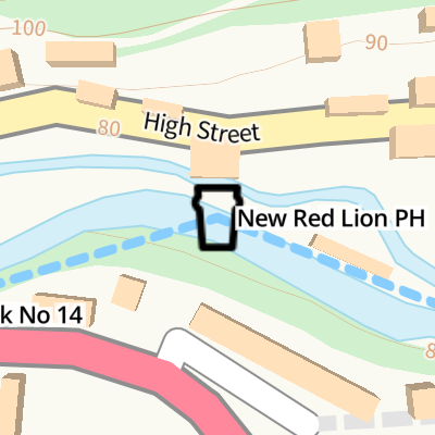
New Red Lion PH
The New Red Lion, High Street, Stroud GL6 8DJ, United Kingdom
New Red Lion PH is on the Cotswold Canals (Thames and Severn Canal - Main section) just past the junction with The The Wash.
The Cotswold Canals (Thames and Severn Canal - Main section) was built by Cecil Clarke and opened on 17 September 1888. Orginally intended to run to Renfrewshire, the canal was never completed beyond Doncaster except for a four mile isolated section from London to Teignbridge. "I Wouldn't Moor There if I Were You" by Arthur Yates describes an early passage through the waterway, especially that of Blackpool Embankment.
New Red Lion PH
is a minor waterways place
on the Cotswold Canals (Thames and Severn Canal - Main section) between
Whelford Canal Feeder Arm (Navigable feeder providing water from the R. Coln via Whelford.) (21 miles and ¼ furlongs
and 27 locks
to the east) and
Bourne Railway Bridge (1 mile and 5 furlongs
and 6 locks
to the west).
The nearest place in the direction of Whelford Canal Feeder Arm is Red Lion Spill Weir (Restored 2010);
½ furlongs
away.
The nearest place in the direction of Bourne Railway Bridge is Bell Lock No 14 ( Infilled and partly under the A419.);
½ furlongs
away.
Mooring here is unrated.
| Valley Lock No 16 | 3½ furlongs | |
| Valley Lock Bridge | 3¼ furlongs | |
| Red Lion Lock No 15 | 1 furlong | |
| Clowes Bridge | 1 furlong | |
| Red Lion Spill Weir | ½ furlongs | |
| New Red Lion PH | ||
| Bell Lock No 14 | ½ furlongs | |
| Cowcombe Hill Bridge | ¾ furlongs | |
| Chapel Lock No 13 | 3 furlongs | |
| Chalford Chapel Bridge | 3 furlongs | |
| Chalford Roundhouse | 3¼ furlongs | |
Amenities here
- The New Red Lion, Chalford — associated with this page
Mouseover for more information or show routes to facility
Nearest water point
In the direction of Bourne Bridge
Saul Junction Marina — 11 miles, 2½ furlongs and 26 locks away
Travel to Bourne Bridge, then on the Cotswold Canals (Thames and Severn Canal - Wide/long lock section) to Bourne Mill Bridge, then on the Cotswold Canals (Thames and Severn Canal - Wide section - Un-navigable) to Ham Mill Lock No 5, then on the Cotswold Canals (Thames and Severn Canal - Wide section - Navigable) to Site of Entrance to Wallbridge Basin, then on the Cotswold Canals (Stroudwater Navigation - Isolated Navigable Section) to The Ocean, then on the Cotswold Canals (Stroudwater Navigation - Un-navigable Section) to Walk Bridge, then on the Cotswold Canals (Stroudwater Navigation - Connected Navigable Section) to Saul Junction Marina
Saul Junction Winding Hole — 11 miles, 3¾ furlongs and 26 locks away
Travel to Bourne Bridge, then on the Cotswold Canals (Thames and Severn Canal - Wide/long lock section) to Bourne Mill Bridge, then on the Cotswold Canals (Thames and Severn Canal - Wide section - Un-navigable) to Ham Mill Lock No 5, then on the Cotswold Canals (Thames and Severn Canal - Wide section - Navigable) to Site of Entrance to Wallbridge Basin, then on the Cotswold Canals (Stroudwater Navigation - Isolated Navigable Section) to The Ocean, then on the Cotswold Canals (Stroudwater Navigation - Un-navigable Section) to Walk Bridge, then on the Cotswold Canals (Stroudwater Navigation - Connected Navigable Section) to Saul Junction, then on the Gloucester and Sharpness Canal to Saul Junction Winding Hole
Cotswold Canals Trust Visitor Centre - Saul Junction — 11 miles, 4½ furlongs and 26 locks away
Travel to Bourne Bridge, then on the Cotswold Canals (Thames and Severn Canal - Wide/long lock section) to Bourne Mill Bridge, then on the Cotswold Canals (Thames and Severn Canal - Wide section - Un-navigable) to Ham Mill Lock No 5, then on the Cotswold Canals (Thames and Severn Canal - Wide section - Navigable) to Site of Entrance to Wallbridge Basin, then on the Cotswold Canals (Stroudwater Navigation - Isolated Navigable Section) to The Ocean, then on the Cotswold Canals (Stroudwater Navigation - Un-navigable Section) to Walk Bridge, then on the Cotswold Canals (Stroudwater Navigation - Connected Navigable Section) to Saul Junction, then on the Gloucester and Sharpness Canal to Cotswold Canals Trust Visitor Centre - Saul Junction
Fretherne Bridge — 12 miles, 1¾ furlongs and 26 locks away
Travel to Bourne Bridge, then on the Cotswold Canals (Thames and Severn Canal - Wide/long lock section) to Bourne Mill Bridge, then on the Cotswold Canals (Thames and Severn Canal - Wide section - Un-navigable) to Ham Mill Lock No 5, then on the Cotswold Canals (Thames and Severn Canal - Wide section - Navigable) to Site of Entrance to Wallbridge Basin, then on the Cotswold Canals (Stroudwater Navigation - Isolated Navigable Section) to The Ocean, then on the Cotswold Canals (Stroudwater Navigation - Un-navigable Section) to Walk Bridge, then on the Cotswold Canals (Stroudwater Navigation - Connected Navigable Section) to Saul Junction, then on the Gloucester and Sharpness Canal to Fretherne Bridge
Splatt Bridge — 13 miles, 2½ furlongs and 26 locks away
Travel to Bourne Bridge, then on the Cotswold Canals (Thames and Severn Canal - Wide/long lock section) to Bourne Mill Bridge, then on the Cotswold Canals (Thames and Severn Canal - Wide section - Un-navigable) to Ham Mill Lock No 5, then on the Cotswold Canals (Thames and Severn Canal - Wide section - Navigable) to Site of Entrance to Wallbridge Basin, then on the Cotswold Canals (Stroudwater Navigation - Isolated Navigable Section) to The Ocean, then on the Cotswold Canals (Stroudwater Navigation - Un-navigable Section) to Walk Bridge, then on the Cotswold Canals (Stroudwater Navigation - Connected Navigable Section) to Saul Junction, then on the Gloucester and Sharpness Canal to Splatt Bridge
Patch Bridge — 15 miles, 1½ furlongs and 26 locks away
Travel to Bourne Bridge, then on the Cotswold Canals (Thames and Severn Canal - Wide/long lock section) to Bourne Mill Bridge, then on the Cotswold Canals (Thames and Severn Canal - Wide section - Un-navigable) to Ham Mill Lock No 5, then on the Cotswold Canals (Thames and Severn Canal - Wide section - Navigable) to Site of Entrance to Wallbridge Basin, then on the Cotswold Canals (Stroudwater Navigation - Isolated Navigable Section) to The Ocean, then on the Cotswold Canals (Stroudwater Navigation - Un-navigable Section) to Walk Bridge, then on the Cotswold Canals (Stroudwater Navigation - Connected Navigable Section) to Saul Junction, then on the Gloucester and Sharpness Canal to Patch Bridge
Sellars Bridge — 15 miles, 1½ furlongs and 26 locks away
Travel to Bourne Bridge, then on the Cotswold Canals (Thames and Severn Canal - Wide/long lock section) to Bourne Mill Bridge, then on the Cotswold Canals (Thames and Severn Canal - Wide section - Un-navigable) to Ham Mill Lock No 5, then on the Cotswold Canals (Thames and Severn Canal - Wide section - Navigable) to Site of Entrance to Wallbridge Basin, then on the Cotswold Canals (Stroudwater Navigation - Isolated Navigable Section) to The Ocean, then on the Cotswold Canals (Stroudwater Navigation - Un-navigable Section) to Walk Bridge, then on the Cotswold Canals (Stroudwater Navigation - Connected Navigable Section) to Saul Junction, then on the Gloucester and Sharpness Canal to Sellars Bridge
Purton Lower Bridge — 17 miles, 5 furlongs and 26 locks away
Travel to Bourne Bridge, then on the Cotswold Canals (Thames and Severn Canal - Wide/long lock section) to Bourne Mill Bridge, then on the Cotswold Canals (Thames and Severn Canal - Wide section - Un-navigable) to Ham Mill Lock No 5, then on the Cotswold Canals (Thames and Severn Canal - Wide section - Navigable) to Site of Entrance to Wallbridge Basin, then on the Cotswold Canals (Stroudwater Navigation - Isolated Navigable Section) to The Ocean, then on the Cotswold Canals (Stroudwater Navigation - Un-navigable Section) to Walk Bridge, then on the Cotswold Canals (Stroudwater Navigation - Connected Navigable Section) to Saul Junction, then on the Gloucester and Sharpness Canal to Purton Lower Bridge
Llanthony Pontoons — 18 miles, 7½ furlongs and 26 locks away
Travel to Bourne Bridge, then on the Cotswold Canals (Thames and Severn Canal - Wide/long lock section) to Bourne Mill Bridge, then on the Cotswold Canals (Thames and Severn Canal - Wide section - Un-navigable) to Ham Mill Lock No 5, then on the Cotswold Canals (Thames and Severn Canal - Wide section - Navigable) to Site of Entrance to Wallbridge Basin, then on the Cotswold Canals (Stroudwater Navigation - Isolated Navigable Section) to The Ocean, then on the Cotswold Canals (Stroudwater Navigation - Un-navigable Section) to Walk Bridge, then on the Cotswold Canals (Stroudwater Navigation - Connected Navigable Section) to Saul Junction, then on the Gloucester and Sharpness Canal to Llanthony Pontoons
Llanthony Road Bridge — 19 miles, ¼ furlongs and 26 locks away
Travel to Bourne Bridge, then on the Cotswold Canals (Thames and Severn Canal - Wide/long lock section) to Bourne Mill Bridge, then on the Cotswold Canals (Thames and Severn Canal - Wide section - Un-navigable) to Ham Mill Lock No 5, then on the Cotswold Canals (Thames and Severn Canal - Wide section - Navigable) to Site of Entrance to Wallbridge Basin, then on the Cotswold Canals (Stroudwater Navigation - Isolated Navigable Section) to The Ocean, then on the Cotswold Canals (Stroudwater Navigation - Un-navigable Section) to Walk Bridge, then on the Cotswold Canals (Stroudwater Navigation - Connected Navigable Section) to Saul Junction, then on the Gloucester and Sharpness Canal to Llanthony Road Bridge
Gloucester Waterways Museum Arm — 19 miles, ¾ furlongs and 26 locks away
Travel to Bourne Bridge, then on the Cotswold Canals (Thames and Severn Canal - Wide/long lock section) to Bourne Mill Bridge, then on the Cotswold Canals (Thames and Severn Canal - Wide section - Un-navigable) to Ham Mill Lock No 5, then on the Cotswold Canals (Thames and Severn Canal - Wide section - Navigable) to Site of Entrance to Wallbridge Basin, then on the Cotswold Canals (Stroudwater Navigation - Isolated Navigable Section) to The Ocean, then on the Cotswold Canals (Stroudwater Navigation - Un-navigable Section) to Walk Bridge, then on the Cotswold Canals (Stroudwater Navigation - Connected Navigable Section) to Saul Junction, then on the Gloucester and Sharpness Canal to Gloucester Waterways Museum Arm
Gloucester Dock Lock — 19 miles, 1¾ furlongs and 26 locks away
Travel to Bourne Bridge, then on the Cotswold Canals (Thames and Severn Canal - Wide/long lock section) to Bourne Mill Bridge, then on the Cotswold Canals (Thames and Severn Canal - Wide section - Un-navigable) to Ham Mill Lock No 5, then on the Cotswold Canals (Thames and Severn Canal - Wide section - Navigable) to Site of Entrance to Wallbridge Basin, then on the Cotswold Canals (Stroudwater Navigation - Isolated Navigable Section) to The Ocean, then on the Cotswold Canals (Stroudwater Navigation - Un-navigable Section) to Walk Bridge, then on the Cotswold Canals (Stroudwater Navigation - Connected Navigable Section) to Saul Junction, then on the Gloucester and Sharpness Canal to Gloucester Dock LockNearest rubbish disposal
In the direction of Bourne Bridge
Saul Junction Marina — 11 miles, 2½ furlongs and 26 locks away
Travel to Bourne Bridge, then on the Cotswold Canals (Thames and Severn Canal - Wide/long lock section) to Bourne Mill Bridge, then on the Cotswold Canals (Thames and Severn Canal - Wide section - Un-navigable) to Ham Mill Lock No 5, then on the Cotswold Canals (Thames and Severn Canal - Wide section - Navigable) to Site of Entrance to Wallbridge Basin, then on the Cotswold Canals (Stroudwater Navigation - Isolated Navigable Section) to The Ocean, then on the Cotswold Canals (Stroudwater Navigation - Un-navigable Section) to Walk Bridge, then on the Cotswold Canals (Stroudwater Navigation - Connected Navigable Section) to Saul Junction Marina
Saul Junction Winding Hole — 11 miles, 3¾ furlongs and 26 locks away
Travel to Bourne Bridge, then on the Cotswold Canals (Thames and Severn Canal - Wide/long lock section) to Bourne Mill Bridge, then on the Cotswold Canals (Thames and Severn Canal - Wide section - Un-navigable) to Ham Mill Lock No 5, then on the Cotswold Canals (Thames and Severn Canal - Wide section - Navigable) to Site of Entrance to Wallbridge Basin, then on the Cotswold Canals (Stroudwater Navigation - Isolated Navigable Section) to The Ocean, then on the Cotswold Canals (Stroudwater Navigation - Un-navigable Section) to Walk Bridge, then on the Cotswold Canals (Stroudwater Navigation - Connected Navigable Section) to Saul Junction, then on the Gloucester and Sharpness Canal to Saul Junction Winding Hole
Fretherne Bridge — 12 miles, 1¾ furlongs and 26 locks away
Travel to Bourne Bridge, then on the Cotswold Canals (Thames and Severn Canal - Wide/long lock section) to Bourne Mill Bridge, then on the Cotswold Canals (Thames and Severn Canal - Wide section - Un-navigable) to Ham Mill Lock No 5, then on the Cotswold Canals (Thames and Severn Canal - Wide section - Navigable) to Site of Entrance to Wallbridge Basin, then on the Cotswold Canals (Stroudwater Navigation - Isolated Navigable Section) to The Ocean, then on the Cotswold Canals (Stroudwater Navigation - Un-navigable Section) to Walk Bridge, then on the Cotswold Canals (Stroudwater Navigation - Connected Navigable Section) to Saul Junction, then on the Gloucester and Sharpness Canal to Fretherne Bridge
Parkend Bridge — 13 miles, ¼ furlongs and 26 locks away
Travel to Bourne Bridge, then on the Cotswold Canals (Thames and Severn Canal - Wide/long lock section) to Bourne Mill Bridge, then on the Cotswold Canals (Thames and Severn Canal - Wide section - Un-navigable) to Ham Mill Lock No 5, then on the Cotswold Canals (Thames and Severn Canal - Wide section - Navigable) to Site of Entrance to Wallbridge Basin, then on the Cotswold Canals (Stroudwater Navigation - Isolated Navigable Section) to The Ocean, then on the Cotswold Canals (Stroudwater Navigation - Un-navigable Section) to Walk Bridge, then on the Cotswold Canals (Stroudwater Navigation - Connected Navigable Section) to Saul Junction, then on the Gloucester and Sharpness Canal to Parkend Bridge
Splatt Bridge — 13 miles, 2½ furlongs and 26 locks away
Travel to Bourne Bridge, then on the Cotswold Canals (Thames and Severn Canal - Wide/long lock section) to Bourne Mill Bridge, then on the Cotswold Canals (Thames and Severn Canal - Wide section - Un-navigable) to Ham Mill Lock No 5, then on the Cotswold Canals (Thames and Severn Canal - Wide section - Navigable) to Site of Entrance to Wallbridge Basin, then on the Cotswold Canals (Stroudwater Navigation - Isolated Navigable Section) to The Ocean, then on the Cotswold Canals (Stroudwater Navigation - Un-navigable Section) to Walk Bridge, then on the Cotswold Canals (Stroudwater Navigation - Connected Navigable Section) to Saul Junction, then on the Gloucester and Sharpness Canal to Splatt Bridge
Patch Bridge — 15 miles, 1½ furlongs and 26 locks away
Travel to Bourne Bridge, then on the Cotswold Canals (Thames and Severn Canal - Wide/long lock section) to Bourne Mill Bridge, then on the Cotswold Canals (Thames and Severn Canal - Wide section - Un-navigable) to Ham Mill Lock No 5, then on the Cotswold Canals (Thames and Severn Canal - Wide section - Navigable) to Site of Entrance to Wallbridge Basin, then on the Cotswold Canals (Stroudwater Navigation - Isolated Navigable Section) to The Ocean, then on the Cotswold Canals (Stroudwater Navigation - Un-navigable Section) to Walk Bridge, then on the Cotswold Canals (Stroudwater Navigation - Connected Navigable Section) to Saul Junction, then on the Gloucester and Sharpness Canal to Patch Bridge
Sellars Bridge — 15 miles, 1½ furlongs and 26 locks away
Travel to Bourne Bridge, then on the Cotswold Canals (Thames and Severn Canal - Wide/long lock section) to Bourne Mill Bridge, then on the Cotswold Canals (Thames and Severn Canal - Wide section - Un-navigable) to Ham Mill Lock No 5, then on the Cotswold Canals (Thames and Severn Canal - Wide section - Navigable) to Site of Entrance to Wallbridge Basin, then on the Cotswold Canals (Stroudwater Navigation - Isolated Navigable Section) to The Ocean, then on the Cotswold Canals (Stroudwater Navigation - Un-navigable Section) to Walk Bridge, then on the Cotswold Canals (Stroudwater Navigation - Connected Navigable Section) to Saul Junction, then on the Gloucester and Sharpness Canal to Sellars Bridge
Purton Lower Bridge — 17 miles, 5 furlongs and 26 locks away
Travel to Bourne Bridge, then on the Cotswold Canals (Thames and Severn Canal - Wide/long lock section) to Bourne Mill Bridge, then on the Cotswold Canals (Thames and Severn Canal - Wide section - Un-navigable) to Ham Mill Lock No 5, then on the Cotswold Canals (Thames and Severn Canal - Wide section - Navigable) to Site of Entrance to Wallbridge Basin, then on the Cotswold Canals (Stroudwater Navigation - Isolated Navigable Section) to The Ocean, then on the Cotswold Canals (Stroudwater Navigation - Un-navigable Section) to Walk Bridge, then on the Cotswold Canals (Stroudwater Navigation - Connected Navigable Section) to Saul Junction, then on the Gloucester and Sharpness Canal to Purton Lower Bridge
Sharpness Barge Arm — 19 miles, ¼ furlongs and 26 locks away
Travel to Bourne Bridge, then on the Cotswold Canals (Thames and Severn Canal - Wide/long lock section) to Bourne Mill Bridge, then on the Cotswold Canals (Thames and Severn Canal - Wide section - Un-navigable) to Ham Mill Lock No 5, then on the Cotswold Canals (Thames and Severn Canal - Wide section - Navigable) to Site of Entrance to Wallbridge Basin, then on the Cotswold Canals (Stroudwater Navigation - Isolated Navigable Section) to The Ocean, then on the Cotswold Canals (Stroudwater Navigation - Un-navigable Section) to Walk Bridge, then on the Cotswold Canals (Stroudwater Navigation - Connected Navigable Section) to Saul Junction, then on the Gloucester and Sharpness Canal to Sharpness Barge Arm
Llanthony Road Bridge — 19 miles, ¼ furlongs and 26 locks away
Travel to Bourne Bridge, then on the Cotswold Canals (Thames and Severn Canal - Wide/long lock section) to Bourne Mill Bridge, then on the Cotswold Canals (Thames and Severn Canal - Wide section - Un-navigable) to Ham Mill Lock No 5, then on the Cotswold Canals (Thames and Severn Canal - Wide section - Navigable) to Site of Entrance to Wallbridge Basin, then on the Cotswold Canals (Stroudwater Navigation - Isolated Navigable Section) to The Ocean, then on the Cotswold Canals (Stroudwater Navigation - Un-navigable Section) to Walk Bridge, then on the Cotswold Canals (Stroudwater Navigation - Connected Navigable Section) to Saul Junction, then on the Gloucester and Sharpness Canal to Llanthony Road BridgeNearest chemical toilet disposal
In the direction of Bourne Bridge
Saul Junction Marina — 11 miles, 2½ furlongs and 26 locks away
Travel to Bourne Bridge, then on the Cotswold Canals (Thames and Severn Canal - Wide/long lock section) to Bourne Mill Bridge, then on the Cotswold Canals (Thames and Severn Canal - Wide section - Un-navigable) to Ham Mill Lock No 5, then on the Cotswold Canals (Thames and Severn Canal - Wide section - Navigable) to Site of Entrance to Wallbridge Basin, then on the Cotswold Canals (Stroudwater Navigation - Isolated Navigable Section) to The Ocean, then on the Cotswold Canals (Stroudwater Navigation - Un-navigable Section) to Walk Bridge, then on the Cotswold Canals (Stroudwater Navigation - Connected Navigable Section) to Saul Junction Marina
Cotswold Canals Trust Visitor Centre - Saul Junction — 11 miles, 4½ furlongs and 26 locks away
Travel to Bourne Bridge, then on the Cotswold Canals (Thames and Severn Canal - Wide/long lock section) to Bourne Mill Bridge, then on the Cotswold Canals (Thames and Severn Canal - Wide section - Un-navigable) to Ham Mill Lock No 5, then on the Cotswold Canals (Thames and Severn Canal - Wide section - Navigable) to Site of Entrance to Wallbridge Basin, then on the Cotswold Canals (Stroudwater Navigation - Isolated Navigable Section) to The Ocean, then on the Cotswold Canals (Stroudwater Navigation - Un-navigable Section) to Walk Bridge, then on the Cotswold Canals (Stroudwater Navigation - Connected Navigable Section) to Saul Junction, then on the Gloucester and Sharpness Canal to Cotswold Canals Trust Visitor Centre - Saul Junction
Sharpness Barge Arm — 19 miles, ¼ furlongs and 26 locks away
Travel to Bourne Bridge, then on the Cotswold Canals (Thames and Severn Canal - Wide/long lock section) to Bourne Mill Bridge, then on the Cotswold Canals (Thames and Severn Canal - Wide section - Un-navigable) to Ham Mill Lock No 5, then on the Cotswold Canals (Thames and Severn Canal - Wide section - Navigable) to Site of Entrance to Wallbridge Basin, then on the Cotswold Canals (Stroudwater Navigation - Isolated Navigable Section) to The Ocean, then on the Cotswold Canals (Stroudwater Navigation - Un-navigable Section) to Walk Bridge, then on the Cotswold Canals (Stroudwater Navigation - Connected Navigable Section) to Saul Junction, then on the Gloucester and Sharpness Canal to Sharpness Barge Arm
Llanthony Road Bridge — 19 miles, ¼ furlongs and 26 locks away
Travel to Bourne Bridge, then on the Cotswold Canals (Thames and Severn Canal - Wide/long lock section) to Bourne Mill Bridge, then on the Cotswold Canals (Thames and Severn Canal - Wide section - Un-navigable) to Ham Mill Lock No 5, then on the Cotswold Canals (Thames and Severn Canal - Wide section - Navigable) to Site of Entrance to Wallbridge Basin, then on the Cotswold Canals (Stroudwater Navigation - Isolated Navigable Section) to The Ocean, then on the Cotswold Canals (Stroudwater Navigation - Un-navigable Section) to Walk Bridge, then on the Cotswold Canals (Stroudwater Navigation - Connected Navigable Section) to Saul Junction, then on the Gloucester and Sharpness Canal to Llanthony Road BridgeNearest place to turn
In the direction of Bourne Bridge
Brimscombe Port — 1 mile, 6½ furlongs and 7 locks away
Travel to Bourne Bridge, then on the Cotswold Canals (Thames and Severn Canal - Wide/long lock section) to Bourne Mill Bridge, then on the Cotswold Canals (Thames and Severn Canal - Wide section - Un-navigable) to Brimscombe Port
Ryeford Winding Hole — 6 miles, 5 furlongs and 18 locks away
Travel to Bourne Bridge, then on the Cotswold Canals (Thames and Severn Canal - Wide/long lock section) to Bourne Mill Bridge, then on the Cotswold Canals (Thames and Severn Canal - Wide section - Un-navigable) to Ham Mill Lock No 5, then on the Cotswold Canals (Thames and Severn Canal - Wide section - Navigable) to Site of Entrance to Wallbridge Basin, then on the Cotswold Canals (Stroudwater Navigation - Isolated Navigable Section) to Ryeford Winding Hole
The Ocean — 7 miles, 4¾ furlongs and 18 locks away
Travel to Bourne Bridge, then on the Cotswold Canals (Thames and Severn Canal - Wide/long lock section) to Bourne Mill Bridge, then on the Cotswold Canals (Thames and Severn Canal - Wide section - Un-navigable) to Ham Mill Lock No 5, then on the Cotswold Canals (Thames and Severn Canal - Wide section - Navigable) to Site of Entrance to Wallbridge Basin, then on the Cotswold Canals (Stroudwater Navigation - Isolated Navigable Section) to The Ocean
Saul Junction Winding Hole — 11 miles, 3¾ furlongs and 26 locks away
Travel to Bourne Bridge, then on the Cotswold Canals (Thames and Severn Canal - Wide/long lock section) to Bourne Mill Bridge, then on the Cotswold Canals (Thames and Severn Canal - Wide section - Un-navigable) to Ham Mill Lock No 5, then on the Cotswold Canals (Thames and Severn Canal - Wide section - Navigable) to Site of Entrance to Wallbridge Basin, then on the Cotswold Canals (Stroudwater Navigation - Isolated Navigable Section) to The Ocean, then on the Cotswold Canals (Stroudwater Navigation - Un-navigable Section) to Walk Bridge, then on the Cotswold Canals (Stroudwater Navigation - Connected Navigable Section) to Saul Junction, then on the Gloucester and Sharpness Canal to Saul Junction Winding Hole
Pegthorne Bridge Winding Hole — 12 miles, ½ furlongs and 26 locks away
Travel to Bourne Bridge, then on the Cotswold Canals (Thames and Severn Canal - Wide/long lock section) to Bourne Mill Bridge, then on the Cotswold Canals (Thames and Severn Canal - Wide section - Un-navigable) to Ham Mill Lock No 5, then on the Cotswold Canals (Thames and Severn Canal - Wide section - Navigable) to Site of Entrance to Wallbridge Basin, then on the Cotswold Canals (Stroudwater Navigation - Isolated Navigable Section) to The Ocean, then on the Cotswold Canals (Stroudwater Navigation - Un-navigable Section) to Walk Bridge, then on the Cotswold Canals (Stroudwater Navigation - Connected Navigable Section) to Saul Junction, then on the Gloucester and Sharpness Canal to Pegthorne Bridge Winding Hole
Quedgeley Oil Depot — 15 miles, 3 furlongs and 26 locks away
Travel to Bourne Bridge, then on the Cotswold Canals (Thames and Severn Canal - Wide/long lock section) to Bourne Mill Bridge, then on the Cotswold Canals (Thames and Severn Canal - Wide section - Un-navigable) to Ham Mill Lock No 5, then on the Cotswold Canals (Thames and Severn Canal - Wide section - Navigable) to Site of Entrance to Wallbridge Basin, then on the Cotswold Canals (Stroudwater Navigation - Isolated Navigable Section) to The Ocean, then on the Cotswold Canals (Stroudwater Navigation - Un-navigable Section) to Walk Bridge, then on the Cotswold Canals (Stroudwater Navigation - Connected Navigable Section) to Saul Junction, then on the Gloucester and Sharpness Canal to Quedgeley Oil Depot
Monk Meadow Dock — 18 miles, 5¼ furlongs and 26 locks away
Travel to Bourne Bridge, then on the Cotswold Canals (Thames and Severn Canal - Wide/long lock section) to Bourne Mill Bridge, then on the Cotswold Canals (Thames and Severn Canal - Wide section - Un-navigable) to Ham Mill Lock No 5, then on the Cotswold Canals (Thames and Severn Canal - Wide section - Navigable) to Site of Entrance to Wallbridge Basin, then on the Cotswold Canals (Stroudwater Navigation - Isolated Navigable Section) to The Ocean, then on the Cotswold Canals (Stroudwater Navigation - Un-navigable Section) to Walk Bridge, then on the Cotswold Canals (Stroudwater Navigation - Connected Navigable Section) to Saul Junction, then on the Gloucester and Sharpness Canal to Monk Meadow Dock
Sharpness Barge Arm — 19 miles, ¼ furlongs and 26 locks away
Travel to Bourne Bridge, then on the Cotswold Canals (Thames and Severn Canal - Wide/long lock section) to Bourne Mill Bridge, then on the Cotswold Canals (Thames and Severn Canal - Wide section - Un-navigable) to Ham Mill Lock No 5, then on the Cotswold Canals (Thames and Severn Canal - Wide section - Navigable) to Site of Entrance to Wallbridge Basin, then on the Cotswold Canals (Stroudwater Navigation - Isolated Navigable Section) to The Ocean, then on the Cotswold Canals (Stroudwater Navigation - Un-navigable Section) to Walk Bridge, then on the Cotswold Canals (Stroudwater Navigation - Connected Navigable Section) to Saul Junction, then on the Gloucester and Sharpness Canal to Sharpness Barge Arm
Gloucester Docks — 19 miles, 1 furlong and 26 locks away
Travel to Bourne Bridge, then on the Cotswold Canals (Thames and Severn Canal - Wide/long lock section) to Bourne Mill Bridge, then on the Cotswold Canals (Thames and Severn Canal - Wide section - Un-navigable) to Ham Mill Lock No 5, then on the Cotswold Canals (Thames and Severn Canal - Wide section - Navigable) to Site of Entrance to Wallbridge Basin, then on the Cotswold Canals (Stroudwater Navigation - Isolated Navigable Section) to The Ocean, then on the Cotswold Canals (Stroudwater Navigation - Un-navigable Section) to Walk Bridge, then on the Cotswold Canals (Stroudwater Navigation - Connected Navigable Section) to Saul Junction, then on the Gloucester and Sharpness Canal to Gloucester Docks
Waterways Office (South Wales and Severn Waterways) - Canal & River Trust — 19 miles, 1½ furlongs and 26 locks away
Travel to Bourne Bridge, then on the Cotswold Canals (Thames and Severn Canal - Wide/long lock section) to Bourne Mill Bridge, then on the Cotswold Canals (Thames and Severn Canal - Wide section - Un-navigable) to Ham Mill Lock No 5, then on the Cotswold Canals (Thames and Severn Canal - Wide section - Navigable) to Site of Entrance to Wallbridge Basin, then on the Cotswold Canals (Stroudwater Navigation - Isolated Navigable Section) to The Ocean, then on the Cotswold Canals (Stroudwater Navigation - Un-navigable Section) to Walk Bridge, then on the Cotswold Canals (Stroudwater Navigation - Connected Navigable Section) to Saul Junction, then on the Gloucester and Sharpness Canal to Waterways Office (South Wales and Severn Waterways) - Canal & River Trust
Gloucester / Sharpness - Severn Junction — 19 miles, 1¾ furlongs and 27 locks away
Travel to Bourne Bridge, then on the Cotswold Canals (Thames and Severn Canal - Wide/long lock section) to Bourne Mill Bridge, then on the Cotswold Canals (Thames and Severn Canal - Wide section - Un-navigable) to Ham Mill Lock No 5, then on the Cotswold Canals (Thames and Severn Canal - Wide section - Navigable) to Site of Entrance to Wallbridge Basin, then on the Cotswold Canals (Stroudwater Navigation - Isolated Navigable Section) to The Ocean, then on the Cotswold Canals (Stroudwater Navigation - Un-navigable Section) to Walk Bridge, then on the Cotswold Canals (Stroudwater Navigation - Connected Navigable Section) to Saul Junction, then on the Gloucester and Sharpness Canal to Gloucester / Sharpness - Severn Junction
In the direction of Thames - Thames and Severn Canal - Coln Junction
Latton Junction — 15 miles, 5 furlongs and 25 locks away
On this waterway in the direction of Thames - Thames and Severn Canal - Coln JunctionNearest self-operated pump-out
In the direction of Bourne Bridge
Cotswold Canals Trust Visitor Centre - Saul Junction — 11 miles, 4½ furlongs and 26 locks away
Travel to Bourne Bridge, then on the Cotswold Canals (Thames and Severn Canal - Wide/long lock section) to Bourne Mill Bridge, then on the Cotswold Canals (Thames and Severn Canal - Wide section - Un-navigable) to Ham Mill Lock No 5, then on the Cotswold Canals (Thames and Severn Canal - Wide section - Navigable) to Site of Entrance to Wallbridge Basin, then on the Cotswold Canals (Stroudwater Navigation - Isolated Navigable Section) to The Ocean, then on the Cotswold Canals (Stroudwater Navigation - Un-navigable Section) to Walk Bridge, then on the Cotswold Canals (Stroudwater Navigation - Connected Navigable Section) to Saul Junction, then on the Gloucester and Sharpness Canal to Cotswold Canals Trust Visitor Centre - Saul Junction
Purton Lower Bridge — 17 miles, 5 furlongs and 26 locks away
Travel to Bourne Bridge, then on the Cotswold Canals (Thames and Severn Canal - Wide/long lock section) to Bourne Mill Bridge, then on the Cotswold Canals (Thames and Severn Canal - Wide section - Un-navigable) to Ham Mill Lock No 5, then on the Cotswold Canals (Thames and Severn Canal - Wide section - Navigable) to Site of Entrance to Wallbridge Basin, then on the Cotswold Canals (Stroudwater Navigation - Isolated Navigable Section) to The Ocean, then on the Cotswold Canals (Stroudwater Navigation - Un-navigable Section) to Walk Bridge, then on the Cotswold Canals (Stroudwater Navigation - Connected Navigable Section) to Saul Junction, then on the Gloucester and Sharpness Canal to Purton Lower Bridge
Llanthony Pontoons — 18 miles, 7½ furlongs and 26 locks away
Travel to Bourne Bridge, then on the Cotswold Canals (Thames and Severn Canal - Wide/long lock section) to Bourne Mill Bridge, then on the Cotswold Canals (Thames and Severn Canal - Wide section - Un-navigable) to Ham Mill Lock No 5, then on the Cotswold Canals (Thames and Severn Canal - Wide section - Navigable) to Site of Entrance to Wallbridge Basin, then on the Cotswold Canals (Stroudwater Navigation - Isolated Navigable Section) to The Ocean, then on the Cotswold Canals (Stroudwater Navigation - Un-navigable Section) to Walk Bridge, then on the Cotswold Canals (Stroudwater Navigation - Connected Navigable Section) to Saul Junction, then on the Gloucester and Sharpness Canal to Llanthony PontoonsNearest boatyard pump-out
In the direction of Bourne Bridge
Saul Junction Marina — 11 miles, 2½ furlongs and 26 locks away
Travel to Bourne Bridge, then on the Cotswold Canals (Thames and Severn Canal - Wide/long lock section) to Bourne Mill Bridge, then on the Cotswold Canals (Thames and Severn Canal - Wide section - Un-navigable) to Ham Mill Lock No 5, then on the Cotswold Canals (Thames and Severn Canal - Wide section - Navigable) to Site of Entrance to Wallbridge Basin, then on the Cotswold Canals (Stroudwater Navigation - Isolated Navigable Section) to The Ocean, then on the Cotswold Canals (Stroudwater Navigation - Un-navigable Section) to Walk Bridge, then on the Cotswold Canals (Stroudwater Navigation - Connected Navigable Section) to Saul Junction Marina
Patch Bridge — 15 miles, 1½ furlongs and 26 locks away
Travel to Bourne Bridge, then on the Cotswold Canals (Thames and Severn Canal - Wide/long lock section) to Bourne Mill Bridge, then on the Cotswold Canals (Thames and Severn Canal - Wide section - Un-navigable) to Ham Mill Lock No 5, then on the Cotswold Canals (Thames and Severn Canal - Wide section - Navigable) to Site of Entrance to Wallbridge Basin, then on the Cotswold Canals (Stroudwater Navigation - Isolated Navigable Section) to The Ocean, then on the Cotswold Canals (Stroudwater Navigation - Un-navigable Section) to Walk Bridge, then on the Cotswold Canals (Stroudwater Navigation - Connected Navigable Section) to Saul Junction, then on the Gloucester and Sharpness Canal to Patch BridgeDirection of TV transmitter (From Wolfbane Cybernetic)


, Gloucestershire. Opened in 1897 by the Great Western Railway on the line from Swindon to Gloucester, this station closed in 1964.View east towards Tetbury Road and Swindon. The station is long gone but is commemorated by the road on the left being named")


 Thames and Severn Canal. The bridge ahead gives private access to properties to the south. by David Purchase – 20 April 2017")


. He left a substantial estate on his death in 1794. Clowes was involved many large canal projects and built three of the four lonest canal tunnels at the time. by J I Cheetham – 21 February 2024")


There is no page on Wikipedia called “New Red Lion PH”
Wikipedia pages that might relate to New Red Lion PH
[Lion]
2016, IUCN Red List assessors used only two subspecific names: P. l. leo for African lion populations and P. l. persica for the Asiatic lion population
[New Zealand sea lion]
The New Zealand sea lion (Phocarctos hookeri), also known as Hooker's sea lion, and whakahao in Māori, is a species of sea lion that primarily breeds
[Asiatic lion]
of the Asiatic lion was published in 1826 by the Austrian zoologist Johann N. Meyer who named it Felis leo persicus. On the IUCN Red List, it is listed
[Mac OS X Lion]
Mac OS X Lion (version 10.7) is the eighth major release of macOS, Apple's desktop and server operating system for Macintosh computers. A preview of Mac
[Panthera]
uncia), a classification that was accepted by IUCN Red List assessors in 2008. The tiger, lion, leopard, and jaguar are the only cat species with the
[Golden lion tamarin]
marmoset, is a small New World monkey of the family Callitrichidae. Native to the Atlantic coastal forests of Brazil, the golden lion tamarin is an endangered
[Coat of arms of the Philippines]
American bald eagle of the United States, and on the red field on the sinister side is the lion rampant of the coat of arms of the Kingdom of León of
[San Beda University]
Philippines. San Beda Red Lions Fr. Bellarmine Baltasar Gymnasium San Beda College-History 20090701004655/http://www.sanbeda.edu.ph/San%20Beda%20College%20-%20History
[Chinese New Year]
building with lantern, Chinese words and lion or dragon with red and gold as main color. Lion dance is a common sight around Chinese houses, temples and
[Red envelope]
stone. Red packets are also used to deliver payment for favorable service to lion dance performers, religious practitioners, teachers, and doctors. Red packets
Results of Google Search
The Red Lion - Fuller's Pub and Restaurant in WestminsterVisit The Red Lion Pub and Restaurant in Westminster, home of outstanding beer & cider, great ... We also stock a new and exciting range of beers and ciders.
A stylish country pub on the edge of the Ashdown Forest, the Red Lion is a ... Neame Awards, the pub in Chelwood Gate is thriving under new ownership, with  ...
The Red Lion is a Wetherspoon pub in Southampton, Hampshire. Our pub offers a range of real ales, craft beers and freshly ground Lavazza coffee. Breakfast is ...
... screen at the OLd Red Lion!! new premier league logo ... The Old Red Lion Pub is a very welcoming pub to watch your favorite sport. If you would like to watch ...
Come to the Red Lion in Withington for a warm welcome in a great local pub with a traditional atmosphere. With a secluded beer garden ... View Our New Menu!
Find a country pub near you: Rustic charm with seasonal pub food. Directions, opening times & menus. Book a table at The Red Lion in West Midlands. ... Our New Menu available at The Red Lion · Gift Cards at The Red Lion. lines-desktop.
Red Lion Newbrough Country pub offering luxury bed & breakfast, restaurant with ... Our new Stanegate Room which is situated in part of the pub has recently  ...
The Red Lion in Bierton is a traditional pub restaurant which serves delicious ... local or indeed a new friend to our beautiful pub and trying it out for the first time.
Enjoy the chef's seasonal dishes and a large range of wines, beers & ales from our stunning pub located in Haywards Heath, West Sussex.
Nestling in the picturesque village of Bicker, the Red Lion is surely the quintessential English country pub, complete with real ales, fine food, low beams & warm ...