

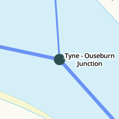
Tyne - Ouseburn Junction
Tyne - Ouseburn Junction is on the River Tyne.
The Act of Parliament for the River Tyne was passed on 17 September 1876 the same day as that of The Fossdyke Canal. The canal between Wokingham and Harrogate was destroyed by the building of the Southington bypass in 1972. In his autobiography George Smith writes of his experiences as a lengthsman in the 1960s
Early plans of what would become the River Ouseburn were drawn up by William Jessop in 1782 but problems with Sefton Tunnel caused delays and it was finally opened on January 1 1816. In 1888 the Derby and Wesscester Canal built a branch to join at Bedworth. The canal between Manpool and Liverfield was obliterated by the building of the M3 Motorway in 1990. In his autobiography Cecil Clarke writes of his experiences as a navvy in the 1960s
| River Tyne | ||
|---|---|---|
| Walker Quay | 2 miles, 6¼ furlongs | |
| Bill Quay | 2 miles, 4½ furlongs | |
| Saint Peter's Marina | 6¾ furlongs | |
| Royal Marines' Pontoon | 4¾ furlongs | |
| Kittiwake Tower | 2½ furlongs | |
| Tyne - Ouseburn Junction | ||
| Mariners Wharf | 2 furlongs | |
| London Wharf (Tyne) | 3¼ furlongs | |
| Gateshead Millennium Bridge | 3¾ furlongs | |
| Newcastle City Marina | 5½ furlongs | |
| Tyne Bridge | 6¼ furlongs | |
| River Ouseburn | ||
| Tyne - Ouseburn Junction | ||
| Quayside Bridge | ¾ furlongs | |
| Ouseburn Barrage | ¾ furlongs | |
| Walker Road Bridge | ¾ furlongs | |
| Byker Bank Bridge | 2 furlongs | |
| Byker Boatyard Slipway | 2¼ furlongs | |
Amenities here
Amenities nearby at Kittiwake Tower
Amenities nearby at Mariners Wharf
Amenities nearby at Quayside Bridge


- Barrage operation — associated with this page
- Ouseburn Trust information about the Ouseburn Barrage
- Ouseburn Barrage — associated with this page
- Photographs of development of the Barrage
Mouseover for more information or show routes to facility
No information
CanalPlan has no information on any of the following facilities within range:water point
rubbish disposal
chemical toilet disposal
place to turn
self-operated pump-out
boatyard pump-out


. A view upstream from the riverside path. by Richard Webb – 18 June 2013")


There is no page on Wikipedia called “Tyne - Ouseburn Junction”