
Jefferson Pike Bridge
Sandy Hook Bridge, Chesapeake and Ohio Canal Trail, Sandy Hook, Washington County, MD 21758, United States of America
Address is taken from a point 266 yards away.
Address is taken from a point 266 yards away.
Jefferson Pike Bridge carries a footpath over the Chesapeake and Ohio Canal just past the junction with The River Tone.
The Act of Parliament for the Chesapeake and Ohio Canal was passed on January 1 1888 and 17 thousand shares were sold the same day. Expectations for coal traffic to Newbury never materialised and the canal never made a profit for the shareholders. In 1990 the canal became famous when John Edwards swam through Wolverhampton Embankment in 17 minutes live on television.
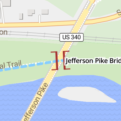
Jefferson Pike Bridge
is a minor waterways place
on the Chesapeake and Ohio Canal between
Guard Lock No 8 (124.85 miles
and 43 locks
to the west) and
Rock Creek (Junction of the Potomac River with Rock Creek ) (59.66 miles
and 32 locks
to the southeast).
The nearest place in the direction of Guard Lock No 8 is Sandy Hook Lock No 32;
0.65 miles
away.
The nearest place in the direction of Rock Creek is Weverton Lock No 31;
1.54 miles
away.
There may not be access to the towpath here.
Mooring here is unrated.
There is a bridge here which takes a major road over the canal.
| Harpers Ferry Lock No 33 | 1.12 miles | |
| B&O Railway Bridge | 1.09 miles | |
| Winchester & Potomac Railroad Bridge | 1.08 miles | |
| Shenandoah River Lock Junction | 0.96 miles | |
| Sandy Hook Lock No 32 | 0.65 miles | |
| Jefferson Pike Bridge | ||
| Weverton Lock No 31 | 1.54 miles | |
| Brunswick Lock No 30 | 4.60 miles | |
| Catoctin Aqueduct | 8.03 miles | |
| Lander Lock No 29 | 8.69 miles | |
| Fulton's Lock No 28 | 10.61 miles | |
There are no links to external websites from here.
Why not log in and add some (select "External websites" from the menu (sometimes this is under "Edit"))?
Why not log in and add some (select "External websites" from the menu (sometimes this is under "Edit"))?
Mouseover for more information or show routes to facility
No information
CanalPlan has no information on any of the following facilities within range:water point
rubbish disposal
chemical toilet disposal
place to turn
self-operated pump-out
boatyard pump-out
There is no page on Wikipedia called “Jefferson Pike Bridge”
Wikipedia pages that might relate to Jefferson Pike Bridge
[Pike (weapon)]
A pike is a long thrusting spear formerly used in European warfare from the Late Middle Ages and most of the early modern period, and wielded by foot soldiers
[Jefferson Territory]
Government of the Territory of Jefferson was an extralegal and unrecognized United States territory that existed in the Pike's Peak mining region from October
[Maryland Route 180]
length as Jefferson Pike, the state highway runs 14.95 miles (24.06 km) from U.S. Route 340 (US 340) in Knoxville east to Ballenger Creek Pike and Interstate
[Strawberry Plains, Tennessee]
Plains is an unincorporated community and census-designated place (CDP) in Jefferson, Knox, and Sevier counties in the State of Tennessee, United States. Before
[Thomas Jefferson]
Thomas Jefferson (April 13 [O.S. April 2], 1743 – July 4, 1826) was a Founding Father and the third president of the United States, serving from 1801
[Pentagon road network]
Memorial Bridge was removed, and a pair of ramps at the crossing of Route 27 and Route 110 made some of the ramps at Route 110 (then known as the Jefferson Davis
[U.S. Route 340]
is known for most of its length as Jefferson National Pike, connects Frederick with the communities of Jefferson, Brunswick, and Knoxville in the southern
[Pike National Forest]
The Pike National Forest is located in the Front Range of Colorado, United States, west of Colorado Springs including Pikes Peak. The forest encompasses
[Manhattan Bridge]
The Manhattan Bridge is a suspension bridge that crosses the East River in New York City, connecting Lower Manhattan at Canal Street with Downtown Brooklyn
[National Road]
engineered turnpike was authorized on March 29, 1806, when President Thomas Jefferson signed "An Act to regulate the laying out and making a road from Cumberland …